Day-1 : Loharkhet- Dhakuri Pass-Chilta Top-Dhakuri Meadow ( 11 kms).
The weather was fine on the start of our first day of the trek with temperature at 11C at 7.00 a.m. After breakfast, we commenced our trek to Dhakuri. The initial gradual climb over the well marked path up to Jhandidhar turned into a moderate climb thereafter through the forest mainly of rhododendron. We were surprised to see rhododendron flowers blooming on some trees though the flowering season starts from early April. There were some village women on the way who were out to collect leaves for their cattle as being winter, meadows had devoid of green grass. We saw one of the lady climbing on the top of the tree to pluck fresh leaves. When we started taking pictures of her, she sarcastically told us that had she known that she will be photographed, she would have worn her new dress. When Surendra told her that she looked beautiful even in her old dress, she responded by smiling shyly.
 |
| Climb to Dhakuri Pass (2950m). |
 |
| A village woman on a tree top to collect fresh leaves for her cattle on way to Dhakuri. |
We came across the first sign of snow about 5 kms before Dhakuri Pass. After a lunch break at Chatri Brunse ( locals have given this name as there is a lone rhododendron tree in an umbrella shape), the snow cover of the trek path increased and in some places it was 1-2 feet of thick snow covering not only the track path but also the surrounding places. There were no foot marks on the snow indicating that the place had fresh snow on the night of Feb. 7 when it had rained in the plains. We reached Dhakuri Pass at around 2.00 p.m. Except around the temple where there was 2-3 feet of snow, the pass was devoid of snow. We could not get peak views as the white cloud had already covered the snow peaks.
 |
| Zig-zag climb to Dhakuri Pass. |
 |
| First encounter with snow path on way to Dhakuri. |
 |
| Thick blanket of snow as we came 2-3 kms before Dhakuri Pass. |
After some rest at the pass, we proceeded to one km trek of Chilta Top through a gate located left of the pass. After walking though forest over a thin layer of melting snow for about 200-300 meters, the snow cover became thicker and just before an intermediate point (we called this place as mini Chilta Top as there is a small table top by the side of the path), the entire place was covered with 2-3 feet of snow. The walking was difficult as our feet often went deep into the snow cover. We reached the intermediate point. From here, we get a 270 degree of snow clad mountains. Unfortunately, thunder clouds covered most of the tops of the peaks. From this place, Chilta Top was another 500m of climb.
 |
| We at Dhakuri Pass. |
 |
| On way to Chilta Top. |
Debu seemed to be reluctant to proceed to Chilta Top as path as well as the surrounding place was covered with a large expanse of snow. Furthermore, the formation of thunder cloud on the eastern horizon meant that it may start snowing any moment. KS was also not too keen to proceed as he felt that he had enough of snow trek to his satisfaction. Finally, we decided that we would proceed to Chilta Top up to a point from where we felt risky to proceed. So Debu led us to the Chilta top followed by my cousin, me and KS in that order. As we trekked towards Chilta Top, the snow cover was much more than our expectation and at some places, our feet went deep inside the snow. Still there was not much of a problem in negotiating the snow path. As we came just short of 10-15m from the Chilta Top, my cousin got stuck knee deep in the snow and he was not able to come out of it despite taking support of his hand and the trekking pole. He waved at me indicating that I should remain where I was and shouted for Debu to help him out. Since Debu was already on Chilta Top, He tried to slide down on the path to reach to my cousin faster. In doing so, Debu himself got stuck on his half way on slide. In trying to stand on his feet, he got himself in more than knee deep in the snow with his trekking pole completely going inside the snow cover. Somehow, he managed to come out of the snow and reached to my cousin to help him out of the snow. Later on, my cousin told me that his hands were completely numbed while trying to take support to come out of the snow.
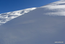 |
| Snow scape on way to Chilta Top. |
 |
| On way to Chilta Top (3010m) |
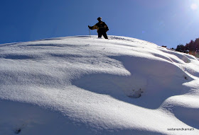 |
| Debu, our guide under more than knee deep snow on Chilta Top (3010m). |
By the time we return to intermediate point from Chilta Top, we could see snowing on the upper reaches of the mountains on the north-eastern side. Without wasting much time, we briskly descended towards Dhakuri Pass. However the thick blanket of snow on a 2 km descending path to Dhakuri meadow was full of thick snow. During the heavy snowfall, the accumulated snow slides down from the Dhakuri Pass making the trek path the repository of snow. So we had to be very careful in our descent. We made it to Dhakuri meadow by 5.00 p.m. and the good news was that it was still sunny on Dhakuri meadow and grey cloud on the eastern horizon had turned into orange colour signifying the clear weather for the next day.
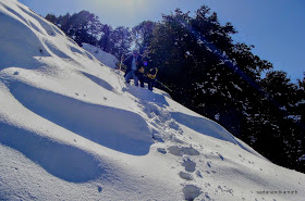 |
| Surendra is helped by Debu to come out of knee deep snow around Chilta Top. |
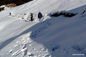 |
| Return from Chilta Top. |
 |
| Thunder clouds formation on the eastern horizon seen from Chilta. |
 |
| Moving towards Dahkuri meadow. |
We stayed in PWD Rest House which had three beds and an attached toilet. Adjoing the PWD Rest House was KMVN Rest House which was closed for winter. Raju's Dabha next to it was, however, operational. It was very cold evening and our room temperature was showing 5C at around 7.00 p.m. Even one of the Dhakuri dogs was trying to stay overnight in our room but my head light made him so uncomfortable that he barked at me for sometime. The room temperature dropped to 2C when we retired for the day. There was a fire place in the Rest House but the choked chimney made it redundant.
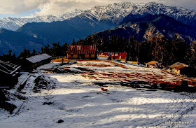 |
| Dhakuri Meadow with res roof PWD Rest House in the background. |
 |
| Warming up at fire place in PWD R H. The comfort was short-lived as choked chimney made it redundant. |
Day-2 : Dhakuri-Khati ( 8 kms)
Morning was clear as expected but there were thin layers of white cloud formations over the snow clad mountains. Thus we were deprived of the sunrise view of peaks. The outside temperature was 2C at 7.00 a.m. But the absence of breeze made our life somewhat comfortable - may be the chill factor was zero. After breakfast, we commenced what was supposed to be an easy 8 km of trek to Khati village at 8.30 a.m. The first 3 kms of trek path was covered with snow which had hardened due to overnight low temperature with frost fallen over the snow. Once we were out of the snow path, our trek became more of a leisure walk passing through Bagdanu, Kharkiya, Umula, Jaikuni and Dau villages. We had a tea break at Dau village, 2 kms before Khati where wireless telephone facility was available.
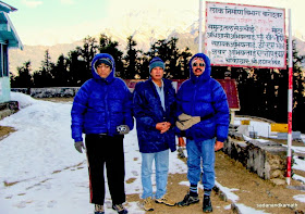 |
| We outside PWD Rest House before departure to Khati |
 |
| On way to Khati |
We reached Sangam Cottage located about 200m before Khati village at 1.00 p.m. The owner Tara Singh was present to receive us. The cottage was constructed two years back probably in anticipation of Khati becoming the base camp for Pindari and Kafani Glaciers treks once the road which has now come up to Kharkiya, 3 kms before Khati, is extended up to Khati. Rooms with attached bath and western toilets were neat and clean. During night, the rooms had provisions for battery operated electric lights which worked for us through the night. During trekking season, the room charges are Rs.100/- per bed per day. We liked the place very much and at one stage my cousin and KS were negotiating with the owner for a possible long term stay – say for a month - during off-season. The owner even offered to provide LPG gas stove in case they wished to cook the food themselves during their long term stay.
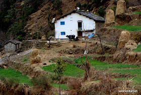 |
| A house with solar panels on way to Khati |
 |
| Zoomed shot of Khati village from Dau village, 2 kms before Khati |
After a sumptuous lunch, we had our first hot water bath here, the last one being in Delhi. In the afternoon, while KS decided to take a nap, Surendra was out in the sun playing with village dogs. I was watching a Himalayan langoor trying to uproot some crops from a nearby field. The village dogs numbering about a dozen charged on the langoor who, after realising that he was outnumbered by dogs, climbed over to a lone tree in the field. The dogs waited for about 10-15 minutes below the tree after which one by one dogs left the place giving a shy of relief for the poor langoor. It is said that longoors ransack crops particulary potato crops and the villagers have trained their dogs to tackle them. A week back a langoor was killed by the village dogs.
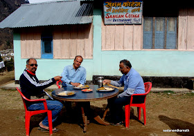 |
| Sangam Cottage, Khati. |
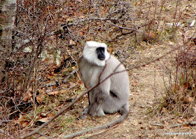 |
| Himalayan langoor near Khati village. |
In the night we got our camera batteries charged from one of the houses in Khati who had generator set in his house @Rs.100/-. In our Darma Valley trek in 2009, we had got our camera battery charged free of cost from an ITBP Camp at Sela.
Khati village has wireless telephones installed in a few houses. Almost all houses have solar panels for electricity for the night which work. A mini hydo-electric power station is being set up over the Pindar river to provide electricity to Khati and neighbouring villages. A BSNL mobile tower has already been erected and it was supposed to be operational within a week when we were in Khati. With this, the mobile connectivity is expected to reach as far as Pindari Zero Point and Sunderdunga, according to Tara Singh, Sangam Cottage owner. Road connectivity is going to be extended up to Khati for which I could see many yellow markers on milestones all the way to Khati. I will not be surprised if in a couple of years from now, the trekking destinations in the Pindar Valley become tourist destinations.
Despite Khati (2200m) being at the lower altitude than Dhakuri meadow (2650m), the night temperature in our room dropped to as low as 5C.
 |
| Sunrise on Nanda Kot seen from Khati village. |
Day-3 : Khati-Kaluwa Taki Pass-Bajling Bugyal ( 6 kms)
I got up at 6.45 a.m. to note that Khilaf, Debu’s son and the cook who was supposed to wake us up at 6.00 a.m. had not reached the cottage from his house. After about 15 minutes, I saw him walking briskly to reach us. That delay our departure by about 45 minutes but since to distance to cover the destination was 6 kms, it did not matter much. After a customary group pictures of three of us, we left Sangam Cottage at 9.15 a.m. After walking about 200m towards Khati village on the Dwali path, we took a right diversion on a cemented path next to a primary school. On the way, we met Kamal Negi, one of the teachers of the primary school who is a post graduate in Science faculty. He had his house in Bageshwar but stays 20 days in Khati. What I got to know from him was that the average attendance in the primary school was 90-95%, all from Khati village. For secondary school, students from Khati village have to walk daily about 10 kms to and fro a nearby village.
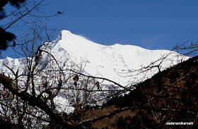 |
| Maiktoli peak seen on way to Kaluwa Taki Pass. |
 |
| Cemented path on way to Kaluwa Taki Pass. |
The trek from Khati to Kaluwa Taki Pass was all through the dense forest and the route reminded me of Wan-Bedni Bugyal trek. According to Debu, during rainy season, the entire track would be displayed with varieties of wildflowers. The entire trek route up to Kaluwa Taki Pass was a cemented path of 2-3 feet wide. The cemented road was constructed by the forest department to get over from the perennial slushy path. Initially, the climb was gradual but as we reached nearer to the pass, the climb became moderately steep with thick snow cover. Maiktoli and Nanda Kot peaks towered constantly over us in this route. We reached the pass at 1.00 p.m. After crossing the pass, the bridal path continues towards Jhuni village, while diversion to the left from the pass over the ridge which is a part of Bajling Dhar goes to Bajling bugyal which is located at a distance of about 1 km from the pass. As we were about 200m short of our destination, the thick snow blanket over the ridge made the descent tricky as by now snow had become soft.
 |
| Just before Kaluwa Taki Pass. |
 |
| On Kaluwa Taki Pass (2850m). |
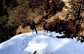 |
| Descent to Bajling Bugyal. |
We reached Bajling bugyal at 1.45 p.m. Debu had already spread sleeping mats on open to get us some sunbath in the cold weather as lunch was delayed. It was an awesome scene sleeping on our mats dried grassy patch surrounded from all sides by thickly snow covered rolling bugyals. To me these bugyals looked like mini version of Bedni Bugyal - rolling bugyals with lines of trees acting as boundaries. After lunch, we all went for a stroll in one of the bugyals on which a temple was located. Maiktoli was already half covered with white cloud. We could see Sunderdunga Valley on the left and Pindar Valley on to the straight line. Just to get some kicks out of the snow trek, we all including Debu and porters decided to climb top most place in the bugyal to have a 360 degree view. Though the distance to climb was less than 100m, it required lots of efforts to reach the top as we underestimated the accumulated snow on the path. Once reached on the top, we could get to see starting from the west, Maiktoli, Nanda Kot, Traill’s Pass, Sudam Khan Pass, Madhari Pass and Khalia Top behind which we could see one of the Panchchuli peaks. In the valley, we saw many small villages in which Mikhila was the prominent one.
 |
After a gruelling snow trek, some rest on Bajling Bugyal.
At Bajling Bugyal. |
 |
| Kilaf trying for a slide at Bajling Bugyal. |
 |
| Snow blanket on Bajling Bugyal. |
As mentioned earlier, due to inclusion of Pangu Top in our itinerary, our schedule had become tight. We discussed with Debu about our going to Pangu Top which was a 3 km climb and returning back to Bajling bugyal for another night stay or take a 6 kms of steep descent to Supi for night stay. In that case, we had to reach Kathgodam the next day from Supi to catch Ranikhet Express in the night. While this was not an impossible task to do, in case of some disruption which was most likely on Supi-Song road, we would have missed our train at Kathgodam. Hence, we decided to skip Pangu Top. Looking from Bajling bugyal, Pangu Top seems to be strategically located to get the grand stand views of Maiktoli, Sunderdunga glacier, Nanda Kot, Pindari glacier, Traill’s Pass, and Kafani Glacier and good views of Sudam Khan Pass, Madhari Pass and Khalia Top.
 |
Trying to climb on the top of the bugyal.
|
 |
At last on the top.
|
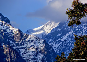 |
| Traill's Pass seen from Bajling Bugyal |
As evening approached, it was no longer comfortable to stroll in the open as temperature dropped sharply. We all gathered inside the stone hut which was generally used by the devotees of the local goddess during summer and autumn. Debu and his team kept the fire burning from evening through the night to keep the hut warm Fortunately, the smoke emanating from the firewood was moving up and exited through the gaps in the stone slab roof making our life comfortable in a cold night. In my view , this was the most comfortable night we had during this trek.
 |
| Sunrise view of Nanda Kot from Bajling Bugyal. |
 |
| Sunrise view of Maiktoli from Bajling Bugyal. |
Day-4 : Bajling Bugyal-Supi (6 kms by trek)-Bageshwar (42 kms by Jeep)
We got up early in the morning to have sunrise view of Maiktoli and Nanda Kot. While topmost of Maiktoli was covered with thin layer of cloud, Nanda Kot was clearly visible. The first rays of sun fell on Nanda Kot and slowly moved westward to reflect on Maiktoli. After taking some pictures, we returned to our stone hut for morning tea only to find that the water source – some 1 kms down the ridge was frozen. Hence we had to manage water from melting snow. This delayed our departure for Supi.
 |
Long shot of Maiktoli from Bajling Bugyal.
|
 |
| White cloud patterns over Bajling Bugyal sky. |
We left Bajling Bugyal at 8.45 a.m. after transversing halfway through Ridge, we took short cut to the right through shepherd’s trail to descent through many bugyals and crossed over the Kaluwa Taki Pass-Jhuni village bridal path to get into the Supi path.We did not encounter snow trails except at one place which was easily negotiated. From here onwards, it was a continuous steep descent through boulders, rocks and stony path followed by stair path up to the Supi village. The view of Supi village from a hill top about 2 kms before the village was superb. Supi is a conglomeration of many small villages having nearly 500 houses. We reached Supi village at 12.15 p.m.We had more than one hour here since the Jeep booked by Debu was to pick us up at 1.30 p.m. So we had lunch in Debu’s friend’s house.
With the operation of Song-Supi mud road, many trekking groups have started Pindari Glacier trek taking Supi-Khati route via Kaluwa Taki Pass. Distance-wise, this route is shorter than Loharkhet-Dhakuri Pass-Khati. As a result, a couple of enterprising villagers have started constructing guest houses to cater to the needs of the trekking groups.
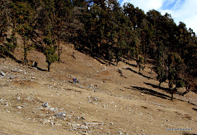 |
| Coming out of forest from Bajling Dhar to cross over Jhuni trek path to get on to Supi track. |
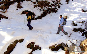 |
| Some snow patches en route Supi |
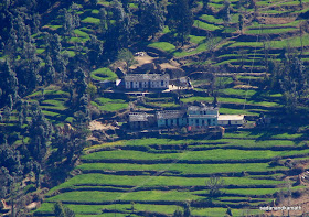 |
| A part of Supi village with step farms seen from a hill top. |
After lunch, we had still to cover a steep descent of about one km to reach the road head to take our jeep to Bageshwar. We reached Bageshwar around 4.30 p.m. and stayed overnight in KMVN. After freshening up, we took a round of Bageshwar market and bus stand to enquire about the taxi hire and bus timings for Kathgodam. A taxi driver quoted Rs.3000/- for Kathgodam drop. We found that there were buses for Kathgodam almost every hour from 5.00 a.m. onwards, the last bus being at 11.00 a.m. We decided to travel by 9.00 a.m.bus to Kathgodam. Perhaps some desperate taxi driver may be scouting here for passengers to Kathgodam in which case we would be in a better bargaining position.
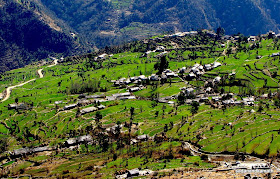 |
| Supi village seen from a hill top about 2 kms before Supi. |
Day-5 : Bageshwar –Kathgodam (161 kms by Car)
Next day, after breakfast, we checked out from KMVN around 8.30 a.m. and proceeded to bus stand which was about 10 minutes walk from KMVN. As we walked half-way, one taxi driver offered us to drop us in Kathgodam @Rs.350/- per passenger (i.e., Rs.1400/- full taxi). Since we were three, he would scout for one more passenger. Apart from time consuming process of searching for a passenger especially during winter, we would have been uncomfortable with four passengers in Alto. So we agreed to take full taxi. At Kasar Devi, our taxi driver got hold of another taxi driver to drop us to Kathgodam with 50:50 share so that he could go back to Bageshwar instead of waiting for the passengers at Kathgodam for the next day. We reached Kathgodam around 2.00 p.m. Ranikhet Express left Kathgodam on time @8.40 p.m. and reached Delhi Jn at 4.00. a.m. the next day. We spent about 3 hours in waiting room, before my former office collegue picked us to drop at a guest house for freshening up. We were back in Mumbai by A K Rajdhani Express.
More Snow Trek Photos
SK: I found this blog report very detailed and extremely well written!
ReplyDeleteThe pictures too are amazing and i am glad you introduced big size window for them (a la almoraboy). Congrats!!
I just added a link to this page in blog of this trek.
SK a very well written blog ! Enjoyed reading it....
ReplyDeletehow to contact for some guide to help in this trek. can you share Debu's contact ?
ReplyDeletethis is very informative blog..thanks for sharing..if possible do help with question on how do we find local guide..planning to trek this route during dec end 2014. will there be snow during this time?
ReplyDeleteVery nice.
ReplyDeleteIf I like to cover this trek in March 1st week, then may I get huge snow?