[In
continuation of Part-II : Visits to Pangong Lake and Nubra Valley]
As
per our schedule chalked out well before the commencement of Leh-Ladakh trip, we
were to take Leh-Khaltse-Domkhar-Hanu-Dah-Batalik-Kargil road covering our visits to Gurudwara Patthar Sahib Magnetic Hills, and confluence of Zanskar
river with Sindhu river. We were to stay overnight in a guest house in Hanu
village and visit Dah village the next day on our way to Kargil for the
overnight halt. We were to return to Leh via Lamayuru and Mulbekh. However, on
the previous day of our schedule departure to Hanu village, Mohammed Ali, the
Manager of Hotel Bijoo told us that the only Guest House at the base of Hanu village in which we were booked was closed down. He
gave us an alternative option of a home stay in Hanu village but the problem
was that we were to climb about 30 minutes from the road head to reach the
village. It was not possible for all of
us to walk 30 minutes even with our minimum baggage.
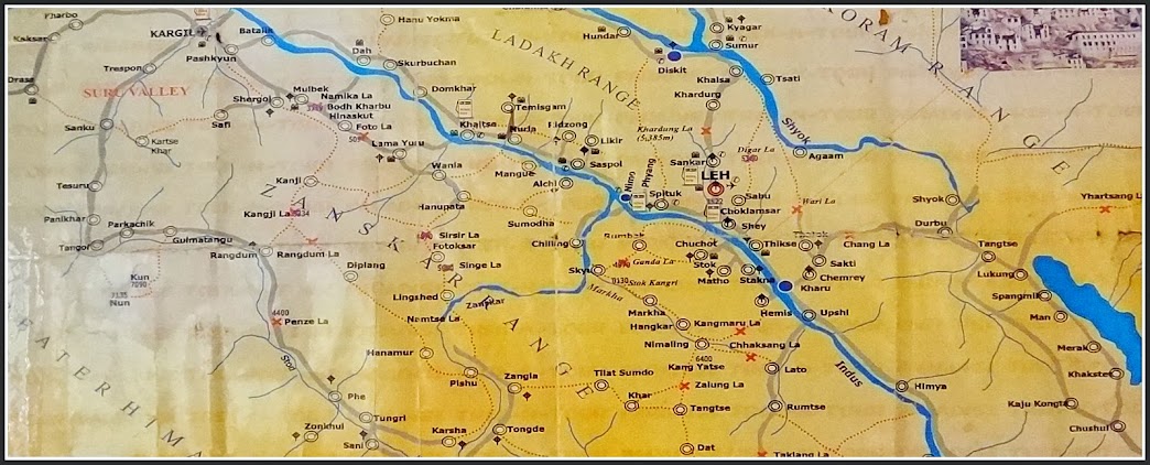
Ladakh map covering all places of our visits
After
sometime, Mohammed Ali came with an alternative option of staying in Lamayuru
and to cover Dah and Hanu villages on our return from Kargil to Leh. I agreed to this option after which he spoke to Hotel Moonland in Lamayuru
and reserved 3 rooms for us. With this development, our first hectic day of Leh-Kargil
trip was converted into a leisurely day as the distance between Leh and
Lamayuru was about 125 kms.
Day-7 : Leh to
Lamayuru (125 kms)
We
commenced our journey from the hotel at around 8.30 am. The first stop was the
Hall of Fame very close to Leh Airport. As
we had reached 15 minutes earlier than its opening time of 9.00 am, our driver
told us that we can visit the place on our return journey to Leh and decided to
proceed to our next destination, Gurudwara Patthar Sahib, 25 kms from Leh.
1.
Gurudwara Patthar Sahib
The
Gurudwara has been built and maintained by Indian Army. There is a story behind
this Gurudwara as mentioned in the display board in Gurudwara. During his second
journey to Tibet (1515-1518), Guru Nanak Dev came to this place for a rest. A
wicked demon was creating problem for the local people by killing one by one
and eating them. Seeing Guru Nanak Dev mediating here, the locals became happy
and relieved. However the demon got angry and hatched a plan to kill Guru Nanak
Dev. One day when Guru Nanak Dev was offering prayers, the demon rolled down a
massive boulder from the hill to kill him. However, the boulder became soft
like a wax when it touched the back side of Guru Nanak Dev. Seeing him still
alive, the demon kicked the boulder with his right leg which also sank into
boulder. Realising that Guru Nanak Dev was a holy man, he regretted his action
and asked for his forgiveness. Guru Nanak Dev advised him to devote rest of his
life to the betterment of the people. The demon followed the advice and lived
happily thereafter.
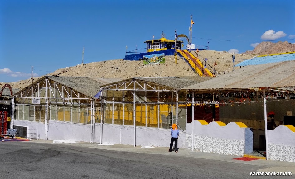
Gurudwara Patthar Sahib.
As
soon as we entered the Gurudwara, we could feel the professionalism in the
maintenance of this Gurudwara. After entering through the main gate, we were
required to remove shoes and socks and walk towards the temple where Guru
Granth Sahib was kept. The army has taken care of the likely discomfort to the
visitors by walking barefoot during summer/winter by placing carpets on the
walkway. In the temple, we found that Guru Granth Sahib was being read by an
army officer and he was so engrossed in reading that he did not notice our visits. We sat for
about 5 minutes in a very serene atmosphere where peace and silence prevailed. On the back side of the temple, there was
a huge boulder which was supposed to be the one rolled down by the demon on
Guru Nanak Dev. The boulder has the imprint of the back side and head of Guru
Nanak Dev.
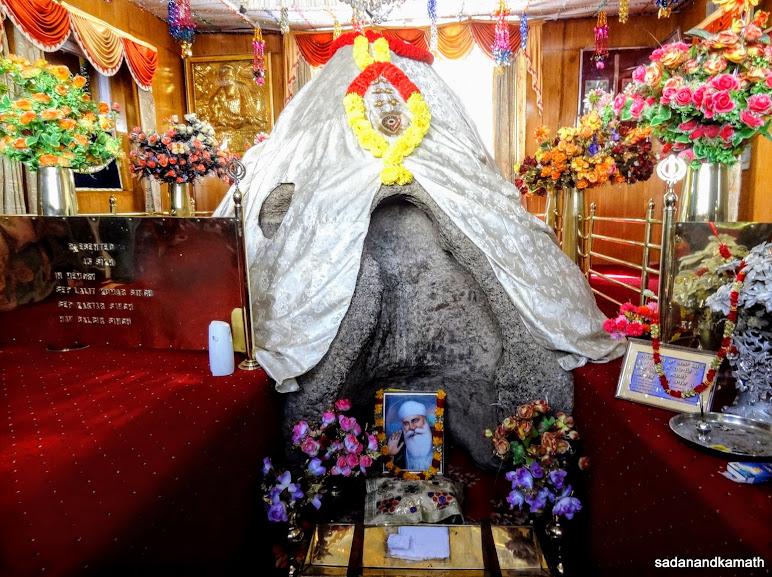
The boulder with imprint of the backside and head of Guru Nanak Dev in the Gurudwara.
After
taking a round of that boulder, we came out of the temple. On the way, we were
given Prasad (sweet semolina pudding). After eating Prasad I was looking for
cleaning my hand when I noticed that immediately on the right side, there was a
mobile wash basin with fresh towel for washing and cleaning hands. Even Army
had thought of this minute’s detail. Thereafter, we were directed to a langar
where we were served tea and light snack.
On
a small hillock, within the Gurudwara complex, there is another temple supposed
to be the place where Guru Nanak Dev sat on meditation. There are stairs to
reach the place. Here also the Army has taken utmost care to reduce the
inconvenience to visitors by making easy gradient of steps apart from covering
them with carpet. From this place, one gets a 360 degree view of Ladakh plateau
and a hill opposite Gurudwara from where the demon had rolled down a boulder to
kill Guru Nanak. One can attempt to reach the top of the hill by climbing
hundreds of steps. We did not attempt the climb as it would have taken at least
one hour more apart from the discomfort which may cause due the breathlessness.
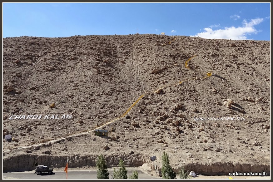
The hillock from where the demon is said to have rolled the boulder to kill Guru Nanak Dev.

View from Guru Nanak Dev's meditation place. Leh-Kargil road on the left.
There
are clean toilets just outside the Gurudwara complex. Since we had already
removed our shoes, we were thinking as to how to go to toilets without shoes.
We found that Army had also taken care of this problem by making available
extra pairs of sleepers to be used for going to toilet. In short, Army has
taken care about almost all the visitors’ comfort.
We
spent about 45 minutes in the Gurudwara and felt that this place had a strong
aura of peace and tranquility. We felt that we ould spend some more time here. This was a good beginning of our day’s
trip on Leh-Kargil road.
2.
Magnetic Hills
After
about 3-4 kms from Gurudwara Patthar Sahib, we came across some zebra crossing
type signs on the tarmac of the road. This was an indication that we were
passing through the magnetic field of hills on both sides of the road. At this
point, our driver stopped the vehicle, switched off the engine and pushed the
gear to neutral. The vehicle started moving slowly despite the fact that the
road was on a slight climb. The magnetic field was pulling the vehicle. I remembered
my wife telling me about a well known author of a travel book who had carried a
magnet with her to check whether it was really a magnetic field or just a myth.
At the point of magnetic field she placed the magnet on the ground. The ground
attracted her magnet proving that it was
really a magnetic field. It is also said that aircraft do not fly over the
magnetic hills at low levels.
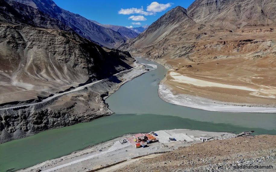
3. Confluence of
Zanskar-Sindhu River
The
confluence of Zanskar river with Indus (Sindhu) river is located about 3 kms
south-east of Nimmo village. The Leh- Kargil road passes at a great height from
the shores of these rivers. Hence it becomes a great viewing point from the
road side with protective guardrails. Since the road is on the plateau and
confluence is at a place where both these rivers come out of their respective gorges, devoid of vegetation, one can
get an uninterrupted view of the confluence. The flow of water of both these
rivers are quite distinguishable with emerald colour of Sindhu river and the
light green colour of Zanskar river. The flows of both the rivers do not get
merged with one another until about 100-200 metres further.
At the point of confluence, there is a nicely constructed platform for disembarking from rafting boats. The rafting in Zanskar river is considered the most challenging one and it takes between 3-4 days to complete the rafting with overnight stays in tents at suitable places on the banks of the river. During winter, Zanskar river completely gets frozen and some adventurous trekkers trek on the frozen river bed to reach Padum in 2-3 days.
At the point of confluence, there is a nicely constructed platform for disembarking from rafting boats. The rafting in Zanskar river is considered the most challenging one and it takes between 3-4 days to complete the rafting with overnight stays in tents at suitable places on the banks of the river. During winter, Zanskar river completely gets frozen and some adventurous trekkers trek on the frozen river bed to reach Padum in 2-3 days.
Confluence of Zanskar river (middle) with Indus (Sindhu) river flowing from the left.
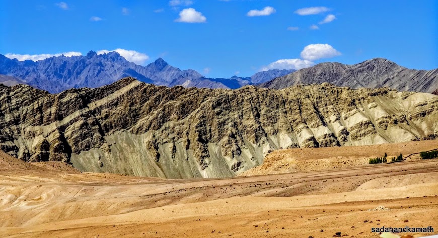
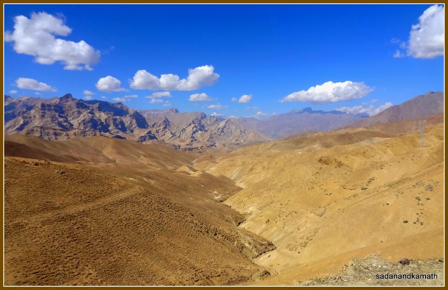
Topography and shades on the mountain on way to Lamayuru.
After
spending about 15 minutes at the viewing point with some photo session, we
moved forward. Sindhu river was on the left side of the road until Khaltse
where we had to cross the bridge over Sindhu river to reach the town. Khaltse
is a junction where a branch of the road goes to Kargil via Batalik. Due to
some traffic jam, we decided to take a short break here until the traffic jam
was cleared. We strolled in the market where most of the shops were managed by
women folks. The most common item on display in these shops was sun-dried
apricots. There are plenty of apricot orchards in this region till Kargil.
4.
Moonland
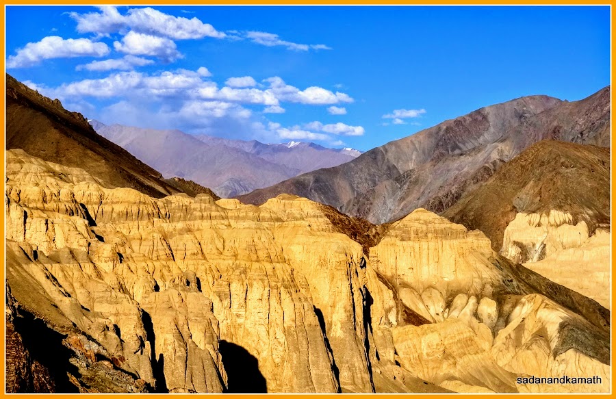
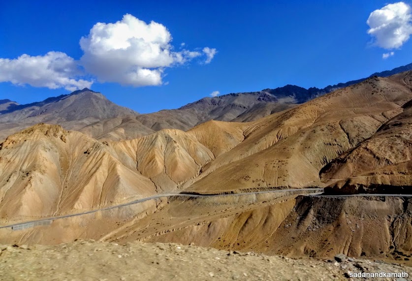
After
the traffic was cleared, we started our final leg of the journey to Lamayuru. On
the way, we passed through beautiful mountain landscape. There were mountains
of sands and stones with different shades and colour, some having unusual
natural carvings, probably due to melting of snow in the summer. About 5 kms before Lamayuru, we passed
through mountains very close to both sides of the road. They displayed mostly
light brownish yellow colour. The partial erosion of the top of the mountain soil has created natural designs over a long period of time giving an impression of the moon’s
surfaces as seen in the pictures. Hence these mountains are nicknamed as
‘Moonland’.
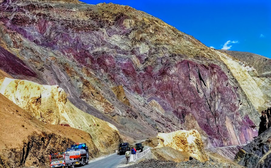
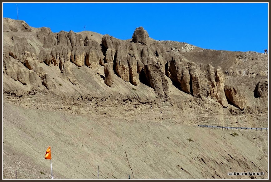
The purple colour mountain about 4-5 kms before Lamayuru on Leh-Kargil Highway. The yellow colour mountians in the foreground signals the arrival of 'moonland'.
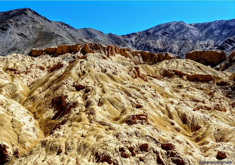
The so called 'moonland' mountain.
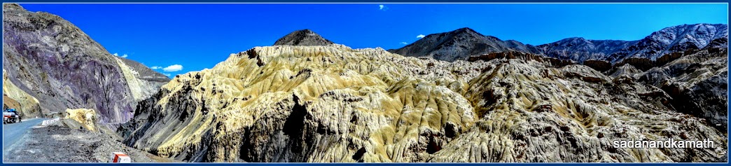
A panoramic view of the 'moonland' mountains.
5.
Lamayuru Monastery (3510m)
It
was nearly 1.00 pm when we reached Lamayuru. We checked in Moonland Hotel about
1 km further from Lamayuru monastery. The hotel was clean with hot water
available from the geyser only in the evening and morning due to load shedding.
It had a good restaurant. After finishing our packed lunches provided by our
Leh hotel, we took about 2 hours of rest in the hotel rooms before proceeding
to Lamayuru Monastery.
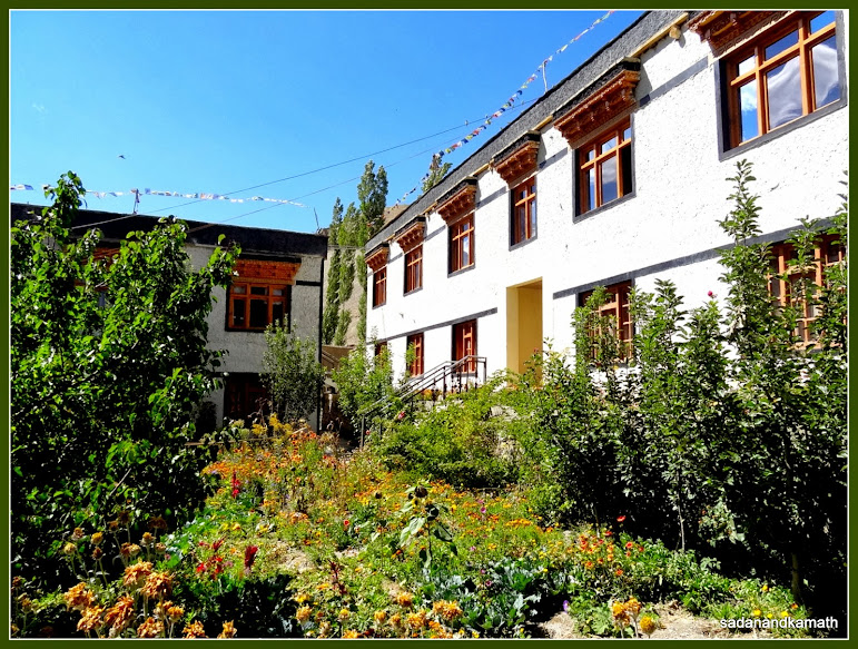
Hotel Moonland, Lamayuru. We stayed on the first floor (right).
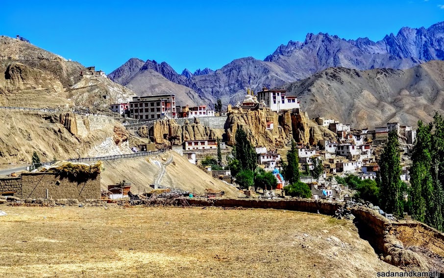
View of Lamayuru Monastery from Hotel Moonland's restaurant.
View from the hotel room. Leh-Kargil road can be identified from the guardrails (right). The road goes to the top of this sand type mountain.
Lamayuru
Monastery is one of the oldest and largest monasteries in the Ladakh region. It
has the capacity to house nearly 400 monks at any time. There are two main
shrines in the monastery. In the first shrine there is a prayer hall with
murals on the walls. There were displays of statues of some Buddhist gurus in
the back side of the main statue of Buddha. As we were coming out from the
shrine, a big Japanese group visited the shrine for whom the Lama had arranged
special prayers. We could not see the second shrine as it was closed.
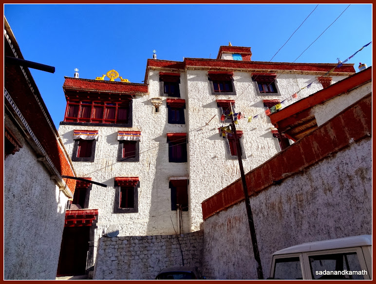
The main entrance of Lamayuru monastery.

Mural on one of the outer walls of the main shrine of Lamayuru monastery.
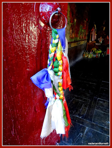
The braided colourful silk cloth tied to the door of the main shrine.
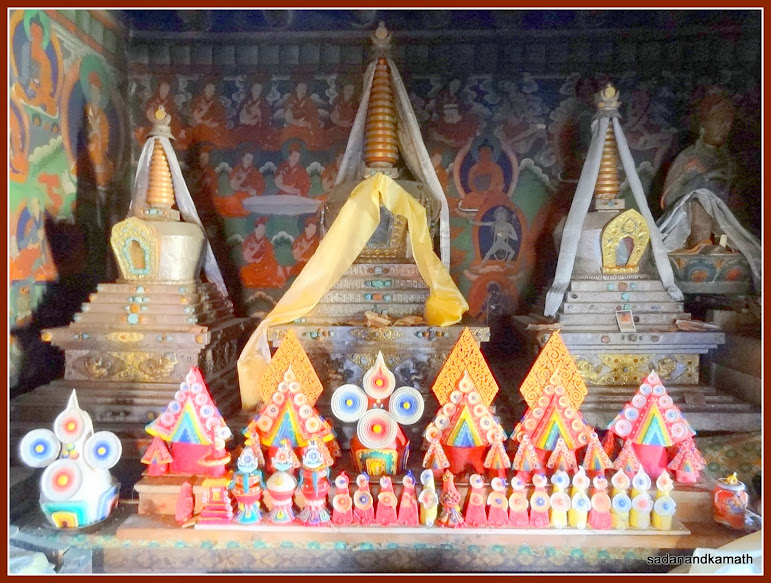
The displays and murals on the wall inside the main shrine.
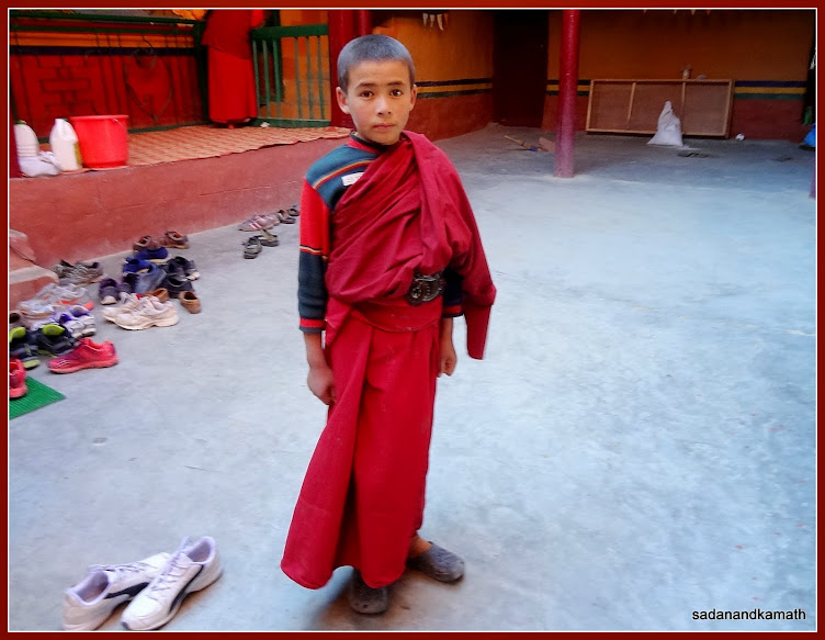
A young monk outside the shrine of Lamayuru monsatery.
The
view from the terrace of the monastery was awesome. In fact, I found the view of
moonland far impressive from here than that from the road side. Probably the
evening sun rays may have enhanced the beauty of the moonland. On the side of
the monastery opposite to its gate are many dwelling places on the hill. It is
said that they are also the residences of monks. Near the main entrance to the
monastery complex is a hotel for visitors with a restaurant and a curio shop.
After spending about 45 minutes, we returned to our hotel. In the night, the
restaurant arranged a buffet dinner as the number of guests had dramatically
increased by evening.
View of 'moonland' from the terrace of Lamayuru monastery.
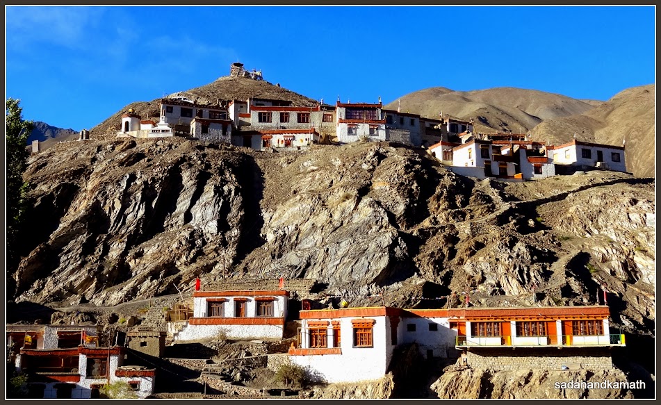
View of the subsidiary monastery from the terrace of Lamayuru monastery.
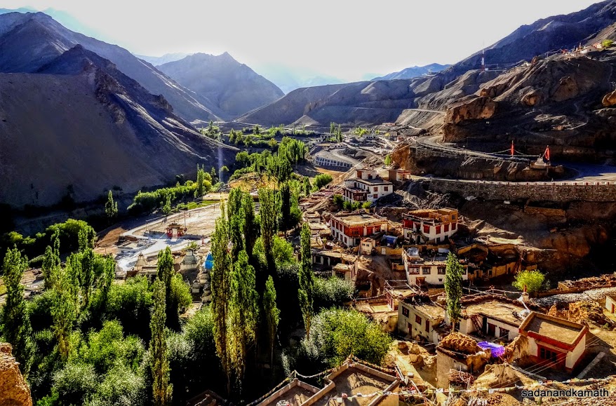
View of Lamayuru village from the main gate of Lamayuru monastery. Leh-Kargil road can be seen in the right of the picture.
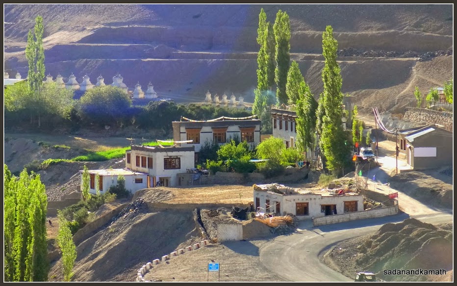
A zoomed view of Hotel Moonland from Lamayuru monastery. Leh-Kargil road is on the right of the picture.
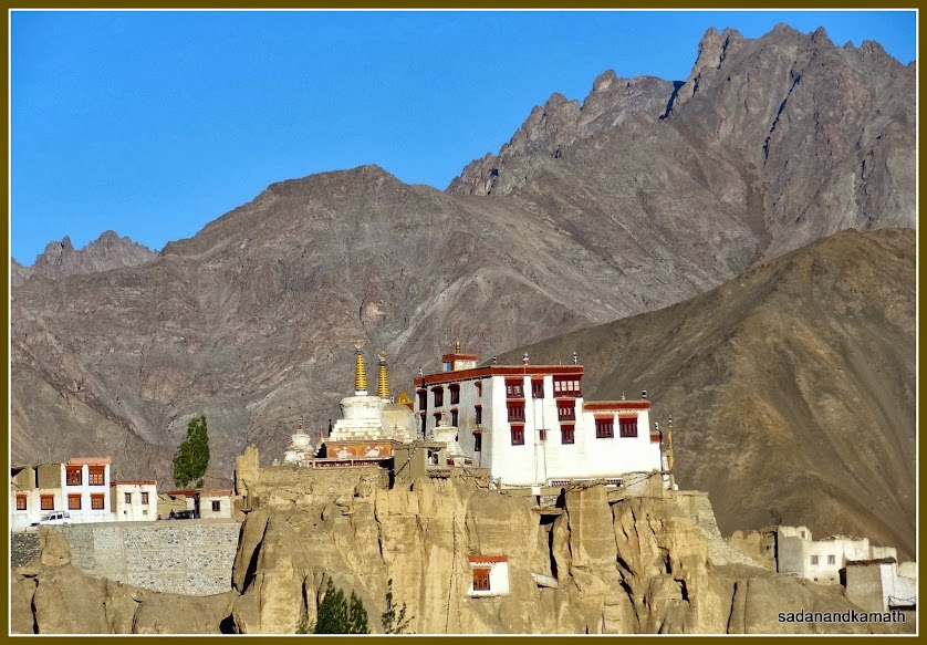
A mid-shot of Lamayuru monastery from Hotel Moonland.
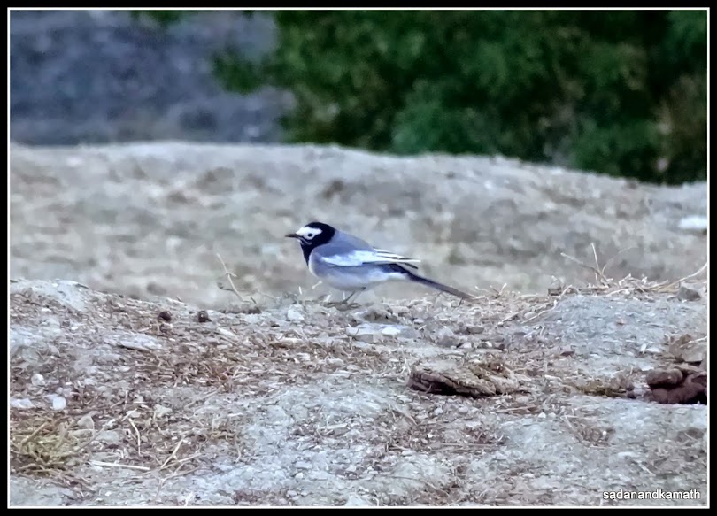
A Wagtail in Hotel Moonland complex.
Day-8 : Lamayuru to
Kargil (110 kms)
1.
Fotu La Pass and Namki La Pass
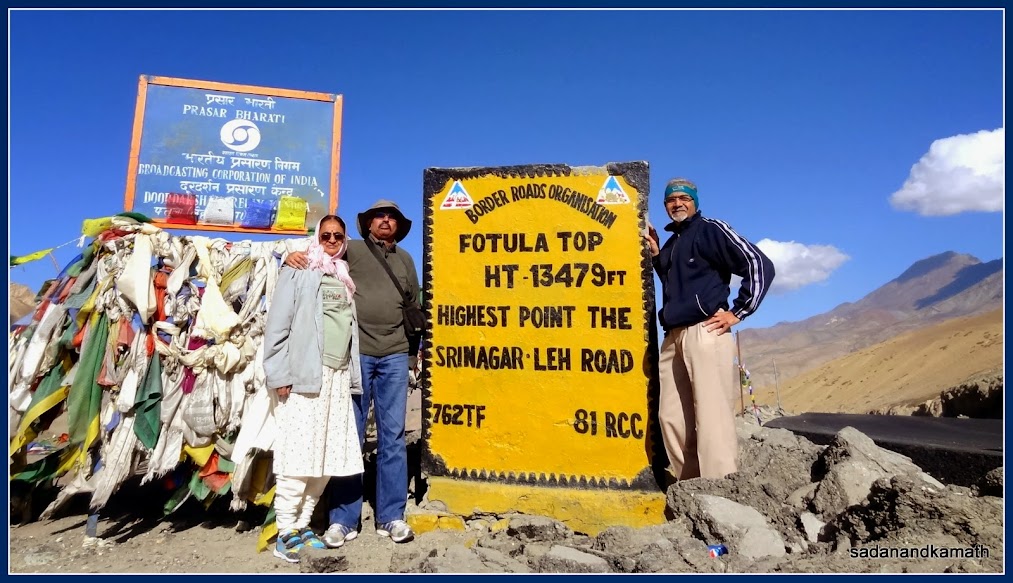
We
left Lamayuru after breakfast at around 8.30 am. After a drive of about 15 kms
from Lamayuru, we reached Fotu La pass(4110m). Until now, except for me and my
brother-in-law, rest of the 4 members of our family had not ventured out of the
vehicle at high passes for fear of breathlessness. Having now adequately
acclimatised and considering a comparatively lower altitude of Fotu La pass, all of us got down here to have a view from the
pass. As usual, there is no greenery around and also in the valley except the
‘bald’ mountains all around. But as I said earlier, there is beauty in the
baldness of these Ladakhi mountains with different shades of colours and the
nature-carved designs.
After about 30 kms of drive, we crossed Namika La pass.
We had no intention of getting down from the vehicle but for the crowd of about 50 local persons who came in about
dozen cars to offer prayer flags at Namika La pass. The 50 odd locals were
accompanying, up to Srinagar, an elderly couple who were going on a haj pilgrimage. It is a practice in the villages
here to accompany the haj pilgrims from their villages and offer prayer flags
en route – on the passes, trees, bridges over the rivers, and any other places for safe and happy journey.
Fotu La Pass
View from Fotu La Pass
View from Namika La Pass
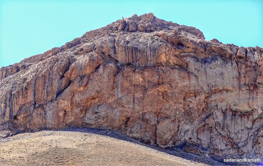
A zoom shot of the top of a mountain in Namika La Pass which locals call it as 'Aasman Ka Satoon' (Pillar of the Sky). But it does not look like a pillar.
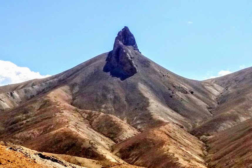
But after a drive of about 3-4 kms from Namaki La Pass, the wide part of the top of a mountain really looked like a pillar.
One
of the elderly gentlemen from the crowd met us and after exchanging the
pleasantries, he apprised us of the importance of some of the mountains on
Namik La pass. According to him, many villagers visit to the top of a mountain
located on the Leh side to have a panoramic view of Leh town and its
surrounding areas. He then directed towards a mountain immediately above the
display board of Namki La pass and said that local calls this mountain as
‘Aasman Ka Satoon’ (Pillar of the Sky). Of course, to all of us , the top of
the mountain did not look like a pillar in the widest sense as the entire
top was very wide to be called as a pillar. When I told the elderly gentleman to that effect, he responded by saying that we
should look at the top of the mountain once again after driving 3-4 kms further
from Namki La pass to see ‘pillar of the sky’. I kept a note of it and after travelling about
3 kms, I looked at the same mountain. Now, instead of its top being looking
very wide, it was looking like a round pillar. The change of direction has made
all the difference.
2.
Mulbekh Chamba
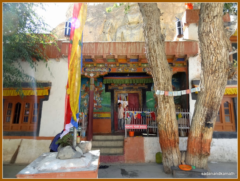
About
70 kms from Lamayuru is a non-descript structure just by the side of Leh-Kargil
road in Mulbekh town. It is called Mulbekh Chamba. One can easily miss the spot
while driving towards Kargil as unlike any other monastery, this one is bang on
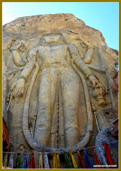
the road and very small in size. The main attraction of this monastery is about
30 feet high sculpture of Maitreya Buddha on a single monolith rock. The rock was
not properly visible from the gate of the monastery. It was only when we were
inside that we came to know that this monastery encircles the Buddha statue.
There are some wall paintings inside the rooms but the entry was prohibited
that day as Head Lama was on a visit to the monastery. Mulbekh Chamba is
regarded as one of the oldest monasteries in Ladakh, probably dating back to 7th
century when Buddhist missionaries here came from the Eastern Himalayas.
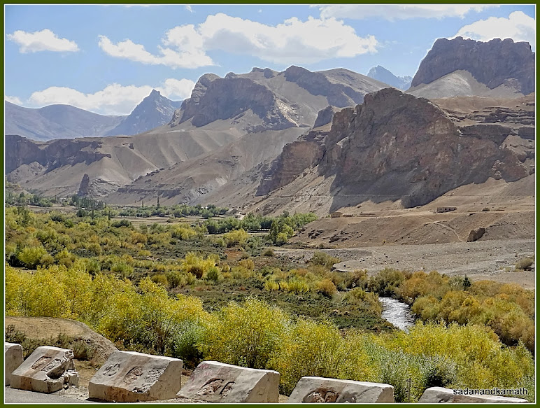
View from Mulbekh village.
Mulbekh Chamba monastery.
30 feet high carved statue of Maitreya Buddha on a monolith rock inside Mulbekh Chamba monsatery.
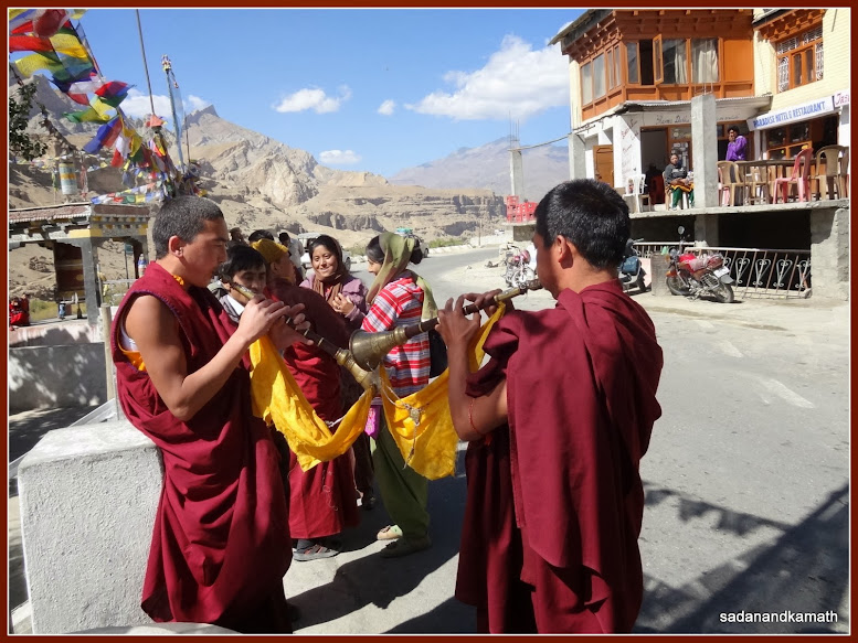
Mulbekh village. In the foreground, two monks of Mulbekh monastery rehearsing the welcome music in honour of visiting Head Lama.
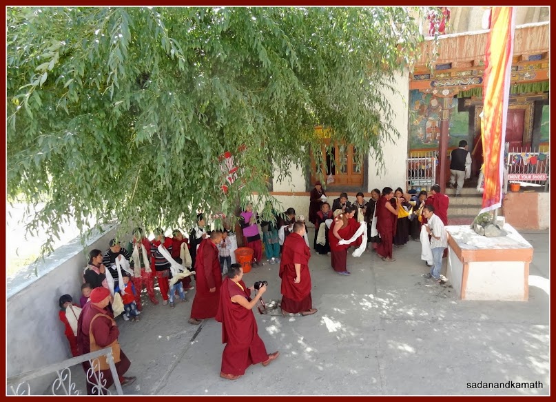
Head Lama (in the middle) arrives at Mulbekh monastery.
3.
In Kargil and LOC View point
After
about a 40 km drive from Mulbekh, we reached Kargil around 12.30 pm. Located in
a valley on the banks of Suru river, Kargil is the second largest town in
Ladakh next to Leh. The town is located at a convenient distance from Leh and
Srinagar which makes it a popular destination for travellers and trekkers for overnight
stays. We checked in Hotel Siachen located near market and took lunch at their
restaurant. We had not planned for any sight-seeing in Kargil except some strolling
in the market in the evening as there was nothing much to see here. However, post
lunch, one guide came to me offering us to take up to the vintage point to see the
Line of Control (LOC) just on the outskirt of Kargil. I was a bit apprehensive
as to how he could take us to LOC view point which normally should be out of
bound for non local civilians. I checked with the hotel staff and they
confirmed that the guide had taken many tourists to LOC view point this season
and no permit was required to visit this point. So we decided to visit. In
worst case, we could be sent back. It may be noted that in Kargil, one has to
take only Kargil registered tourist taxis for local sight-seeing. So we could
not take our Innova which was registered in Leh.
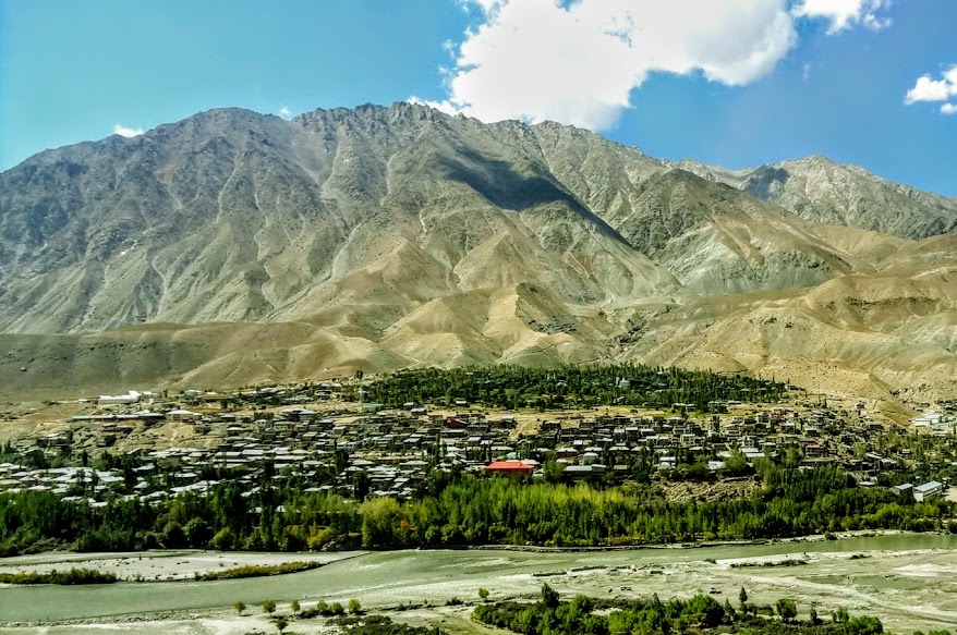
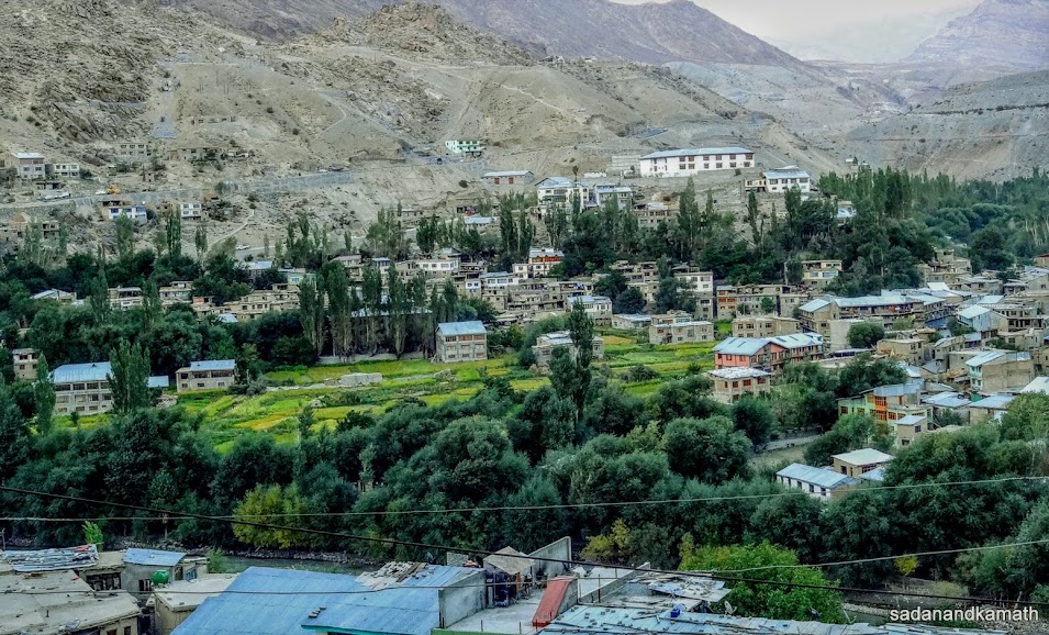
View of Kargil town with Suru River in the foreground as we reached close to Kargil.
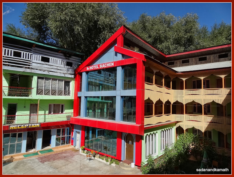
Hotel Siachen where we had an overnight stay. This is one of very few good hotels in Kargil with a good restaurant (ground floor).
After
a cup of tea, we got into the guide’s Omni van. Immediately after passing
through Munshi Aziz Museum, a left turn took us to a narrow dirt road which
seemed to have been recently constructed. The single lane road was on a stiff
gradient and had many bends and curves without any protection of guardrails.
The journey looked to be unending not because of the length of the road but because of the bad road condition. Just 2 kms
before the LOC view point, the Omni got stuck in the pebbles which were being laid
on the road as a prelude to making a
tarmac road. Even after so many attempts by driver, the Omni remained stuck in
the pebbles. Finally, we decided to walk down the remaining 2 kms and reached
the LOC view point. Our guide told us that the road is being constructed under
National Rural Employment Guarantee Scheme (NREGS) and each labourer gets a
wage of Rs.500/- per day. However, they work for only 120 days in a year. When completed, the
road would connect Kargil with Hundurmun Broke, a village at the base of LOC.
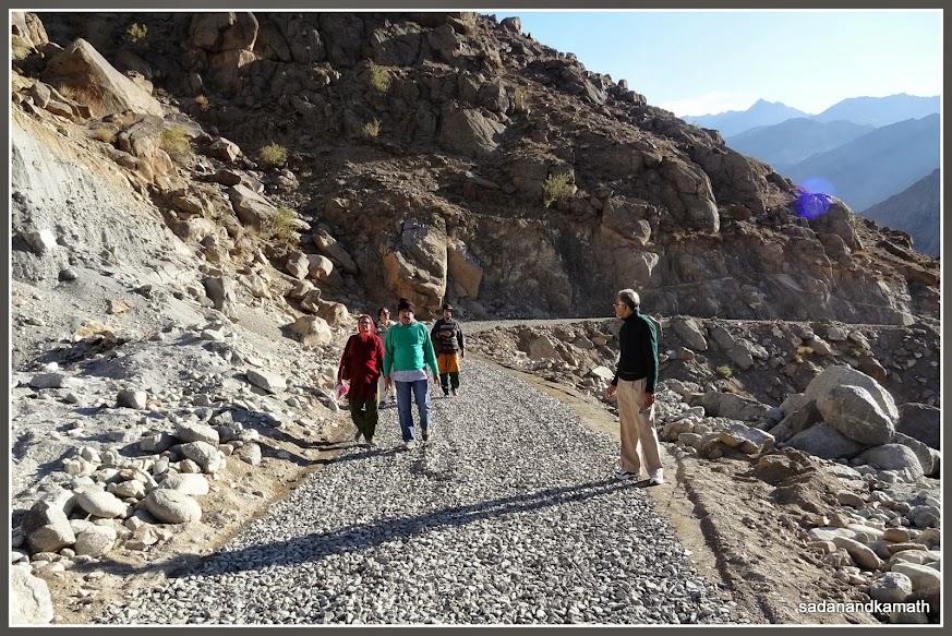
We walked about 2 kms of pebble-laid road to reach LOC view point.
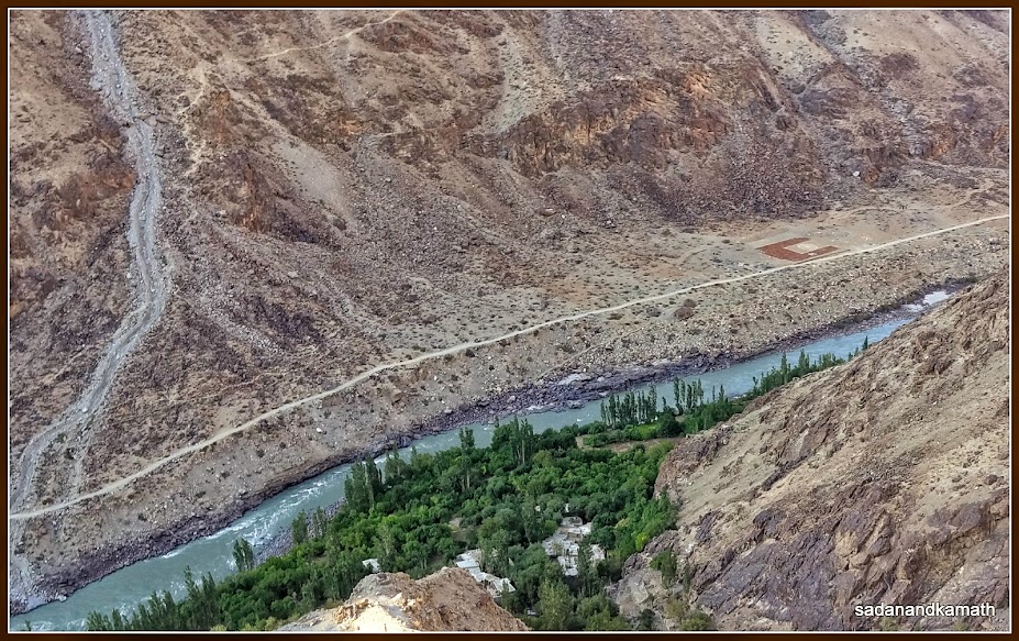
Hundurmun village at the banks of Suru River seen from LOC View Point. The village and the mountain across the river came under the control of Indian Army after Kargil War 1999. On the right across the river is a helipad.
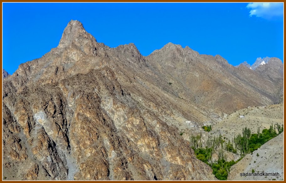
Hundurmun Broke (Upper Hundermun) village on the right along with the mountain top also came under the control of Indian Army during Kargil War 1999. A few Indian Army camps can be seen in the saddle below the peak ( middle left) as white dots though we could see them clearly from the naked eyes.
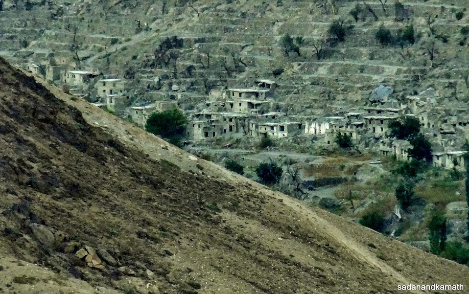
Picture of Shingir village under the control of Pakistan Army since 1948 on the banks of Suru River taken using 20x optical zoom of my camera.
From
the view point, our guide pointed towards two high mountains in front of us –
one on the left which was under Pakistani Army’s control and the one on the
right which came under Indian army’s control with a village at its base known
as Hundermun Bloke (Upper Hundermun) in the Kargil War of 1999. We could see
from our naked eyes a Pakistani army camp, probably made up of green colour
fibreglass while the Indian army’s camps were made up of white colour fibreglass.
Below these high mountains, Suru river flows. There was one village at the true
right bank of Suru river below the road known as Hundurmun which came into Indian
army’s control after Kargil War of 1999. Both these villages have orchards of
apples and apricot. On the true left bank of Suru river diagonally opposite Hundurmun village was an helipad where a flag meeting of Indian and
Pakistan armies were held in July 2013 according to our guide. However, further
to about 2-3 kms from this village was another village known as Shigiri, also
on the true right bank of Suru River which has been under the occupation of
Pakistani army since 1948. From what I saw through 20x optical zoom of my
camera, Shigiri village looked almost deserted.
The
camps of both Indian and Pakistani armies were perched on high mountains. One
can imagine as to how the army personnel of both the countries would be facing
the winter when the temperature comes down to as low as -30C even in Kargil.
During our return journey to Kargil, I was wondering whether it was proper to
showcase the LOC as tourist destination especaiily when there were reports of tension on the LOC.
We wound up the day after visiting Munshi Aziz Museum, a private museum and strolling in Kargil market. There are not many good hotels here. Probably, its proximity to LOC may have discouraged the locals to set up new hotels. However, I could see a couple of hotel properties under construction in around market area.
We wound up the day after visiting Munshi Aziz Museum, a private museum and strolling in Kargil market. There are not many good hotels here. Probably, its proximity to LOC may have discouraged the locals to set up new hotels. However, I could see a couple of hotel properties under construction in around market area.
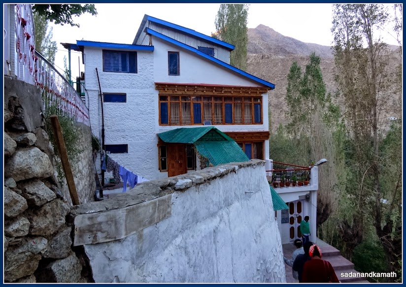
Munshi Aziz Museum, Museum is on the top floor while the Aziz family lives on the ground and first floor.
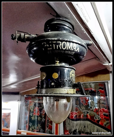
An old petromax on display in the museum.
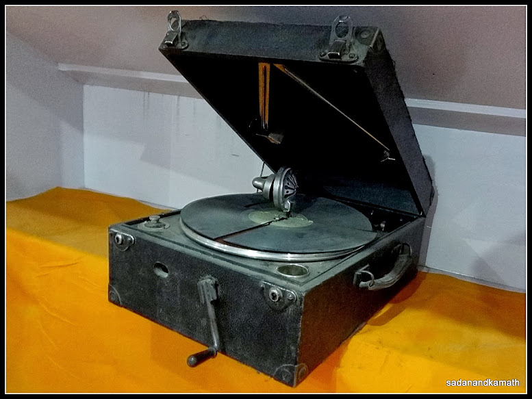
A very old gramophone on display in the museum.
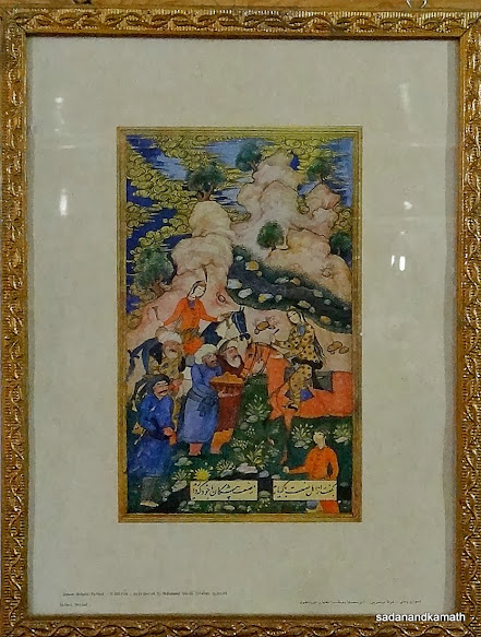
One of many paintings on display in the museum.
View of Kargil town from Munshi Aziz Museum.


An old petromax on display in the museum.
A very old gramophone on display in the museum.
One of many paintings on display in the museum.
View of Kargil town from Munshi Aziz Museum.
Day-9 : Dah Village
and back to Leh (262 kms)
I
was keen to visit Dah and Hanu villages located off Kargil-Batalik-Leh road,
two of the four ‘Aryan’ villages in Ladakh. I had also read on the websites
about the unique culture of the inhabitants of these villages which are quite
different from the Ladakhi culture. Visiting these two villages require Inner
Line Permit (ILP) from District Commissioner, Leh as they are close to Batalik
sector of LOC. Our hotel at Leh had already arranged ILP for us. Before the
start of our Leh-Kargil drive, I checked the ILP and found to my dismay that
permission to visit Batalik was struck down on ILP while permitting visits to
Dah and Hanu villages. As mentioned earlier, Dah and Hanu villages are located
off Kargil-Batalik-Leh. Hence to visit these two villages, one has to drive
through Batalik. There was no time to get this rectified which meant losing at
least half-a-day and that too we were not sure whether the office would reverse
the decision. A way out was found by our driver who said that there was a
village road via Mulbekh which meets Kargil-Batalik-Leh road somewhere between
Dah and Hanu villages. In other words, we will have to back track on Kargil-Leh
NH-1 and take a diversion to the village road after Mulbekh.
1.
Visit to Dah Village
After
a breakfast of Kande-Pohe ( flattened rice with onion), we left Hotel Siachen
at around 8.30 am. As decided, we took Kargil-Leh NH1 road and at Mulbekh, we
took a left diversion on a village road. It was a single lane tarmac road and
surprisingly, the condition of the road was good. For the first time during our
Ladakh trip, we were driving through a road passing through thick vegetation.
There were orchards and agricultural farms as the natural boundaries very closed to both sides of the
road. So there was no much maneuverability in this single lane road if a truck
came from the opposite side. On a couple of occasions, we had to drive reverse to find a suitable extra space to allow the
incoming army trucks to pass. Just before the junction of this village road and
Kargil-Batalik-Leh road, we crossed an iron bridge at which point army jawans
checked our ILP. They were surprised as to why we had taken a longish route to visit
Dah village as Batalik route would have taken much lesser time to reach the destination.
This meant that ‘Batalik’ was struck off from ILP by oversight as army jawans
had no objection to coming from Batalik.
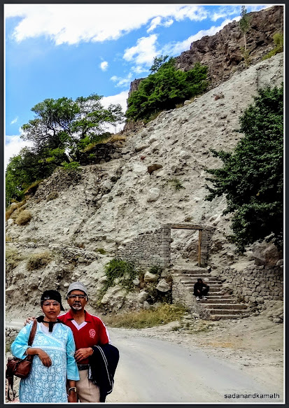
Stone gate (right) to Dah village.
After
crossing the bridge over Indus (Sindhu) River, the left of the road goes to Dah
village towards Kargil while right side goes to Hanu village towards Leh. We
reached the road end to Dah village after driving over about 500m of dirt road
and passing an army camp. On the right hand side of the road, the stone gate to Dah village was visible. We
alighted from Innova and walked towards the gate only to know that Dah village
was about 2 kms further. We decided to walk to the village. We were walking
though the dense orchards of Apricot on one
side and agricultural farms on the other side. Sindhu river was flowing to our
left in a gorge just after the boundary of agricultural fields ended. We met
some villagers on the way and chatted with them but still the village itself
was not visible from the walking path.
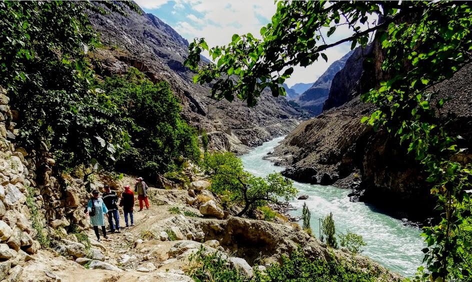
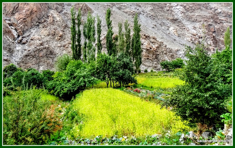
The approach to Dah village. Sindhu river is on the right.
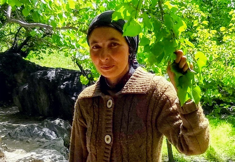
A Dah woman who was first to meet us on the way.
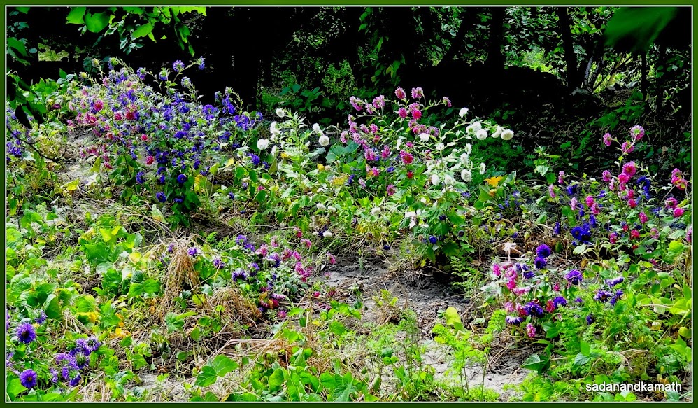
Barley fields on the way.
And flowers.
Apricot tree full of apricot fruits.
Our
women folks were getting frustrated as we have already walked nearly 2 kms. At
last, the first house of the village became visible which was perched on a
higher level of ground. Thereafter it was our walk
through alleys of the village. Dah village is perched on a ledge above Indus
River gorge at an altitude of about 2200 metres above the sea level. The
population of Dah village as per 2001 Census was 542. A clear stream of water
flows through the village from where some water channels have been diverted in
all the alleys in the village and also to the nearby agricultural fields. We did
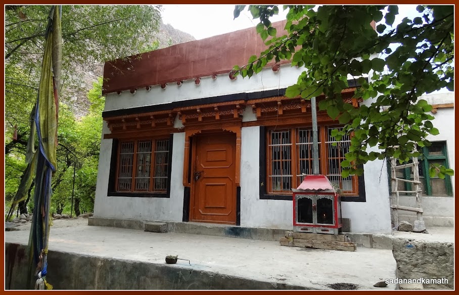
not come across any shop in the village. There was a home stay run by Mr Dorji where
we rested for some time had tea. Dorji
is assisted by some NGO to make and sell
dried apricots and apricot jam to earn some extra income. As it is, most of the
apricot fruits are wasted here. We tasted apricot jam and found to be yummy. We
purchased some dried apricots and apricot jam bottles. The apricot jam is not of
conventional type. Instead, apricot fruits are boiled and socked in sugar syrup
without any preservative. Hence, in warm
region like Mumbai, the apricot jam bottles have to be kept in freeze and
consumed say within a week.
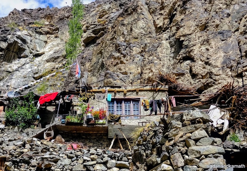
The first house of the village .
Barley fields.
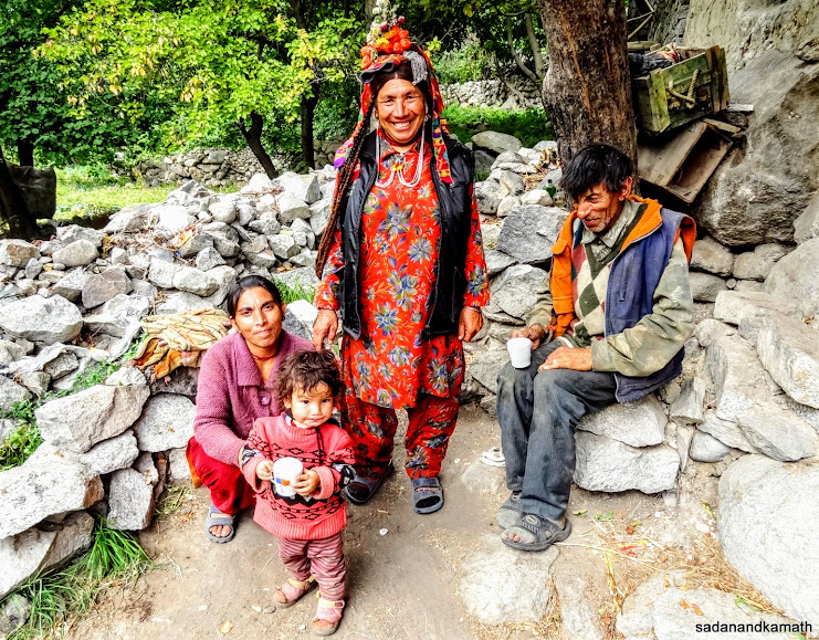
A Dah village family. The lady with a kid is the daughter of the elderly couple.
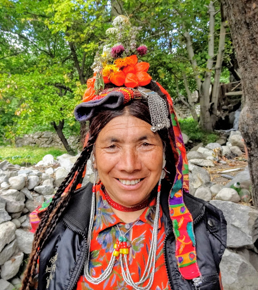
The traditional attire of a married Dah woman. The hair braids, the flowers, the silver head wear and the red beads in her necklace signify her marital status. However, her married daughter did not have these attires. On my query, she said that her daughter is of new generation who does not like to wear the traditional attire except on the occasion of festivals.
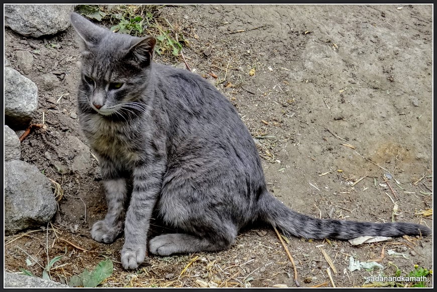
Dah village cat.
While
women folks work in their agricultural fields, men folks mostly work as
civilians in a nearby army camp. Towards the end of the village boundary, there
was a Buddhist temple with a prayer wheel which was closed as the monk has gone
out. I was surprised to find that at the back side of the village, a Mahindra
Trax was parked. On enquiry, a villager told me that there was a narrow dirt
road from the main road to reach the village but the road was so bad that only small
vehicles with 4-wheel drive can attempt to drive on this road. On the backside
of the villages, there are grazing grounds and some more agricultural fields. A
army personnel who was passing through the village told us that the area 200
metres beyond the temple was out of bound for civilians.
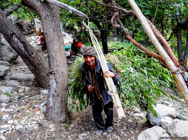
A man carries green grass and tree leaves probably for his goats. The wooden planks in his left hand is the dried branches of Poplar trees. In my numerous visits to Uttarakhand and Himachal Pradesh for the last 30 years, I have not come across any man carrying grass and leaves as such work is done by woman folks.
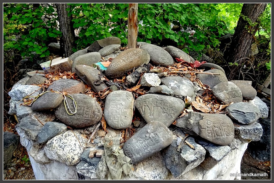
Buddhist temple in Dah village.
The inscripted stones placed below the temple flag post.
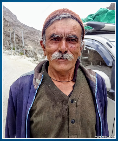
An elderly Dah villager who met us on the road.
2.
Some background about ‘Aryan’ villages of Ladakh
I
had gone through materials on Aryan villages of Ladakh before undertaking the
trip and also had opportunity to read some pages of a book ‘An Enthnography –
The Buddhist Dards of Ladakh’ written by
Rohit Vohra which was very kindly given to us by Mr Dorji of Dah village while
on a tea break at his place, for reading. I guess, a short discussion on the inhabitants of Aryan villages of Ladakh
and their culture is in order here.
In
the North-East of Kargil, there are four villages among others – Dah, Hanu,
Darchik and Garkon. All these four villages are situated at the banks of Indus
(Sindhu) River. While Dah and Hanu villages fall under the jurisdiction of Leh
district, Darchik and Garkon villages are in Kargil district. The inhabitants
of these villages are known as ‘Dards’. Locals also call them ‘Brokpas’ which
in Tibetan language means 'the highlanders'. According to the census of 1981,
these inhabitants were around 2000 in numbers. The origin of the inhabitants of
these four villages have been a subject matter of debate as they claimed to be
the pure Aryan breed, said to have migrated from South-Eastern Europe. Incidentally,
some of the villagers I met in Dah village were tall and had very fair
complexion with prominent nose and high cheek bones. They had the light
coloured eyes. Their facial features did not match with the Mongolian features the people of Ladakh normally have. The inhabitants of Dah village speak a
language known as Brokskad which is quite different from Ladakhi language. However,
inhabitants of Hanu village speak Ladakhi language.
Dards
of Aryan villages marry within the village itself or with the inhabitants of
other Aryan villages to keep the purity of their Aryan breed. The system of polyandry and polygamy was prevalent among Dards until few years back. However, with education and modernity, this system is being discarded. It is said that
because of their purity of so called Aryan breed, some of the foreigners
especially from Germany had visited the Aryan villages and attempted to marry
Dards probably to regain the ‘purity of Aryan breed’. But such news has been discounted
by the local authorities. In fact, foreigners cannot visit these villages
unless they obtain Home Ministry’s permission.
Dards of Aryan villages are generally vegetarian though during important festivals, they indulged in eating meats. They do not drink cow’s milk and milk products. Nor they eat chicken and eggs. Though they do have cows in their sheds but they are used for agricultural operations. For Dards, goats are most important animal and they do drink goat’s milk which are also used for making tea.
Dards of Aryan villages are generally vegetarian though during important festivals, they indulged in eating meats. They do not drink cow’s milk and milk products. Nor they eat chicken and eggs. Though they do have cows in their sheds but they are used for agricultural operations. For Dards, goats are most important animal and they do drink goat’s milk which are also used for making tea.
With
about 6 kms of to and fro walk and spending sometime in Dah village, our half a
day was consumed with still about 175 kms of drive to reach Leh. So after
leaving Dah village at around 1.00 pm, we continued on Batalik-Dah-Hanu-Khaltsi
road and reached a waterfall point of a stream which ultimately meets Sindhu river on the
right side of the road. Many locals take a halt here to spend some time to be
in the waterfall. As we reached the Hanu, we came to know that one has to walk
about 30 minutes to reach the Hanu village. Since we had already seen Dah
village which is regarded as the cultural hub of Dards (Aryans), we felt that there
may not be much value addition in spending time especially when we were short
of time. So we skipped the visit to Hanu village and continued our journey to
Khaltse where the road joins the Kargil-Leh NH-1. We reached Khaltse at 4.00 pm
and had a late lunch in a Punjabi Dabha. Once we were on NH-1, the excellent
road condition gave our driver to gain some momentum in driving. We reached at
6.00 pm at the gate of Hall of Fame. Luckily for us, the closing time of Hall
of time was 7.00 pm.
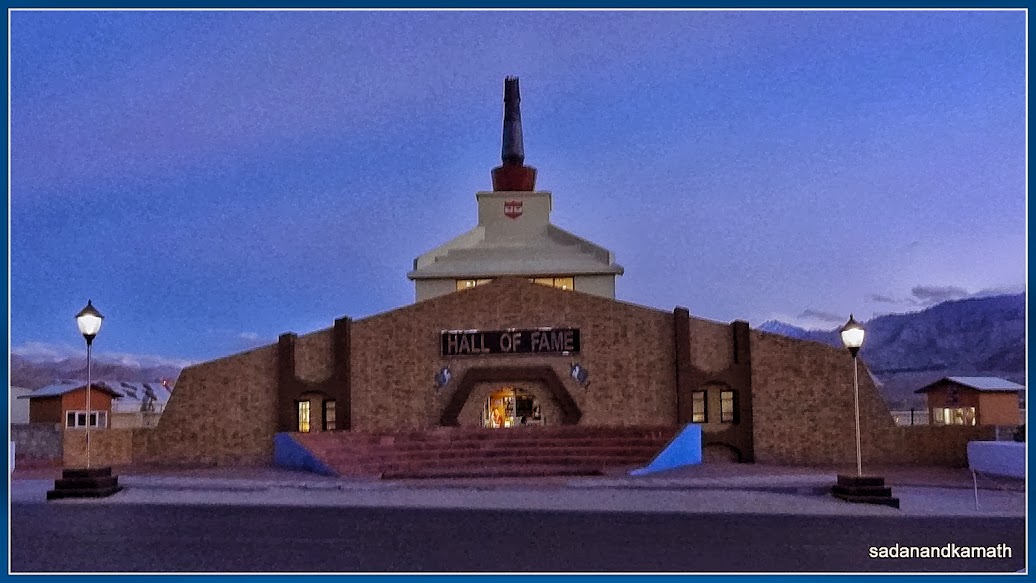
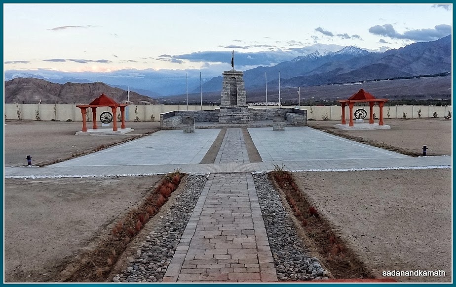
Hall of Fame facade shot at the dusk.
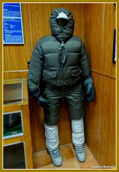
Replica of a gear for soldiers at Siachen Glacier with an oxygen cylinder on the back.
Back side of Hall of Fame in memory of Indian soldiers who lost their lives during Indo-Pak and India-China wars.
The
Hall of Fame is a sort of a museum which has mostly the displays of 1948 Kashmir War, 1962 Chinese intrusions
and Kargil War of 1999. There are details stories about the heroic efforts of
some of the martyrs of these wars. In one section, the weapons, artillery and
models of aircraft used in these wars are also displayed. There are also
displays of flora and fauna of Ladakh region. In fact there are a lot to see in
this museum. However, due to closing time and also the fact that we were quite
tired after a long drive and also some long walks in Dah village, we completed
the round of the Hall of Fame in about 45 minutes and reached our hotel in Leh
by 7.00 pm. With this, our Ladakh Trip almost came to an end except that the
next day (i.e., Day-10) was a extra day which was specifically kept as such for
taking care of some eventuality like postponement of a day’s trip due to
unforeseen reasons like health, bad weather etc. Since all day to day trip went
as per our schedule, the extra day was utilised for shopping and visiting Leh
Palace.
On
Day-11, after breakfast, we were dropped at the Leh airport courtesy Hotel
Bijoo at around 9.00 am. Air India flight to Delhi left Leh at its schedule
time of 11.10 am and reached Delhi at 12.45 pm. We checked in Hotel Madonna by
1.30 p.m. and had a light lunch before visiting Red Fort for the whole of
evening. Next day morning, we came to know that our train A K Rajdhani Express was
delayed by about 7 hours due to cloudburst somewhere around Bharuch. So we had
enough time in Delhi to cover some more places like India Gate, Amar Jawan
Jyoti, Doll Museum and visit to Lotus temple etc. In fact I and my wife had
seen all these places in our earlier visits. Fortunately, our hotel had allowed
us to keep one room upto 6.00 pm as against the check out time of 12 noon. The
train finally left at 10.00 p.m and reached Borivali at 4.00 pm the next day
thus ticking off one more destination from our travel list.