Showing posts with label Harsil. Show all posts

Friday, October 21, 2022

Ramblings in Uttarkashi District: Part-4 - In Harsil: Trek to Lama Top

October 12, 2022 

We woke up to a knock on the door of our room in Sundar Homestay exactly at 05:30 a.m. It was Shailender, the multi-tasking person of the Homestay, with cups of tea in steel glasses. I had never expected that in mountains, we would get the bed tea so early. Even in Uttarkashi, a big town, we would have to wait for one more hour to get bed tea. I went out to the balcony with my bed tea in hand to observe the weather condition. In the twilight, the weather looked excellent for Lama Top trek which we will be attempting after the breakfast. The sun had risen by now. I went out for a stroll in the Harsil market. With the afternoon rains in the previous day, the upper reaches of the mountains surrounding Harsil seem to have received fresh snow. 
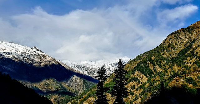
Morning view from Harsil market with fresh snow on the mountains in the background.


Morning view of Mt. Harsil Horns from the garden of Sundar Homestay.
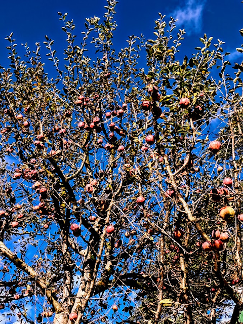

Red apples on the tree with a background of the blue sky in the garden of Sundar Homestay.


Trek to Lama Top (3+3Kms)

I became aware of Lama Top trek only few months back when I was researching on our proposed trip to Harsil. After watching a couple of videos on Lama Top trek, I felt that I must do this trek though it required a 3 kms of almost continuous climb, gaining around 400m in altitude to reach the top.

After finishing the breakfast around 9:00 a.m., we packed our respective backpacks with umbrella, some eatables and 1 litre of water bottle. We walked towards the main gate of Army cantonment to take an exit to the right and crossed the pedestrian iron bridge. The trek to Lama Top starts at the right turn after the bridge. Immediately, we were on a gradual climb which continued until we reached a viewpoint after about 20 minutes.

View of Lama Top from the street of Harsil.

Starting point of Lama Top trek. The right turn at the end of the bridge is the route to Lama top. Photo by K. Srinivasan.

The initial part of the trek goes along Jalandhri River on the right side.


On the Lama trek path.

Some rest in the backdrop of Mt. Harsil Horns.


Harsil Valley with Harsil village seen from the trek route.

The main trek path is well laid thanks to the Jadh Bhotiyas of Bagori village who had done the initial laying down of the trek path to enable them to worship on Lama Top. There are some subsidiary paths and diversions on the initial part of the trek. Eventually, they meet the main trek path after few metres, So, there is not much worry about losing the path. The soft soil on most part of the path covered with dead leaves and dry grass and with almost 45-degree gradient of climb, and similarly ascend on return trek, the chances of slipping on the trek is high. This is especially so if trek path is drenched in rains. 

It had rained in the previous afternoon in Harsil which continued till late evening. Our homestay guys had advised us to avoid trek to Lama Top if the rains continued on the next day. So, I would strongly advise to those who wish to visit Lama top to carry a trekking pole (or wooden stick) and wear shoes with good grip. Also carry some eatables and sufficient water as there is nothing available on the 3-km trek route.


View of Bhagirathi River from the trek route.

Despite steep climbs we faced, the good thing about this trek path is that we came across 3 viewpoints where we could enjoy the sceneries and at the same time get some rest to bring back our breathing to normal. In the entire 3-km of trek, we were the only two persons on the trek. It was only on our return trek we came across a Bengali lady who came with a guide.

From this point, it is a steep climb up to Lama Top.


Note the steepness of the climb from right. Still more to climb.


Looking at the prayer flags and the flat top, I first thought we have reached the Lama Top.


We also took a couple of pictures 


But there was still about 50m of steep climb off the cliff to reach Lama Top.

After a steep ascend of about 20m on narrow stone steps off the rock cliff followed by equally steep climb, again on stone-made steps off the cliff, we reached the Lama Top. It took about 2 hours to cover the 3-km of distance. The first thing we observe on reaching the top was fluttering of hundreds of prayer flags because of the strong breeze. Yet there was no view of Harsil Valley. A climb of one step on a flat rock and standing on it gave virtually 270-degree view of Harsil Valley with Mt. Harsil Horns in the far-end and Harsil and Bagori villages with Bhagirathi River at the base of the Valley. I was looking at my shoes to ensure that I was standing firmly on flat rock to face the strong breeze, and that very moment I also saw the Harsil Valley down below

It is interesting to note that in the morning, when I was in Harsil Street, I looked up to see the Lama Top Mountain which stood vertically. Now, I am on Lama Top, and looking down to see Harsil village. What a contrast. Another contrasting feature of the place is that though it is just 3 kms from the hustle-bustle of pilgrims enroute Gangotri and tourists in Harsil, Lama Top is a place for solitude lending a spiritual atmosphere. The pleasure of spending some time in deafening silence except the occasional sound of fluttering prayer flags on Lama Top is more than compensated by the hardship faced in steep climbing for reaching this place.

Lama Top is a worshipping place for the Jadh Bhotiyas living in Bagori village and around. It is a place for them to get their wishes fulfilled. First, they visit praying for their wishes be fulfilled. After their wishes are fulfilled, they visit once again for thanksgiving. At each visit, they host prayer flags as has been the ritual among the Bhotiya Buddhists. 


View of Harsil Valley from Lama Top. Harsil village with Bhagirathi River in the foreground and Mt. Harsil Horns in the background.


Coins imbedded in a dead tree trunk at Lama Top. It is the belief that wishes will be granted for each of the coins embedded.


Influenced by a spiritual feel, I am sitting in a meditation mode on Lama Top.


Returned to Bagori village path from Lama Top.


This was the place where Pahadi Wilson's wooden house was located. After a fire destroyed his house, a new house has been constructed by Forest Department as Rest House for visiting Government officials.

After spending about 30 minutes on Lama Top, we commenced our return trek. The weather had turned partly cloudy and the chances of rain showers after some time seems imminent. But the steep descend was also equally difficult in balancing oneself. Still, we could complete our return trek in about 45 minutes without taking any break and viewing sceneries. After reaching, we realised that we had unknowingly taken a different trek route which brought us down to a car parking place on the way to Bagori. So, it can be construed that those living in Bagori would use this trek path for Lama Top while those in Harsil would use the path on which we commenced our trek in the morning.

We returned to our Homestay by 01:00 p.m. After lunch, we had planned to walk 3 kms to Mukhba village to visit Maa Ganga temple and take a walking tour in the village. However, the continuous rains in the afternoon stretching till dusk forced us to abandon the plan.


Wednesday, October 19, 2022

Ramblings in Uttarkashi District: Part-2 - To Harsil and Bagori Village Walk

October 10, 2022

The morning twilight appeared in Uttarkashi around 05:30 a.m. By 06:15 am, sun rays started falling on the top of the hills. This was the time slot we used for a walk up to Tekhla bridge on Kedarnath road where we would have our first morning tea, spend some time watching the perennial flow of Bhagirathi River from the bridge and the progress of the sun rays covering the hills. We would return to our abode, have some chit-chat with our host, Tilak ji. During this period, he would suggest the breakfast menu which he would personally prepare for us as his cook will come only around 08:30 a.m.

After sumptuous breakfast of Puri-Aloo Subzi with coffee, we commenced our journey to Harsil in a sunny weather at around 09:30 am by Mahindra Maxx which was arranged by Tilak ji (Rs.2200/- for Harsil drop). The 75-km distance to Harsil was covered in about 2 hours 30 minutes with a couple of stops for some photography. The road conditions, by and large, were excellent. The road journey was a climb from an altitude of 1100m in Uttarkashi to 2620m in Harsil.

Khedi waterfalls near Maneri. It is the water discharge from the Maneri Hydroelectric Project from Maneri Dam.


The road to Sukhi Top on the way to Harsil.


Bhagirathi River on the way to Harsil.


A left diversion from Gangotri road and a further drive of about 1 km via army cantonment road took us to Harsil market. From here, it is about 200 km of walk on a paved path (only 2-wheeler can ride on this path)  to reach GMVN. We had got booking for only today as during Chardham Yatra time, GMVN rooms are booked for pilgrims using their conducted tours. For the next two days, we got booking in a homestay very close to GMVN which I will cover in a separate Blog.

As usual for GMVN (also for KMVN), this property is located in a picturesque place on the shore of Bhagirathi River. We had a grand-stand view of the River from the balcony of our cottage. There is also a staircase leading to the shore of the River for those who wish to walk on the river bed.  

We had a simple lunch of rotis with daal and vegetables in GMVN's restaurant after which we proceeded to a walking tour of Bagori village.

GMVN Rest House, Harsil - Photo by K Srinivasan.


Bhagirathi River clicked from our cottage in GMVN, Harsil.


Walking in Bagori Village

One can proceed to Bagori village either from Harsil market or GMVN which is more or less in equal distance of about 400m up to which 4-wheel vehicles can go. Thereafter, one has to walk about another 200m to reach the gate of Bagori village. We walked through Harsil market and took a right turn at the end of the market. We crossed an iron bridge built over Jalandhri River. After crossing two more narrow bridges over streams, we reached the gate of the Bagori village. Eventually, Jalandhri River and two unnamed streams joins Bhagirathi River.

Harsil and its surroundings

On a new iron bridge under construction over Jalandhri River on which 4 wheelers can drive up to the gate of Bagori village once it is opened. The iron bridge visible in the background is the old narrow bridge on which only two-wheeler can pass.

Bagori village gate.

Bagori village has an interesting history. The inhabitants of this village are mostly Jadh Bhotiyas, a semi-nomadic tribe who preferred to settle near Jadh Ganga River. They were originally from high altitude Indo-Tibetan border villages like  Nelong, Jadong etc. Most of them were cross-border traders, selling their products in Tibet for buying mineral salt, wool and sheep etc. In winter, they used to migrate to villages in lower altitudes such as villages near Uttarkashi and Dunda. After the Indo-China war in 1962, the trade with Tibet stopped. They migrated to Bagori, a familiar village for them which was on a trade route to Tibet beside being on the pilgrimage route to Gangotri. Even now, in winter, they migrate from Bagori to Uttarkashi and Dunda. 

Since Jadh Bhotiyas were originally the inhabitants of the Indo-Tibetan border villages, some influences of the Tibetan culture are very much in evidence like their costumes, the use of prayer flags, the food habits etc. Most of the Jadh Bhotiyas of Bagori follow Hindu religious practices. If I go by some displays, they had recently celebrated Navratri and Dussehra. Probably they would be celebrating Diwali also. This village has set good example of intermingling of Buddhist culture with Hindu religious activities and vice versa. 

Since the winter had not yet started and the apple season is in full swing, almost all the houses in Bagori are occupied. A feature I have noticed of Bagori is that houses are constructed in rows on both sides of the paved street which are mostly made up of Deodhar wood with some carvings. It appears that most of Bhotiyas preferred wood houses with carvings as I had witnessed such Bhotiya houses in villages of Darma, Mana and Niti valleys. Most of the apple orchards and agricultural farms are located on the backside of the houses. It appears that Jadh Bhotiyas had followed some system in village planning.

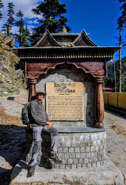
The board detailing the history of Bagori village.


One of the many Deodhar wood houses with carvings.


The intricate wood carving in a Bagori home.


The contrast - A house made up of Deodhar wood on the right and a newly constructed house with cement bricks on the left.


A well wood carved 'Nelong Homestay' in Bagori village. The homestay was closed.


The main vocations in Bagori village are growing apples and Rajma as cash crops, handcrafts, producing wool items like shawls, gloves, mufflers, coats etc which are displayed outside their houses for sale. While KS bought a necklace and earrings, I bought a small shoulder bag. We also bought fresh apples - both red and green @ Rs.50/- per kg. which we consumed during our day trekking. The apples were sweet, crispy and juicy.

Walking on the main pathway in Bagori village which is of 1 km distance.


A Buddhist temple in Bagori. Just across the street is a Hindu temple of Laal Devta


Wood crafted artifacts on display with windmill.


Apple crates waiting to be loaded on minivan for onward transportation on highway in trucks.


KS tasting the Bagori apple which we bought in the village.


A street scene in Harsil in the evening. Only KS and I were on the street.


Harsil market and taxi stand. In the background is Lama Top.


After about 1 hour of walking trip in Bagori village, we headed back to Harsil market which has some attractive looking houses with paintings. There were not many tourists on the streets. In the evening, we arranged for the next day's trip to Bhaironghati for Gartang Gali trek, thereafter to Gangotri and back to Harsil. More about this part of our trip in the next Blog.