Sunday, May 24, 2009

Trek to Valley of Flowers, Hemkund & Kedarnath : August 1990

Impossible to take a step without crushing flowers. This observation by Frank Smythe, who accidentally discovered the Valley of Flowers (VOF) in 1931, was enough for me to plan a trek to VOF in August 1990 with Jambukewaran and Deshpande, my office colleagues. Those days, GMVN brochure was the main source of information about the details of the VOF trek. The idea of trekking VOF in monsoon season was somewhat not appealing but that was the best season to see flowers in VOF [ mid-July to mid-August]. We reached Haridwar via Delhi from Mumbai and stayed overnight [Samrat Hotel @110/-].
Day-1 : Haridwar-Joshimath (280 kms)
We commenced our road journey from Haridwar at 8.00 in the morning by a hired Maruti van. Although it was almost a rain-less day, we encountered first landslide near Byasi on way to Devprayag. After about an hour or so, the debris were cleared and traffic resumed. The next landslide was somewhere between Pipalkoti and Joshimath resulting in the partial road block and slow movement of traffic to and fro Joshimath. We reached Joshimath at around 6.00 p.m. by which time the last gate for the road beyond Joshimath was closed for the day. We had to stay overnight at Joshimath [Kamet Hotel @70/-].
Day-2 : Joshimath-Govindghat-Ghangaria [20 kms by road and 14 kms by trek]
We took the first gate at 6.30 in the morning from Joshimath for Govindghat in the cloudy weather. After reaching Govindghat, we descended by a side path for about 500m and after crossing the suspension bridge over Alaknanda river, we reached near Gurdwara. After depositing our non-essential luggage at one of the shops in the vicinity of Gurdwara and buying ponchos, we commenced 14 kms trek to Ghangaria.
Govindghat
Beginning of trekking to Ghangaria
A group of sikh pilgrims on way to Ghangaria

The mule track was all along Lakshaman Ganga stream which eventually meets Alaknanda river. After about 3 kms, we reached Pulna, a small hamlet where many pilgrims stopped for a while for rest. At this point, it started raining which became heavy as we proceeded towards Bhyundar. The rainwater flowing across the mule track made our progress slow. The water level of the Lakshaman Ganga stream had already started rising and at some places it was close to the trekking path. There were many waterfalls on the way, a couple of them being the large ones. By the time we reached Bhyundar, we were completely drenched even with our ponchos on. The rains and the cold weather made us shiver as we stopped at Bhyundar for rest. After a cup of hot tea, we decided to move ahead as walking was a better option in cold weather than taking rest.

Waterfall somewhere between Pulna and Bhyundar

A swollen stream very close to the trekking path towards Bhyundar

The torrential rain continued to lash as we commenced our final lap of the day's trek to Ghangaria. The overhang of clouds with heavy rains deprived us of any scenery on the way. The steep climb under heavy rains made our progress very slow. We reached Ghangaria ( 3050m) by 4.30 p.m. Fortunately rains had abated but the weather was still cloudy and cold. Without doing much scouting, we took a room at Hemkund Lodge [@60/-]. After dumping our luggage, we spent the rest of the day sitting near the cooking place of the lodge to get our wet cloth dry. We left the place only after dinner and retired to our room quite early.

Day-3 : Ghangaria-Valley of Flowers-Ghangaria (5+5 kms trek]

After the breakfast of Alu Parathas and tea, we started our trek for VOF around 7.30 in the morning in cloudy weather. After paying the entry fee (Rs.2/- per head + Rs.2/- per camera), a short walk led us to a point where the Forest Department's board indicated the direction to the left for VOF and the right to Hemkund Saheb. The first 2 kms of trek was paved alongside the Pushpavati stream which flows from VOF.

On way to Valley of Flowers from Ghangaria

A make-shift wooden bridge over Pushpavati stream

As we moved further, we came across the first broken glacier over the trekking path which was not difficult to negotiate. However, the subsequent two glaciers which we came across were large ones completely covering our trekking path. Fortunately, PWD workers had already made steps and the sticks which we were carrying come handy in negotiating the snow path without much difficulties. As we were at the end of our snow walk, the valley became visible between two mountains which become clearer as we moved ahead. The valley looked beautiful with carpet of plants with flowers surrounded by meadows with snow-caped peaks visible at the far end.

Encountering first snow on way to Valley of Flowers

Walking over snow towards the valley


Cloud formation over Valley
The valley opening between two mountains
It was around 11.30 a.m. as we entered the valley. The weather was cloudy with occasional light rains. It was a mesmerising feeling for us to walk in the midst of green carpets with long stretches of wild flowers plants as far as my eye could see. Many of the flower plants were as high as 6-7 feet. The observation of Frank Smythe was, however, no longer valid after 60 years as a narrow path made by a steady flow of trekkers existed. [ I understand that forest authorities have paved this path with stones]. Nevertheless, in many places, it was impossible to avoid brushing with plants and flowers while walking in the valley. In some places, we had to physically push these plants sideways to walk further.


First encounter with mass flowering as we entered the valley

The valley of green carpet with wild flowers


Wild flowers-1
Wild flowers -2
Wild flower-3


Wild flowers-4
We saw varieties of wild flowers many of which I had not seen in any of my earlier visits to Himalaya. It was a visual treat for all of us to see from an higher elevation the light breeze swinging the flowering plants giving an impression of a multi-coloured carpet being laid in the valley. We were surprised that compared to the pilgrims crowd at Ghangaria, there were not more than 8-10 trekkers in VOF including our group to see the nature's spectacles. One of the members of other group was heard complaining to their Leader in Marathi. " Have you brought me here all the way from Mumbai just to see therda chi phula ( Impatiens flowers) which I could have seen in Borivali National Park in rainy season?" Each person has his own perspective of looking at the nature. The pilgrims were here mainly to complete their visits to Hemkund Saheb. Additionally, they would rather make a visit to Badrinath than 'wasting' one day in VOF for seeing some jungli phuls (wild flowers).

Me, Deshpande and Jumbukeswaran in VOF


Wild flowers-5

Wild flowers-6
The most common wild flower in VOF

Multi-coloured wild flowers

We had already spent about an hour in the valley and still there were miles to go where we could see the stretches of wild flower plants merging with meadows all around. The the constant cloud movements, however, eclipsed the view the snow covered peaks. Since the muddy path was already water-logged and it was raining a bit, we decided to return. We reached Ghangaria by 2.00 p.m in a cold and cloudy conditions. We had our lunch at one of the dabhas and rest of the day was spent mostly in the same dabha to get some warmth from the cooking place with several rounds of tea and assorted pakodas to justify our sitting in the dabha for long time. We also visited the Gurdwara just to enquire about the possibility of getting a better room for the stay but a large pilgrim crowd taking shelters in the Gurdwara premises was good signal that rooms were full.

Day-4 : Ghangaria-Hemkund Saheb-Ghangaria (6+6 kms trek)

After the usual breakfast of parathas , we left Ghangaria at around 6.45 a.m. for Hemkund Saheb in a sunny but cold morning. After about 200-300 meters walk from Ghangaria, a stony path to the right goes to Hemkund (6 kms). After initial plain walk on the stone-paved path, we came across a large glacier which was broken into two parts, the dividing line being the stone-paved path. We saw a few buffalow grazing on the broken glacier which had slided through the slopes and settled in the valley. Perhaps some small patches of grass must have grown through the thin snow layers.

Ghangaria seen from trekking path to Hemkund

Trekking junction - left to VOF and right to Hemkund Photo by Deshpande

On way to Hemkund by the side of a broken glacier

After crossing the glacier, the climb became steeper which was obvious as we were to gain altitude by more about 1300m in a 6 kms trek. The steep climb forced us to take rest quite often to regain our normal breathing. Even the mules carrying pilgrims and other supplies were breathing fast as seen from the foam accumulated around their nostrils. On this stretch also, we came across some of the wild-flowers we saw in VOF. As we gained altitude, the wild flowers were replaced by a series of brahm kamal plants. As we were close to our destination, the weather turned cloudy and in some places we were virtually walking in cloud and mist making our progress slow. Fortunately, it did not rain much. We reached Hemkund at around 11.00 a.m. At first, the constant movement of cloud and mist around the lake did not give us any idea of the topography of the area. After taking a quick dip in the ice-cold water of the lake, we took a round of the lake starting with Lakshaman (Lokpal) temple and ending with a visit to Gurudwara with star-shaped roof which was under renovation .

Other part of the broken glacier lying in the valley on way to Hemkund
Pilgrims resting on way to Hemkund

Trekking through the mist on way to Hemkund

There was a brief lull in the cloud movement mist which gave us an opportunity to see the Hemkund Saheb in good perspective. The lake was surrounded by snow-covered mountains with scree and boulders lying at thier slopes. The Gurdwara was located at the shore of the lake. The sad part was that the film in my camera got over. I cursed myself for inadvertantly leaving the extra film rolls at Govindghat.

There were some places around Hemkund which could have been explored by us such as walks to the nearest bases of snow-clad mountains. But at high altitudes, the psychology of most of trekkers, who had just a couple of trekking experiences like us, would be to leave the place as early as possible when the weather was fine. So without exploring any nearby places, we started our return trek around 12.30 in the afternoon and reached Ghangaria by 3.00 p.m. without facing any rain on the way. As in the previous days, the rest of the day was spent in the dabha for lunch, tea, more tea and pakodas and ended with dinner.

A hidden waterfall on way to Hemkund

Wild flower on Hemkund route

Wild flower on Hemkund route
Day-5 : Ghangaria-Govindghat [14kms- trek] Govindghat-Badrinath-Pipalkoti [120 kms - car]

We commenced our trek back to Govindghat at 7.00 in the morning. The plan was to drive from Govindghat to Badrinath for an overnight stay and trek to Mana-Vasudhara falls. We reached Govindghat by 11.00 a.m. After collecting our luggage, we drove to towards Badrinath. As we were just short of 3 kms from Badrinath, we came across a huge water fall which was cascading from the top of the mountain with a great force crossing the road with full force. Our driver, after seeing the force of the water, decided that it was dangerous to drive through the waterfall as the light vehicles like Maruti van may be thrown in to the valley by the sheer force of the waterfall. Even Ambassdor car drivers refused to cross the waterfall and went back. After pondering over the options of going back to Joshimath or crossing the waterfall and walk the remaining 3 kms of distance to Badrinath, we decided to go for the latter option taking only one pair of toursers leaving the rest of our luggage in the van. It would not have been possible for us to cross but for the support of the locals who took us one by one from the cliff side of the road in swift movements allowing bare minimum time to take support of our legs through the water.

We reached Badrinath by walking 3 kms on the road. After a much needed bath in the hot spring, we took the darshan of Badrinath which was all for oursleves. The priests advised us to stay overnight to witness the religious ceremony of Krishna Jnamashtmi ( birth day of Lord Krishna). We could not do so as we were eager to come out of the treacherous waterfall before further rains make it impossible to cross. After spending about an hour or so, we walked down up to waterfalls. Fortunately, we were lucky as we boarded a GMOU bus coming from Badrinath side as it reached the waterfall point and got down on the other side of the waterfall where our driver was waiting for us. We stayed overnight at Pipalkoti [Atul Hotel @60/-]. Since we had now 3 extra days, we decided to visit Kedarnath, the first visit by all of us to one of the chardhams.
Day-6 : Pipalkoti - Gaurikund [155 kms]
After the breakfast of idlis and dosas at a restaurants near bus stand, we started for our next destination Gaurikund at 8.00 in the morning. The rains had made the drive to Gaurikund via Rudraprayag scenic with Alaknanda river in full force. The cloud and mist in the valley did not give us the chance to view the mountains. We reached Gaurikund at around 2.oo p.m and stayed overnight. [Annapurna Lodge @45/-].

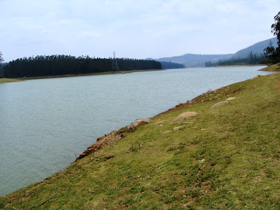
Paddy fields on the bank of Alaknanda river somewhere between Pipalkoti and Rudraprayag
Day-7 : Gaurikund-Kedarnath [14 kms trek]
We got up early in the morning and had a bath in the hot springs located very near to our place of stay. After the breakfast of Alu Paratha, we commenced for trek for Kedarnath around 6.00 in the cloudy morning. Up to Rambara, the trek was a gradual climb, mostly in a slushy path. Being rainy season, there were not much of a pilgrim traffic. Just before Rambara, the muddy path came close to a roaring Mandakini river. After crossing a wooden bridge, we reached Rambara. We took some rest as here onwards, it was a steep climb upto Garud Chatti.
Mandakini in spate near Rambara

Since we had already done trek to VOF and Hemkund Saheb, we were well acclimatised to this part of the steep climb. After Garud Chatti, it was about 2 kms, more or less, of a plain walk up to Kedarnath. Having done this trek 5 times so far, I can say that psychologically, this is the most difficult part of the trek/piligrimage as after having done about 5 kms of a steep climb from Rambara, Kedarnath temple looks so near but it was too far to reach. This is also the place where many pilgrims get breathing problem despite walking on a plain path as they are at an altitude of about 12000 feet. But for nature lover, all pains and fatigue are soon forgotten when they encounter the grassy patches full of wild flowers , especially in rainy season, on both sides of the path with a soft sound of gushhing water of Mandakini river .

Zig-zag trekking path to Kedarnath from Rambara
Wild flowers on the way about 2 kms before Kedarnath


 Kedarnath temple complex in the shadow of cloud-covered Kedar dome 


Kedarnath temple
We reached Kedarnath at around 12 noon. After checking in Himlok Hotel [@60/-],
we had an 'exclusive' darshan at Kedarnath temple since there was not a single pilgrim inside the temple. This encouraged Jambukeswaran to go for some special puja. After taking the receipt for the said puja, we again went inside the temple, sat in front of the hump-shaped shivling, chanted the mantras with priest and bathe the shivling with water, milk and ghee. It took about half an hour to cokmplete the ceremony.

Kedarnath temple seen from the backside

Kedar dome forms the background to the Kedarnath temple
Day-8 : Kedarnath-Gaurikund [14kms trek]-Haridwar [234 kms]

We started from Kedarnath around 8.00 a.m. in ther sunny morning. As we walked towards Garud Chatti, the Kedarnath peak which had so far elluded us due to cloudy weather was now visible. After a short stop at Rambara, we reached Gaurikund at 12 noon. After locating our driver near the bus stand ( there was no cell phones those days) we commenced our last lap of journey to Haridwar which was smooth. We reached Haridwar by 7.00 p.m. We returned to Mumbai after taking a day's halt at Delhi.

Meadow on the other side of Mandakini near Kedarnath
Pilgrims returning from Kedarnath going towards Garud Chatti
Terrace farms seen somewhere between Kund and Rudraprayag

Photos by the author


Monday, May 18, 2009

Trip to Nilgiri - April 2009

I and my wife visited Ooty, Coonoor, Kotagiri, Avalanche and Kundah during April 12-18. We had decided to stay 3 nights at King’s Cliff, Ooty, 2 nights at Destiny Farmstay at Avalanche (actual location is between Emerald and Avalanche) and 1 night at Vivek Hotel, Coonoor – the last one as an extra day back-up.

Day-1 : Coimbatore-Ooty-Botanical Garden

We reached Coimbatore from Mumbai by flight at noon. The overnight rain had made the weather a pleasant one at Coimbatore. Sivakumar, our driver was already waiting at the airport concourse to receive us. I was happy to note that Sivakumar was fluent in English and had a keen interest in nature trails and exploring new areas.

At around 12.30 p.m., we left airport for Ooty, our first destination. The journey was smooth except in Mettupalayam where it took about an hour to cross the town due to traffic jam reportedly created by a horde of trucks parked around the vegetable market for unloading vegetables brought from Ooty side. The Mettupalayam-Ooty road was in excellent condition and there was not much of traffic on the road. It was nice to see many Jacaranda trees in bloom on the road sides. We reached Ooty at around 4.00 p.m. We checked in King’s Cliff, a heritage property located about 2 kms north-west of Charring Cross on a hill top overlooking the valley. We liked the secluded location, the ambience and the food in the hotel.

King's Cliff Hotel, Ooty


In the evening, we visited Botanical Garden. Being Sunday, the garden was full of noisy crowd. To me, the Botanical Garden looked more cramped than the one I had seen in my last visit in December 1975 – perhaps due to crowd outnumbering trees in the garden. The large slopping lawn looked somewhat congested due to more trees being planted on the lawns than what I saw in 1975. Nonetheless, in my view, the Ooty Botanical Garden is still one of the best maintained gardens in the country.

Botanical Garden, Ooty


Dragon tree - Botanical garden

Day-2 : Doddabetta- Rose Garden-Wenlock Downs-Pyakara-Glenmorgan
The next day, we drove to Doddabetta ( 2623m) - the top of Tamilnadu. From here we got the good view of Ooty and Coonoor towns and also a faint glimpse of Avalanche Dam at the far end. On the way back to Ooty, we visited the Rose Garden which was laid out in three layers. It was not a peak season for the roses and we could see roses only in the third layer. Even then, it took us about an hour to complete the round of the third layer. In the month of May, all the three layers of garden would be full of roses and serious rose lovers can easily spend half-a day to complete the rounds. Also the annual rose show is held in the month of May.

Ooty town seen from Doddabetta

Doddabetta watch tower


View of Rose garden

After a hearty lunch at Ooty Sravanan @Rs.35/- we drove towards Pyakara lake. After 7-8 kms from Ooty, our driver pointed out on the left the dense pine tree forest where the climax scenes of the Roja were filmed. Locals call this place as Ooty’s silent valley. A steep descent from the road through the dense pine forest led us to a lake formed from the water from Kamraj dam. This is a very serene place devoid of crowd. I was a bit surprised by the presence of pine trees in such a large number in this place (and also elsewhere in Nilgiri) as I was under the impression that pine trees grew mostly in temperate climate. However, the pine tree cones were smaller here than what I used to see in Himalayas.

Pine tree forest leading to Kamraj lake


Kamraj lake

We walked about one km further by the side of the lake. I could imagine that this walk could have led us to one of the meadows of Wenlock Downs which was our next destination – the shooting meadow as locals call it and one of the the favorite places for film shooting in Ooty. A gentle climb of about one km in the warm afternoon led us to the top of the meadow. From here, one could have a panoramic view of grasslands surrounded by the mix forests of pine and eucalyptus and also the Mukkurthi peak. There was not much of the crowd on the top. This was the place we could have spent some more time had we carried sun caps.


'Shooting meadow' - one of the many meadows in Wenlock Downs

View from 'shooting meadow'

We skipped Pykara waterfalls as those who were returning from the place told us that the force of the waterfalls was very low. We did stop for sometime at the Pykara lake boat house. Although there was not much of a crowd for boating, we also skipped the boating for spending more time at Glenmorgan View Point, our next and the last destination of the day. In my view, boating at Pykara can be more rewarding than in the Ooty lake due to less crowd, the clean lake water and the surrounding scenery.

Pykara boat house

Most of the drive to Glenmorgan was through the forests of pine and eucalyptus trees. The road was generally in good condition. As we reached close to Glenmorgan, the forests gave way to a cluster of tea plantations on the right side with the lake on the left of the road. After reaching the gate of Tamilnadu Electricity Board (TEB) Rest House, we realised that Glenmorgan View Point was a restricted area and we were required to take prior permission from TEB to enter the View Point area.

Glanmorgan tea plantations

Sivakumar, who was very enthusiastic to get into the View Point, talked to TEB security staff and explained to him that we had come all the way from Mumbai to see the place. The TEB staff, perhaps feeling pity on us, gave permission and directed us to also seek permission from the police manning the Check Post inside the premises. After producing my I-card, giving my background (RBI Pensioner etc.,) and writing our details in the log book, the police permitted us to walk through the gate to the View Point. The photography inside the TEB premises was strictly prohibited. The police told us later that recently a militant was arrested in the Kodaikanal forest area after which they had stepped up security in the Power House and they allow very few genuine tourists ( as against picnickers) to visit the View Point. He also pointed out that in the recent period, some of the picnickers had misused the View Point and the tunnel with drinking binge and immoral activities.

As we entered the restricted area, a short walk towards the right side took us to the tunnel which was closed. For the security reason, the tunnel is kept closed except in the morning at 8.00 a.m. and in the evening at 5.00 p.m. for ferrying TEB staff to and fro Singara Power House located about 3 kms down in the valley. The way to the left led us to a cliff on which there was a small tower by the side of the winch (trolley pulled by a mechnical rope) track. The view from the tower was spectacular to say the least. The bowl-shape valley was densely covered by the shola forest with Power House in the mid-point. The forest was extended to the Madumalai Wildlife Sanctuary.

The next amazing view of this place was the three stage rail track on which the winch runs. The first stage journey looked more dangerous as the track was almost perpendicular to the cliff followed by a steep downward inclination until it reaches the second stage where the second winch is stationed. From second to third stage, the winch journey appears to be a straight one. Unfortunately, the journey by winch has since been discontinued even for TEB staff for safety reasons. The winch stationed at the View Point had the capacity to carry six passengers and freights. The fresh coating of grease on the cable ropes would indicate that the winch may have been occasionally used for ferrying the freights to the power house. Looking at the topography of the area, I could imagine that the winch journey to the Power House would have been adventurous and rewarding.

Day-3 : Coonoor-Kotagiri-Kodanad View
We traveled to Coonoor by the morning toy train. Sivakumar dropped us at Ooty railway station and thereafter drove to Coonoor to pick us up at the station after an hour or so. The toy train hauled by a diesel engine stopped at Lovedale, Ketti, Aravankadu and Wellington stations before reaching Coonoor at around 10.00 a.m. Though the valley views from the train, especially between Lovedale-Ketti (right side) and between Ketti and Aravankadu (on the left side) were great, I felt that we could get, more or less, the same view from the road journey as well. Perhaps Coonoor-Mettupalayam train journey could have been more interesting than the one we took.


View from toy train near Ketti


Me on the Guard's cabin of toy train

From Coonoor, we drove to High Field Tea Factory, located in the midst of their own tea plantations, about 5 kms from Coonoor. After taking a round in the factory to understand the tea making process ( dehydration of tea leaves, cutting, roasting and finally grading of tea), we visited Sim’s Park, the botanical garden of Coonoor. The park is not as big as Botanical Garden in Ooty but exotic trees are better laid out here than in Ooty Garden.

One of the tea plantations of High Field Tea

Interesting branches of a tree in Sim's Park

The road to Lamb’s Rock/Dolphin’s Nose passes through the large expanse of tea plantations, the most prominent and beautifully laid tea plantations being that of Singara Tea Estate. The drive was smooth as a major portion of the 10 kms road to Dolphin’s Nose has been paved with inter-locking tiles and work on the remaining portion of the road was underway. From the road end, we trekked about one km through monkey infested forest to reach the first ( lower) view point of Land’s Rock. The view from this point was restricted towards Mettupalayam plains. A further walk of 100 meters took us to a higher view point with watch tower from where we had the wide angle view of shola forest and tea plantations on the lower and the higher alleviation respectively.

View of tree plantations from Lamb's Rock watch tower

While returning from the forest path, a monkey made threatening gestures to my wife perhaps eyeing on the water bottle she was holding. As she threw the water bottle, the monkey quitely picked up the same, opened the cap with his teeth and drank the water. Perhaps the warm weather made the monkey desperate for the water.

Me at one of the view points on Lamb's Rock

It was a warm afternoon as we reached Dolphin’s Nose Point. I did not find the view from this point as spectacular as that from Lamb’s Rock though the view of Catharine’s falls was great even with only one stream of waterfall gushing down to the deep valley.

Catherine's waterfall as seen from Dolphin's Nose


After lunch at Rangoli located at Orchid Square, about 3 kms before Coonoor, we proceeded towards Kotagiri road from one of the interior bylanes connecting Orchid Square, bypassing Coonoor. The Kotagiri road was in good shape and there was not much traffic. Much of the tea plantations of Nilgiri are located on the Coonoor-Kotagiri-Kodanad circuit which was a scenic journey. After crossing Kotagiri, we drove about 15 kms to reach Kodanad Point View. The steep drop from the View Point to the plains was awesome. On the south-eastern side was the Rangaswamy peak with a conical rock called Rangaswamy Pillar. The hazy conditions in the plains and around Rangaswamy peak gave a defused view of the valley which was not good for the photography. Perhaps our morning visit would have given a much clearer view of the plains.

View from Kotagiri road

Valley seen from Kodanad View Point

Ramaswami pillars seen from Kodanad View Point

The 45 kms return journey to Ooty via Kettabettu was equally scenic. As we were near to Doddabetta crossing, the dark clouds made their presence in the sky. By the time we reached our hotel, it started raining heavily followed by hails. The rains lasted about one hour bringing down the night temperature further. We had to take recourse to burn the wood in the fireplace that night to keep the room warm.

Burning woods in a fireplace in room at King's Cliff

Day-4 & 5 : Destiny Farmstay, Avalanche
After breakfast, we commenced our road journey to Destiny Farm. Last evening, Sivakumar had told me that he had never been to Avalanche/Emerald/Red Hills sides of the Nilgiri and he was eagerly looking forward to this part of the journey. On the way, we spend sometime around Ooty Lake just to refresh the memory of our last visit in December 1975. The lake frontage around the boat house which was visible from the road in 1975 was eclipsed by the row of shops. I missed the serenity around Ooty lake due to its proximity to markets and bus stand though it still is a great place for children to enjoy the trip.

Jacaranda trees in full bloom at Ooty lake boat house


Leaf-less trees in the midst of tea plantation at Palada

Good Shepherd International School at Palada

Without wasting much time, we proceeded towards Fernhill side for our journey on the Avalanche Road. The weather was perfect and the road was excellent for the drive. Once we crossed Palada, the road journey to Emerald Town and then on the Red Hill road/Avalanche Forest Check Post was very scenic. It was visual treats for us to see rolling tea plantations on the hill side and vast expanse of vegetable farms on the valley side. The Emerald Town surrounded by hills and vegetable farms looked stunning with unique landscape. For the first time, I saw tea plantations on the upper slopes and the vegetable farms, mainly carrots and cabbage, on the lower slopes of the hills in continuum. I would rate the Ooty-Emerald-Avalanche route as the best scenic road journey of our Nilgiri trip.

Emerald Town seen from Avalanche road

Vegetable farms and tea plantations seen from Red Hills road

Sivakumar was so engrossed in enjoying the journey that he missed the right turn to Red Hill road after Emerald Town and instead he drove straight on the road full of potholes towards forest check post. I was a bit worried about our Indica car withstanding the rough road. But it was such a terrific scenic journey through dense forest cover with Avalanche lake on the right side that the doubt about the road worthiness of the car went out of my mind. This was one of the rare drive on the road where both forest and Avalanche lake 'traveled' with us until our halt at a forest check post beyond which we needed to have the written permission from DFO to proceed. The forest guard was in no mood to allow us to walk towards Avalanche lake probably due to the presence of a group of two families who had permits to visit the forest beyond the check post. In any case we had not planned for this visit.


Cottages at Avalanche Forest Check Post

We made the return journey to Emerald stopping at a couple of places to see Avalanche lake. But the dense tree lines by the side of the road made it difficult to get a good perspective of the lake. My guess is that in rainy season, the Avalanche lake water level would touch a point where the forest begins.

Road to Avalanche forest check post

As we drove about 3-4 kms on Red Hills road, we reached a bridge dividing the Avalanche lake (left) and Emerald lake (right). The low water levels in both these lakes had resulted in a dry patch of land of about 200-300 meters wide in-between these two lakes below the bridge. It was pathetic site to see a group of picnickers with their minivan spoiling the serenity of the place on the dry patch of the lake. A further 2 kms drive on the Red Hill road and 1.5 km drive on a mud road to the left led us to the car parking lot of Destiny Farm. The pick up van of Destiny took us to Destiny Farm on a 1.5 km forest mud road. The 15 minutes ride on a 1.5 km forest mud road reminded me of a popular TV advertisement about a truck carrying loads of passengers on a bone rattling journey on a rough road but sticking together because of Favicole!!

Vegetable farms skirt the forest mud road to Destiny farmstay

Destiny is a 128 acre vegetable farmstay situated in a picturesque location bordering the Avalanche lake in the south and east slopes, hills of pine and shola forests in the west and Emerald lake in the north-east. There are electric fences all around the farm to prevent wild animals, particularly wild boars from damaging the vegetable crops.

Destiny Farmstay


View from our room-1


View from our room-2

Soon after the buffet lunch, we went for a stroll within the farm. The main vegetabl crops grown in the farm are carrots, cabbage – both Indian and Chinese varieties, green peas and some herbal plants. There are ranches for horses, cows and sheeps. There was a large fish pond just in front of our room meant for those interested in fishing. Bhaskar, the rock-climbing and raffling instructor from Darjeeling working with Destiny for last 2 years told me that in rainy season, the level of lake water touches the higher slopes of the farm and then the lake will be clearly visible from the hotel room. In fact the lake we saw near the forest check post takes a U turn behind a hill with one shore at Destiny and other one at the road bridge near Emerald.

We inside the ranch. Avalanche lake in the background

Avalanche lake seen from Destiny's ranch

Lily flower plant

The schedule of the activities in the Destiny Farm included one-hour trek through forest in the morning and agro-tour/ fishing activities after breakfast. The afternoon activities included visits to dairy farm, horse-riding and other sports activities in the complex. We spent most of our morning time by taking a long walk around the farm venturing as far as the shores of Avalanche lake and returning back via the track through the pine forest. In the evening, we preferred to take a round in the grassy patch located on the higher slope of the farm. From here, we get the panoramic view of the surrounding areas – vegetable farms on rolling slopes ending at the shores of the Avalanche lake on the one side and the green forest cover on the other side. Looking at the Avalanche lake from the height, I was imagining whether it could have been an interesting walk on the circumference of the lake starting and ending at the bridge dividing the Emerald and Avalanche lakes. All in all, it was worth spending 2 days in the Destiny Farm with easy-paced activities, comfortable stay in a rural setting, good food and, above all keeping us in constant touch with nature.


Me on morning walk through pine forest
Strawberry farm
Fishing at Destiny pond


At the shore of Avalanche lake

Day-6 : To Kundah-Manjoor-Coonoor
As per our schedule, we were to drive to Coonoor via Ooty under the impression that Emerald-Kundah road was not in good condition. With 2 days stay in Destiny, Sivakumar had become an ardent admirer of nature and he was keen that we visit Kundah and Upper Bhavani also. As I was returning from morning trek, he told me in great enthusiasm that road to Kundah was in good condition as told to him by one of the drivers sharing room with him. I checked with one of the Destiny staff who told me that while the road up to Kundah was in good condition, road to Upper Bhavani was not fit for vehicles like Indica and advised me not take the car to Upper Bhavani.

After breakfast, we started our journey to Kundah and as predicted, the road was in excellent condition except some patches near Kundah. As we came near Kundah village, a zigzag road from the base of Kundah village to the Manjoor village was visible. The location of the Manjoor village looked interesting. We decided that once we were through with Kundah dam, we would drive to Manjoor.
Zig-zag raod to Manjoor seen from Kundah

We reached near Kundah Power House. I was not much interested in visiting inside the power house but my wife and Sivakumar were interested in the working of a power house. In his most humble way, Sivakumar talked to Asst. Engineer and introduced me to him giving my credentials. Without much ado, we were permitted to go inside the Power House. A well-maintained park with varieties of blooming flowers by the side of Kundah lake lent colour to the area in otherwise drab atmosphere of the Power House. We met the Plant Manager who took us on a 45 minutes tour inside the Power House . A point which interested me was that there were eight hydro-electric power houses in Nilgiri district and the lakes formed from the dams at Upper Bhavani, Avalanche and Emerald ( may be Western Catchments and others) were interlinked by tunnels. I have seen only two power houses in Nilgiri and in my view, these power houses and related dams do not appear to have damaged the beauty of surrounding places. Again, in my view, the Singara Power House in the lap of Glenmorgan valley surrounded by dense shola forest does not spoil the serenity of the place.

Kundah dam


After driving around Kundah dam, we proceeded to Manjoor on a climbing zigzag road. Manjoor is a big village (or town?) with usual bustle. As we drove 1-2 kms further on a climbing road from the village, we came across a point from where we had almost 360 degree view of the dense forest and mountains all round. The weather was much cooler than what we had experienced in Kundah. Though Sivakumar was interested in taking us further on this road winding down through the forest to Upper Bhavani, I decided against it on fear of breakdown of the car. We returned to Coonoor in the afternoon via Kundah on a 30 kms scenic drive through forests.

In the afternoon, we took a round of Wellington town and visited the places around Golf Course, Madras Regimental Centre and Army Staff College. Being an army cantonment, Wellington is a clean town with good roads and bylanes. Sivakumar took us to the highest point at the outskirt of Wellington from where we had panoramic view of Wellington town on the one side and the dense forest on the other side.
Madras Regimental Centre seen from a hilltop
Dense forest at the outskirt of Wellington

Ayurvedic Retreat in the midst of tea plantations - Outskirt of Wellington

Day-7 : To Coimbatore and back to Mumbai
After breakfast at Hotel Sri Lakshmi (good and cheap south Indian snacks and coffee), located near bus stand, we commenced our journey to Coimbatore airport. There was not much traffic on the Coonoor-Mettupalayam-Coimbatore road and we could reache the outskirt of Coimbatore in less than 2 hours. Since we had time and my wife wanted to buy Coimbatore cotton saris , we proceeded to Coimbatore. After lunch at Annapurna (best south Indian meals of our trip), we proceeded to airport. The Air India flight to Mumbai was on schedule time. As the air- hostess was announced landing of the flight in Mumbai, the thought of the sultry weather and daily traffic jams at Western Express Highway loomed large on us.

Photos by the author