I had visited Dalhousie on two occasions. But these trips were in the nature of side trips after the completion of treks to Manimahesh Kailash in August 1996 and to Kugti-Kathik Swami temple trek. An opportunity to visit Dalhousie and Dharamshala-Mcleodganj came to me and my wife when my son's family were planning the trip during the summer vacation. After zeroing on the convenience of all, it was decided to visit these places during May 13 - 24, 2016.
After finishing our sight-seeing trip in Dalhousie and Kajjiar-Chamba which, as I said earlier, I had already visited these places in 1996 and 2012, I was eagerly waiting for our next destination - Dainkund Top trek followed by a visit to Kalatop. We had hired a tourist car for the full day which picked up from Hotel Manimahesh at 9.30 a.m. The day was pleasant and the sky was cloudless. We drove on Dalhousie-Kajjiar road. At Lakkad Mandi, we took a right turn on a single lane road covered with dense forest of fir and deodar trees. The car dropped at the Air Force Station barrier, beyond which the entry was prohibited.
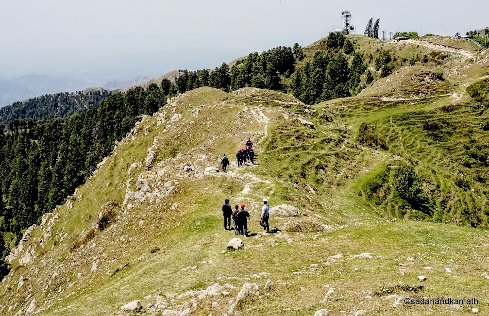
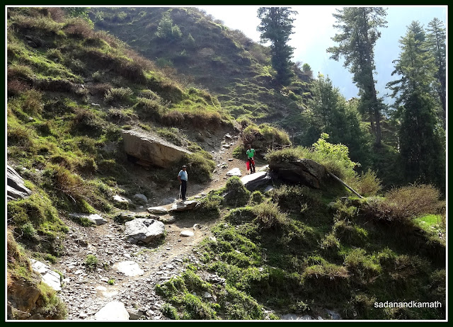
After taking the essential gears like sun hats and light jackets along with some snacks and water bottles, we commenced our trek at 10.15 a.m. We were six people - from myself, 70 years to my grandson of 8 years. The initial climb was a bit steep up to the resting point - slightly less than 1 km from the starting point. The pathways up to the rest point was made up of concrete taking a bit longer route to make the climb gradual. The experience trekkers can take somewhat shorter shepherds'/villagers' path which is more steeper than the concrete path. On the right side is a large valley which deepens as we climb. the left side is covered with forest of mostly deodar trees beyond which one can see the snow clad mountains of Pir Panjal range of the Himalayas. We were very lucky to have a day of clear sky after the two consecutive cloudy days.
The trek just started from the starting point on a concrete pathway. On the left is the mud pathways used by shepherds and villagers.
The first rest point (top) which is about one km from the starting point.
Walking on short cuts instead of on concrete round about pathway (on the left) towards the rest point.
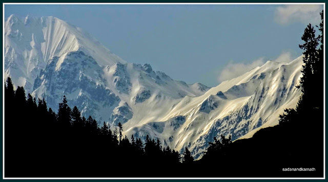
The first view of snow-clad peaks of Pir Panjal range.
Looking back the trek path as we are close to the rest point.
Even though the weather was pleasant, the strong sun on a cloudless day made thewalking a bit tough, that to on a climb. But the beautiful sceneries of valleys and the green forest in contrast with snow peaks of Pir Panjal range made us forget the minor agony of sun tan. While children and ladies in our family took rest for some time in the shaded rest point, myself and my son walked towards the valley side to have great views of the deep valley and did some photography. A group of Air Force Cadets were returning from Dainkund probably after their daily walking exercise.
A zoomed shot of one of the peaks of Pir Panjal range taken on way to the
rest point.
The valley side view from the Rest Point.
A few of the hikers can be seen on the top of a hillock to have a ring side view of the snow clad peaks of Pir Panjal range.
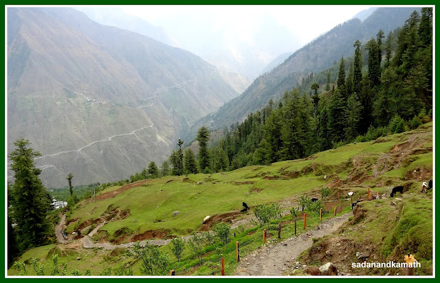
After resting for about 10 minutes at the rest point, we commenced our walk towards Paulhani Mata temple. From now onwards, the walk was easy as the climb was gradual. Also, there was no more concrete path as the it was more or less an even path except in a couple of places where small patches of climbs were followed by descends. Now, we were moving closer to a wider range of the Pir Panjal snow peaks. Also, there were meadows all along the path. So occasionally, we would see shepherds taking their livestock of cows, buffalo and goats to these meadows for grazing.
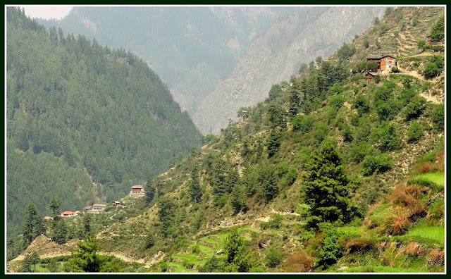
View of Kajjiar with lake from Dainkund trek.
Zoomed shot of one of the prominent peaks of Pir Panjal range.
A long shot of a panoramic view of Pir Panjal range.
Paulhani Mata temple which is actually located in a valley top (as against the mountain top) can be seen only when we were barely 200m from it. Until then, the temple was not visible from the trekking path.
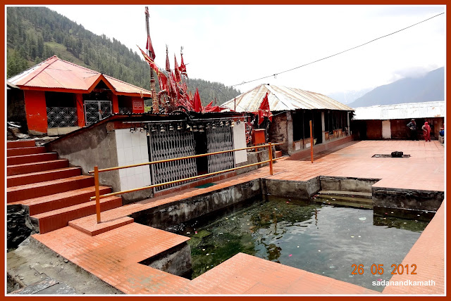
We reached the Paulhani Mata temple complex at 11.45 a.m. There was a moderate crowd of tourists as well as locals from the adjoining villages. Paulhani Mata is said to be an incarnation of Kali Mata. The story goes that there was a kund ( pond) where dains (witches) used to visit and create problems for the villagers. Hence the name is Dainkund. Kali Mata in the guise of Paulhani Mata visited the place freed the pond from the witches. In honour of Kali Mata, villagers constructed a temple. Now the pond is located under the Air Force jurisdiction which is prohibited for the general public. The locals revere the Paulhani Mata and on all the important events in the family like birth, marriage and the important festivals, locals visit the temple to take the blessings of Paulhani Mata. The devotees present tridents to the deity on each visit.
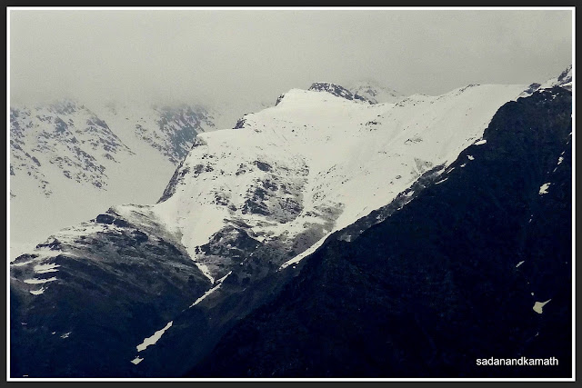
View of snow clad Pir Panjal panorama from the temple complex.
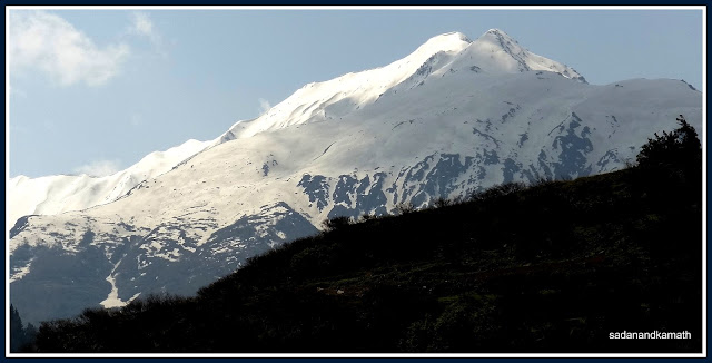
Zoomed shot of Manimahesh Kailash peak from Temple.
Zoomed shot of some unidentified peaks of Pir Panjal range from the temple.
Zoomed Shot of an unidentified peak of Pir Panjal.
In the vicinity of the temple, there are a couple of eateries which provides tea, cold drinks and fast food for the devotees. Most of the visitors starts their return journey after visiting the temple. Many may be under the impression that the panoramic view of the snow clad mountains can be best seen from the backside of the temple complex. This is partly true as some part of the view on the left side gets blocked by a hill top. We decided to explore the hill top under the assumption that the snow peak view from the hill top would be better than that from the temple complex. We were not wrong. It was a ring side view of 360 degree - from snow clad Pir Panjal range to the plains of Punjab.
View of Paulhani Mata temple from the hill top.
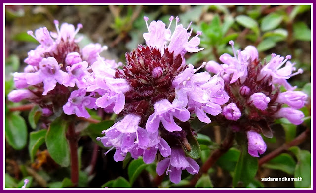
A dog climbs on a hill top amidst the carpet of wildflowers ' to have 360 degree view of the Himalayas'.
We look so small in the backdrop of snow clad Pir Panjal range as we are about to reach the hill top.
At last on the top of a hill top with a meadow at about 3000m ( 10000ft.) above sea level.
A panoramic shot of snow clad Pir Panjal range from the hill top.
After spending about 30 minutes on the hill top to have 360 degree grand stand view of snow clad Pir Panjal range, we descended to the temple complex and commenced return journey at around 12.30 p.m. It took us hardly 30 minutes of non- stop walk to reach the Air Force Barrier where our car was parked.We proceeded by Car to Kalatop Sanctuary before returning to our Hotel at around 4.30 p.m.
Returning from Dainkund trek with resting point in the background.
The trek was most rewarding for all of us among all other sight-seeing points in around Dalhousie. The weather was right. The trek route was right for a family group including the children. Sceneries were breath-taking. The risk en route the trek was minimal.After observing the topography of the trek, my view is that Dainkund would be a great destination for a winter trek for those who needs to have some calculated adventure added to the trek.
Ever since I had read some time in 1989, Christina Noble's book Over The High Passes - A year in the Himalayas with the migratory Gaddi shepherds (Collins, 1987), I have been fascinated by all things connected with Gaddis including their villages and the high altitude Himalayan passes which they cross twice over the years during summer and autumn months. After reading the book, I get an impression that among the shepherds of the Himalayas, Gaddis are the one who undertake the longest march of migration with their flocks from the lower hills of Kangra and Palampur to as far as the Lahul Valley after crossing the most inhospitable high passes of the Himalayas such as Kalicho Pass (4990m), Chobia Pass (4966m) and Kugti Pass (5040m). During my younger days, I had a wish that I should try replicating a part of the Gaddis's migratory route not in one go but by way of a series of treks. But this remained my a distant dream.
My first exposure to the land of Gaddis was in August 1994 when I and my friend decided to undertake Manimahesh Lake trek. This was my first trek in the heart of Gadderan - the land of Gaddis with Bharmour as our base. After completion of Manimahesh Lake trek, I had intended to visits some nearby villages but my friend's eagerness to return home after the completion of the trek led me the abandon the plan. Thereafter, I had no occasion to trek in Himachal Pradesh though I visited the state twice with my family as tourists.
When my friend K Srinivasan (KS) telephoned me some time in the last week of March this year to plan for a quick trek with a narrow time slot - last week of May to early June, I thought of reviving one of my oldest wish of exploring the migratory routes of Gaddis. This plan suited KS as well as after doing a series of treks in Uttarakhand, he wanted a change of trekking scene and HP was foremost in his mind. Since we were not familiar with logistics that goes with treks in HP, we decided that we would first plan to visit Chamba-Bharmour and decided the areas to be explored by treks cum road journey. In a way, this was my first tryst with unplanned trip.
Days 1 & 2 : Mumbai-Pathankot-Bharmour The
first challenge was the booking of to and fro train tickets as we were to travel in
the peak of summer holidays. While we could get the tickets for
Mumbai-NewDelhi-Mumbai and Chakki Bank- Delhi, New-Delhi-Chakki Bank/Pathankot tickets were
wait-listed and did get confirmed even at the time of chart preparation. So we
had to take a Valvo AC Sleeper Bus going to Katra leaving from New
Delhi (Pahad Ganj) at 07.30 pm at the last minute inflated price. However, the
bus journey was comfortable and we had a nice sleep in the bus. After leaving
Delhi, the bus stopped only at one place – Kurushetra for dinner.
As we
were some 17 kms short of Chakki by-pass, our bus broke down at around 5.30 am.
Realising that it was a major break down and it may take a long time to set it
right, at around 6.30 am, we decided to take chances by waving to passing
private tourist buses. But being the peak of the travel season, none of the bus
would stop as they did not have seats. Finally, a private tourist bus stopped
to our request. At first, the bus conductor refused but the driver of the bus, accommodated us on the back of driver’s seat
and dropped us at Chakki by-pass. We immediately got an auto rickshaw to reach Pathankot bus stand (4 kms).
After
freshening up and finishing a light breakfast at the Pathankot bus stand, we boarded the 08.45 am HPRTC’s bus to Bharmour via Bannikhet and Chamba. The bus took about 9
hours to cover a distance of 177 km. Almost entire road journey was on a hill
road involving climbs. The bus took some 3-4 longer stops enroute probably to
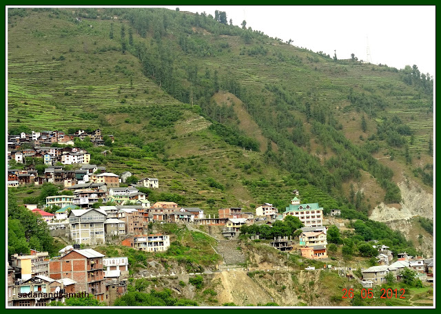
cool down the engine and also for lunch and tea breaks. We reached Bharmour (2190m) at
6.00 pm. After experiencing a very warm day during our bus journey, it was a pleasant weather at Bharmour. We checked in to Chaurasi Hotel, some 500m away from the bus stand (
@Rs.400/- double bed with 24 hours hot water and TV). The room was spacious and
clean. The food was good at our hotel's restaurant. After a grueling journey of about 40 hours (Mumbai-Bharmour), we had a sound sleep in the night.
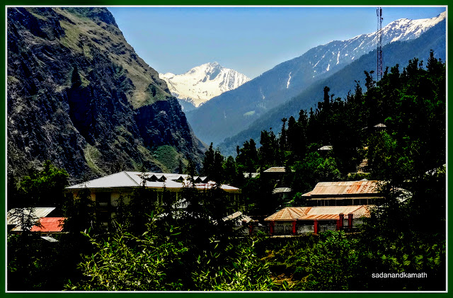
View of Bharmour from Chaurasi Hotel where we stayed.
Another view from our hotel room. In the foreground is PWD Rest House (green roof).
Day-3 : Bharmour-Brahmani Mata temple-Chaurasi temple complex.
I got up at around 7.00 am to a overcast sky. A peep through the window glass indicated that it had rained in the night or early morning and it was still drizzling. I could hear the distance sound of thundering. We went for the breakfast in our hotel's restaurant at 8.30 am where we met an elderly couple. They had come from Chandigarh in their self driven car and were staying in the PWD Rest House located at the road below our hotel. The elderly gentleman turned out to be a retired Air Marshal probably in late 70s who had come in Bharmour to enjoy a couple of days in the lap of the nature. It was not only a pleasure meeting them but it turned out that both were travel buffs like us. During the breakfast, we shared our many travel experiences. At the end of our breakfast, we were no longer strangers and we felt as if we knew them for a long time. They invited us to their PWD Rest House in the evening for a further tete-a-tete which we accepted.
After
the breakfast, our first destination was a 3 km trek to Brahmani Mata temple. After
a walk on a narrow road which goes skirting the main gate of the Chourasi
temple, the path goes through various alleys of the villages up to Melkota, the
last village before the Brahmani Mata temple. One could easily get lost in the
various alleys but for the well marked direction enroute. The weather was good
for the trek as it was drizzling most of the time followed by some sunny
intermissions. When we were walking through Melkota village, we got trapped in heavy showers. Seeing stranded, a man sitting in the balcony
called us to his house to take shelter for some time. His name was Bikramjit Thakur and he was one of the trustees of the Brahmani Mata temple. We spent about 30 minutes in
his house during which he served tea for us and discuss the background of
Brahmani Mata temple. All I could remember now was that Brahmani Mata was Parvati who came to Chaurasi temple complex for mediating. Disturbed by pilgrims, she decided to move out at a secluded place on a ridge not far off from Bharmour for continuing her meditation. Lord Shiva who was also meditating at Manimahesh Kailas came to Chaurasi temple complex. After knowing that Parvati had gone to Brahmani ridge, he gave her a boon that henceforth all pilgrims going for Manimahesh yatra would first visit Brahmani ridge to take a bath in the pond before embarking on to Manimahesh Kailas yatra. Otherwise the yatra would not be considered as completed. Bikramjit also revealed that during the yatra season (June-September), he accommodates
yatris in his house free of cost.
When the rain stopped, we took leave of Bikramjit Thakur and continued our trek by which time, we had already covered half the distance. After Melkota village, the trek was on a cemented path in the open with steady climb. From here, the views of Melkota village as well as Bharmour were scenic with most of the hill slopes covered with apple orchards. There were two gates on the trek route located roughly at the end of one and two kms of walk. from the second gate, the temple complex with two steams flowing by the side of it became visible but not the main temple.
We
reached the temple complex around 12 noon. The temple was located just below
the ridge with 3-4 water springs flowing from its front side. There were two
ponds within the temple complex. Presently, bathing in the pond just front of
the temple is not permitted. However, one can sprinkle water taken from it over
one’s head to symbolically complete the bath ritual. The temple is located in a
scenic place surrounded the dense lines of pine trees at upper elevation and
meadows on the lower elevation. This is
one of the temples in this region which Gaddis visit to seek Goddess’s
blessings for the safe passage during their migration with flocks to the higher
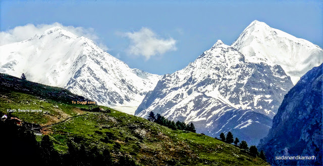
reaches of the Pir Panjal range. I met one Gaddi shepherd with his flock of
goat and sheep. To my query as to when he is going to cross Kugti Pass, he said
due to large accumulation of snow over the passes, this year, the pass may open
later than what it generally used to be. So he would be spending 3-4 days here
with this flocks before starting his journey to Duggi caves via Kugti and
Kartik Swami (Kelang) temple. To my question as to why they take so much risk
to cross high passes for getting into Lahul valley for grazing, he said that
grass over Lahul valley was more nutrient for goat and sheep resulting in
softer sheep wool( pashmina wool) besides flocks gaining more weights (adding meat quantity).
After
spending about 45 minutes at the temple, we started return journey to Bharmour.
The weather continued to be alternating between light rains and sunny. We return to our hotel and had a lunch in its
restaurant before taking an afternoon siesta. In any case, we would not have
liked to roam around Bharmour when it was raining and the streets were muddy.
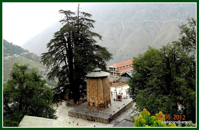
In the
evening, we visited Chaurasi temple complex. The day long cloud cover was
getting cleared and we could see snow clad mountains behind the Manimahesh and Narsimha temples. Like Chougan in Chamba,
Chaurasi temple complex is a meeting place for people of Bharmour. So there
were many people in the temple complex standing and sitting in groups for chit
chats. In the night we visited PWD Rest House to call on the retired Air
Marshal M M Singh and his wife as agreed during the morning breakfast. In the
sitting room there were another couple – retired Commodore Inderjit Singh
Sandhu and his wife. We had discussion mainly on travels as we
all were avid travellers. After more than hour’s tete-a-tete, we took leave of
retired air force officials and took dinner in our hotel’s restaurant. Since we
were to depart for Kugti village the next day, we segregated our luggage from
those to be left behind in the hotel and those to be taken on our 3 days’
sojourn in around Kugti.
Some pictures of Day-3 are uploaded below:
Back side view of Manimahesh temple in Chaurasi temple complex as we were on our way to Brahmani Mata temple.
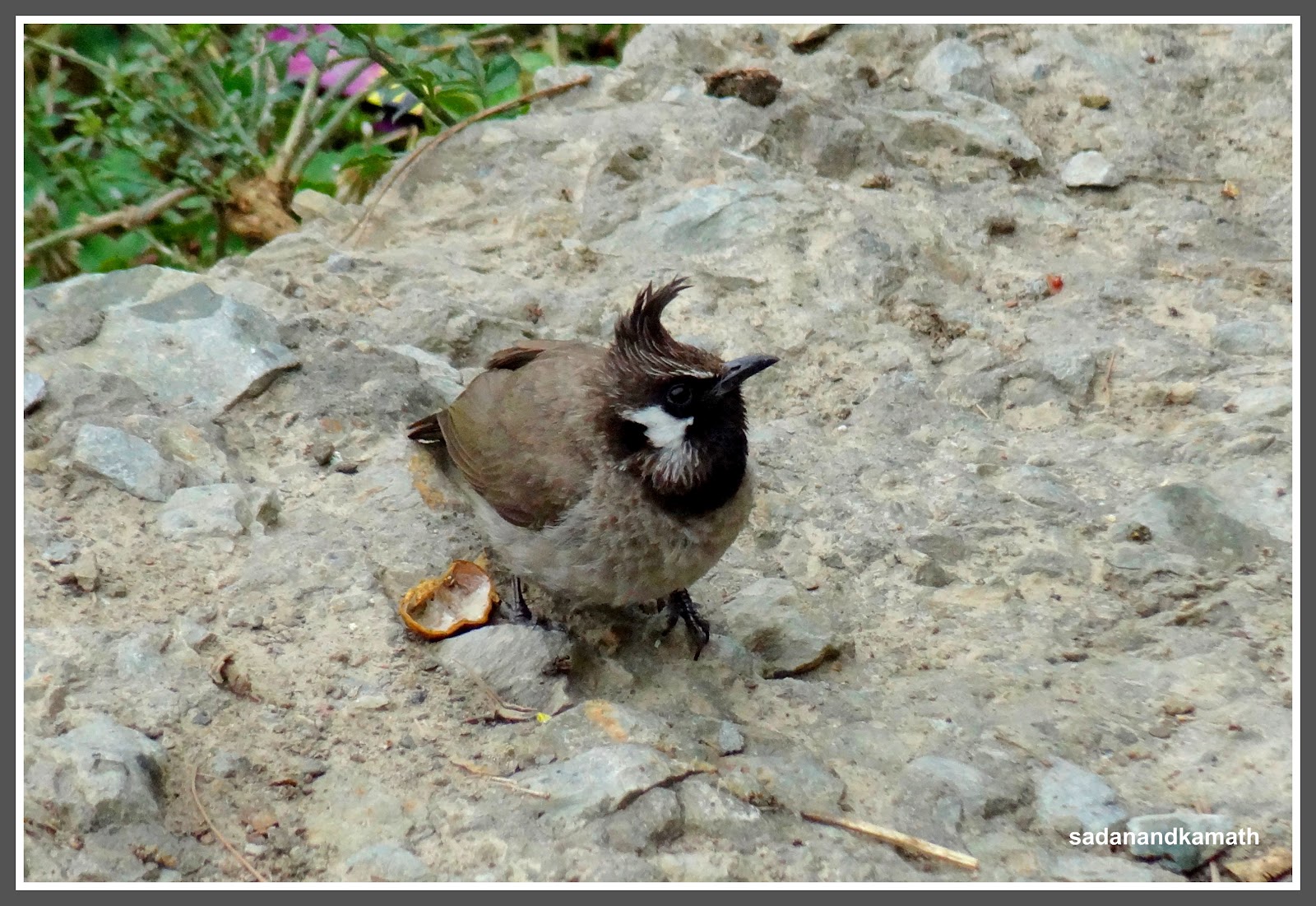
Red vented Bulbul on our path to Brahmani Mata temple.
View of Bharmour town from half way path to Brahmani Mata temple.
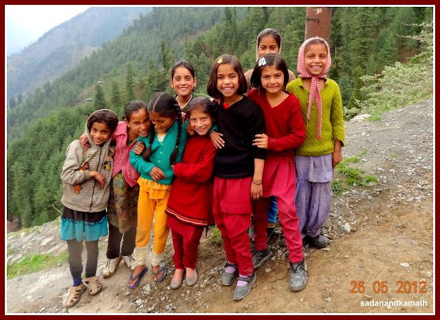
School children from Melkota village during their recess.
Path to Brahmani Mata temple after Melkota village.
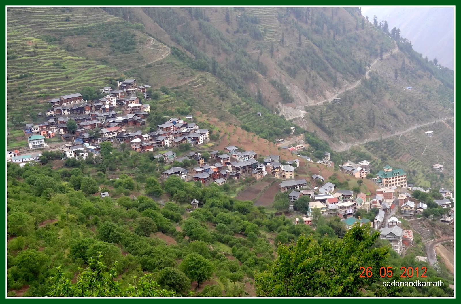
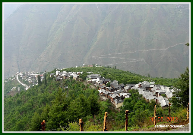
View of Melkota village, the last village on the way to Brahmani Mata temple.
Wild flowers on way to Brahmani Mata temple.
Climb on a zig zag route as we are in about 1 km distance from the temple.
Brahmani Mata temple (right) with holy pond in the foreground
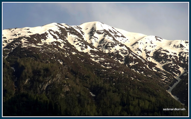
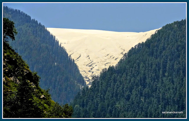
Zoom shot of snow clad mountains forming backdrop to the temple.
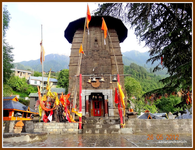
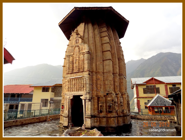
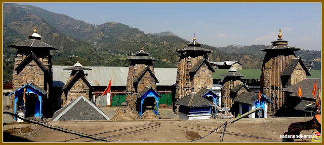
Manimahesh temple in Chaurasi temple complex.
Snow clad mountain forming backdrop to Manimahesh temple.
Narsimha temple in Chaurasi temple complex.
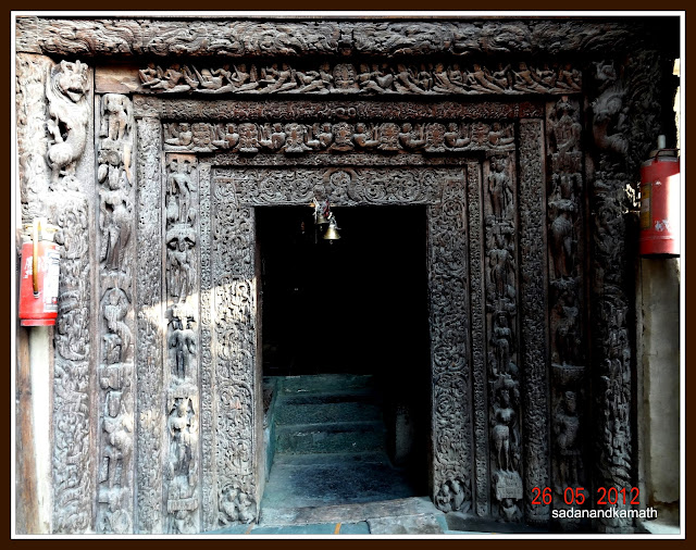
Intricate wood carvings on the main door of Lakshna Devi temple inside Chaurasi temple complex.
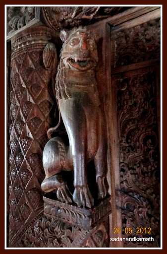
Wood carved pillars and lion at the sanctum of Lakshana Devi temple.
Day-4 : Bharmour-Dharol-Kugti
On the
previous day, we had firm up with a guide recommended by our hotel to accompany
us for our trek to Kugti and Kartik
Swami (Kelang) templeand weather permitting,
also to Duggi caves. Actually, there was no need for a guide up to Kartik Swami
temple as the trail was well marked and in case of doubt, we could got the
guidance from some villagers and mule men were seen on the Kugti village route. But we
thought that having a guide could be handy especially if we decide to do some
side treks.
Being
Sunday, everything was in slow pace in Bharmour. But our hired Alto had already
arrived outside our hotel to pick us for drop to Dharol, the last road head for
Kugti. Our hotel restaurant was not opened even at 8.00 a.m. So after a quick breakfast at the only dabha opened near PWD
Rest House, we departed at 8.30 am for Dharol (22 kms) by Alto (Rs.600/- for a
drop). Since road is mostly muddy with potholes in some places, it took about 1 hours to reach Dharol ( 2300m).
Presently, a small car like Alto can go about 2 kms further from Dharol.
However, due to some blasting work, the last stretch of the road beyond Dharol
was closed. After about 200m further from Dharol, we descended steeply to a
small stream followed by equally steep climb to the same road to continue our
trekking on the proposed road path. The weather was sunny and very warm but the
occasional cool breeze helped us in
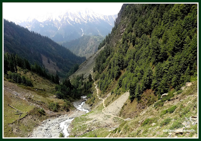
overcoming the heat. The trek path ( or the proposed road) to Kugti runs
parallel to Budhil river on the right. Being the route of the proposed road, it
was a little longer (7 kms) than the usual trek route which goes through the other side
of Budhil river. But the advantage of the road route was that ascends and descends
were moderate as compared to the traditional trek route as told to us by our
guide.
At
around half way to Kugti village, we met Thakur Singh Bharmouri, the local MLA
who was coming with his followers after spending the night in Kugti village, a
part of his assembly constituency. After exchange of pleasantries, he enquired
with us whether we need any help. We replied in negative but requested him for
the sake of Kugti villagers to at least hasten the completion of the road to
Kugti. He assured us that the remaining part of the road to Kugti would be
completed within one year. Looking at the topography of the remaining section
of the proposed road and the inaccessibility of the place during winter months,
I feel that it would be impossible to complete the remaining stretch of the
road within one year.
About 2
kms from the Kugti village, we had to cross a small stream after which it was
more or less a straight walk up to Kugti village. At the meeting point of this
stream with Budhil river, there was a stretch of a plain meadow where a
building for a high school is under construction. In fact, some of the high
school classes have already started operating from this place. This meadow in front of the school is being used by
trekkers as camping site. From this point, Kugti village is about 2 kms of
straight walk on the proposed road which ends at the gate of PWD/Forest Rest
House. Kugti village is located about 500m from this place. We reached Kugti village (2560m) around 12.30
pm. We had thought of staying at the Forest
Rest House but got the news that after being used by the MLA’s
followers, the place was not in a living condition due to choking of bathroom/toilet
drainage. So we stayed in the house of Tara Chand on the first floor (Rs.200/-
double bed+Rs.50/- per head each for breakfast, lunch and dinner).
In the
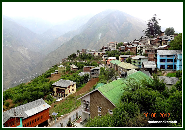
evening, we went for a stroll in the main part of the village. Kugti village is
divided into two parts – Lower Kugti with about 80 houses and upper Kugti with
about 60 houses. The population of the village is about 1000 and almost all are
Gaddis. The village has electricity and the good thing about it was that during
our 3 days of stay, only once the electricity tripped.There are no telephone and mobile connectivity
though there are at least two places in
the village where one can have access to satellite telephones. In our home stay, the owner had satellite TV connection. In fact, he invited us in his room for watching the final of IPL match. I found almost all the youngsters of the village having mobile phones which they use for listening MP3 songs but it becomes handy when they visit Bharmour or other nearby villages having mobile connectivity. Agriculture is
the main occupation of the villagers with Rajma beans and potatoes being the
main crops. Earlier, they were growing corns but due to bear menace, the
villagers have almost stopped growing this crop which is a favourite of the
Himalayan bears. While we were on the stroll, suddenly it started raining
heavily. After waiting for about 30 minutes, we decided to go back to the
comfort of our room rather than chilling out in the open. After a dinner of
rajma-rice-roti, herbal chutney and pickle, we retired for the day praying for
a clear weather the next day for our trek to Kartik Swami (Kelang) temple.
Some pictures of Day-4 are uploaded below:
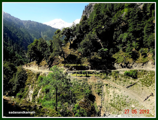
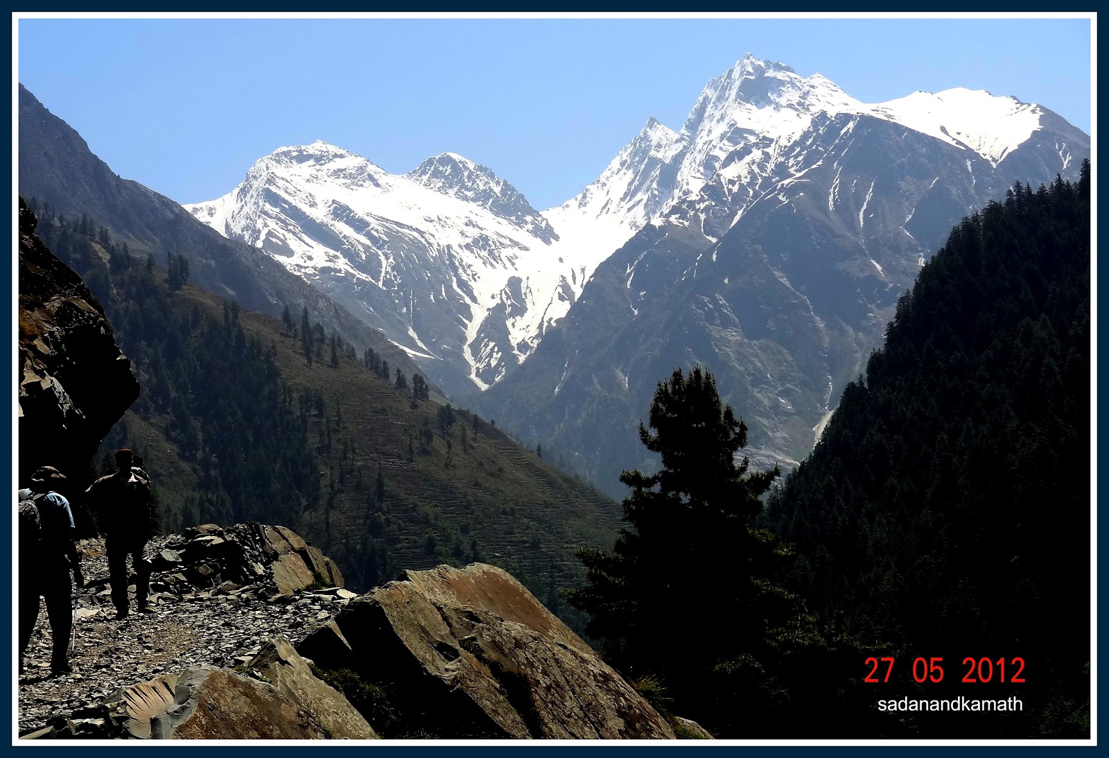
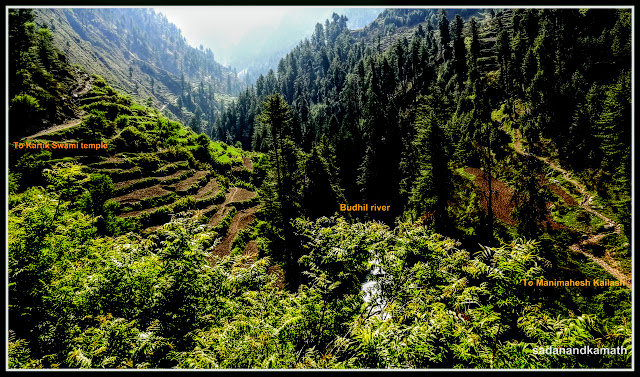
At this point of Dharol, our trek started for Kugti village.
Dharol hamlet seen from the trek path.
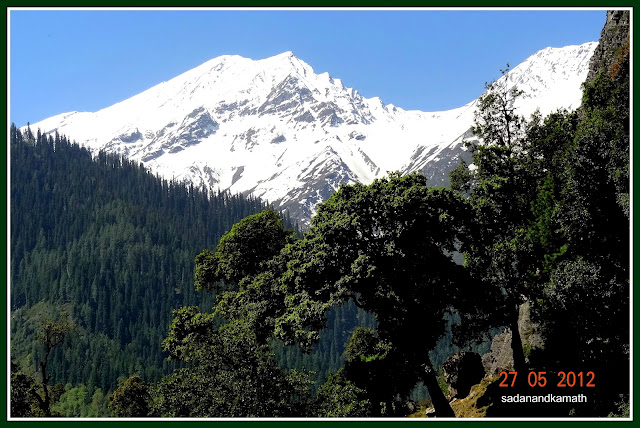
Manmahesh Kailash sub range seen from the trekking path to Kugti.
View of some more snow clad peaks.
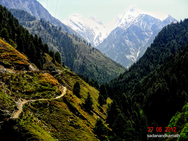
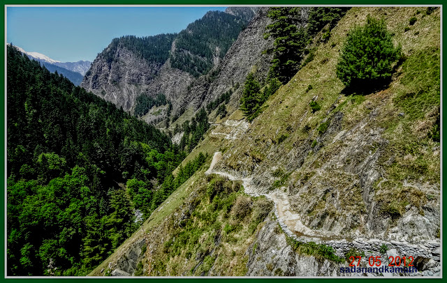
After about 2 kms of trek which was on the proposed road, the path becomes narrow.
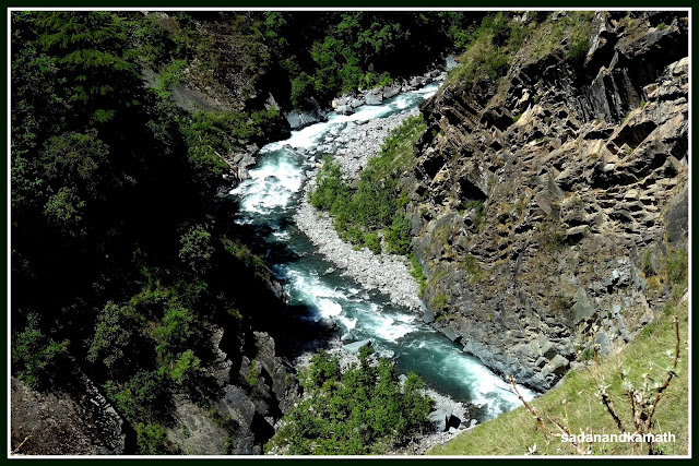
Budhil river seen to our right from the trek path.
The narrow trek path continues but Budhil river (left of the picture) is unseen in the gorge.
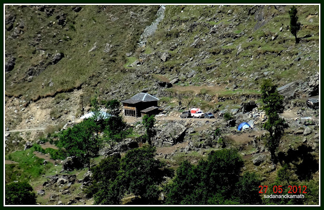
Some glimpse of Kugti village is seen through the zoom shot but it still 3 kms away. The read roof house in the middle is PWD Rest House and a house above it is Forest Rest House.
Some more unnamed snow clad peaks are seen.
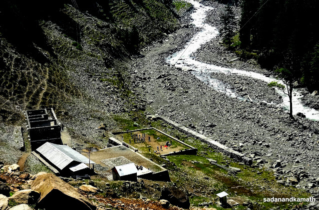
This is the place about 2 kms before Kugti village on the banks of Budhil river where a high school building is under construction. The rectangular shaped open space is used as a campsite for trekkers.
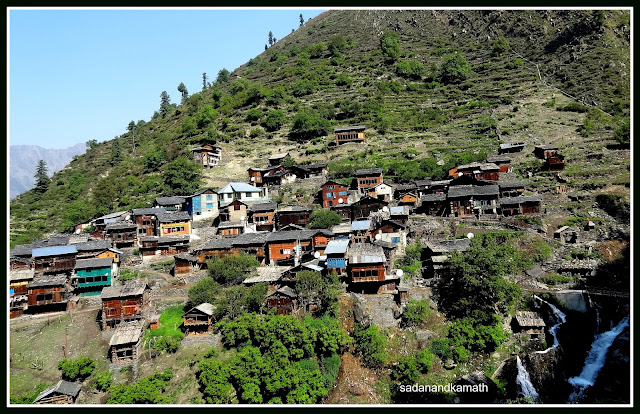
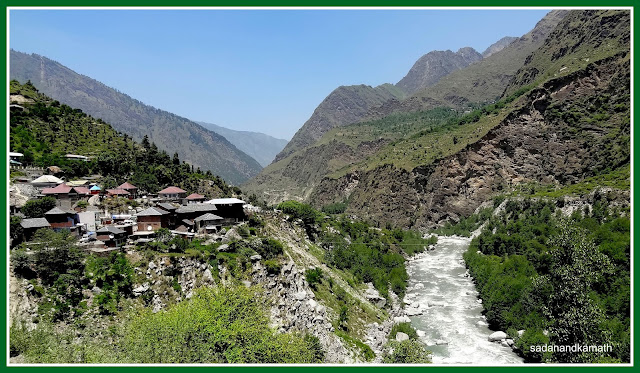
Kugti village seen from about one km of distance.
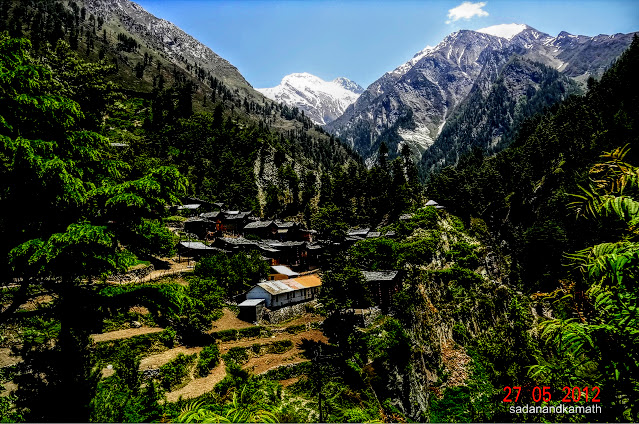
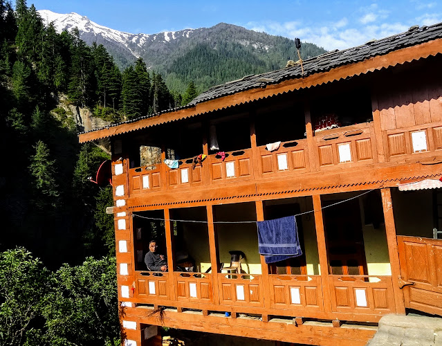
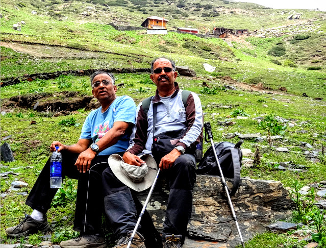
Our home stay in Kugti village.
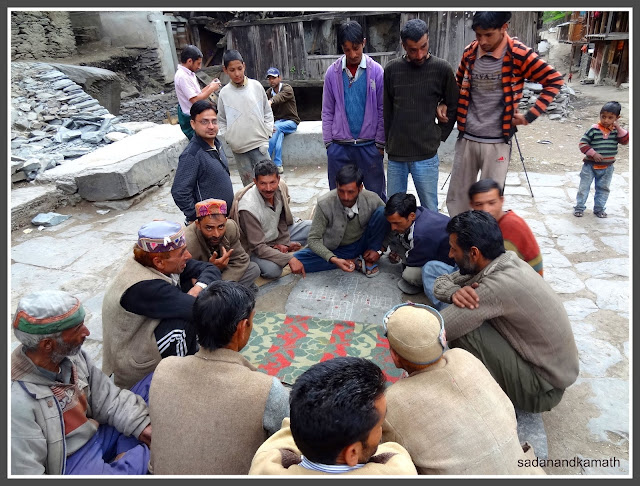
Kugti villagers playing some Mahabharat type games.
Day-5 : Kugti-Kartik Swami Temple-Kugti
I got
up at 6.00 am and was happy to see a sunny morning. The weather was pleasant
even in the early morning at this altitude when one would expect it to be cold.
After the breakfast of aloo parathas, we left Kugti at around 8.45 am for a 6km Kartik Swami temple trek. After
passing through the lower Kugti village, we crossed the make shift iron bridge with wooden planks over a
stream and climbed another 100m to reach at a place from where the path
bifurcates – Manimahesh parikrama (circular) route to the straight after
crossing a bridge over Budhil river and Kartik
Swami to the left. The trail was a gradual climb up to the next about 2 kms
after which it swirled to the left behind a mountain. At this point, we could
still see lower Kugti village and a solitary house of upper Kugti. The trail
continued on a gradual climb with intermittent descends. On both sides of
Budhil river there were terraced fields belonging to Kugti villagers. Since the
sky was clear, we could see many snow clad mountains and peaks – one of which
was the holy Manimahesh Kailash.
When we
were just short of about 2 kms from the Kartik Swami temple, we had to cross a
small stream after which the trail turned into a steep climb up to the temple
gate. At some places, it was slippery. We were fortunate that it had not
rained. Otherwise, we could have tough time in descending this path while
returning. The dense pine tree forest which we saw on both sides of Budhil
river has now become sparse with shorter height. Just before 100m to the temple
gate, the spring water oozing out of a galvanised pipe gave us a welcome
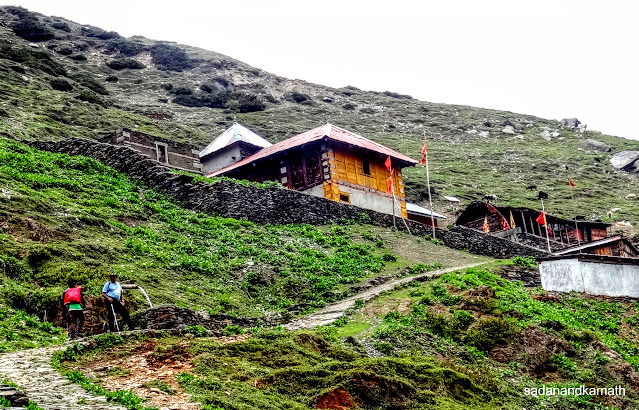
respite from thirst. We reached the temple at 12 noon. The priest was present
when we went inside the temple. This temple is revered by both Gaddis as well
as the people from other side of Pir Panjal range – Lahulis. This temple is
opened only during summer and autumn months as at an altitude of 3100m, the
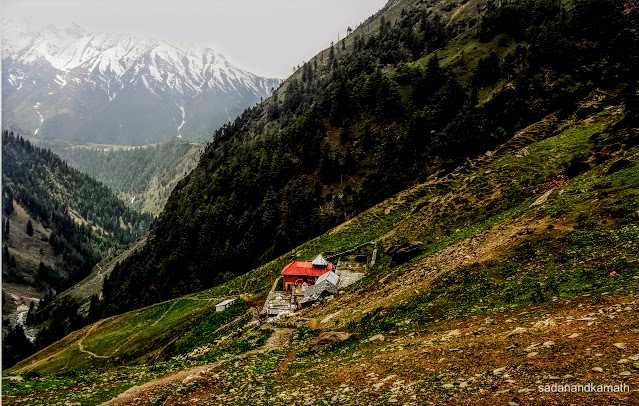
place is heavily snow bound in winter. There is a wooden house inside the
temple complex where a few can stay overnight provided they carry sleeping bag
or blankets. There is a lone dabha just outside the temple complex where one
can have tea and biscuits. About 100m further up on the way to Duggi caves
route, there is another temple called Marla Mata temple. In fact, the main
Marla Mata temple is located on a high cliff of the opposite side of the mountain.
This temple is for those who are not able visit the main temple due to its
steep climb. I could see the traces of blood on the entrance to Marla Mata
temple – probably a goat/sheep sacrifice which is a common ritual among the
Gaddis to seek the blessing of the Goddess for the safe passage when they take
their flocks to Lahul valley after crossing the treacherous Kugti Pass (5040m).
We left
the temple complex at around 1.00 pm and were back in home stay in Kugti by
3.00 pm. Rest of the day was spent in Kugti village.
Some pictures of Day-5 are uploaded below :
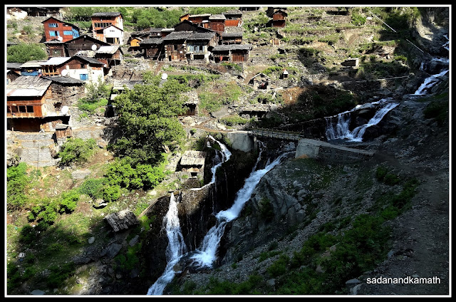
The stream coming from upper Kugti turns into waterfalls at the end of lower Kugti village.
Lower Kugti village seen from the eastern side.
The trail to the left is for Kartik Swami while on the right is a part of Manimahesh Kailash Parikrama. Due to dense vegetation, Budhil river (in the middle) is not visible.
The snow clad mountains - a part of Manimahesh Kailash sub-range.
Another side of the snow clad mountains with some unnamed peaks.
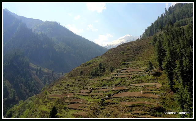
Terraced fields on both sides of Budhil river on the route to Kartik Swami temple is a common site.
At this point the trail swirls towards the left behind the mountain.
This is the last we see of lower Kugti (left) and higher Kugti (right)
Manimahesh Kailash peak on the left and unnamed peak on the right.
Another mountain range with some unnamed peaks.
The snow clad mountains in front of the Kartik Swami temple (extreme left)
The trail seen from the top point just before Kartik Swami temple.
Resting point just 1 km short of destination. Kartik Swami temple behind us. From the wide angle picture, the trail looks like a gentle climb, in reality, this one km of stretch is the steepest climb on this trail.
Very close to Kartik Swami temple.
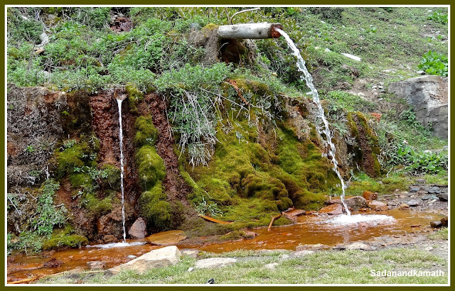
The water spring said to contain some 27 minerals. I tasted the water which was hard. The place where the water falls has turned orange in colour probably due to minerals' reaction on the surface.
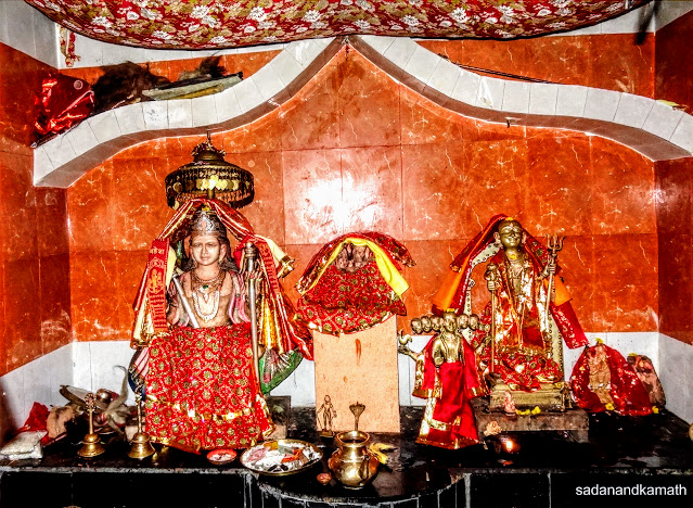
The idol of Kartik Swami on the left.
Marla Mata temple. the original temple is on a high mountain cliff ( top).
The location of Kartik Swami temple seen from Marla Mata temple.
Video of Kartik Swami temple, Kugti
Day-6 : Kugti-Dharol-Bharmour
In the
previous day, we were debating whether it would be a worthwhile to undertake a
day trek to a part of Manimahesh Kailash Parikrama trek, the trailwhich we saw outside Kugti village. The plus
point of this trek according to our guide was that we would get a closure view
of snow clad Manimahesh Kailash sub-range and a longish high altitude meadow
where Gaddis camp with their flocks in summer. The minus point about this trek,
in our view, was that we would see the
same mountain range and the same scenarios as we saw while trekking to Kartik
Swami temple. We ultimately decided to
drop the idea and instead planned our visit to Holi village the next day from
Bharmour.
After
breakfast, we started our return journey to Bharmour at 10.00 am. Being mostly
the descend, the 7 km trek to Dharol was completed in 2 hours 15 minutes. We
had pre-arranged Alto car to pick us at 12 noon from Dharol. After spending
about 45 minutes at Dharol, our car did come on time. In a way, it was good
that we pre-arranged the car. The alternative – share sumo was going to be a
tough option for oldies like us as we saw that the sumo was overcrowded with 14
persons inside and a couple of persons on the top of the carrier.
It took
about one hour for our car to reach Bharmour. We checked in our earlier hotel –
Chaurasi Hotel where we had left our luggage. We had lunch in the hotel’s
restaurant. Rest of the day was spent in Bharmour.
Day-7 : Bharmour-Holi-Chamba
We had
firmed up with our Alto car driver to take us to Holi village and then drop to
Chamba @Rs.2600/- (whole day). After breakfast, we checked out from the hotel
by which time our car driver had already parked his car outside the hotel. We
started for Holi around 9.30 a.m. At Khadamukh which is at at distance of 14
kms from Bharmour, the road bifurcates – to Holi (24 kms) to the left and to Chamba
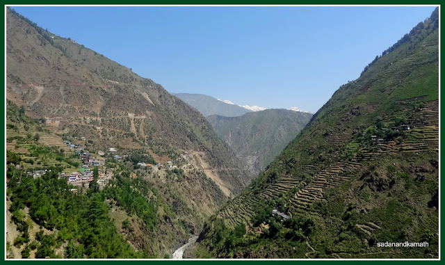
on the right. Khadamukh is a awesome place where one can see the tall and
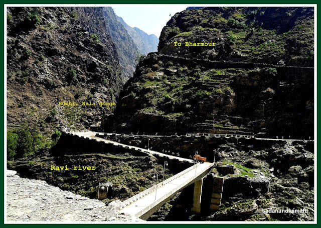
almost vertical mountains on all the sides. At this place, Budhil river joins
Ravi river. The Budhil gorge is so deep that we cannot see the river from the
road side.
The
road to Holi from Khadamukh though a single lane is in a better condition than
Bharmour-Hadsar road. The whole route to Holi is very scenic with Ravi river on
the left, terraced fields on high mountains and apple orchards on the slopes of
lower hills. On the way there are villages like Gorala, Dilli etc which are
scenic. We reached Holi village around 11.15 a.m. After having a short tea
break, we walked towards a cemented bridge over Holi stream. After crossing the bridge, we had two options
– continue the walk on the road which was in fact circular road which meets the
same bridge via the staircase of PWD/Forest Rest House or climb the stair case
to reach the PWD/Forest Rest Houses and take the circular road to come back on
the bus stand. We did the latter as we were keen to see almost 270 degree view
from the top of Holi village. From the PWD Rest House lawn, we saw the snow
bound Talang Pass. The pass looked like a
vertical snow wall. The Chowkidar of PWD Rest House told me that Talang Pass
was one of the most difficult passes on the Dhuladhar range and due to its high
altitude and almost vertical climb. The pass normally opens towards the end of
July. This year, he said, the pass may not open until early August due to a
high level of snow accumulation.
Holi is
a very scenic village located at the banks of Ravi river with a backdrop of
Talang Pass and other snow clad mountains. It is a place for doing nothing but
relaxation if one is able to get the booking of PWD/Forest Rest Houses which
are located in a very strategic place for viewing scenic beauties. The
architecture of some of the houses show that the people here are financially
well off. Holi is also the base for some of the high altitudes treks such as
Jalsu Pass (3600m), Talang Pass (4643m), Waru Pass (3850m) and Kalah Pass
(4720m).
After
spending about one hour in Holi, we started our journey for Chamba which is
about 75 kms from Holi. We reached Chamba around 2.30 p.m. We checked in HPTDC’s Iravati Hotel and had
our lunch in its restaurant which was very good. Surprisingly, despite a very
warm weather outside, our non-AC room was cool. In the evening, I ventured out
to take a stroll around Chougan. Since we
had a late lunch, we skipped dinner.
With
this, our main part of trek cum trip came to an end. After spending a day in
Chamba to visit Lakshminarayan temple complex, Bhuri Singh museum and Chamnuda
Devi temple, we left Chamba for Dalhousie via Kajjiar to enjoy the cool weather
for a couple of days before returning home via Chakki Bank.
Some
pictures of Day-7 and thereafter are uploaded below:
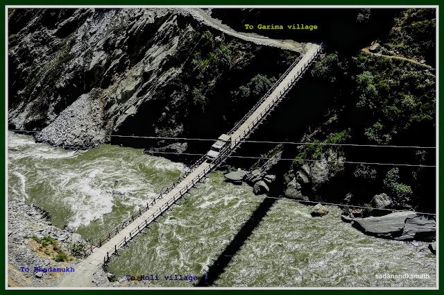
Khadamukh from where bifurcation to Holi and Hadsar originates.
Ravi river gorge on way to Holi village
A Max crosses the suspension bridge over Ravi river. When the Max was driven over the bridge, it was swaying.
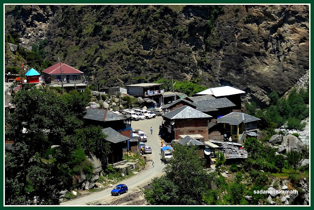
Holi village with its Bus/taxi stand seen from PWD Rest House.
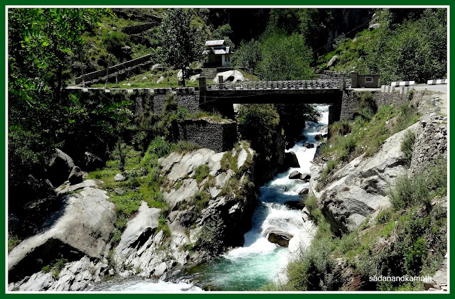
A bridge over Holi stream.
View from Forest Rest House, Holi
View of Talang Pass from PWD Rest House lawn.
Holi village to the left and Ravi river to the right.
Laxminarayan Temple complex, Chamba.
View of Chougan, Chamba from Chamunda Devi Temple.
Chamunda Devi Temple
View of terraced fields from Chamba-Kajjiar road.
Kajjair meadow
Kajjiar meadow with HPTDC's Kajji Cottage in the background.
Dalhousie seen from road to Subhash chowk.
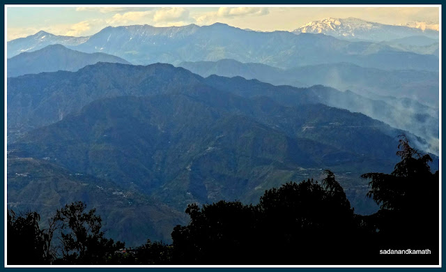
View of Dhauladhar ranges from Hotel Manimahesh, Dalhousie.