After my return from Nanda Devi Outer Sancatury trek in last June, my cousin was keen to do some treks with me in the Himalaya. I thought, as a first timer, it would be better for him to do some soft treks in Uttarakhand. So we planned for a 5-day Chenap Bugyal trek from Joshimath in October 2010. However, a series of landslides in Badrinath road in September 2010 created some uncertainty particularly when we had a tight schedule without any spare day. Since I did not want my cousin's first trek to go awry due to uncertainties, we called off the trek and instead decided to make a short winter trip during the first half of December 2010 combining day treks with visiting some off beat places covering Ukhimath-Deoria Tal, Tungnath-Chandrashila, Kalimath-Ruch Mahadev and Rudraprayag-Koteshwar-Kartik Swami Temple in Garhwal. We reached Haridwar by train in the evening and checked in Hotel Shiv Murti (opposite railway station).
Day-1 : Haridwar-Ukhimath ( 180 kms)
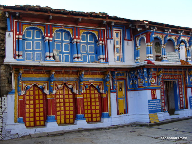
We left Haridwar at 7.00 a.m. in a hired Indica for Ukhimath drop. The road condition was not bad but at many places, the road was dusty and reduced to single lane due to accumulated debris from the September landslides. After a short break at Byasi for breakfast, we reached Ukhimath at 2.00 p.m. We checked in GMVN TRH and had lunch in TRH. Being winter, we thought it best to make TRH Ukhimath as the base for our treks/trips to Deoria Tal, Tungnath-Chandrashila and Kalimath-Ruch Mahadev. After some rest, we visited Omkareshwar temple which was about one km from GMVN. We spent about an hour in the temple complex having darshan of Kedarnath and Madmaheshwar deities and admiring the colourful single story wooded houses. My cousin had a long chat with the priest on the subject of Kedarkhandam. This was my third visit to the temple and despite a cluster of residential houses (including new ones) and shops in the alley, the temple still retains its ambience and peaceful atmosphere.
 |
| Colourful wooded house in the court yard of Omkareshwar temple in Ukhimath |
Day-2 : Ukhimath-Sari-Deoria Tal-Painj-Ukhimath
We had planned to trek Ukhimath-Deoria Tal-Ukhimath (8+8 Kms) but the GMVN Caretaker suggested to do Ukhimath-Sari by car, trek 2.5 km to Deoria Tal and trek back to Ukhimath via Painj village. This, according to him, was better option than the planned one to reach Deoria Tal early giving us the opportunity to see the reflection of peaks in the lake water before the sun rays cover the lake. We agreed with the suggestion and accordingly arranged an Alto car to drop us to Sari village. One of the GMVN staffers offered to accompany us to Deoria Tal to guide us in our return trek to Ukhimath.
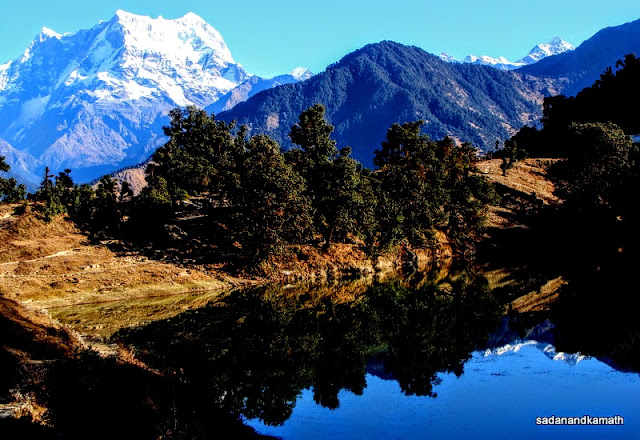
We started from Ukhimath at 6.30 a.m. and reached Sari village (10 kms) by 7.00 a.m. After about 2 kms of a gradual climb, we reached a tri-junction before 500m from Deoria Tal. The path to the left was the trekking route to Ukhimath (8 kms) which we would take later while the straight path gradually descends to Deoria Tal. We reached Deoria Tal around 9.00 a.m. by which time sun rays had partially covered the lake water. Fortunately, we could see some reflection of peaks in the lake water. The weather was perfect with cloudless sky and we could see Bandar Punch, Swargarohini, Kedarnath, Sumeru, Choukhambha, Neelkanth among many other unknown peaks. Being a part of the Kedarnath Wildlife Sanctuary, we paid a forest fee of Rs.150/- per head.
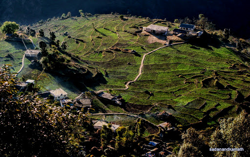 |
Sari village fields seen from trek path to Deoria Tal.
|
Deoria Tal with Choukhmbha in the background
 |
| Women folks going for grass and leaves collection around Deoria Tal |
 |
| Kedarnath on left and Chaukhambha on the right amongst other peaks seen from Deoria Tal. |
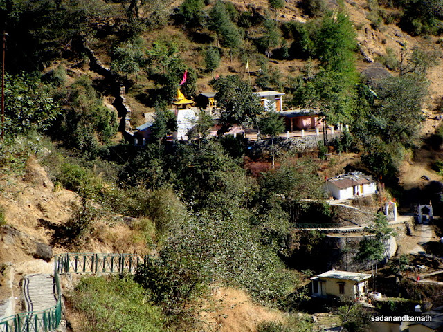
After a cup of tea from Hira Singh Negi's dabha which was the only one in operation in Deoria Tal, we proceeded for a full round of the lake . Half-way though the round, we came across a newly constructed Forest Rest House which was strategically located on a highland giving the complete view of the Himalayan peak as well as the lake view. The FRH is likely to open for booking by this December-end according to a forest official who accompanied us on a walk around the lake.
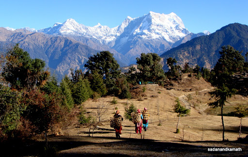
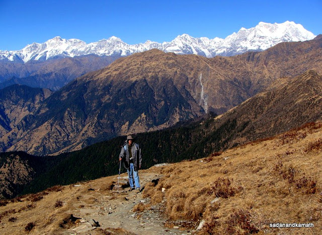
After completion of the lake round and finishing the breakfast at the dabha, we started the return trek from Deoria Tal at around 11.00 a.m. for Ukhimath. The 8 km trek was a steep descent over the uneven rocky and stony path giving the view of the Himalayan peaks like Chaukhambha, Kedarnath and for some time Neelkanth peaks among others on the one side and the rolling mountains on the other side most of the time. At many places, path was not well marked. At few places, there were multiple diversion creating a confusion as to which path to take. Of course, there was no danger of missing in wilderness as these diversions would eventually lead to some villages like Mansuna, Painj( which was on our trek route) and others located within the distance of 4-6 kms from these diversions according to our guide. After crossing the Painj village, the path continued to descend through forest cover. After crossing the Ukhimath-Deoria Tal road (under construction), we descended to Ukhimath market and reached GMVN, Ukhimath after a further 1 km of walk. It took us nearly 5 hours to reach Ukhimath from Deoria Tal.
 |
| Himalayan peaks as we came out of the forest cover on our march to Ukhimath. |
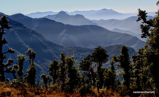 |
| Rolling mountain view from trek to Ukhimath. |
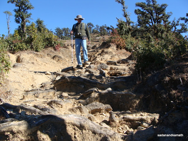 |
| Trek path on way to Ukhimath. |
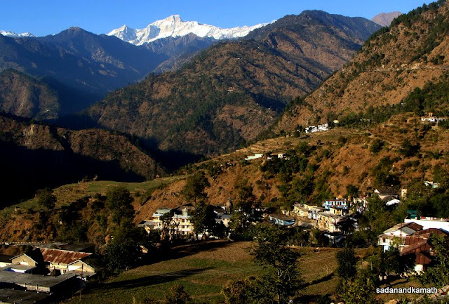 |
| Ukhimath village with Omkarewhwar temple in the middle with Kedarnath peak in the background. |
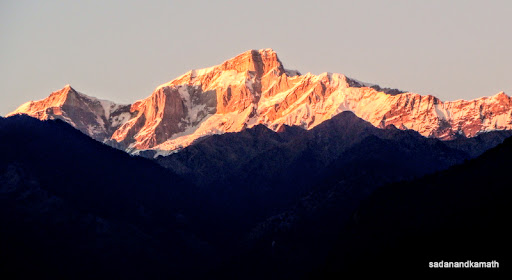 |
| Sun set view of Kedarnath peak from GMVN, Ukhimath. |
Day-3:Ukhimath-Chopta-Tungnath-Chandrashila-Ukhimath
The completion of our Tungnath-Chandrashila trek was in doubt when the GMVN Caretaker gave us a mild shocker that there was some hard snow on the trekking path around Tungnath temple and beyond. He said that the frost over the snow path had made the snow still harder. He rightly cautioned us that if we came across large accumulations of hard snow on the trekking path in around Tungnath temple and beyond, we should not venture further. Since we did not have spikes in our shoes, walking on hard snow could be risky even though we had trekking poles.
With some uncertaintly, we started our journey to Chopta by a hired Max at 7.30 a.m. The newly asphalted Ukhimath-Chopta road was in excellent condition and that made us to reach Chopta in about 45 minutes. As we approached Chopta bend from where a road to the right goes to Makkumath (16 kms), our driver stopped the Max to give the lift to a sadhu who happened to be the one whom I had met in Tungnath temple in October 1998. The sadhu was coming from Makkumath to visit his cave dwelling close to Tungnath temple. He gave us an encouraging news that weather at Tungnath-Chandrashila had been excellent during the last 4-5 days and much of the snow had melted on the trekking route. As we got down from the Max at Chopta, we saw only one dabha , Rajkamal open and other dabhas including the next to it which was supposed to be a better one according to sadhu, was yet to open their doors. After a breakfast of Maggie and ordering lunch for us on our return from Chandrashila, we proceeded to Tungnath-Chandrashila trek.
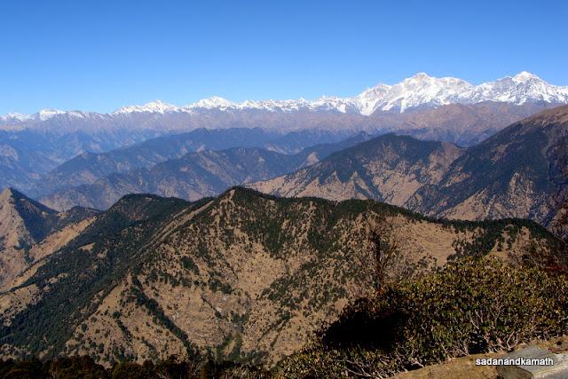
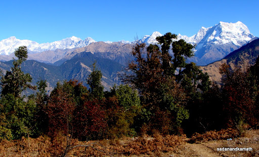
Himalayan peak ranges seen from Chopta
On half way mark to Tungnath.
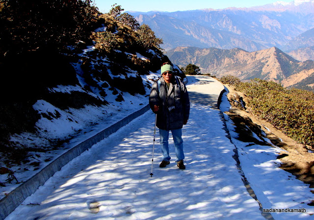
Some hard snow on the way to Tungnath temple.
Once again, the weather though bit chilly in the morning was perfect with the clear sky. We came across small patches of hard snow after about one km of trek but it did not create problem for us as a narrow muddy sidewalks was free from the snow. As we moved further, snow patches though thin, became longer. After successfully negotiating this hard snow patch, we reached the half way mark on way to Tungnath. We met here a Canadian couple who were returning after completing the Chandrashila trek. They had commenced trek from chopta at 6.00 a.m. and reaching half-way point to Chopta at around 10.00 a.m. was a good progress. We did not face any snow on the way until the we reached the paved path near Akash Ganga shade which was fully snow bound for about 50m where walking was tricky. At this stretch, my cousin slipped and fell down but fortunately he was alright. We reached the temple at around 11.30 a.m. The Tungnath temple court yard had comparatively higher snow accumulation than even in Chandrashila as we observed later as the former place remains under mountain shadow for a longer time.
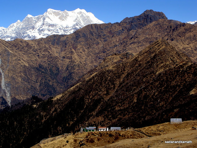
Chaukhambha looming large over Alpine Reserach Centre opposite Tungnath temple.
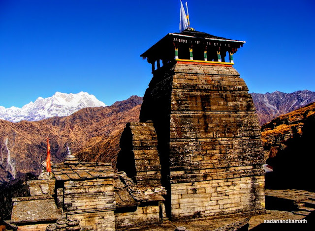
Backside of Tungnath temple.
Alpine Research Centre is dwarfed in front of Himalayan mountain ranges and peaks opposite Tungnath temple.
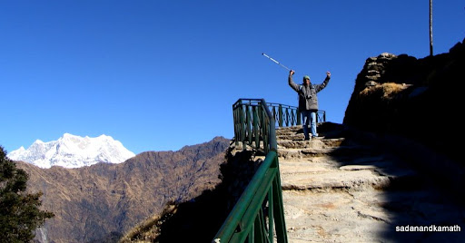
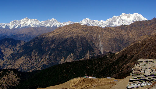
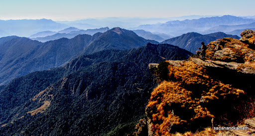
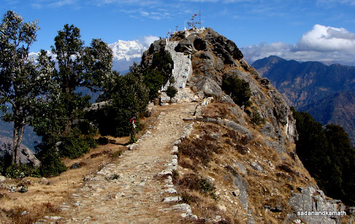
We just had a quick look at the temple complex. As expected, there was not a single soul around Tungnath temple complex. After spending about 30 minutes in the temple vicinity, we moved towards Chandrashila peak from the back side of the temple. The weather continued to be good with clear sky. In my earlier two visits to Tungnath ( in the months of September and October), I had faced strong breeze which made me shiver. But this time, the absence of breeze made our life comfortable. There was not much of snow in our 1.5 km of trek to Chandrashila probably the accumulated snow melted here faster than in Tungnath due to direct sun rays falling on the path. As we moved towards Chandrashila peak, the Himalayan peaks from Bandarpunch to Chaukhambha were constantly visible. It was only when we reached Chandrashila peak around 2.00 p.m. that Dronagiri and Nanda Devi group of peaks unfolded before us. It was a show of 270 degrees of snow clad Himalayan peaks from Bunderpunch in the west to Nanda Devi group of peaks in the east with remaining 90 degrees covered with rolling Himalayan mountain ranges. I had visited Chandrashila peak in October 1998 in foggy condition and hence I had no inkling about what was waiting for me in this trip. But to get a sparkling view of the Himalayan peaks in a cloudless sky, that too in the afternoon was, in my view, something akin to special darshan of gods in the form of numerous peaks from the sanctum of Chandrashila. My cousin was so ecstatic about the place that he felt as if he was on top of the world.
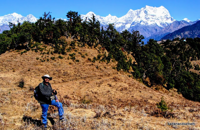
Me on the ridge-end with rolling mountains in the back of Tungnath temple.
An unknown peak of an interesting shape seen on our way to Chandrashila.
Kedarnath (left) and Chaukhambha (right) peaks in the background on way to Chandrashila peak.
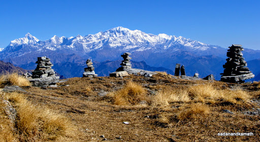
Himalayan peak view from Chandrashila peak with cairns in the foreground.
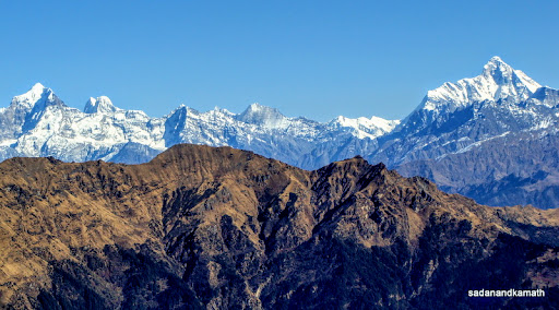
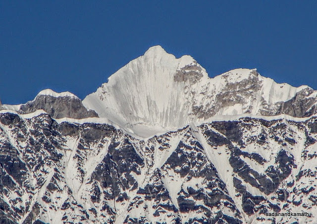
Dronagiri peak on the left and Nanda Devi peak in the right see from Chandrashila peak.
It was time to bid an adieu to Chandrashila, the surrounding peaks and mountain ranges as we had also planned to visit Makkumath after reaching Chopta. While we trekked down quickly to Tungnath using shot cuts, we probably lost time in taking pictures and looking for monals while returning from Tungnath. We did spot 4-5 monal birds around half way to Chopta. It was around 5.00 p.m. when we were less than one km from Chopta that we missed a life time opportunity to spot a leopard in wild. I was taking a picture of forest path with setting sun rays falling on the tree arch over it when a Ukhimath based guide who had earlier accompanied a Canadian couple to Tungnath-Chandrashila in the morning, came to look out for us as it was already getting dark. His interest was to get a lift in our Max for Ukhimath. He told me that a leopard stood on the trekking path but the sound from my trekking pole which slipped out of my hand and fell on the stony path made the leopard nervous and ran across the path in the cover of dense forest. He guessed that I must have seen the leopard as it had stopped momentarily on the track not far from the place from where I was busy in adjusting my shot. What to say - the leopard was in front of us and we did not see it - sheer bad luck.
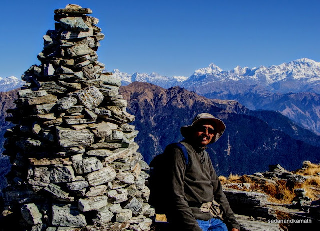
Me besides a cairn on Chandrashila peak with Nanda Devi peak in the background (middle).
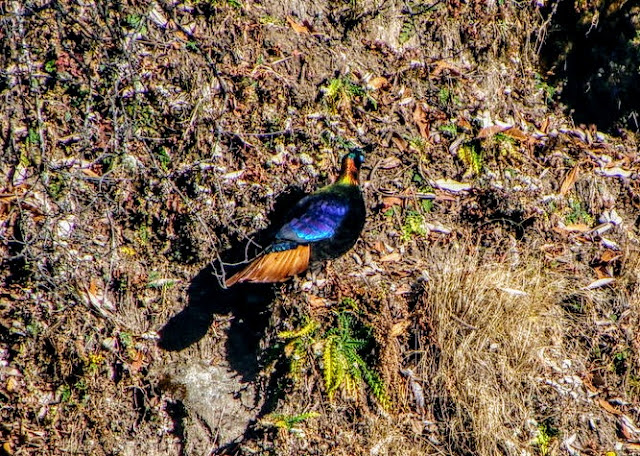
We spotted 3-4 monals in around this spot on our way back to Chopta
Tree lines on a bugyal with abandoned shepherds' huts in the evening on way to Chopta
This was the place where we failed to spot a leopard crossing this track on way to Chopta.
It was already dark when we reached Chopta. So visiting Makkumath was ruled out. After finishing our lunch in supper time, we proceeded to Ukhimath TRH .
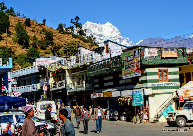
Day-4:Ukhimath-Kalimath-Ruch Mahadev-Guptakashi-Ukhimath
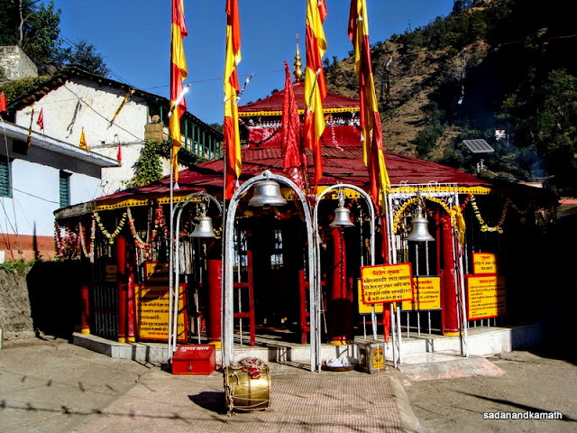
We engaged the same Max which had taken us to Chopta, for our trip to Kalimath-Kotma-Guptakashi-Ukhimath. After breakfast at TRH, we commenced our journey to Kalimath at 8.30 a.m. via Kund and Guptakashi ( in fact about 2 kms before Guptakashi, there is a diversion to the right for Kalimath). The road to Kalimath was not in good condition at many places. It took about one hour to reach Kalimath for a 24 km journey. From the road head, it was about 10 minutes of descent on a cemented path followed by a walk on the bridge over Kali Ganga river to reach the Kalimath temple. There was no crowd around the temple except a couple of shop owners who were sitting near the temple warming themselves under the sun. After paying obeisance to Kali Mata, we visited the adjoining Mahalakshmi, Mahasaraswati and Guarishankar temples. I had visited Kalimath in October 1998 in the aftermath of massive landslides that happened around Kalimath due to cloud brust in August 1998. The place still retains its serenity and peaceful surroundings.
 |
We returned to Ukhimath by 3.00 p.m. after taking a break at Guptakashi for lunch and visiting Vishwanath temple.
Day-5: Ukhimath-Rudraprayag-Koteshwar-Rudraprayag
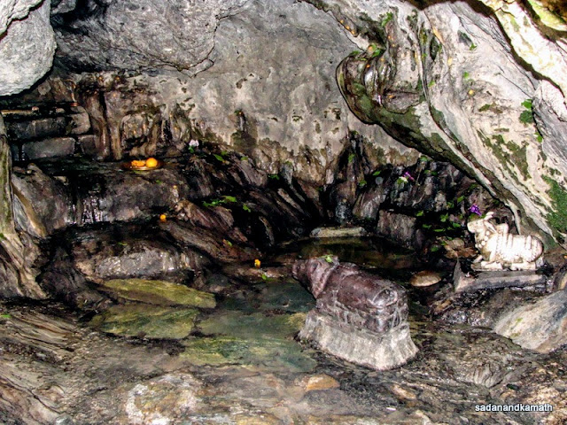
After breakfast, we took a Ukhimath-Rudraprayag bus at 8.30 a.m. from GMVN gate. The 50 kms road journey took about 2 hours 30 minutes due to a traffic jam at Chandrapauri followed by traffic police diverting all buses and jeeps bound for Rudrarayag and Haridwar thorugh by-pass road (adding about 6 kms more road journey). This diversion helped us to get down at the GMVN gate. We checked in GMVN. After lunch, we visited Koteshwar Mahadev cave temple located at the bank of Alaknanda river. Instead of waiting for a share jeep (@Rs.10/-) to drop us near the Koteshwar Mahadev temple, we preferred to walk down a distance of 3 kms to the temple on Rudraprayaf-Chopra road , a diversion to the right after 1 km of walk on Rudraprayag-Pokhari road. We reached the Koteshwar cave temple after covering about 500m of gradual descent on the cemented path followed by steps. The cave temple has many naturally cut shivlings and idols of other deities. The cave temple has beautiful setting with calm Alaknanda river flowing close to the cliff of the cave temple through big boulders. One can sit here for hours just looking at the Alaknanda river with its blue water calmly making ways through some large boulders, some of which looked like having some carvings on them. Since there was no indication of any share jeep for our journey back to Rudraprayag, we again walked down the distance to reach TRH.
 |
| Koteshwar Mahadev Cave temple, 3 kms from Rudraprayag. |
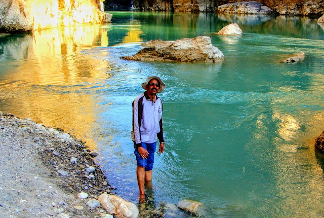 |
| Me in the calm Alaknanda river which flows close to Koteshwar Mahadev temple. |
Day-6 : Rudraprayag-Kanak Chauri-Kartik Swami Temple-Rudraprayag
In the previous day, GMVN Caretaker told us that we may find it difficult to get share jeep from Kanak Chauri to return to Rudraprayag as this being the peak marriage season, many Max are hired by the marriage parties. We had also observed during our journey to Kalimath-Kotma and also in Rudraprayag about the lines of decorated cars and Maxs plying on these roads. Without any hesitations, we decided to hire a Max.
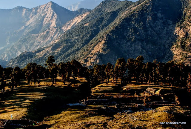
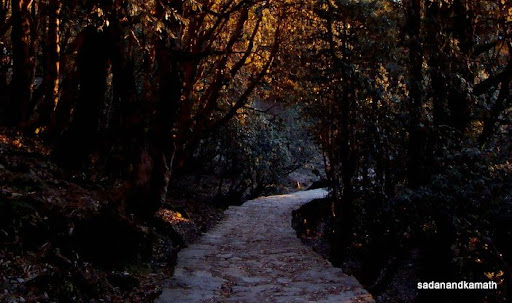
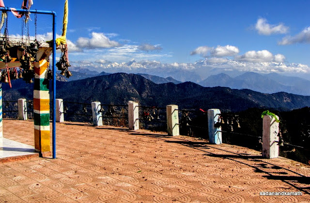
After the breakfast at TRH, we left Rudraprayag at 8.00 a.m. for Kanak Chauri (35 kms) which is on the Rudraprayag-Pokhri Road. The road was bad and on the hindsight, it was good that we hired Max rather than cars like Alto and Indica. We passed through some beautiful villages surrounded by step farms – Setarkhal, Durgadhar-Chopta-Khadpatia and Ghimtoli before reaching Kanak Chauri at 9.30 a.m. After a cup of tea from one of the dabhas, we commenced our trek turning left from the arch from where the snow clad peaks including Kedarnath and Chaukambha were clearly visible. The trek was inintially on a paved path with gradual ascend through dense forest which is the part of Nagnath Forest Range. We found on the trekking path scores of broken bangles, combs and vermilion packets. It apeears that devotees offer these things in the temple and thereafter they leave these on their way back. After about 2 kms of trek, we reached a place where a Dharamshala and the residence of the priest of Kartik Swami Temple was located. In fact, the priest was sitting outside his house and seeing us, he also joined us to reach the temple which was still 1 km up on uneven steep rocky steps on a ridge. At the base of the Kartik Swami Temple was a Bhairon temple.
 |
| The arch gate at Kanak Chauri. From here, it is a 3 km trek to Kartik Swami temple. |
 |
| View of Chaukhambha from the forest cover on way to Kartik Swami temple. |
 |
| View of Kartik Swami temple seen on the ridge from trek path. |
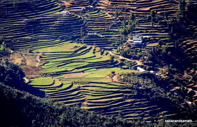 |
| Step fields seen from the ridge on way to Kartik Swami temple. |
 |
| Final walkway to Kartik Swami temple. |
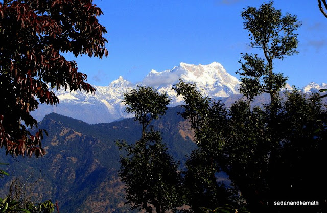
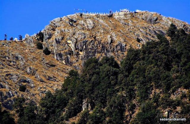
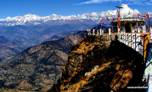
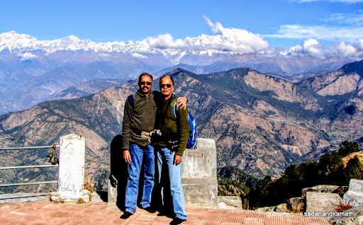
Kartik Swami Temple ( 3000m) is located on the end of a narrow ridge surrounded from all sides by wide and deep valleys about 1000-1500 down from the ridge. One can get some idea about how deep and wide the valleys are from fact that Guptakashi (1320m) is visible from the temple. The Himalayan snow clad peaks starting from Bandar Punch in the west, Kedarnath, Sumeru Chaukhambha in the middle and Neelkanth, Dronagiri and Nanda Devi group of peaks extending to west among other peaks formed the backdrop to the temple. On the front of the temple, the view of rolling mountains was as beautiful as the snow clad peaks at the back of the temple. When we reached the temple, there were some white clouds hovering over some of the peaks but soon they cleared and we could get fairly clear view of all the peaks. For the first time, I saw Nanda Devi peak in an angle which was somewhat different from what we had seen from Auli, Kuari Pass and Saini Kharak.
 |
| Kartik Swami temple. |
 |
| Peak view from the left side of Kartik Swami temple. |
 |
| Peak view from the right side of the temple. |
 |
| Peak view from the backside of the temple. |
The temple has a naturally carved idol of Kartik Swami on a marble type rock. Behind the temple, is a narrow path which goes down to a pond from where the water is bought for pujas. The priest told us that he has been witnessing a pair of crows coming regularly in the temple complex. When we were there, a crow came close to us but soon flew away. I saw the same crow responding to the call given by the priest sat on a railing at some distance from us.
Since we got almost the same peak view from Kartik Swami temple as from Chandrashila peak, three days back, a comparison is in order. Obviously we got somewhat closure view of Himalayan peaks from Chandrashila peak (4100m) than from Kartik Swami Temple (3000m). We also got to see the rolling mountains from both these sites. But the wide and deep valleys with step farms seen from Kartik Swami Temple was more breathtaking than the ones we saw from Chandrashilla peak. My cousin was, however, of the view that the feeling of ‘top of the world in wilderness’ he got was more pronounced on the Chandrashila peak than in Kartik Swami Temple.
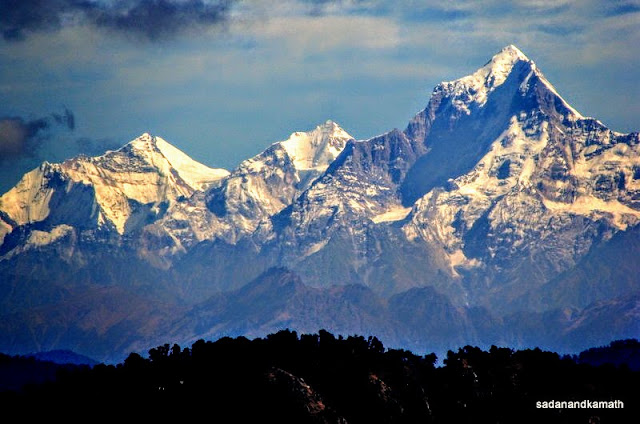 |
| Dronagiri (Dunagiri) peak (right) seen from Kartik Swami temple. |
 |
| Nanda Devi peak seen from Kartik Swami temple. |
After spending about 45 minutes around the temple, we returned to Kanak Chauri within an hour and took a lunch break at Chopta (not to be confused with the place with the same name on Ukhimath-Gopeshwar road) before returning to the comfort of GMVN, Rudraprayag. On a hindsight, I felt that if we had started early morning from Rudraprayag, we could have also covered Pokhari (about 15 kms from Kanak Chauri) for visiting Nagnath temple.
Day-7 : Rudraprayag-Haridwar
We had thought of hiring a car to drop us at Haridwar. But a staffer at the GMVN recommended to take 8.30 a.m. bus which starts from Rudraprayag and goes to Haridwar. When we told him our apprehensions about the small and cramped seats in the bus, he assured us that seats had adequate leg room and due to slack season, we will surely get window seats for both of us. Since it was only about 5 hours of drive, we decided to give it a try. The GMVN staffer stopped the bus just outside the TRH as we were getting ready to depart. The bus was half-empty and both of us got window seats. The bus journey was more comfortable than what we had in last June while travelling from Rishikesh to Joshimath. We reached Haridwar at 1.15 p.m. and being the slack season, the traffic police allowed the bus to drop the passengers just outside the Haridwar Railway Station.
All my previous visits to Uttarakhand had been during the months of May to November. This was my first visit to Uttarakhand in the month of December. Although I missed much of the greenery and wild flowers, the loss was more than compensated by clear views of the Himalayan snow clad peaks and haze free rolling mountains, the clarity which I missed even in autumn months.
More pictures at :
Sari-Deoria Tal-Ukhimath Trek
Kalimath-Ruch Mahadev-Koteshwar-Kartik Swami