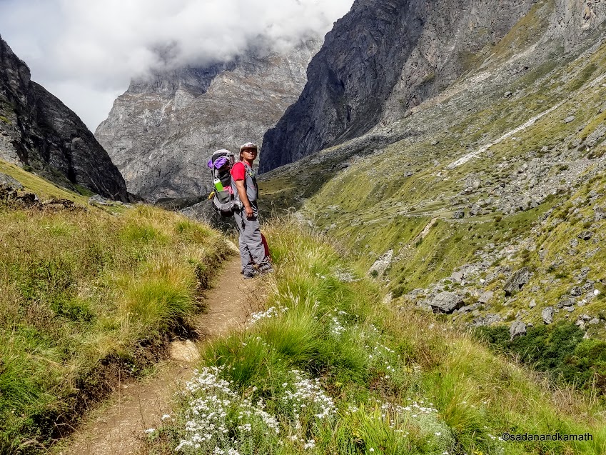
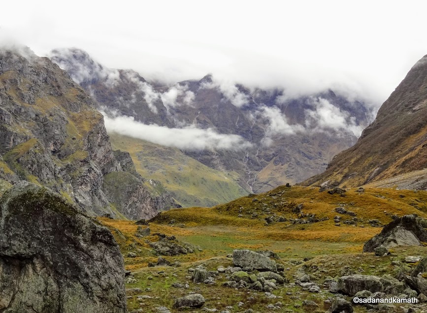
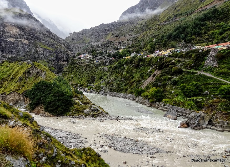
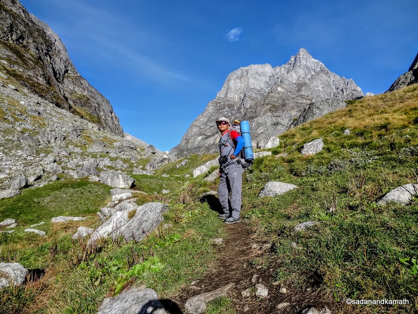
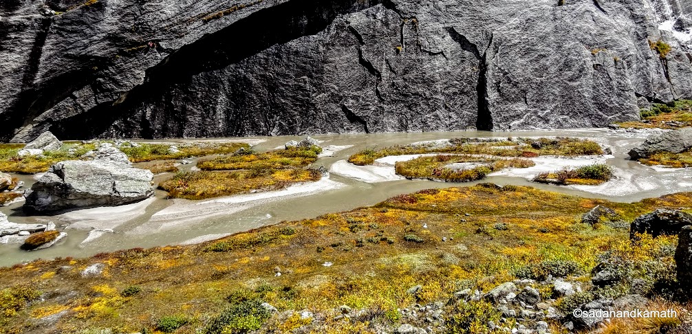
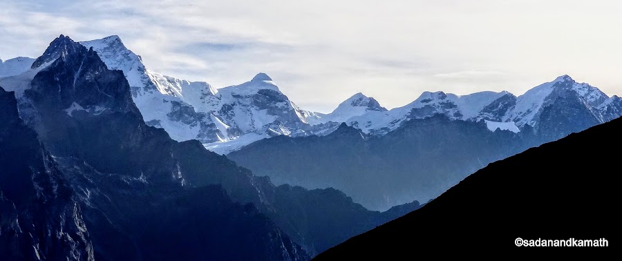
As per the plan, we were to camp at Laxmivan. However, after a couple of climbs and descents, I felt weakness in my calf and thigh muscles. I was not able to walk with my normal speed even on a level path. I do not know whether it was due to old age catching up with me or the after-effect of the flu which I suffered just a week before the departure for the trek. Sonu had noticed my condition during the trek. So he sent message to his porters who were already ahead of us to wait at Chamtoli Bugyal - about 2 kms before Laxmivan. The result was that while KS reached Chamtoli campsite around 12.30 p.m., I reached at around 2.00 p.m. It was decided to camp at Chamtoli.
Chamtoli campsite is located opposite Vasudhara falls. There is also a campsite on the other side of Alaknanda river. I found the location ideal for a campsite as it is flat and grassy as against Laxmivan which has more weeds than the grass as I came to know later. Those who are fond of seclusion like me would prefer Chamtoli to Laxmivan as the latter is most popular campsite. There were two large teams of trekkers who had gone ahead of us and in all likelihood, they all may pitch their tents in Laxmivan making it a crowded campsite.
I recovered from my tired limbs as well as a bit of nauseating feeling as soon as I had lime tea followed by soup. And this gave me a false sense of optimism 'oh! I could have attempted Laxmivan today'. From now onward till the completion of our trek, lime tea and soup became a part of our post-camping drinks.
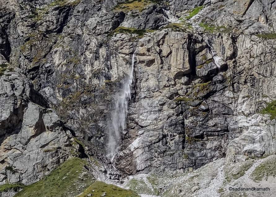 |
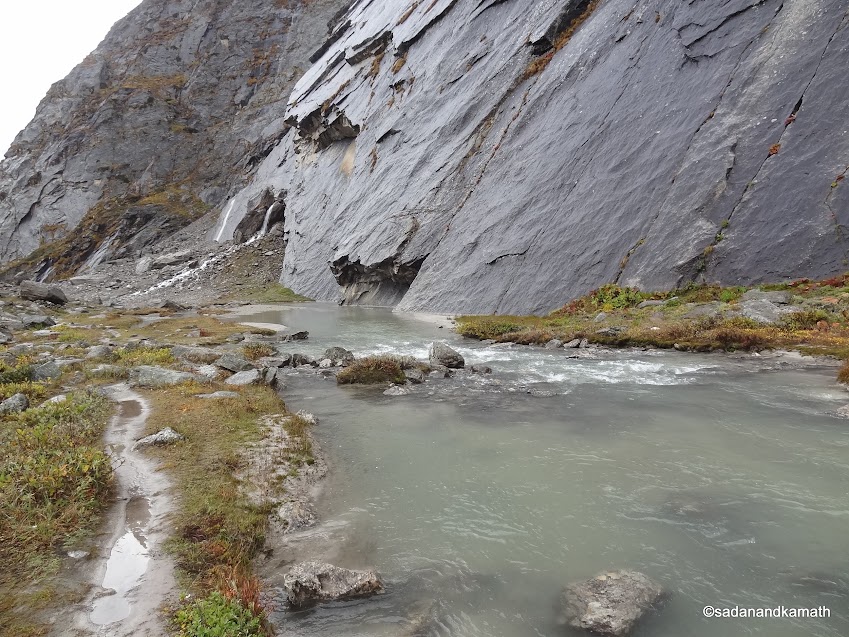
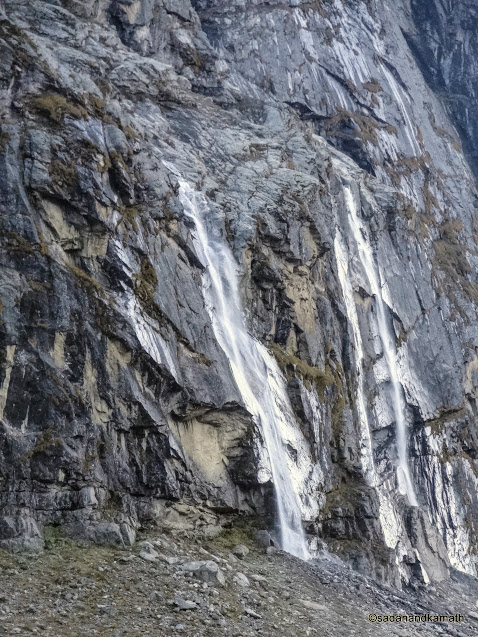
| Vasudhara falls as we are near to Chamtoli Campsite. Due to strong breeze, the waterfall does not touch the ground though the sprinkles would eventually fall on the ground. | |
 |
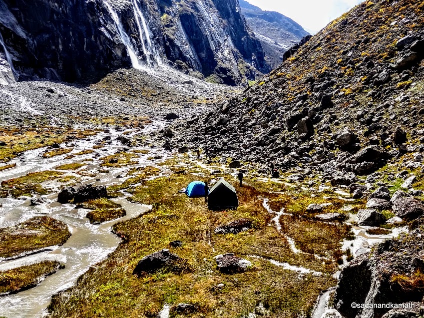
| Chamtoli Campsite. Our tent in blue, kitchen tent in military green and toilet tent in grey. | | | |
|
Day-2 : Chamtoli to Sahashtradhara (3875m) - 8 kms
The early morning saw heavy dew outside and for the moment I felt that it had rained in the night. Dew was a good news as the weather was expected to be sunny with blue sky which was good for the photography. The temperature inside the tent in the early morning was 6C which meant it was still low outside the tent. Still, we made an attempt to come out of the tent to admire the scenic beauty of the place. The sky was blue without any trace of cloud. Sun was about to come out.
As soon as I came out of the tent, 3 Bhotia dogs, probably belonging to a shepherds' group who had camped with almost 500 goats and sheep, about 500m away from us, came running towards me in a friendly way waging their tails. I gave a part of the left over paratha from the packed lunch to one of the dogs. But the dog would not eat. Another dog came and ate it in one gulp. Oh! there seems to be a hierarchy among these dogs. The senior most or the leader would eat first. So I took the dog who had missed his paratha, to a distance and offered the remaining part which he ate. I thought that one of the dogs would accompany us in the trek as usually happens in almost all Himalayan treks, more so in this trek because a dog had accompanied Yudhishthir to Swargarohini (stairway to haven). But it was not to be with us.
 |
| I am surrounded by 3 friendly Bhotiya dogs in the early morning at Chamtoli. By nature they are ferocious but I always found them to be friendly with trekkers. | | | | |
 |
| Ready for moving to the next destination from Chamtoli. | |
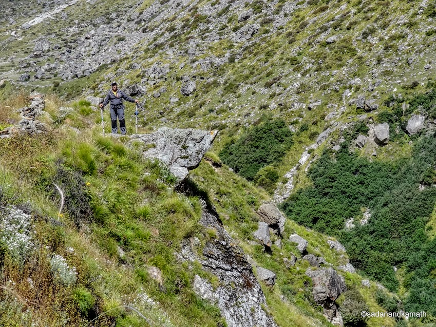
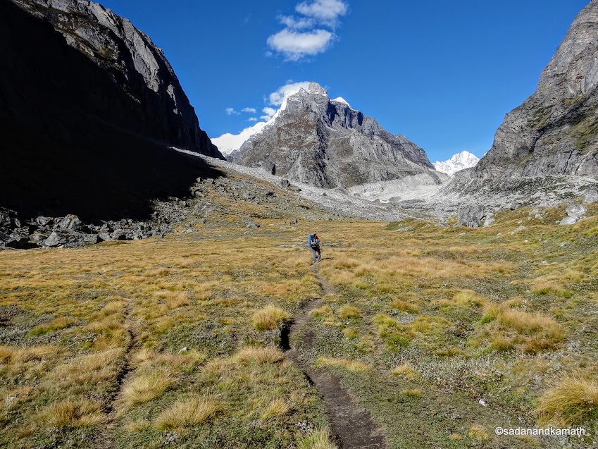
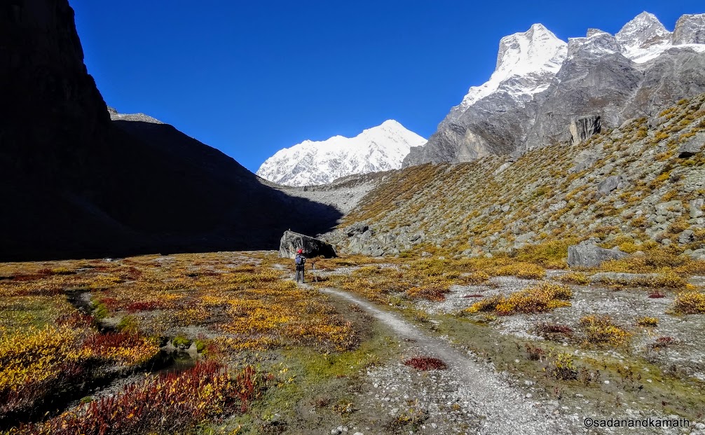
We commenced the day's trekking at around 7.30 a.m. in a sunny weather with blue sky. Like the previous day, today was also the trek of ascents and descents at regular intervals with more boulder/stone zones. In this process, we would gain an altitude of about 400m. Today was also a day when we would be required to trek on the ridge for sometime rather than crossing the ridges. especially nearer to Shahshtradhara. Of course, there were some patches of level walks through Laxmivan to give some relief to our legs. It is believed that at Laxmivan, Daruapadi breathed her last.
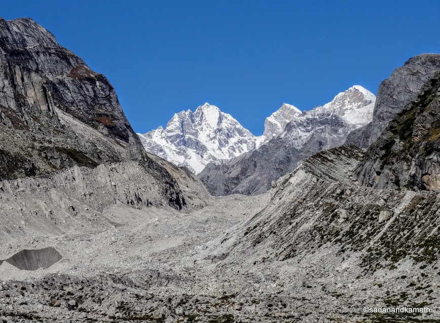
This part of the trek was more scenic than the previous day. For the first time, we could see Mt. Balkun (6067m) and some more unnamed peaks. From Laxmivan, we could see the bifurcation of path - the one to the right going towards Alkapuri (Bhagirathi Kharak glaciers) and to the left going to Satopanth glaciers which our mythology refers to as Swargarohini. Alaknanda river snout was also located in this bifurcation. Tonnes of ice sliding from these glaciers have been lying below the debris of moraines for years which is the main source of Alaknanda river. The scenes at the bifurcation were awesome.
 |
| Sonu leading us toward Laxmivan on our way to Sahashtradhara. |
|
 |
| First glimpse of Mt. Balkun (6067m) on the left. |
 |
| A group of Himalayan Doves near Laxmivan. | | | | |
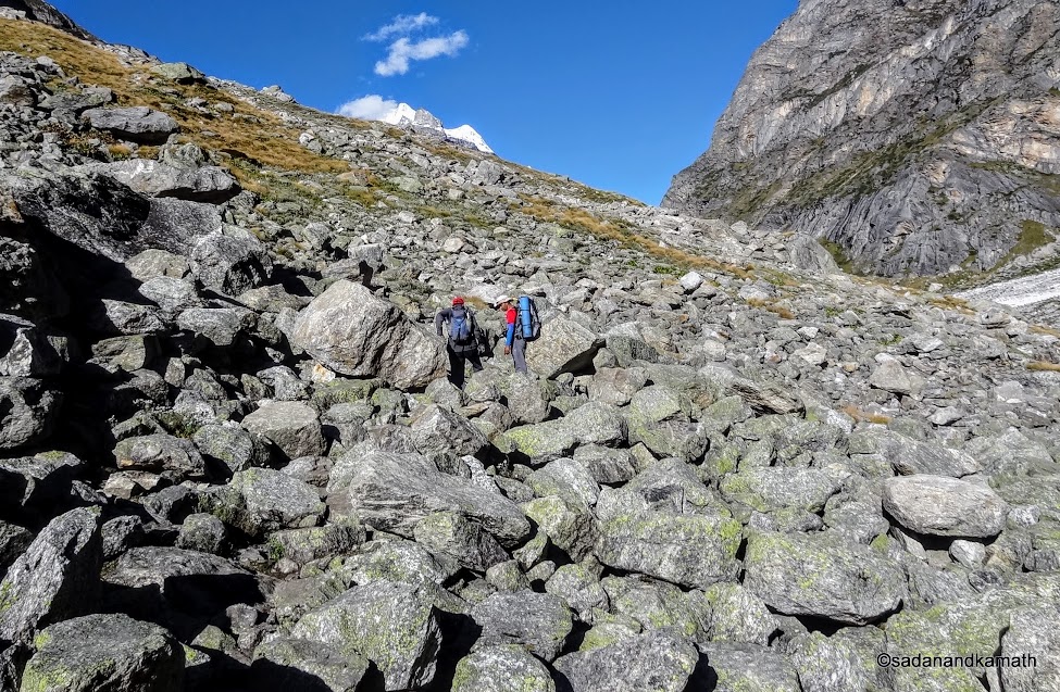 |
| Climb through boulder zone for reaching Laxmivan. |
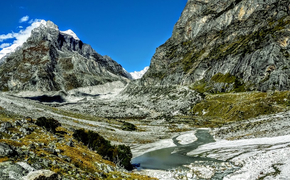 |
| Alaknanda river has just emerged from the bifurcation region of Alkapuri glacier (Bhagirathi Kharak) and Satopanth glacier (not visible in the picture) from the left near Laxmivan. |
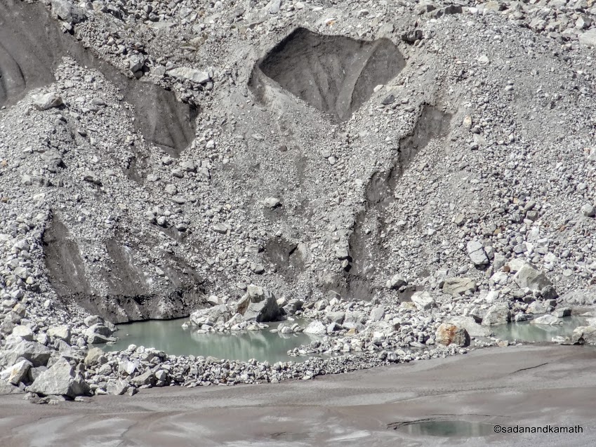 |
| Alaknanda river snout. The dark grey patches among the debris are in fact the glaciers concealed under debris of moraines. |
 |
| Laxmivan campsite. | |
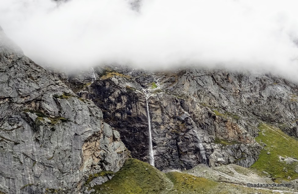
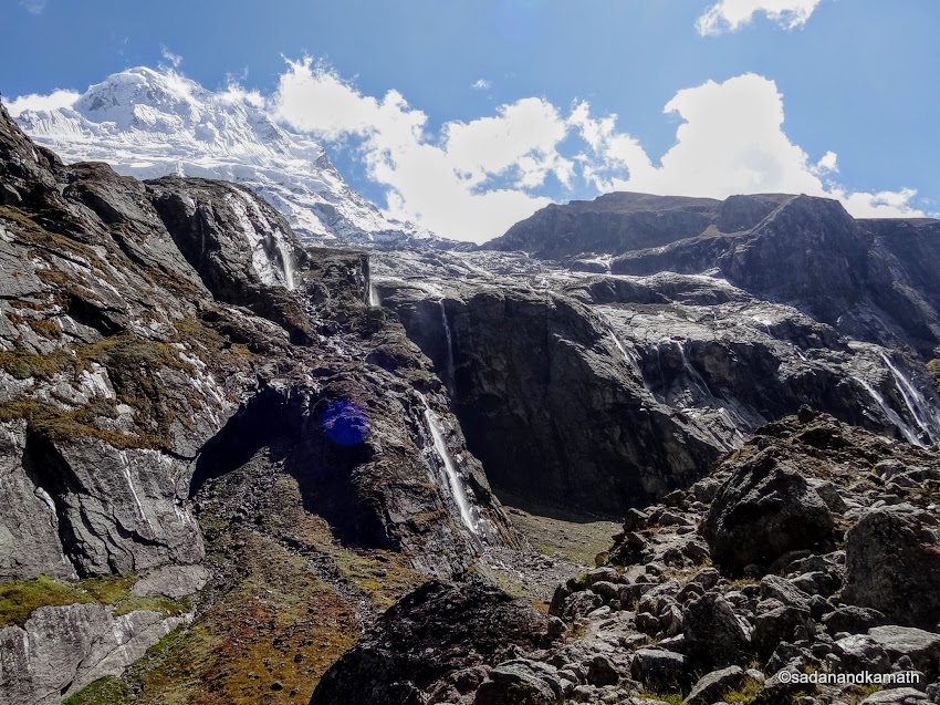
Another
unique feature of today's trek was the Sahashtradhara region. It is
said that there are thousands of waterfalls in this region. I would say
that there are numerous waterfalls in this area ranging from as thin as a
line to as wide as say 3-4 feets which cannot be counted to arrive at an exact number. Hence Sahashtradhara - waterfalls in thousands. Most of the
prominent waterfalls are on the left side of the trek path. As we
trekked further into Shahshtradhara region on a ridge, we could see that
source of most of these waterfalls was the glaciers of Mt. Neelkanth
(6590m), which can also be seen from Badrinath and regarded as the protector of Badrinath temple. The series of these waterfalls have created the multi-pronged
perennial streams below the base of the mountains which eventually merged
with Alaknanda river somewhere near Laxmivan.
It is said that Arjun shot an arrow which resulted in the water to gush from the mountains to create these waterfalls to quench Yudhishthira's thirst.
 |
| Under the debris of moraines, tonnes of ice emanating from Bhagirathi Kharak are concealed which is a major source of Alaknanda river. |
 |
| Himalayan Sparrow near Laxmivan |
 |
| Mt. Parvati range seen from a ridge near Sahashtradhara | |
 |
| Mt. Neelkanth (6590m) with its glaciers at the base is the major source of waterfalls in Sahashtradhara. |
 |
| A series of waterfalls emanating from Mt, Neelkanth in Sahashtradhara. |
 |
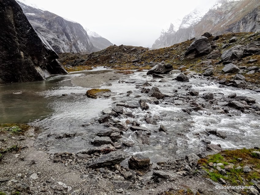
| A multi-channel stream created from the waterfalls of Sahashtradhara. |
As happened with me in the previous day, I was not fully fit today also to take a longer trek for the day and my legs refused to obey my command. Since the next 3 kms of trek to Chakrateerth involved a steep climb, Sonu decided to camp for the day in Sahashtradhara as by the time I reached here it was already 2.30 p.m.
But for the compulsion, Sahashtradhara is an unlikely place for a campsite from the safety point of view. Apart from it being a small place, it is engulfed from all side by numerous streams formed from the waterfalls. Moreover, the calmness of the area is shattered by the deafening noise of the numerous waterfalls in the region. Also, the continuous rains can make the life miserable in this campsite as the water levels in the streams can rise suddenly due to rains, submerging the tents amidst the flow of stream water. Our expectation was that nothing these sorts of things would happen in the next 12 hours or so due to a clear sky and the excellent weather conditions with low day temperature (around 17C). The evening was very cold (less than 10C) and this gave us hope that the weather for the next day would also be an excellent one.
 |
| We camped at Sahashtradhara surrounded from all side by numerous streams formed from the waterfalls. Our source of drinking water was from a waterfall (extreme top left). |
 |
| Mt. Neelkanth in the evening seen from our campsite in Sahashtradhara. |
 |
| Close up shot of waterfalls seen from our campsite in Sahashtradhara. | |
Day-3: Sahashtradhara to Chakrateerth (4010m) - 3 kms
We woke up to the morning of an excellent weather. That the overnight dew deposited on the tent had become
the ice flake indicated that the outside temperature must have touched
close to 0C though we checked in the tent that it was 3C. The surprising thing was that we had not heard the roaring sound of waterfalls for quite a long time. When we came out of the tent, we saw that almost of major waterfalls had been reduced to a tickle. The reason was that in the night, due to very low temperature, glaciers stopped melting making the waterfalls almost non existent.
A debate might be going in the mind of Sonu whether I can make it today straight to Satopanth Lake skipping Chakrateerth camp. Because the distance from Sahashtradhara to Chakrateerth is hardly 3 kms. On the other hand, the 5 kms of trek from Chakrateerth to Satopanth lake is the most difficult part of the trek involving crossing at least 5-6 ridges strewn with boulders and loose stones. I guess Sonu must have assess my problem and decided to camp at Chakrateerth for overnight so that the most difficult part of the trek can be started afresh in the early morning. In any case, we had spare days built into our schedule.
We commenced the trek to Chakrateerth at 7.45 a.m. There were three sections of climbs and descents of about 1 km each. At the last stretch, there was a steep descent followed by a level walk of about 500m to reach the Chakrateerth campsite. I completed the 3 kms of trek in 3 hours - a slight improvement over my previous two days of records. Chakratirth is the place where Arjun gave up his earthly life.
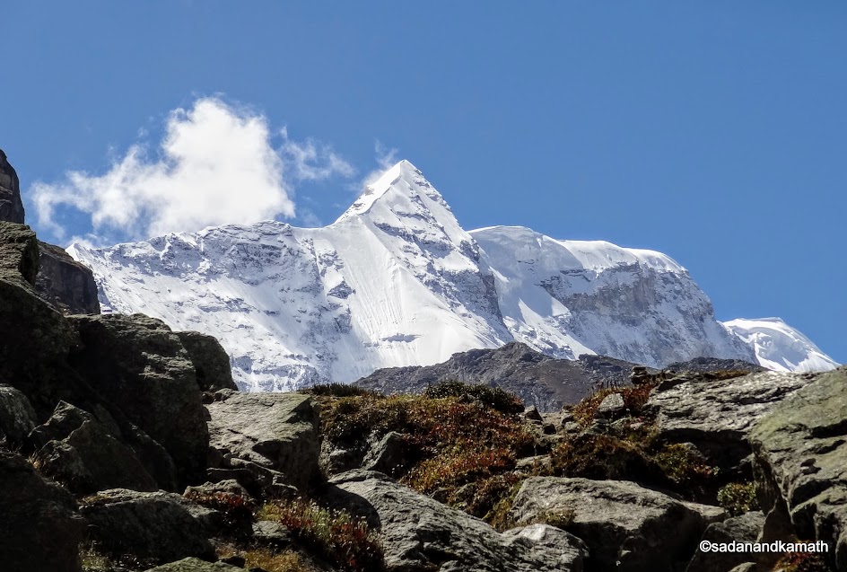
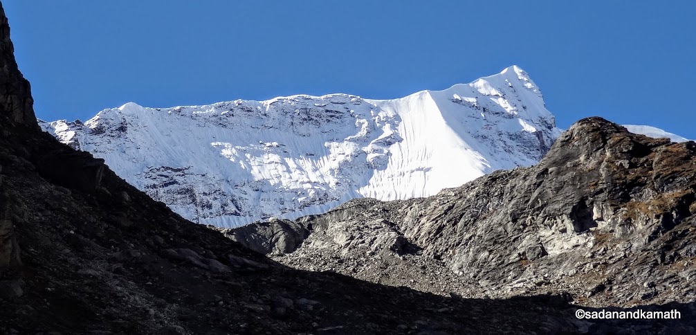
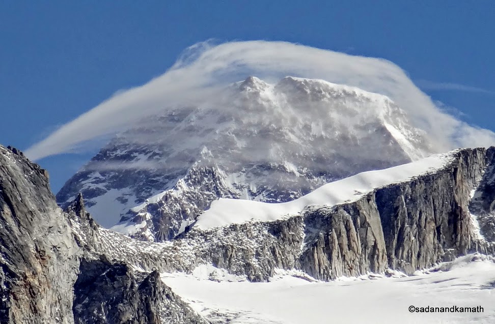
For the first time, we could get a fuller views of Mt. Chaukambha (7180m) and Mt. Balkun (6067m) apart from Mt. Neelkanth. From the Chakrateerth campsite, we got to see for the first time Mt. Kamet (7765m), Mt. Bangneu (5710m), Mt. Deoban, Mt. Narayan (5965m) and some other unidentified peaks.
 |
| Reflections of Mt. Chaukambha (left) and Mt. Balkun (right) on the streams in Sahashtradhara. |
 |
| Wild flower Blue Poppy captured somewhere near Bandhar |
 |
| Walking through Bandhar campsite with Mt. Chaukambha and Mt. Balkun in the background. |
|
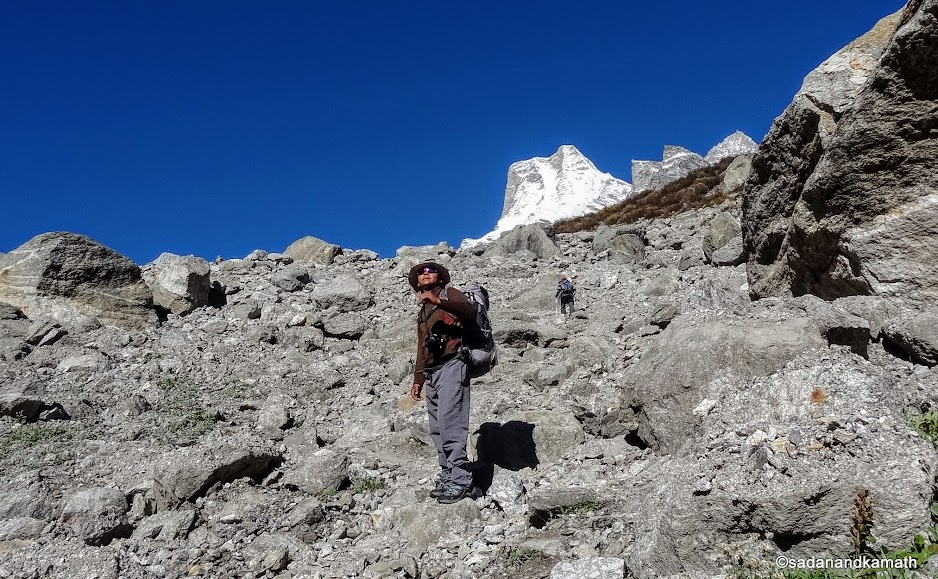 |
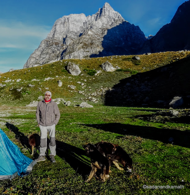
| Climbing through boulder/stones zone to reach Chakrateerth. In the foreground is our guide Sonu. KS is way ahead. |
 |
| Mt. Parvati range seen from the ridge of Chakrateerth. |
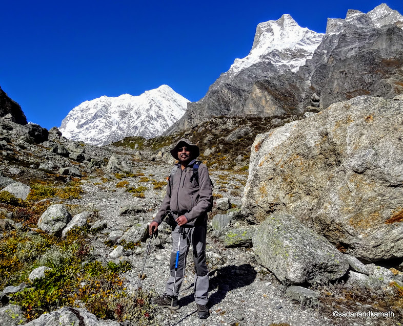 |
| A photo session for me with Mt. Chaukambha also called Mt. Badrinath (left) and Mt. Balkun (right) in the background |
 |
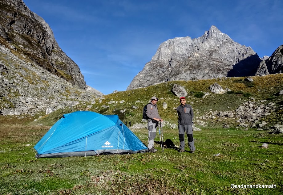
| Chakrateerth Campsite with a part of Mt. Parvati (left, partially seen) and Mt. Chaukambha (right). |
 |
| Mt. Bangneu, Mt. Kamet, Mt. Deoban and other unidentified peaks seen from Chakrateerth in the morning. | |
Day-4: Chakrateerth to Satopanth Lake (4230m) - 5 kms
Today was the day of reckoning for me, it was a test of my will power and endurance versus the physical condition. While I had absolutely no problem with acclamatisation as I had proper appetite and getting more or less a sound sleep in the night. The problem I faced so far was related to my leg and thigh muscles which seems to getting better. Sonu had discussion with me in the previous evening and I had given him my feed back that my leg muscles were in a better shape than the first two days of the trek. None the less, he said that he would like an early start to the trek - say about 6.00 a.m. We actually started the trek from Chakrateerth at around 6.45 a.m.
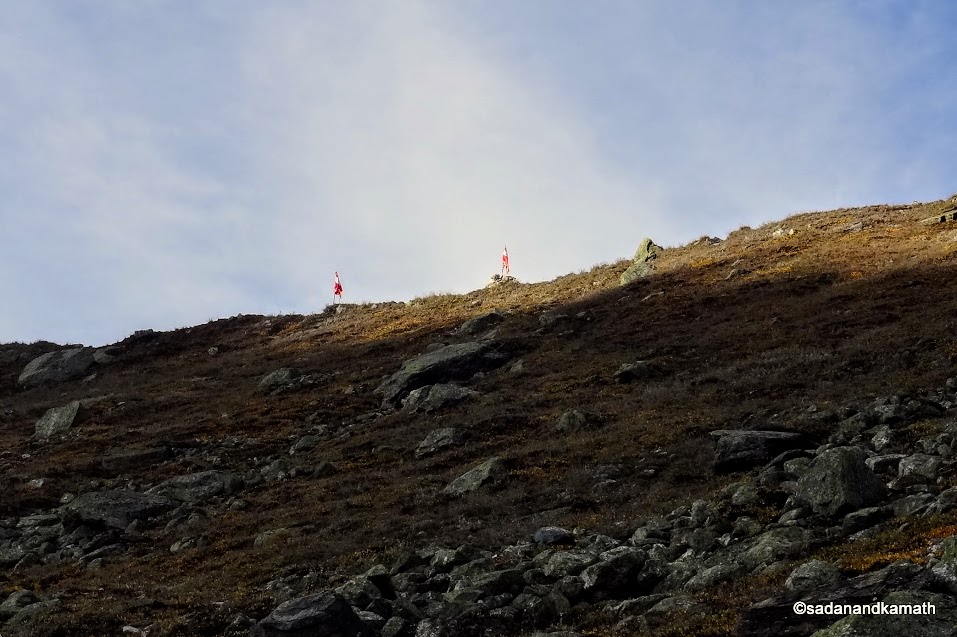
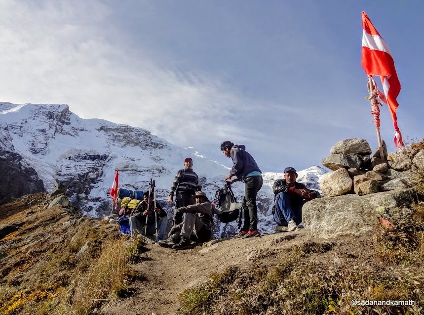
After the initial plain walk of about one km or so, the first hurdle was to cross the high ridge. Luckily, the zigzag path was well marked through the grass and small shrubs, making it a gradual climb. It was a long ridge and the two flags fluttering over it was the indicator that we had to cross the ridge at this point. One would generally get a feeling that after the crossing of the ridge, we would see the glimpse of Satopanth lake from the ridge top. It was not to be.
 |
| We have to climb the ridge from Chakrateerth to cross between two flags. |
 |
| We have reached the top of the ridge. Mt. Parvati range in the background. |
 |
| Now in the boulder/stone zone for descents followed by ascends. | |
 |
| Descending through boulder zone to climb another ridge. In the background is Mt. Chaukambha.In the foreground is myself. |
 |
| A zoomed shot of the top part of eastern side left of Mt. Kamet (not visible).One can notice the numerous crevasses in the glacier. In the background is probably Mt. Bangneu (5710m). |
 |
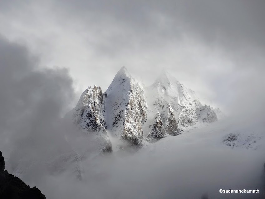
| An unusual white cloud formation probably over Mt. Bangneu (5710m) seen from the ridge. | |
 |
| Zoomed shot of Mt. Kamet (7765m) seen from the ridge. |
From the top of the ridge, one could see a large expanse of boulders and stones without any mark of the trek path except some crains placed at some boulders to decide as to which path on the boulders to be taken. Moreover, there were at least 5-6 medium ridges to be crossed before one could see a flag post indicating the last ridge to reach Satopanth Lake. we came across a big group of trekkers from Mumbai who were returning from Satopanth.
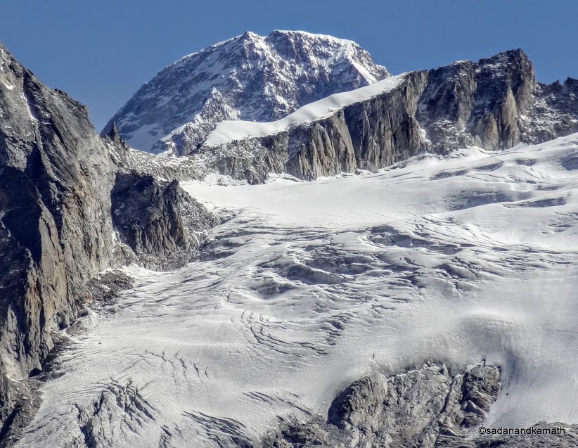
One positive aspect of our boulder hopping was that we could see Mt. Chaukambha at the close range (probably not more than 3-4 kms distance with its almost vertical base) and also the Satopanth glacier (also known as Swargarohini ice falls). Also Mt. Neelkanth was seen from the last ridge in a different perspective than what we have been seeing from the last two days. Unfortunately, by the time I reached the top of the last ridge to take the picture, Mt.Neelkanth was already covered with white cloud. However, KS who had reached earlier than me, had already clicked the picture.
 |
| A close up of what is called as Swargarohini (path to heaven) ice falls lying on the side of Mt. Chaukambha which only Yudhishthir among the Pandvas and a dog with him crossed the glacier to reach the heaven. In geography, it is called as Satopanth glacier, the melting of which created Satopanth Lake. | | |
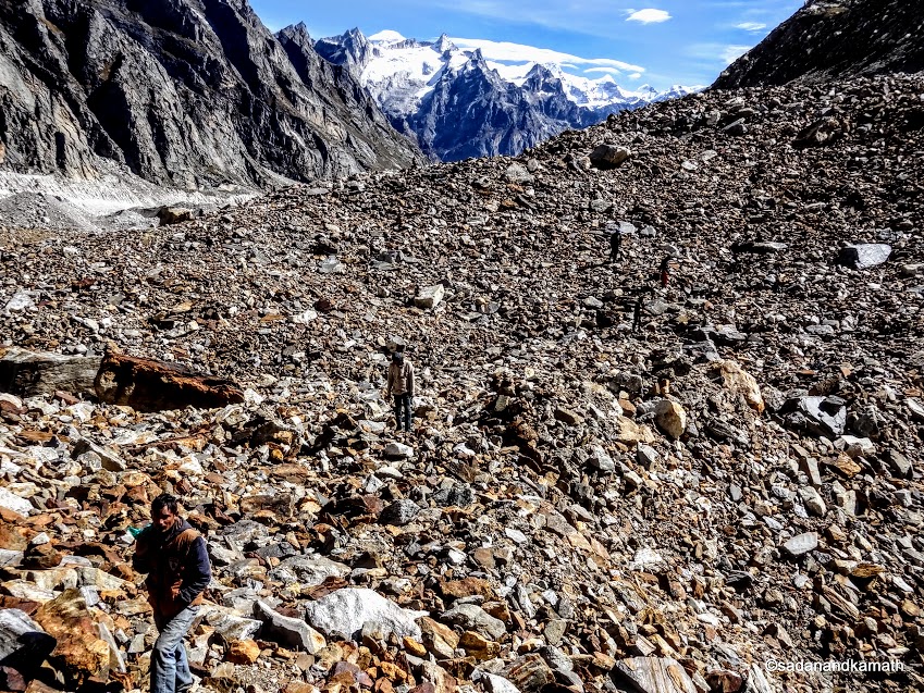 |
| Large expanse of boulders/stones as we near Satopanth Lake. In the picture are a few pilgrims. |
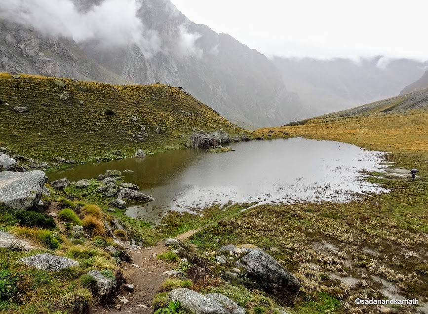
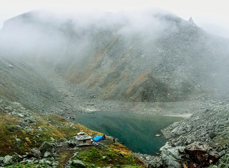
After crossing the last ridge, it was a steep descent of about 100m to reach Satopanth Lake's main area where a make-shift temple is located. I reached Satopanth Lake around 11.15 a.m. in 4 hours 30 minutes. For the first time in this trek, my leg muscles did not let me down. Our tent was pitched near a make-shift temple. Since a small room constructed by the Mana village panchayat for the benefit of villagers for performing certain religious ceremony was available, there was no need to pitch the kitchen tent.
 |
| Satopanth Lake. |
After having our usual lime tea and resting for an hour or so, myself and KS ventured to take a symbolic bath in Satopanth Lake. Contrary to our expectation, the water in the Satopanth Lake was not ice cold. We could stand in the water for sometime to sprinkle the water over our body and head.
Due to difficult terrain for the trek and the path being not suitable for horse rides, only hardcore pilgrims visit Satopanth Lake. On Ekadashi days, the numbers of pilgrims may increase a bit to take a holy bath in Satopanth Lake. It is believed that on Ekadashi days, the trinity of Gods - Brahma, Vishnu and Mahesh visit Satopanth Lake to take bath. Though the trekking season is June and September, pilgrims visits Satopanth Lake anytime between June and early October.
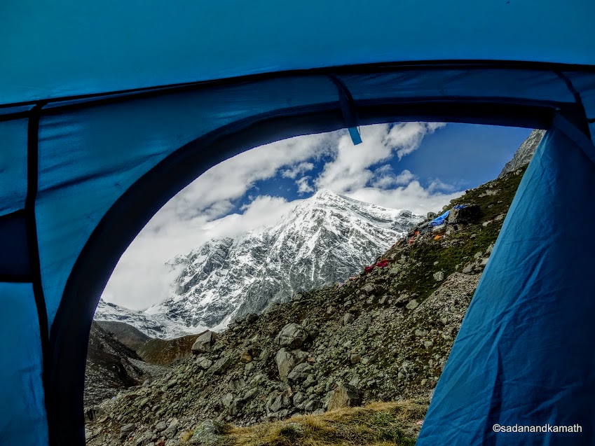 |
| View of Mt. Chaukambha from our tent in Satopanth Lake. |
 |
| Myself and KS in Satopanth Lake for a bath |
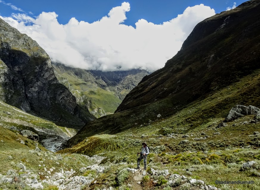
Sometime in the middle of the today's trek, Sonu told me that after reaching Satopanth Lake and resting for sometime, we would go beyond Satopanth to explore the region by trekking over the Satopanth Lake ridge without the haversack and return on the same day. However, neither KS nor myself took a serious note of it. In fact, it went completely out of our mind. By the time we had completed our bath and returned to our tent, Sonu had already left for the exploration beyond Satopanth Lake. He returned in the evening and apprised us about his visit to Suraj Kund which he found it completely dried up. We abandoned the plan to visit Swargarohini ice fall base as having seen it about 4 kms of distance from the ridge, there was no point in going more closure to see it that too on the edge of the glacier completely concealed under the debris of moraines. There was also the danger of crevasses for which we were not equipped to handle.
In the afternoon, weather in Satopanth became cloudy and by the time we had dinner at around 6.30 p.m., it was drizzling. In the night, there were intermittent rain showers. It was not a good sign for our return trek.
Day-5 : Satopanth Lake to Bandhar (3910m) - 8 kms
We woke up to a cloudy sky with some light drizzling. Surprisingly, in spite of at the higher altitude than Sahashtradhara and Chakrateerth, the early morning temperature was 7C as against 3C observed in Sahashtradhara and Chakrateerth. It is said that in the mountains, rise in temperature is an indication of the cloudy weather.
When we commenced the return trek at around 7.30 a.m., there was no rain but the clouds in the sky indicated that it could rain any time. Today, we had no fixed destination to camp but the idea was to trek as closure to Mana village as possible. That means, we would certainly skip camping at Chakrateerth and try to reach Laxmivan if not Chamtoli for camping. But in Himalayas, our plans are only on papers. The actual plan may work out something else depending upon the weather conditions and the physical fitness of the trekkers.
 |
| Satopanth Lake as clicked from the first ridge on our return trek. Our blue tent is being unfolded |
 |
| The weather is turning bad as we are somewhere between Chakrateerth and Bandhar. |
After crossing the first ridge, we faced the light showers. We had already put on our raincoats from the start. So there was no question of drenching in the rains. The light showers continued when we reached Chakrateerth. Here, we had a short break for the packed lunch. From Chakrateerth, the light showers turned into medium showers. After observing the cloud formation in the sky, we thought it fit to camp in Bandhar (3910m). We reached here around 12.30 p.m.
The light rain continued for the next two hours. However, from around 2.30 p.m. onward, the intensity of rain increased to so much that we had to take our evening soup and the dinner in our tent. It rained whole of the night. The sound of the rains falling on our tents disturbed our sleep. We were all hoping for the rains to stop by the next morning so that we could continue our return trek.
Day-6 : At Bandhar in the tent
We woke up to the sound of the rains. As usual, we had lime tea in the morning in the tent at which time we noticed that there was some dampness in our sleeping bags. It turned out that some rain water had seeped below the sleeping mats making the sleeping bag wet. Luckily, only the outer of the lower parts of the sleeping bags were affected and the water had not passed through the inner side. Sonu with the assistance of one of the porters created a deeper water passage around our tent to ensure that the rain water drains through these passage to join the streams passing through some distance away. For the time being, it seemed to work as there was no further seepage in the tent.
We all were hopeful that rains would stop in less than 24 hours as even the cloud bursts in Himalayas had normally ended in about 24 hours in non-monsoon period. The rain continued as we ate noodles for the lunch. Post-lunch, Sonu came to our tent to discuss the further course of actions in case the rains continued unabated. He said that there was enough food items to manage extra days. On our part, we had no problems about delay as we had already built in two extra days.
Since it has been continuously raining for more than 24 hours, Sonu had some apprehensions. He pointd out that when we descended from the ridge to reach Bandhar yesterday, the water in the stream was just a tickle. Now, the force of the water in the stream was so strong that the single stream has branched out into a number of streams which were passing through the both sides of Bandhar campsite. Though water in the streams have not overflowed, there was a danger that if the present intensity of the rains continued, streams flowing from both sides of our tents may overflow and water may enter our tents. He told us that he along with a porter had gone to an adjoining hill where he found a cave like dwelling at a higher level. In case of the need, we could stay in the cave till the rains stopped. He said this was only a back-up arrangement and we should be ready to shift in a short notice with our personal belongings should the occasion arise.
We had now spent more than 24 hours in the tent without giving us opportunity to go out for a walk. In fact, we were virtually under 'tent arrest' waiting for the rains to stop so that we can resume trekking to reach to our destination. Our condition was akin to a Himalayan spotted dove who had taken shelter under a plant near our tent as it could not fly presumably due to the accumulation of waters in its wings. The dove was waiting the rain to stop so that its wings can get dried up and can fly once again to its destination. The dove remained under the plant for a long time. Even during taking a photo from a close range, it was unperturbed.
 |
On the left picture, a Himalayan Spotted Dove had taken shelter under a plant close to our tent waiting for the rains to stop so that it can fly to its destination. The picture in the right shows that our position was like that of the Himalayan Spotted Dove. We have taken shelter in the tents, waiting for the rains to stop and resume our trekking for reaching our destination. (pictures clicked by Sonu Bisht from my camera).
In the early evening, I went to Kitchen tent to have chit chat with Sonu and other porters just to break the monotony of sitting in the tent for long time. From the talks, it appeared to me that porters were eager to reach Badrinath as early as possible. In fact they even suggested that if the rains stopped now, we should commence trekking to reach Laxmivan/Chamtoli. The response of Sonu was more matured. He said that the stopping of rains did not mean that the water levels in a large number of streams on the way would come down immediately. In fact it would become risky to cross such roaring streams. He was more concerned about the likely water-logging around our tents should the rains continued in the night.
I shared my view that even if the rains continued, the chances of streams overflowing around our tents were less likely. The point was that the streams around the tents did not overflow despite more than 24 hours of the continued rains. My view was supported by the porters. Sonu did not counter my view but he said that we should be fully prepared for all the eventuality and be ready shift at the short notice to the cave on a hillock should the occasion arise.
We took dinner in our tent and once again hoped for the rains to stop in the night. Of course, rains did not stop in the night but the silver lining was that the intensity of rains had reduced and there were short breaks in the rains. In the dead of the night, Sonu came twice to check the passage of water around our tent and to enquire about water seepage in the tent. We had no problems in the night from the rains.
Day-7 : Bandhar to Mana Taxi Stand: 14 kms
We did not know as to when the rains had stopped in the night. When we woke up in the morning, there was no rains though the sky was overcast. The roaring sounds of the adjoining waterfalls had considerably been reduced. The number of streams coming from the ridge had also been reduced. Sonu seemed to have got up very early in the morning as we had bed tea at around 5.00 a.m. We were instructed to get ready to depart from Bandhar around 6.00 a.m. with packed lunch. The intention was to reach Joshimath today itself. It seems, porters as well as Sonu were eager to reach their home destination though the plan suited us also in line with our schedule.
We left Bandhar at 6.15 a.m. under the overcast sky. From the high clouds, the chances of rains were less. Probably, we may have to face occasional drizzles on the way. As anticipated by Sonu in the previous day, despite the respite from rains, we had some difficulties in negotiating roaring streams which were earlier completely dried up when we had crossed them a few days back. The campsite at Shahshtradhara was submerged in stream water.
The two days' continuous rains have made the waterfalls in Sahashtradhara to spill more waters in the streams making the crossing at some places difficult. I can visualise that a few hours back, even the trekking path on the left was submerged.
Place for boulder hopping over the stream near Sahashtradhara.
The fresh snow on these unidentified peaks as the veils of clouds is clearing.
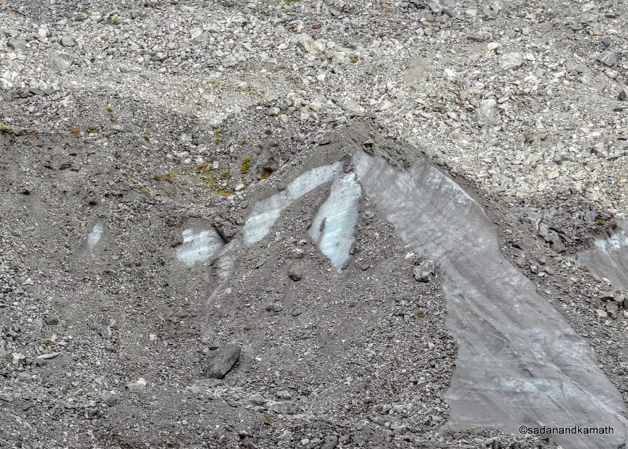
This pictures shows as to how tonnes of solid ice sliding from the glaciers are hidden by the moraines.
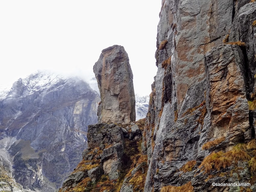
The natural rock pillar at Bhimbar. Acccording to legend, this rock pillar is commemorative of Bhima's release from earthly life at this point.
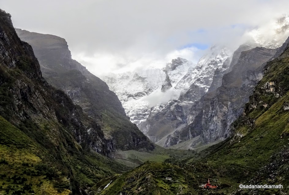
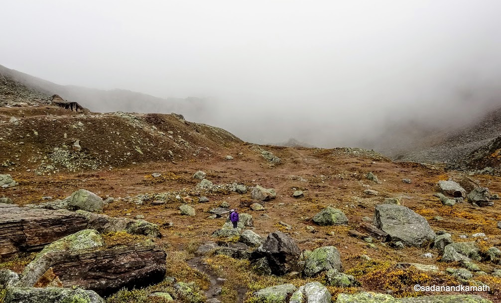
We are near Chamtoli. While Sonu is looking at me, KS seems to be observing something interesting on opposite side.
We
crossed Laxmivan at around 10.00 a.m. and Chamtoli at 11.00 a.m. Just
before Chamtoli, we had our packed lunch. Chamtoli campsite had turned
into a lake due to accumulation of rain water. From Chamtoli, we had to
face two landslide zones which had become dangerous due to continuous
rains for the past two days. Sonu did not allow us to stop in these
stretches even for a short period for breathing to become normal. Thereafter,
it was an easy trek with short climbs and descents. When we were about 2
kms from Mana, moderate rains started which continued until we
reached Mana Taxi Stand at 2.30 p.m. The 14 kms of trek from
Bandhar in 8 hours boosted my confidence. It was now apparent that I had overcome my
calf and thigh muscle problems at the beginning of the trek last week.
Vasudhara Falls.
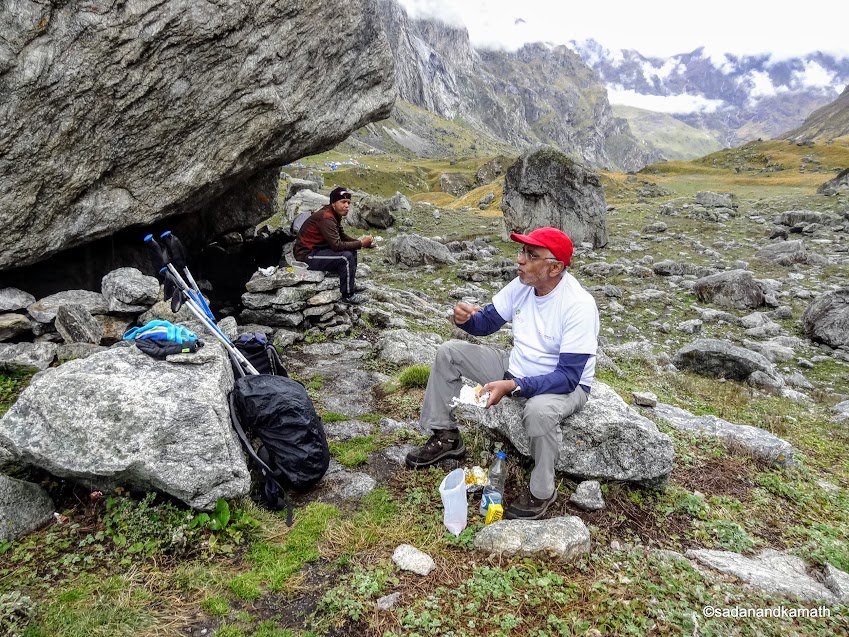
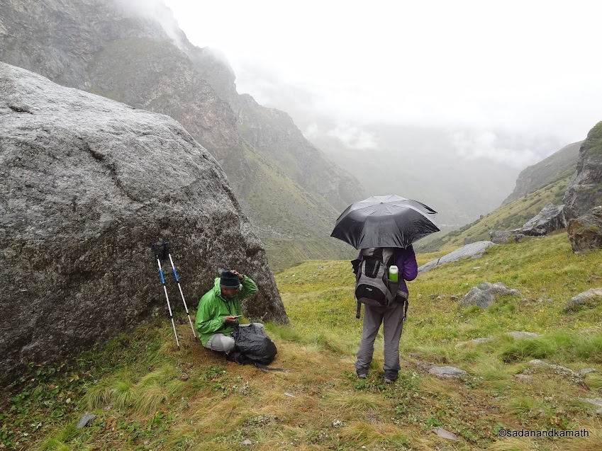
Lunch break near Chamtoli Bugyal.
Chamtoli Bugyal.
Chamtoli campsite where we had pitched our tent last week has now tuned into a lake thanks to two days of continuous rains.
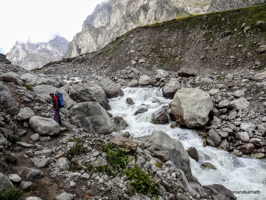
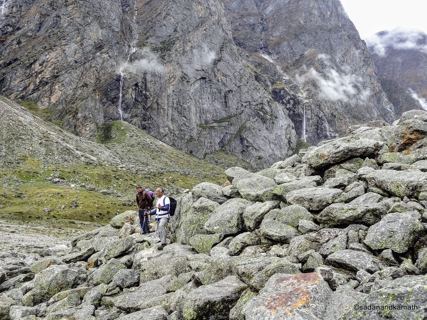
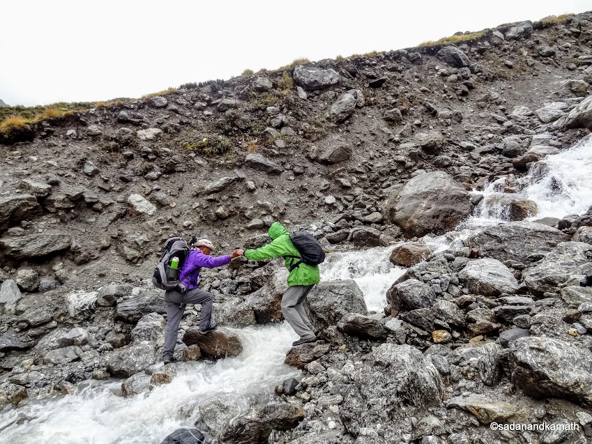
The stream which we had easily crossed 4 days back has become a bit risky to cross as water has been gushing thanks to two days of continuous rains. Here KS is being assisted by Sonu, the Guide to take a big leap from one boulder to another and climb in one go.
We are near Mana village. KS and Sonu are trying their lucks to get the mobile signal. While Sonu could speak to his wife, KS had no such luck.
Keshavprayag - the confluence of Saraswati river (far end) and Alaknanda river (foreground). Mana village can be seen above the Saraswati river.
We hired a jeep at Mana Taxi Stand and reached Badrinath in 30 minutes. Badrinath town looked almost deserted. There was some apprehension as to whether Badrinath- Joshimath route was affected by the last 2 days of rains. We came to know that due to Presidnet's visit to Badrinath temple on the previous day, the authorities had held back pilgrims at Joshimath for few hours. The road was not affected by the rains. So it was a good news for us so that we would be able to reach Joshimath today itself.
We had about 45 minutes break in Badrinath for coffee as well as the time taken to hire a share jeep to Joshimath. We started from Badrinath around 4.00 pm for Joshimath. The weather was cloudy but there was no rain. However, after Pandukeshwar, the rain started and a landslide at the familiar Lambagad halted the traffic for more than 1 hour until the landslide was cleared by BRO. We reached Joshimath around 7.30 p.m. We checked in Hotel Atithi near Taxi Stand. After dropping us at Joshimath, Sonu left for home at his village Parsari.
The next day, we got into 6.30 a.m. bus to Haridwar. It took nearly 12 hours of tiresome journey to reach Haridwar in the late evening. It was not a good idea to take a bus for Haridwar after 7 days of boulder hopping trek. But we had no option as there were no share jeep in Joshimath on that day. After two days of leisure stay in Haridwar, we reached Mumbai via Haridwar-New Delhi-Mumbai.
|