My wife and I along with other 5 couples - all our family relations and all senior citizens, joined a 7-day trip arranged by Anubhav Vacations to some off-beat tourist spots in and around Sirsi town in Uttar Kannada district during December 31, 2022 to January 6, 2023. During our trip, we stayed in Anubhav's own resort, Green World Forest Resort, located 18 kms east of Sirsi town. One of the places covered in the trip was a visit to Mirjan Fort, the name I heard for the first time. I did some research on the Fort to have some basic information before we proceed there.
Mirjan Fort
Mirjan Fort is located 12 kms from Kumta and 23 kms from Gokarna. From our Resort, it was around 78 kms via Sirsi town. A reference to Wikipedia revealed that the Fort does not have a definitive history as to when it was constructed and who constructed it. A display board of the Archaeological Survey of India (ASI) outside the Mirjan Fort also says that there is no reference as to the construction of the Fort. Yet, based on the contemporary sources, the Fort is supposed to be constructed by Shareef-Ul-Mulk (1608-1640), the ruler of Ponda under the patronage of Adilshahi Sultanate of Bijapur.
The other contemporary sources indicate that the Fort came under the ownership of the Vijayanagar kingdom who allowed Queen Chennabhairva Devi of Tuluva clan who ruled South Kanara (the present Mangluru and Udupi districts), North Canara (the present Uttar Kannada district) and South Goa, to occupy the Fort as a protectorate of Vijayanagar kingdom. She used the Fort for trading in Spices especially pepper and nutmeg. These spices were exported to Middle East and Europe through various ports such as Malpe, Honnavar, Kumta, Mirjan, Bhatkal etc. Because of almost her monopoly of trade in pepper, she was given a title of 'Pepper Queen".
With the decline of Vijayanagar kingdom, other chieftains of the neighbouring regions joined hands and defeated Queen Chennabhairva Devi who was taken as prisoner. She died while in the prison. The Fort changed hands, the Portuguese, the Marathas, and finally the British took the control of the Fort which remained with them until 1947.
Driving direction from Green World Resort to Mirjan Fort.
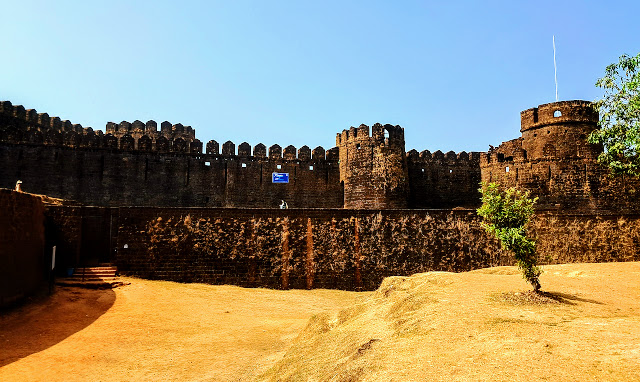
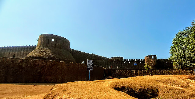
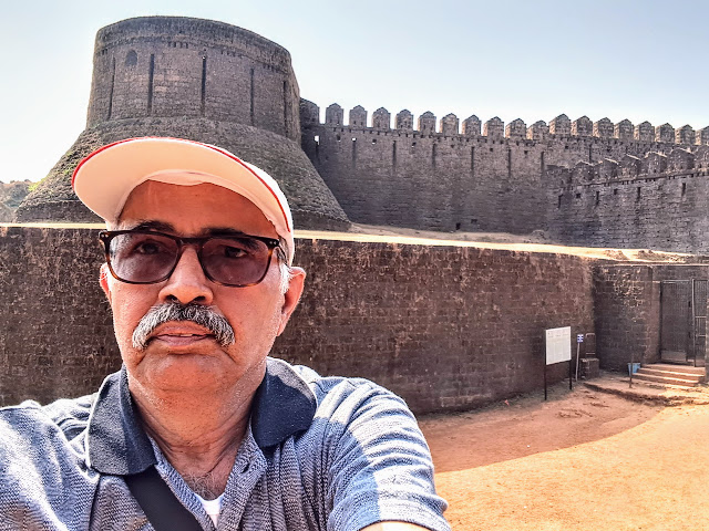
Ultra-wide-angle view of Mirjan Fort from parking area
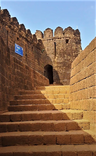
The main gate to the Fort on the right.
The stairs from the main gate leading to the Fort.
At the outset, it looked like that a canal surrounded the Fort which is now completely dried. Since Aghanashini River flows very close to the backside of the Fort, it is quite likely that water from the River was diverted through the canal as a part of the protective measure.
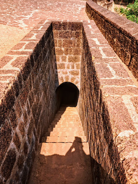
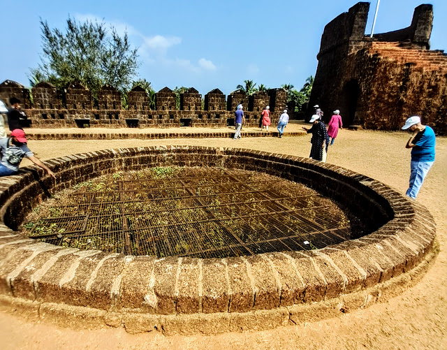
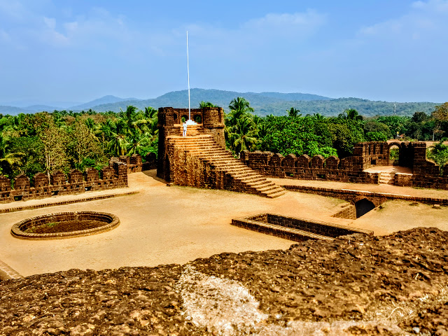
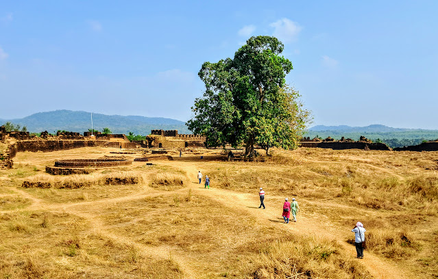
There are four entrances, the main and 3 subsidiaries gates of which one is a secret passage now closed. As we enter through the main gate, a climb of about 20 stairs leads to the open plain area covered by laterite stones. There is a staircase going down to a secret underground passage which was closed for the visitors. On the right side of the secret passage, there is a watch tower with a flag post. This flag post is used to unfurl India's flag during the Independence Day. As we move to the left side, there is a big round well now covered with grills on the top as a precautionary measure. The well has water throughout the year.
Stairs leading to the secret passage in the Fort.
The first of the two big round wells, covered with grills.
The well on the left, the watchtower with flag-post in the middle, another watchtower on the right and the secret passage in the foreground.
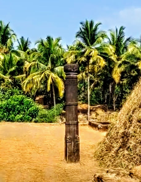
As we walk further by the side of the watchtower, we come across a single stone pillar with some carvings which would indicate that the pillar was a part of the temple inside the Fort which is no longer there. As we walk further towards the backside of the Fort, we come across another open space with ruins. The remains of the ruins and two wells inside the Fort indicate that there were houses for those who were permanently settled here in connection with both the trading as well as for the protection of the Fort.
The pillar found on the Fort would indicate that there was a temple inside the Fort which might have been destroyed by the invaders.
Probably the ruins of the houses and the watch towers on both sides.
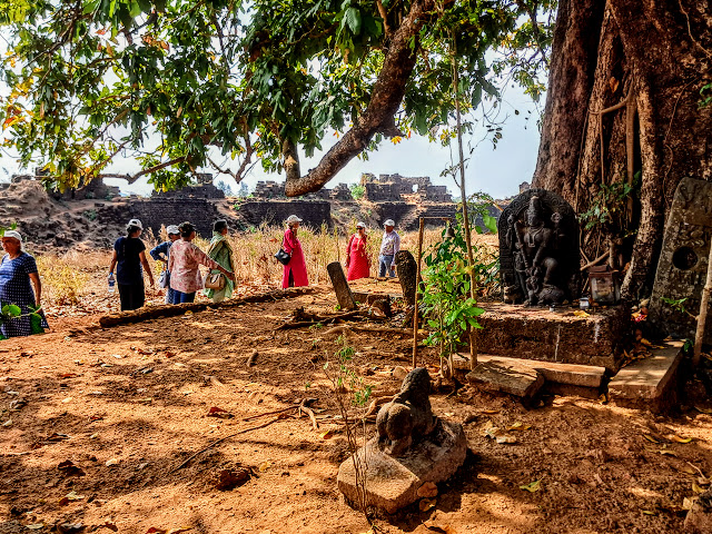
As we walked towards the backside of the Fort, we found one more well which was also covered with grills. There was a lone Banyan tree below which a stone sculpture of Mahisasur Mardini was kept in the open. This stone sculpture was found by ASI while excavating the Fort. There is also a stone sculpture of tiger kept opposite Mahisasur Mardini Sculpture. This is the only place on the Fort where one can sit under the shadow of the Banyan tree after walking under the sun for a long time.
A bird's eye view from the backside of the Fort. One can see another well on the left and the lone Banyan tree in the middle.
Mahisasur Mardini with the tiger as her vahana under the Banyan tree.
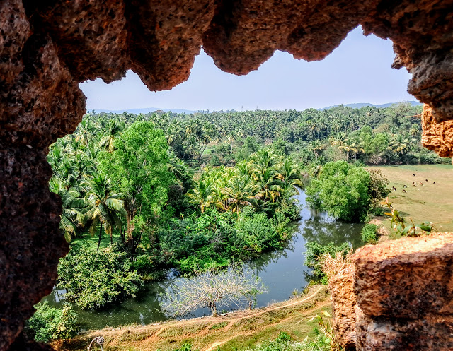
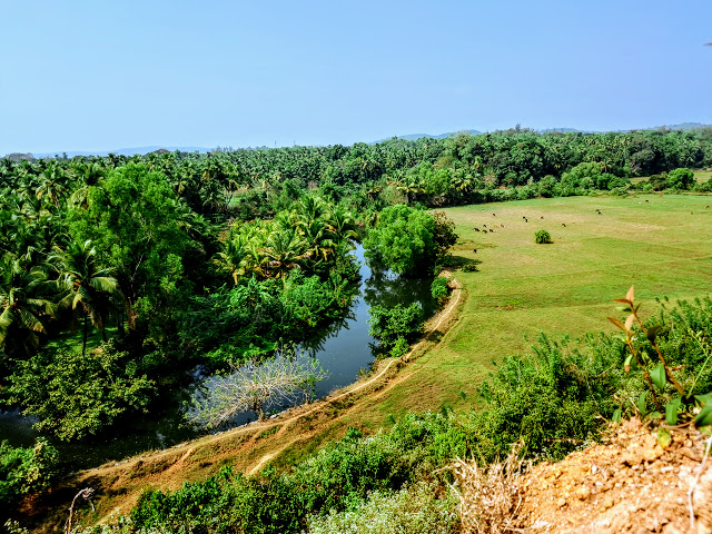
Moving further towards the North-Western side of the Fort which requires a short climb of some uneven steps, we get a beautiful, lush green plains and a meadow by the side of which Aghanashini River flows. This is very beautiful sight for photo session.
View from the backside of the Fort with Aghanashini River flowing almost by the side of the Fort.
Another view from the Fort with a meadow on the right.
It was nearly 2:00 p.m. when we completed the tour of the Fort, spending around 90 minutes inside the Fort. The weather was warm and humid. As soon as we came out of the Fort, we had tender coconuts as our drink before we boarded the bus for our lunch halt at Go Green Homestay off NH-66. We returned to our Resort in time for dinner after visiting Idagunji Ganapati temple and watching the sunset at Echo Beach in Honnavar.