Bahut isne dekhen hain past-o-bulund
Safar iss ko manzil se bad kar hai
-Allama Iqbal
He has seen many low and high.
For him, travelling is more important than the destination.
For him, travelling is more important than the destination.
I started trekking in the Himalaya from 1984 onward involving easy and moderate to difficult treks. I was, therefore, intrigued by the fact that I did not consider undertaking trek to Dodital and Dayara Bugyal all these years which is one of the treks of easy to moderate difficulties. As often said in regards to visiting the popular Himalayan shrines, one needs to get 'invites' from the presiding deities of these shrines to fructify the visits. Based on my experiences, I think a somewhat similar situation exists in regard to undertaking treks in the Himalayas. In my 30 years of trekking in the Himalaya, I also revered the peaceful valleys, the forests, the rivers and the snow clad mountains as nothing less than the Himalayan shrines. So one needs 'invites' from the Himalaya also.
I first planned for Dodital-Darwa Pass-Dayara Bugyal trek some time in autumn of 2012. However, the unprecedented floods in Asi Ganga river in August 2012 and consequent damages in Sangamchatti and other places in Dodital route compelled us to postpone the trek to sometime in 2013. I and my trekking partner K Srinivasan (KS) had almost finalised to trek Dodital-Dayara Bugyal in early June 2013. However, due to some domestic compulsion, we had to cancell the trek. In the hindsight, it turned out to be the wise decision as in the aftermath of a cloudburst in Uttarakhand in mid-June 2013, the road connectivity to Uttarkashi from Barsu as well as from Sangamchatti was cut-off for many days. The extensive damages to road and bridges would mean that normalisation of road conditions may take a long time. So we dropped the idea of undertaking trek to Dodital-Dayara Bugyal in 2014 also and instead did Everest Base Camp trek.
I had not even thought of undertaking this trek in 2015 also but for the reminder from KS before his departure to the USA for a family visit. He suggested that on his return from the USA sometime in mid-May 2015, he would like to do a trek with me. Since I already had a tentative schedule of the trek to Dayara Bugyal-Dodital-Sangamchatti with me since 2012, I suggested this trek to him which was also in his mind. So trek destination was settled. I contacted our Joshimath based guide Sohan Singh Bisht who agreed to accompany us for this trek. However, since he had another commitment with a trekking group as a guide from May 29th, he accompanied us for the first part of the trek from Sangamchatti to Darwa Pass and arranged another guide Rajesh Panwar from Agora for Dodital-Suru Thatch-Dayara Bugyal-Barsu part of the trek. Because of this and for the logistic reasons, we had to change our plan of trek starting from Barsu and ending in Sangamchatti to other way round.
There was still some uncertainties in my mind. KS was to return to Mumbai from the USA on May 19th early morning and I had booked tickets in the train leaving May 21st early morning. What will happen if, for some unforeseen reasons, KS's departure from the USA is delayed. Whether he would be able to cope up with jet-lag without any hiccups. Fortunately, KS did arrived on the scheduled date and he did not feel the effect of jet-lag until we reached Uttarkashi.
We reached Lokmanya Tilak Terminus by 7.00 a.m. and boarded Haridwar AC Superfast Express which left the station at 9.45 a.m. instead of its scheduled departure of 7.55 a.m. We reached Haridwar the next day at 3.00 p.m. It was a very hot afternoon in Haridwar (42C). So we hired an AC tourist taxi for Rishikesh and stayed in Bharat Bhoomi (GMVN) for the overnight. The AC tourist taxi driver cum owner offered to drop us to Uttarkashi the next day @3600/- which we accepted. We need to have these luxuries at our age as we need to conserve energy for the trek. It was very warm in Rishikesh too (41C). So we remained in our room for the rest of the day. It cooled down in the night and we had a comfortable sleep.
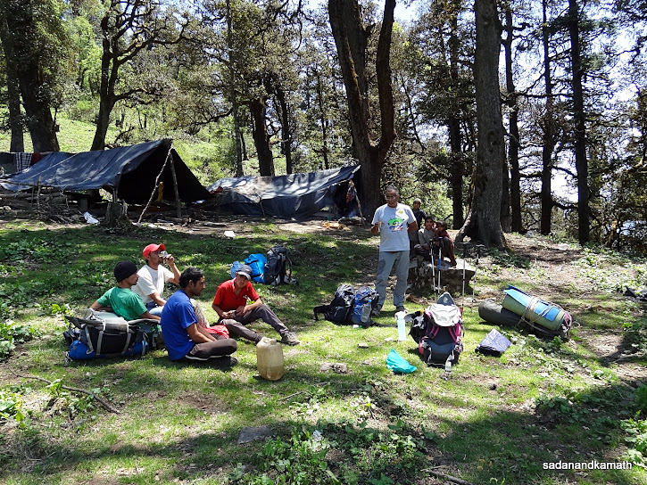
Next day, we left Rishikesh by the tourist taxi at around 7.00 a.m. and reached Uttarkashi at around 11.30 a.m with a short tea break. We checked in Bhandari Hotel where our guide Sohan Singh was already camping. After lunch, Sohan Singh went for purchasing grocery items and vegetables etc while we rested in the room. Our tents, sleeping bags and porters were to be picked up from Agora. The thunderstorm in the evening brought down the temperature and we decided to take a stroll in the market area. Since the thundering and lightening continued, we returned to our room early. KS was already under the spell of jet-lag. So he went into a deep slumber foregoing his dinner and woke up only the next day early morning.
Day-1 : Uttarkashi-Sangamchatti (1680m)-Agora(2210m) - 16 kms by road, 6 kms by trek.
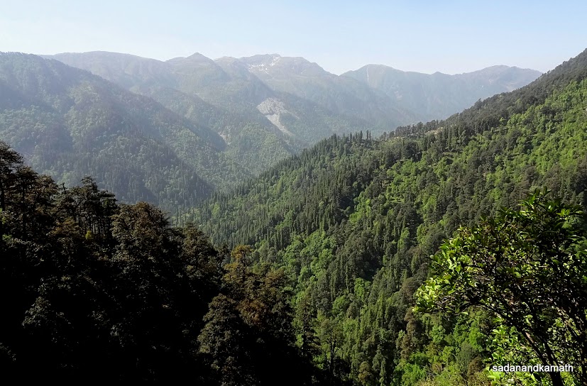
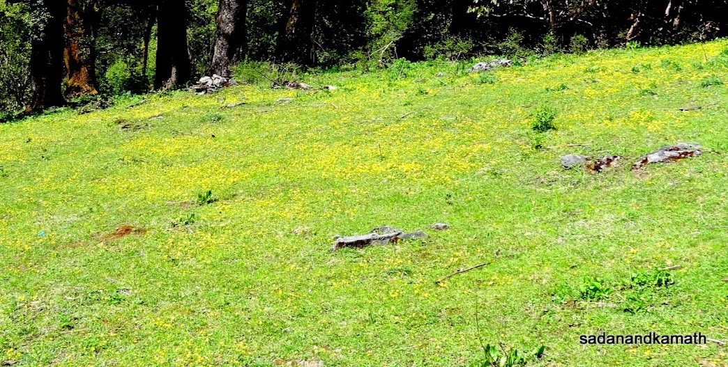
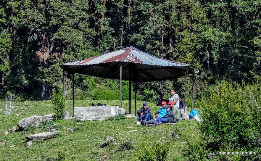
We left Bhandari Hotel at around 8.00 a.m. by Mahindra Maxx under a clear sky with loads of enough provisions - rice, wheat floor, sugar, vegetables, eggs, milk powder, kerosene, biscuits etc. to last for 7 days of trek. At Gangori on Gangotri road, a left diversion took us to a mud road which was in bad shape to say the least. The 12 kms of this single lane road was badly damaged during the unprecedented flooding of Asi Ganga river in August 2012. In some places, there is no trace of the road. Instead there are diversions where surfaces are uneven. So one cannot drive vehicle on this road for more than 10-20 km/hour speed. In some stretches, the work of relaying of road with tar top has been taken. But I doubt whether surfacing of the entire road will be completed before this monsoon. It took nearly an hour to cover the 16 kms of road journey to reach Sangamchatti (1680m). There is nothing now in Sangamchatti except a couple of huts as the entire village was wiped out during Asi Ganga floods in August 2012.
 |
| Sangamchatti is the road head for trek to Dodital.
Once a flourishing hamlet, the unprecedented flood in Asi Ganga river
(left below) in 2012 wiped out the entire hamlet. Now there are only a
couple of huts here.
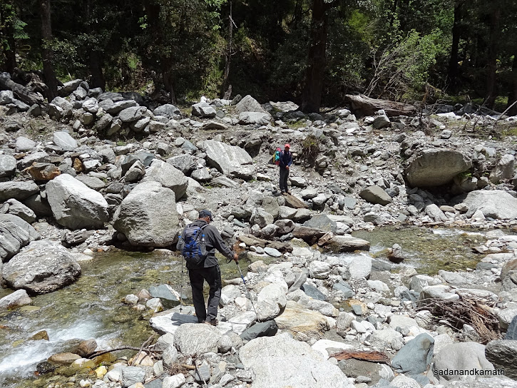
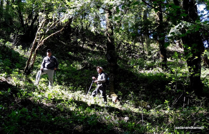
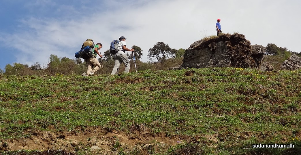
Since porters were to join us from Agora, we hired a mule to ferry the loads to Agora @Rs.400/- and thus commenced our first day of the trek of 6 kms from Sangamchatti. After crossing the newly constructed iron bridge over Asi Ganga river, we turn left on a track which seems to have been eroded to some extent by 2012 floods. We had barely walked not more than 10-20 steps, when we were greeted by scores of colourful butterflies. In this milieu, we hardly made any progress in our trek as we were busy with capturing some of the butterflies in our cameras. Added to this there was constant chirping of some birds in the forest which took time to locate them and capture in our cameras. After spending about 15-20 minutes, we thought it was enough and proceeded on our trek. This trend continued through out the trek.
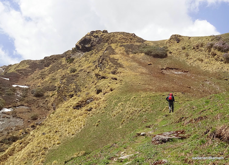
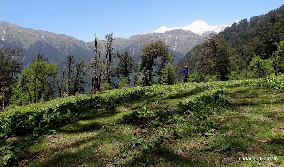
The 6 kms of trek to Agora (2210m) is all along Asi Ganga river which flows deep down in the valley. Even though we had to cover the altitude gain of about 500m in 6 kms, the gradient for climb was gradual. There seems to be no human habitat until one reaches Agora village. Half way through our trek, we could see Bakeria Top ridge (3800m) devoid of any snow. We came across some varieties of wild flowers which had just started blooming. We reached Agora village around 12.30 p.m. taking about 3 hours of trek which in normal time should have taken 2 hours, the reason for longer time to cover the distance was the extra time taken for photography. I was surprised to see a good accommodation called Bharat Lodge owned by Rajesh Panwar (M: 09927099352) and his brother who will be our guide for the second part of our trek to Dayara Bugyal. The lodge was neat and clean. The common toilets and bathrooms were also kept clean. That the lodge had electricity and the internet coverage was an added bonus. This is the last point on our trek where one could recharge batteries of cell phones and cameras. The lodge's frontage has a nicely maintained lawn from where one gets a good view of Asi Ganga valley and the Bakeria Top ridge.
In the afternoon, we had a simple lunch of rice and dal from Lodge's kitchen after which we rested for a while in the room. The weather was sunny and pleasant. However, after sometime, the dark cloud covered the sky and there was thundering and lightening. Soon it drizzled for a while. However, by evening the drizzle had stopped. So myself and our guide Sohan Singh decided to trek towards Bebra settlement, the route which we would be trekking on the next day. However, after about 1 km, we had to hurriedly return to the Lodge as fresh dark cloud had gathered with a higher intensity of thundering and lightening. It rained intermittently after the dusk forcing us to take our dinner inside the Lodge. After dinner, we retired for the day at around 8.30 p.m. However, a trekking batch of 10 persons who were returning from Dodital reached Agora very late around 9.00 p.m. The loud conversations during their dinner disturbed my sleep. Finally, I could sleep around 11.30 p.m.
Some pictures taken during the day are uploaded below:
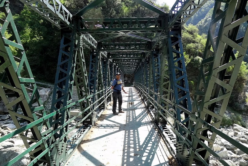
The newly constructed bridge over Asi Ganga river in Sangamchatti.

The exotic butterflies.

An unusual butterfly.

The trek path along Asi Ganga river (right).
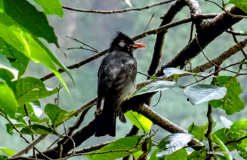
The Black Bulbul sighted on our way to Agora.

Wild flowers -Delphinium Decorum.

Cannabis plants near Agora village.
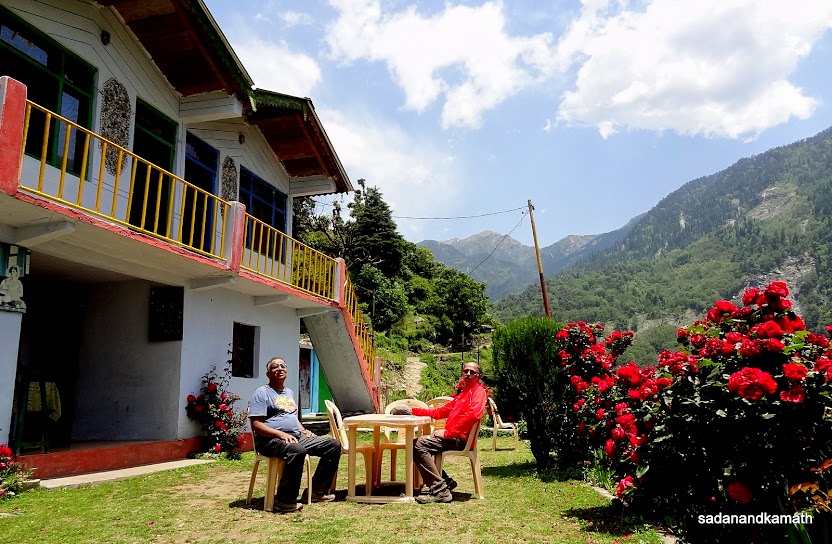
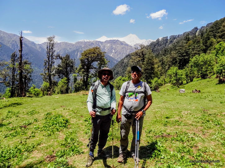
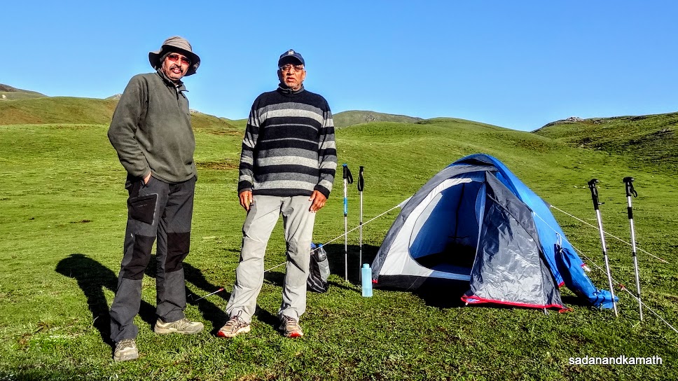
Myself (right) and KS at the lawns of Bharat Lodge, Agora for an overnight stay. In the background behind the pole is Bakeria Top.
Day-2 : Agora (2210m) to Dodital (3065m) - 15 kms by trek.
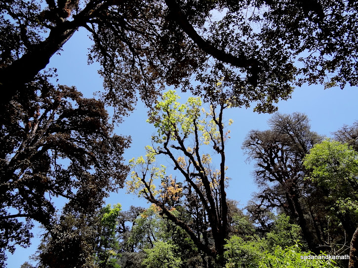
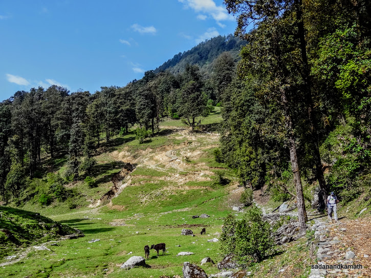
After a breakfast of omelette-toast and porridge, we commenced the trek of 15 kms - longest in terms of distance in this trek, at around 7.30 a.m. It was sunny with clear sky. Additionally, almost the entire stretch of trek was through the dense forest, mostly of Silver Oak and Rhododendron trees protecting us from the harsh sun. Although the gain in altitude was more than 800m for the day, we did not face any discomfort both physically as well as in terms of difficulties in breathing as the gradient was gentle with some respite in between by way of level walks.
After crossing the Bebra stream and its summer settlements, a gentle climb started. We rested at a rain shelter at Darkot as the climb was to continue upto Manjhi (2900m) which we reached around 1.00 p.m. Manjhi is the place for the summer settlements of shepherds who reside during summer and rainy season with their cattle for grazing when snow melts and finer varieties of grass grows in the meadows. We had brought packed lunch from Agora which we ate here.
We left Manjhi at 1.30 p.m. The weather turned cloudy but there was no immediate threat of rain. We had barely covered 2 kms towards Dodital when the sound of thundering and lightening started. There were dark clouds emerging from north-western side. We were in two minds whether to continue the trek to Dodital or return to Manjhi where we could pitch the tent for the overnight stay. Two factors decided in favour of continuing the trek to Dodital even if rains start pouring. First, we had observed that during the last 3 days, it had become a pattern that in the afternoon, dark clouds hover on the sky followed by thundering and lightening and the rains which did not last not more than an hour or so. Second, in my view, the atmosphere in Manjhi was not ideal for camping as with a large cattle population, the place was dirty and there was a nuisance of flies.
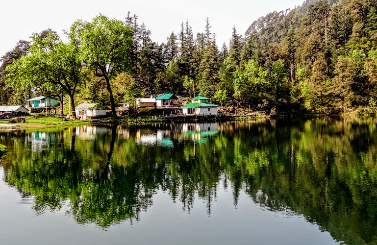
At around 2.30 p.m., it started raining followed by hails which becomes bigger as the intensity of thundering and lightening increased. Since large size of hails could injured our heads despite covered by caps, we took shelter under a protruding rock. After about 15 minutes, the intensity of hails subsided though light rains continued. We had hardly resumed our trek, once again hails started falling like a rapid fire bullets from machine guns. Once again we had to take a shelter until the hails subsided. Because of the accumulation of hails on the trek path, we had to be careful while walking. As per our anticipation, rains and hails stopped completely followed by sunny weather. We reached Dodital at 3.45 p.m. Our porters pitched the tent on a grassy ground in front of Dodital lake and used Forest Department's hut as kitchen. The weather was cold and the gentle breeze blowing from Dodital lake made it colder. A hot cup of tea gave some temporary respite from the cold.
Dodital is not only the trekkers' paradise, it is also a place with some religious significance. Dodital is supposed to be the birth place of Lord Ganesh. If Mount Kailash is the abode of Lord Shiva, Dodital is the abode of Lord Ganesh. The mythological story is that once Parvati decided to take bath in Dodital lake. She created a boy out of her dirt and instructed him not to allow anybody to visit the lake. It so happened that Lord Shiva was on a visit to Dodital. But the boy would not allow him to cross the path. Angry with the boy's behaviour, Lord Shiva cut off his head in anger. When Parvati came to know about the incidence, she was angry as Lord Shiva had killed his own son. To pacify Parvati, he ordered his followers to go to forest and bring the head of the first living creature they encountered. His followers found an elephant whose head was cut and brought to Lord Shiva. He placed the elephant head on boy's body and thus Lord Ganesh was born.
We met Rajesh Gadgil and his wife who had commenced their trek from Barsu and reached in the early afternoon here covering Dayara Bugyal - Devkund-Satgadi-Manjhi. Like us, they were also planning to trek to Darwa Pass the next day.
While we were enjoying the serenity of the Dodital lake and its surrounding places, once again the sky was overcast and it started raining. Soon rains turned into hails. The temperature dropped to less than 10C. It was very cold outside. So we took shelter in the kitchen which was relatively warm due to it being a log hut and also the stove was in operation for cooking. The hot Knorr soup served by our guide which I used to dislike in Mumbai, was now tasting superb in the cold weather. Since there was no electricity in Dodital, we finished our dinner at dusk and retired in the tent at around 8.00 p.m. In the night there were short spells of rains and hails, at times heavy. Fortunately, there was no seepage of rain water inside the tent and we had a comfortable sleep.
Some pictures of the day are uploaded below:
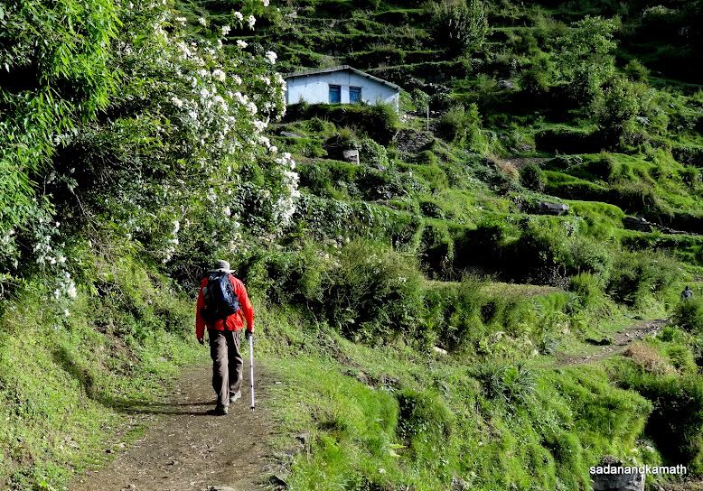
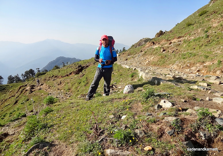
It is me walking from Agora somewhere before Bebra.

Our guide helping KS to cross Bebra stream which fortunately for us had a low water level.
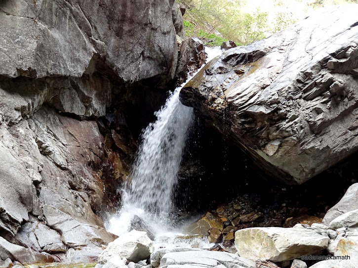
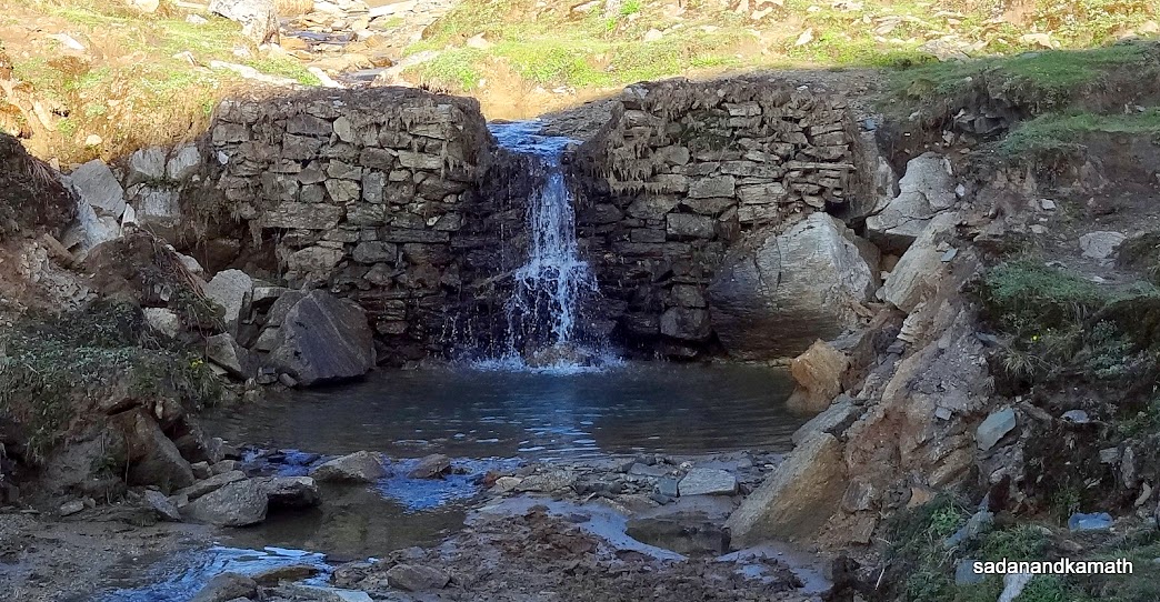
A mini waterfall in Bebra stream.

Yellow bellied Bulbul sighted near Bebra.
|

Wild flowers on way to Bebra.

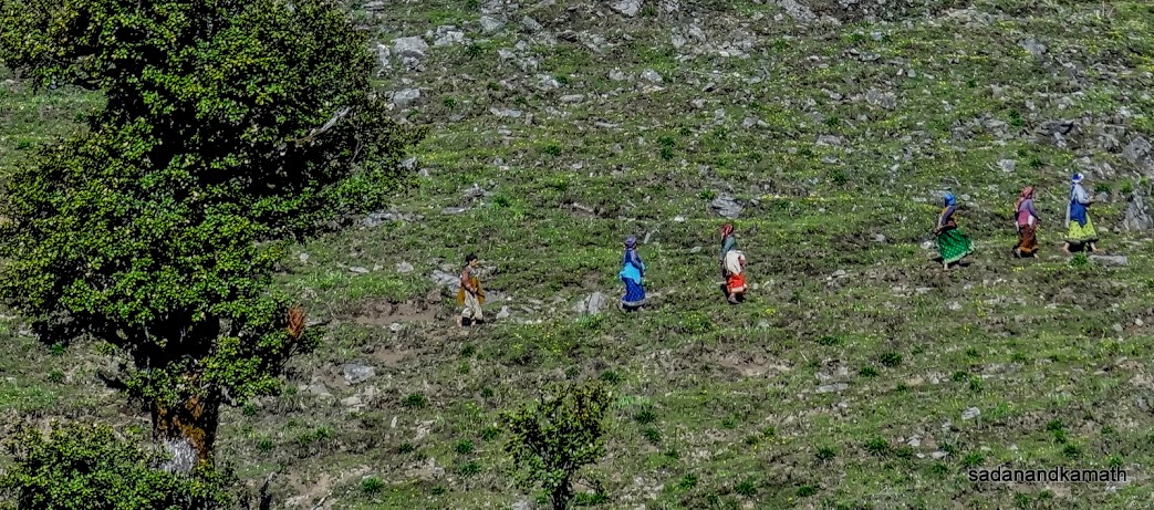
Agora village women carrying heavy loads of firewood from the forest. It is their daily routine in the morning.
Bebra houses seen as we climb up towards reaching Manjhi.

Asi Ganga valley as we climb up from Bebra.
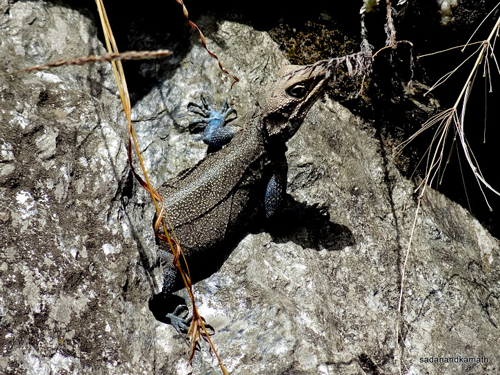
A chameleon camouflages with the rock.

We are 2 kms short of Manjhi campsite. The diversion to the right near a tree trunk goes to Dayara Bugyal via Satgadi and Devkund.
Summer settlements of shepherds in Manjhi.
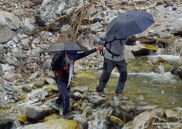
Hails have started falling as can be seen on the umbrellas as KS crosses a stream on way to Dodital.

The size of the hails.

Dodital lake with Ganesh temple at its shore. One can see that the light rains have started.
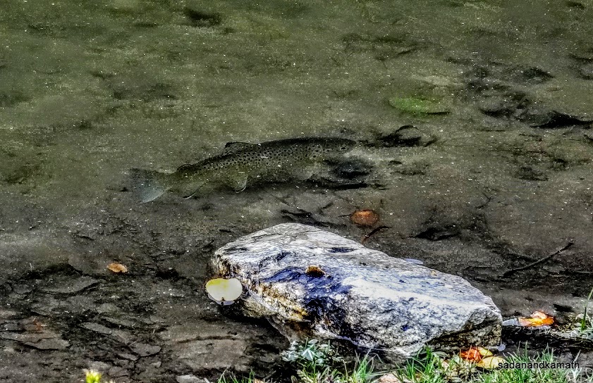 Himalayan Trout fish in Dodital Lake.


The intensity of hail falls can be gauged by the unusual water surface in Dodital lake.
Day-3 : Dodital (3065m)-Darwa Pass (3800m)-Dodital - 6+6 kms of trek.
Based on my experiences, it is always prudent to start the trek in the early morning and reach the next camp or return to the base latest by 2.00 p.m especially at higher altitude. The reason is that often the weather turns bad in the afternoon. With this motto in mind, we got up quite early at around 5.00 a.m. so that we can start the trek to Darwa Pass (3800m) by 6.00 a.m. As soon as I came out of my tent, I was disappointed to see an overcast sky with light rains. So with rain like situation, there was no point in visiting Darwa Pass as nothing will be visible from Darwa Pass.
KS had stomach upset since last night. So he was not keen to undertake the trek to Darwa Pass. Instead he preferred to take a day's rest at Dodital. It looked like that I may also have a forced rest unless the rain stops and sky clears up as early as possible. In the meanwhile, we completed our breakfast as scheduled so that in case the weather improves, we are ready to trek Darwa Pass. Luck was in our favour as rains stopped by 7.30 a.m. and the sky in the direction of Darwa Pass cleared.
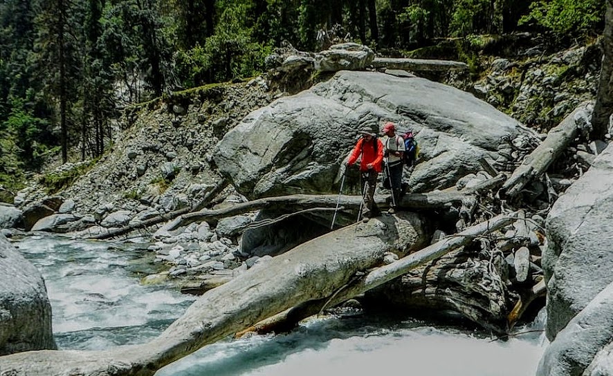
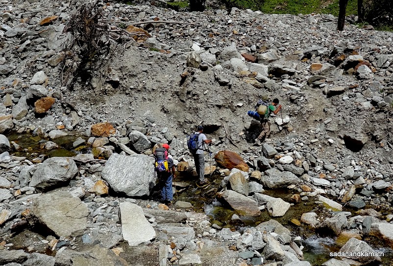
Since it was a day trek with a return to Dodital, there was no need to take my backpack of nearly 5 kgs of weight. The packed lunch was carried by our guide. We started at around 8.00 a.m. from Dodital for 6 km trek of Darwa Pass. Rajesh Gadgil was also there with us. The first two kms of trek was through moraines which had been deposited by Asi Ganga river following the cloud burst and the resultant flooding in August 2012. So walking was difficult. Added to this problem was the fact that we had to cross Asi Ganga river 10 times. Fortunately for us, despite the overnight rains, the water level in the river was low which facilitated crossing the river without removing our shoes by jumping from one rock to another in the river.
Once the moraine part of the trek was over, the climb become steep and zig-zag. We were now trekking above the tree line (3500m and above) which meant lesser oxygen to breathe. After walking about 15-20 steps each time, I had to stop for sometime to let my breathing come back to normal. So it took us more than 4 hours to cover 6 kms of trek to Darwa Pass. Rajesh Gadgil who reached much earlier on the pass met us on the pass and we had a photo session.
On the trekking side of Darwa Pass, there was not much of snow accumulation. But once we crossed the pass, there were long stretches of snow accumulation. The overnight rains had made walking over the snow very slippery. I could barely cross only one stretch of snow accumulation with lot of difficulties. To reach Darwa Top (4000m), two more snow stretches were to be crossed which I found to be highly risky given the fact that my shoes did not have crampons attached to securely walk on such type of snow. So I did not venture to trek to Darwa Top. Instead after crossing the first snow stretch, I sat on a flat rock to have my packed lunch.
On the trekking side of Darwa Pass, there was not much of snow accumulation. But once we crossed the pass, there were long stretches of snow accumulation. The overnight rains had made walking over the snow very slippery. I could barely cross only one stretch of snow accumulation with lot of difficulties. To reach Darwa Top (4000m), two more snow stretches were to be crossed which I found to be highly risky given the fact that my shoes did not have crampons attached to securely walk on such type of snow. So I did not venture to trek to Darwa Top. Instead after crossing the first snow stretch, I sat on a flat rock to have my packed lunch.
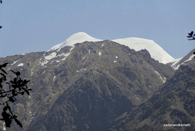
It was about 12.30 p.m. when I finished my lunch. The weather was turning bad with black cloud hovering around in the north-western side. However, paradoxically, the the sky on the north-eastern side was getting cleared and now I could clearly see peaks like Bandarpuchh West (White peak) and the main Bandarpuchh. After taking few pictures of snow clad peaks and snow stretches on Darwa Pass, we commenced our return trek to Dodital.
The return trek with steep descends looked more dangerous than the climb because of the uneven surface as well as loose stones and pebbles. However, the use of two trekking poles (one given by Rajesh Gadgil) helped me a lot in balancing my walk and finishing the trek in about 3 hours. Again the luck was in my favour as it started raining only after I reached Dodital at around 4.00 p.m.
In the evening, we visited Ganesh temple and had a small pooja conducted by the priest followed by a full round of walk around Dodital lake which is about 1.4 km in circumference. With this, we completed our first part of the trek for which our guide was Sohan Singh. From here onward, Rajesh Panwar would take over as our guide till we reach Uttarkashi.
Some pictures of the day are uploaded below:

The calm and serene Dodital lake. Photo taken in the morning just before the commencement of trek to Darwa Pass.
 First of the 10 Asi Ganga river crossing for Darwa Pass.
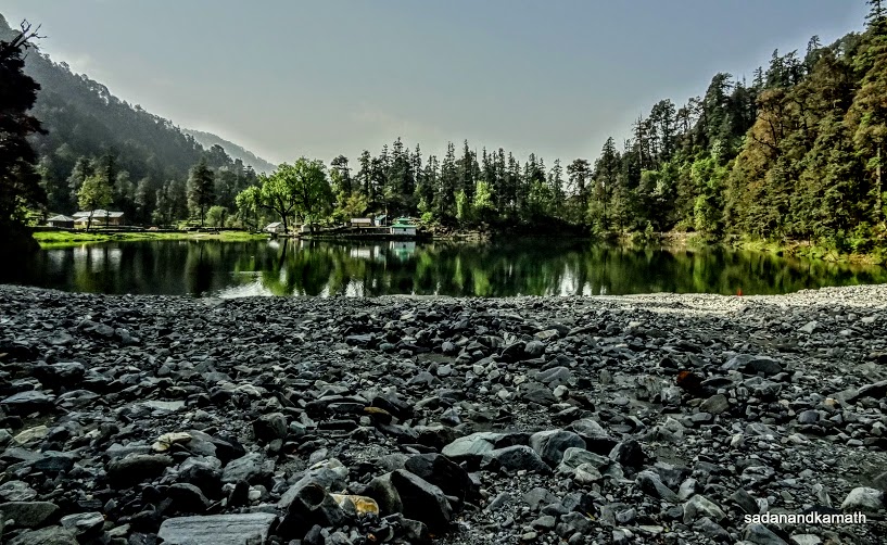 View of Dodital lake from Darwa Pass side. The moraines in the foreground was accumulated after the massive flood in Asi Ganga river in August 2012. As a result, about 25% of Dodital lake has been swallowed by rocks, pebbles and silts.
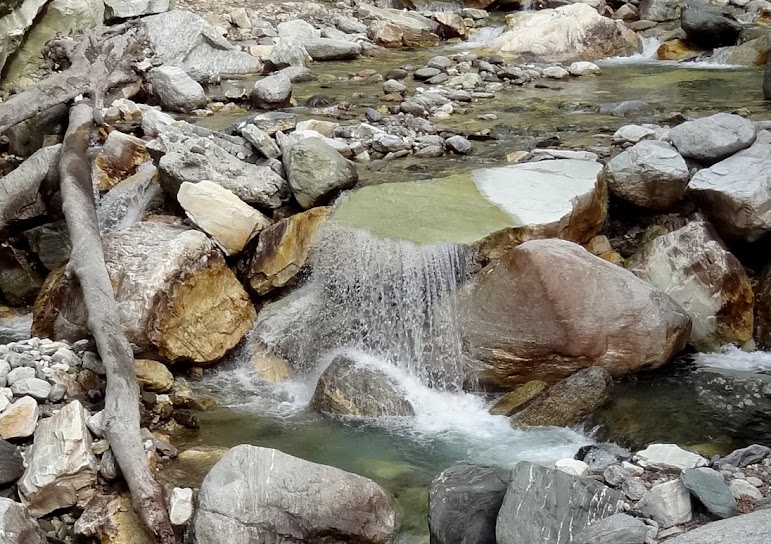
 A gentle fall of Asi Gnaga river from a rocky gap on way to Darwa Pass.
 Asi Ganga river cascading through rocky stretches on way to Darwa Pass.
 Unidentified wild flowers on way to Darwa Pass.
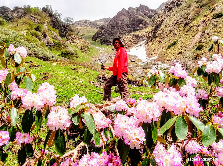 Purple rhododendron flowers in the foreground, myself in the middle and Darwa Pass in the background.
 Himalayan Mongoose waiting for his prey, probably tail-less rat Mika.
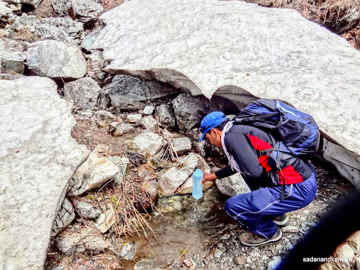 Our guide Sohan Singh collecting water from a melting glacier for me on way to Darwa Pass.
 Orange bellied Robin sighted on way to Darwa Pass.
 Just one km short of reaching Darwa Pass.
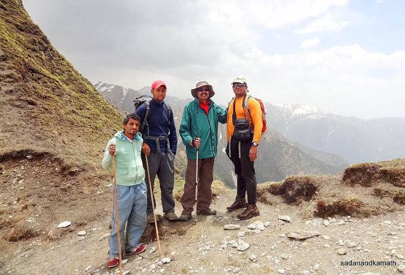 On Darwa Pass (3800m). From right to left : Rajesh Gadgil, myself, Rajesh Panwar, our guide-in-waiting for second part of the trek and the guide of Rajesh Gadgil.
 While crossing the first glacier, I am asking my guide point my finger 'is that Darwa Top?' In the picture, Darwa Top looks close. Actually, one is required to cross two more glaciers and then climb to the top.
 It is around 12.30 p.m. and I am having my packed lunch with Bandarpuchh range in the background slowly coming out of mist. Photo courtesy : K Srinivasan.
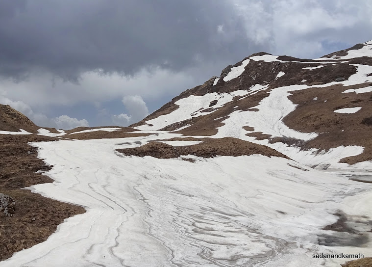 A large glacier followed by another glacier (partly visible) before one can attempt to reach Darwa Top.
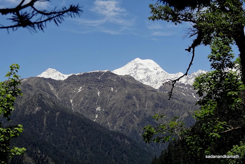
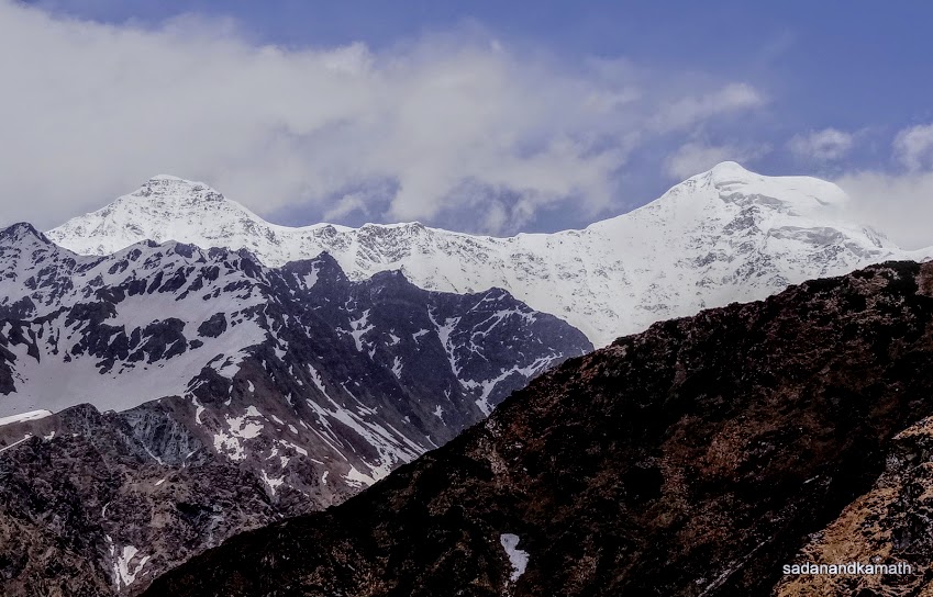 The mist has cleared over Bandarpuchh West (left) and the main Bandarpuchh peak (right) as seen from Darwa Pass.
 On return from Darwa Pass. At bottom left of the picture, Asi Ganga river merges with Dodital lake. At the middle left the river emerges from Dodital lake as a cascading fall and flows until it merges with Bhagirathi river at Gangori near Uttarkashi.
 Myself and KS in front of Ganesh temple after completion of a small pooja in the temple.

The idol of Lord Ganesh in the temple.


The idol of Lord Ganesh in the temple.
Day-4 : Dodital (3065m)-Manjhi-Riverside Camp(2650m) - 8 kms of trek.
We woke up at 5.00 a.m. and were happy to note that the sky was clear devoid of any cloud. At around 6.00 a.m., we bid goodbye to Sohan Singh Bisht who would return to Joshimath via Uttarkashi to join the group that would be trekking to Bagini Glacier and Changbang Base Camp. Today being an easy day of trek, things were moving in a leisurely way. After a late breakfast, we commenced our second part of the trek with a new guide, Rajesh Panwar who is an expert of treks in Uttarkashi district. He has completed both basic and advance courses in mountaineering from Nehru Institute of Mountaineering, Uttarkashi.
We woke up at 5.00 a.m. and were happy to note that the sky was clear devoid of any cloud. At around 6.00 a.m., we bid goodbye to Sohan Singh Bisht who would return to Joshimath via Uttarkashi to join the group that would be trekking to Bagini Glacier and Changbang Base Camp. Today being an easy day of trek, things were moving in a leisurely way. After a late breakfast, we commenced our second part of the trek with a new guide, Rajesh Panwar who is an expert of treks in Uttarkashi district. He has completed both basic and advance courses in mountaineering from Nehru Institute of Mountaineering, Uttarkashi.
After settling the forest fee of Rs.10/- per head and also the rent @Rs.100/- per day for use of the forest hut as kitchen, we started the trek around 8.00 a.m. In less than 90 minutes, we covered 5 kms to reach Manjhi. Here we spent about an hour so that porters could adjust their loads which required repacking. Also, two of our porters who had cleared their 12th examinations, wanted to celebrate the occasion by sponsoring tea to all of us.
After a tea break, we commenced 3 kms of trek to a riverside camping site. Before the last huts of Manjhi, there is a bifurcation of route - the right goes to Agora-Sangamchatti while left diversion goes to Dayara Bugyal via Suru Thatch. This route has no formal trekking path but only the shepherds' trails which at some places are confusing. The reason is that there are many diversions on the trails. Hence the services of a local guide is necessary on this trail. Actually, we had planned to use Satgadi-Devkund route which has well marked trekking path. However, our guide told us that of the three trails from Dodital-Manjhi to Dayara Bugyal, the trail via Suru Thatch is not only shorter but also less strenuous among the three routes. Of course the third route from Dodital involves high altitude trekking via Lambi Dhar-Surya Top (with an option to trek to Gidhara Bugyal)-Devkund-Bakeria Top-Dayara Bugyal making it virtually a ridge trek.
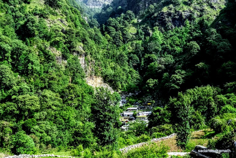
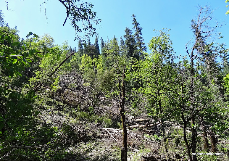
We reached the riverside campsite (2650m) at 12 noon not before crossing Asi Ganga river on a trunk of a fallen oak tree. One can see enormous destruction by scores of fallen trees and landslides on the banks of the river following massive flooding in August 2012.
Our guide kept the campfire burning throughout the night not because of cold but because during his visit to the opposite bank of Asi Ganga river, he saw a leopard sitting on a rock across our campsite. It is said that this forest has a sizeable population of Himalayan Bears too. As is well known, wild animals keep away from the fire.
Some pictures of the day are uploaded below:

Early morning in Dodital waiting for a hot cup of tea.

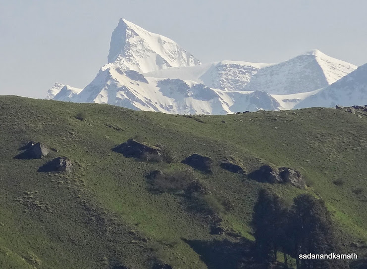
After two days of snowing in the upper reaches of the mountains, the snow has completely melted over Bakeria Top (middle in the background).

Bandarpuchh peak partially visible from Manjhi.

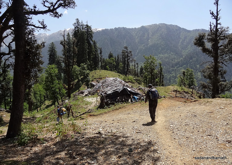
Just before the last shepherd's hut, there is a bifurcation of trekking path. The path to the right of the picture goes to Agora-Sangamchatti while the path to the left goes to Dayara Bugyal via Suru Thatch.

The rest point on way to Riverside campsite.

The first stream crossing before reaching Riverside campsite.

I am about to walk over the trunk of an uprooted Oak tree over Asi Ganga river just before climbing to Riverside campsite. Photo courtesy : K Srinivasan.

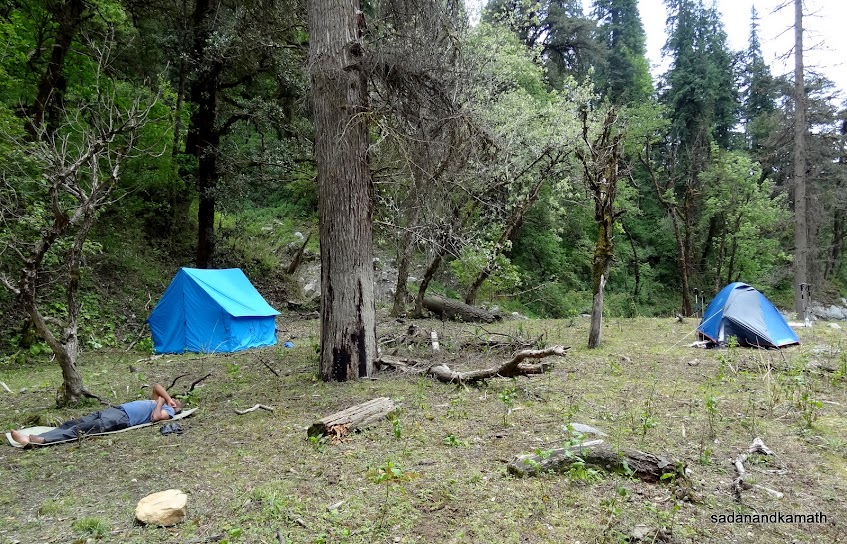
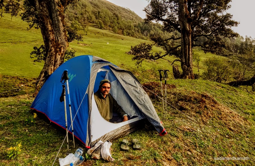
Riverside Campsite with KS taking a short nap outside as it was warm inside the tent (35C) because of the strong sun while the outside temperature was a pleasant 22C.

Asi Ganga river as seen from our campsite.
Day-5 : Riverside Campsite (2650m)-Suru Thatch (3370m) - 11 kms of trek.
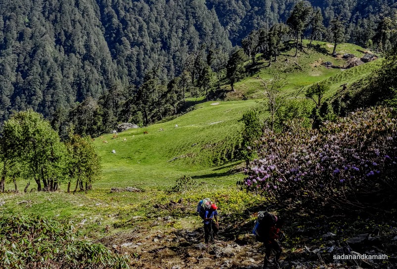
The day's trek was supposed to be somewhat strenuous because, from the Riverside campsite itself, the steep climb started on shepherds' trails which at many places were not more than one feet of width. However, the trail was not risky as it was all through the forest devoid of steep slopes on the either side of the trail. The only problematic part of the trail was that there were some diversions where even our guide and porters got confused as to which one to take. So in the event, our guide will send one of the porters to go ahead to locate the correct trail based on some guess work or some familiar markings and we would follow him. All of them have trekked in this route for at least 2-3 times but the dense forest with multiple trails would even confuse them.
At one place, the main trail was obstructed by a score of falling trees. So we had to take a detour of about one km to join the main trail. The positive side of the trail was that we did not face harsh sun rays. After about 4 hours of continuous climb, we got some respite by way of walking over an unnamed bugyal (3190m). The presence of buffaloes assured me that there would be shepherds' huts nearby where we could break for lunch. And I was not wrong. We located two huts in front of which we sat and ate our packed lunch. We also ordered some fresh hot milk from the shepherds(@Rs.20/- per litre). At one time, I felt that we could pitch our tent here which had a good view of Bundarpuchh range. However, there was no water source nearby.
Post-lunch, it was a descend of about 1 km from the unnamed bugyal. After crossing a stream, we resumed the climb of about 3 kms which continued until we reach Suru Thatch (3370m). It took us sometime to decide about place for pitching the tent as the nearby water source had almost dried up. However, a shepherd came to our rescue by providing water from his source. So we pitched our tents close to his hut.
Until our tent was set up, we had a chat with the shepherd who was also the owner of cows and buffaloes grazing here. He had brought his cattle here from Dehradun to protect them from sweltering heat and get them a good feed of grass from the bugyals. He has shifted here with his family and would stay here until the autumn. However, his children will go back to Dehradun once their schools reopen. He said that he had a permit from the forest department for grazing his cattle from vast stretches of bugyals from Lambidhar to Barnala Tal. The milk collected are passed on to persons from nearby villages who finally sell in big towns in around Uttarkashi. The unsold milk is converted into paneer and sold in Uttar Kashi.
The evening view of setting sun with arrays of mountain ranges from our tent was superb. So was the view of a long stretch of bugyal (meadow) from the backside of our tent. However, we could not have any snow clad peak view due to mist on the north-western side. We had a good dinner of roti, rice, dal and mixed vegetables soon after sun set and retired in our tent by 8.00 p.m.
Some pictures taken during the day are uploaded below: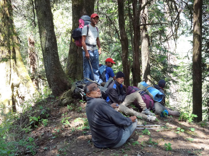

Our climb started right from the Riverside campsite which continued for nearly 4 hours.

The main trail was obstructed by scores of fallen trees. So we had to take a longish detour by the side of it.

We are on a subsidiary trail detouring the main trail due to fallen trees.

Rest point on way to Suru Thatch.

The first glimpse of Bandarpuchh range during this trail on way to Suru Thatch.

The trees of forest cover on the trail to Suru Thatch.

At last we are about to reach an unnamed bugyal with Bandarpuchh range in the background.

Lunch break at an unnamed Bugyal with shepherds' huts in the background.

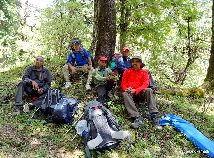
Myself and KS posing for a picture before commencing the trek to Suru Thatch.

Crossing a small stream after which it was a climb of about 3 kms to reach Suru Thatch.
Carpet of yellow wild flowers which have just bloomed.

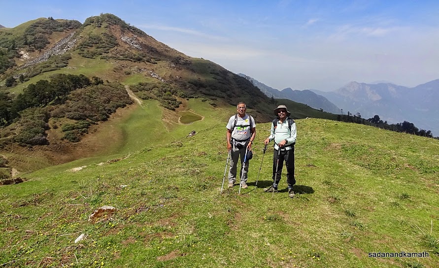
Our guide Rajesh Panwar stands on a rock to signal that we have reached Suru Thatch.

A bugyal (meadow) in Suru Thatch. Next day, we have to cross the mountain in the background (right) to reach Devkund.

It is me in the tent which was pitched in a strategic place for better views.

View from our tent of sun going behind mountain ranges.
Day-6 : Suru Thatch (3370m)-Dayara Bugyal (3410m) - 6 kms of trek.
The morning in Suru Thatch was very cold. The temperature inside the tent was 9C. Surely, outside temperature may be around 5C. Since today's trek was only 6 kms to Dayara Bugyal, my guide was suggesting that we could go beyond Dayara Bugyal and camp in Barnala Tal which is about 4 kms further from Dayara Bugyal. However, having fascination for Dayara Bugyal and having heard about vastness of this bugyal with good snow peak views, I wanted to spend overnight here. KS concurred with me.
The morning was sunny with no trace of any cloud in the sky. The Bandarpuchh range which we missed last evening due to mist was partly visible as Lambhi Dhar ridge was obstructing its complete view. So we decided to climb a hillock which was by the side of the kitchen tent. We had now not only the good view of Bandarpuchh range, we had a panorama of bugyals from all the sides. Later on we realised that we had still better views as we climbed the mountain towards Devkund.
We left Suru Thatch around 8.15 a.m. ahead of our porters and guide as they were busy in packing the loads. After a gradual climb of about 2 kms through rhododendron trees, we reached the top of the mountain (3500m) which was the beginning of bugyal. From here we got a better view of Bandarpuchh range than what we had in Suru Thatch. On the north-eastern side the view of peaks such as Dropadi Ka Danda, Jaonli, Srikantha etc were hazy. Devkund was visible as we ascended from the bugyal to take the lower left path for Dayara Bugyal. It is said that Devkund is the starting point of the boundary of Dayara Bugyal.
Standing on the mountain top meadow, one could distinctly notice that Devkund is a big junction point for treks. From where we stood, we could see a trek path coming from Manjhi-Satgadi joining Devkund from the right while trek route from Dodital-Lambhidhar-Surya Top merges with the trek path which we had taken from Suru Thatch just before Devkund. From the south side of the Devkund, the trek route climbs to Bakeria Top ridge from where one can ascend to Dayara Bugyal. The lower trek route on the left of us which we are going to take goes directly to Dayara Bugyal.
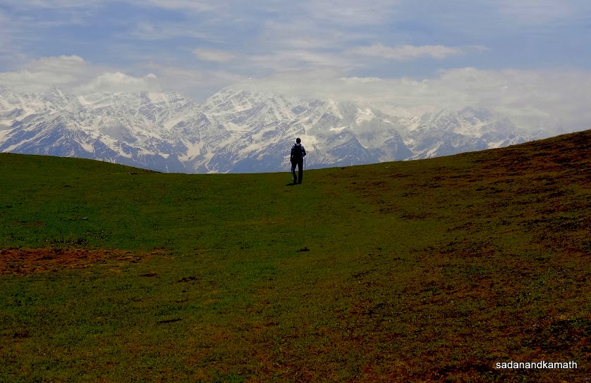
From Devkund, it is a gradual descend to Dayara Bugyal followed by some moderate climb with altitudes in the range of of 3300m-3500m. For better views of snow clad peaks like Bandarpuchh West (White Peak), the main Bandarpuchh peak, Kala Nag (Black Peak), Srikantha, Dropadi Ka Danda, Jaoli etc, it is better to camp in Dayara Bugyal at higher altitude.
We reached here around 11.30 a.m. Unfortunately for us, we could not get a clear view of north-eastern sides of the peak as they were covered in haze. However, we had a clear view of Bandarpuchh ranges. Our hopes for a clear view of north-eastern peaks over the sunset were dashed when the weather turned cloudy in the afternoon. It rained intermittently throughout in the evening and night.
Some pictures of the day are uploaded below.


The morning in Suru Thatch was very cold. The temperature inside the tent was 9C. Surely, outside temperature may be around 5C. Since today's trek was only 6 kms to Dayara Bugyal, my guide was suggesting that we could go beyond Dayara Bugyal and camp in Barnala Tal which is about 4 kms further from Dayara Bugyal. However, having fascination for Dayara Bugyal and having heard about vastness of this bugyal with good snow peak views, I wanted to spend overnight here. KS concurred with me.
The morning was sunny with no trace of any cloud in the sky. The Bandarpuchh range which we missed last evening due to mist was partly visible as Lambhi Dhar ridge was obstructing its complete view. So we decided to climb a hillock which was by the side of the kitchen tent. We had now not only the good view of Bandarpuchh range, we had a panorama of bugyals from all the sides. Later on we realised that we had still better views as we climbed the mountain towards Devkund.
We left Suru Thatch around 8.15 a.m. ahead of our porters and guide as they were busy in packing the loads. After a gradual climb of about 2 kms through rhododendron trees, we reached the top of the mountain (3500m) which was the beginning of bugyal. From here we got a better view of Bandarpuchh range than what we had in Suru Thatch. On the north-eastern side the view of peaks such as Dropadi Ka Danda, Jaonli, Srikantha etc were hazy. Devkund was visible as we ascended from the bugyal to take the lower left path for Dayara Bugyal. It is said that Devkund is the starting point of the boundary of Dayara Bugyal.
Standing on the mountain top meadow, one could distinctly notice that Devkund is a big junction point for treks. From where we stood, we could see a trek path coming from Manjhi-Satgadi joining Devkund from the right while trek route from Dodital-Lambhidhar-Surya Top merges with the trek path which we had taken from Suru Thatch just before Devkund. From the south side of the Devkund, the trek route climbs to Bakeria Top ridge from where one can ascend to Dayara Bugyal. The lower trek route on the left of us which we are going to take goes directly to Dayara Bugyal.
From Devkund, it is a gradual descend to Dayara Bugyal followed by some moderate climb with altitudes in the range of of 3300m-3500m. For better views of snow clad peaks like Bandarpuchh West (White Peak), the main Bandarpuchh peak, Kala Nag (Black Peak), Srikantha, Dropadi Ka Danda, Jaoli etc, it is better to camp in Dayara Bugyal at higher altitude.
We reached here around 11.30 a.m. Unfortunately for us, we could not get a clear view of north-eastern sides of the peak as they were covered in haze. However, we had a clear view of Bandarpuchh ranges. Our hopes for a clear view of north-eastern peaks over the sunset were dashed when the weather turned cloudy in the afternoon. It rained intermittently throughout in the evening and night.
Some pictures of the day are uploaded below.

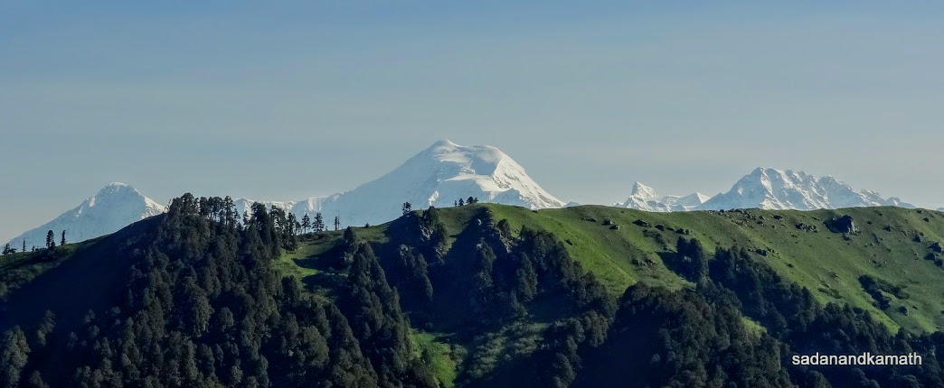
View of Bandarpuchh range from a hillock of Suru Thatch.

A mid-range view of Bandarpuchh West (left), Main Bandarpuchh (middle) and Kala Nag from a hillock of Suru Thatch. In the foreground is Lambidhar ridge.

A zoomed view of Kala Nag (Black Peak) from a hillock of Suru Thatch.

Our tents seen from a hillock in Suru Thatch.

Looking back Suru Thatch.

Zoomed shot of Bandarpuchh range as we climb up towards Devkund.

Our porters are catching up with us as the climb to Devkund starts from here. Suru Thatch in the background.

The climb to the top (left) will lead us to a bugyal (meadow).

Bugyal on the table top. Devkund is located below the hump (right).

KS and me with Devkund in the background.

The strategic location of Devkund. A trek path comes from
Manjhi-Satgadi from the bottom right of the picture (where porters are
resting) which joins Devkund. From here, one can climb to Bakeria Top
and descend to Dayara Bugyal through the trek path in the middle of the
picture which goes up (top left in the picture) . The trek path at the
bottom left of the picture leads to Dayara Bugyal directly where trek paths coming from Suru Thatch and Dodital-Lambidhar (not
seen in the picture) merge.

We are at Devkund with Bandarpuchh range in the background.

Dropadi Ka Danda, Jaoli, Srikantha among other unnamed peaks on North-Eastern side looks hazy from Dayara Bugyal.

Looks like KS is walking from Dayara Bugyal towards snow clad peaks on north-eastern side. Actually, he would be descending on another bugyal.

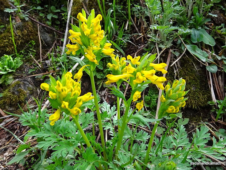
Himalayan Iris - Iris Kemaonensis
Day-7 : Dayara Bugyal (3410m)-Barnala Tal (2900m)-Barsu (2275m)-Uttarkashi - 8 kms of trek, 40 kms by road.
I have often experienced that on the last day of any trek all of us including porters and guide are interested in reaching the road head as early as possible to have the luxuries of hotels and homes. So eventhough today's trek was 8 kms of easy descends to Barsu, we left Dayara Bugyal at 7.00 a.m. so that we are back in Uttarkashi for lunch. Similarly, porters guide were also interested in reaching Uttarkashi early so that after settlement of accounts, they catch a share jeep and reach their homes in Agora by afternoon.
After about one km of walk on the bugyal, we encountered a diversion of trek path. The path to the right goes to road head Raithal via Goi Bugyal while the left path goes to Barsu via Barnala Bugyal. Both the road heads would eventually take us to Uttarkashi. I had heard from a taxi driver of Uttarkashi that the road to Raithal was in very bad condition while that of Barsu was in good condition. In any case, we had already decided in favour of Barsu. In the meanwhile, our guide had talked to the driver of Mahindra Maxx and booked his vehicle exclusively for us.
The descend upto Barnala Tal was gradual with good forest cover. From a hillock, we had a good view of Goi Bugyal and Raithal. We reached Barnala Tal in about 2 hours and spent about 15 minutes. There were two ponds in Barnala Tal, the smaller one being located before the rain shelter. The bigger one was located after the rain shelter. Wild flowers of various colour had just started blooming on the bugyal surrounding the rain shelter. Being the week-end, we encountered two groups who had come more as picnickers than trekkers for Dayara Bugyal from the nearby villages.
After the end of Barnala Bugyals, the steep descend started which we felt uncomfortable as most places the trek path was made of stone work. The last one km of trek was on a concrete path on which lots of loose stones and pebbles were littered making the path slippery. We reached Barsu at 10.45 a.m. Our guide did not expect that we would reach so early. Hence he had called the exclusive Mahindra Maxx to barsu at 12 noon. We, therefore, rested for about 30 minutes in Dayara Resort. Luckily, the Mahindra Maxx driver came earlier than 12 noon and by 11.30 a.m. we were on the road to Bhatwari on our way to Uttarkashi. The 40 kms distance to Uttarkashi was covered in about one hour and by 12.45 p.m. we had checked in Hotel Bhandari Annexe (Rs.750/-) which was a better choice than Hotel Bhandari in terms of cleanness and room service while the tariff was more or less the same.
Some pictures of the day are uploaded below.

At Dayara Bugyal just before winding up of tent for proceeding to Barsu.

Dayara Bugyal.

Dayara Bugyal.

Dayara Bugyal.

Water source in Dayara Bugyal.

At this point, Dayara Bugyal ends. The Path on the right goes to Raithal via Goi Bugyal while the path on which our guide is standing goes to Barsu via Barnala Tal.

View of Raithal from an hillock.

Zoomed shot of Goi Bugyal from a hillock.

Women in colourful dresses walks towards Dayara Bugyal.

We are about to reach the rain shelter (top visible) of Barnala Tal.

Barnala Tal (Pond).

KS, guide and porters resting at a rain shelter in Barnala Tal.

Looking back at Barnala Tal. Rest of the trek to Barsu is on a stony path (right).

About 1 km before Barsu, the view of the agricultural fields of Barsu. On the left with green roof is GMVN, Barsu.

Part of Barsu village as seen from Dayara Resort.

A giant statue of Lord Shiva at Pilot Baba Ashram reminded us that we were now close to Uttarkashi.
With this, our long pending trek of DDD ( Dodital-Darwa Pass-Dayara Bugyal) was successfully completed. After resting for one day in Uttarkashi which was reserved as an extra day for contingency, we left Uttarkashi for Haridwar by a hired taxi and stayed overnight in Haridwar. On the next day, we boarded the early morning Janshatabdi Express for New Delhi. We boarded Rajdhani Express from New Delhi and were back home in the early morning of June 3rd.