In continuation of Part-2 : Namche Bazar-Khumjung-Lobuche
May 3rd : Lobuche-Pheriche (10 kms), 4 hours.
Lobuche (4930m)-Dhukla (4620m)-Pheriche (4240m)
May 3rd : Lobuche-Pheriche (10 kms), 4 hours.
Lobuche (4930m)-Dhukla (4620m)-Pheriche (4240m)
At a higher altitude (above 4000m), it is difficult for most of the trekkers to get a sound sleep. If I go by my experiences, after about initial 2-3 hours of sleep, I spend rest of the night almost sleepless. It is at this time of the night that I get some weird thoughts. I also rate myself as a foolish man to leave the homely comfort and spend money on treks for return of hardship and discomfort. I eagerly wait for dawn to set in as, at higher altitudes, nights are gloomy and dawn brings hopes and exhilaration.
I was for a pleasant change in my sleeping pattern at higher altitudes in EBC trek. It was at Dingboche (4360m), Dhukla (4620m) and Lobuche(4930m) that I had most of sound sleep. In Lobuche, I must have broken my record of getting sleep at higher altitude. I had retired to the bed in the previous day at 8.00 p.m. I got up at 2.00 a.m. for pee and slept thereafter uninterrupted till 5.00 a.m.
I was surprised to find that PKD was still sleeping. Normally, he was the first to get up in the morning. He eventually woke up at around 5.30 a.m. and told me that he did not sleep from 10.00 p.m. to 4.00 a.m. as he experienced breathlessness. Even sitting postures did not help him to get over his breathlessness. I was surprised by his revelation. Apart from the fact that I failed to notice his discomforts when I had woken up at around 2.00 p.m. for pee, I did not expect that he would suffer from breathlessness after spending almost the whole day in Lobuche without any discomfort.. There was not an iota of discomfort to him on account of high altitude trekking for the last 4 days. He had a running nose which he had been suffering from the day he started the trek from Shivalaya and occasional coughing from Namche Bazar onwards, but he was fine in all these days.
I was surprised to find that PKD was still sleeping. Normally, he was the first to get up in the morning. He eventually woke up at around 5.30 a.m. and told me that he did not sleep from 10.00 p.m. to 4.00 a.m. as he experienced breathlessness. Even sitting postures did not help him to get over his breathlessness. I was surprised by his revelation. Apart from the fact that I failed to notice his discomforts when I had woken up at around 2.00 p.m. for pee, I did not expect that he would suffer from breathlessness after spending almost the whole day in Lobuche without any discomfort.. There was not an iota of discomfort to him on account of high altitude trekking for the last 4 days. He had a running nose which he had been suffering from the day he started the trek from Shivalaya and occasional coughing from Namche Bazar onwards, but he was fine in all these days.
After sometime, we both came down from our room for freshening up and had our morning tea in the restaurant. I did not notice breathlessness in him while he was talking to me. His walking from our room to restaurant was steady. That he could climb down and again climb up to his room after morning tea gave me some hope that he was no longer suffering from breathlessness. There were no other indications of high altitude sickness like fatigue, head ache, loss of appetite, dizziness etc. I pointed out to him these facts to prop him up. But this did not evoke any positive response from him. It was only when I observed that he did not smoke his usual post-tea cigarette, I realised that he was really worried about the attack of breathlessness in the night.
I recall my own experiences of attack of breathlessness in the nights at Bhojbasa in May 1989 and at Manimahesh Lake in August 1996. But I became completely normal after freshening up followed by a cup of tea. I assumed that PKD would also become alright.
In the meanwhile, I was exploring the options in case PKD intended to abort the trek to Gorakshep, our today's destination and instead return from Lobuche to a lower altitude camp. Both myself and PKD went to restaurant for breakfast where our porters were already present. I discussed with PKD who was now more forthcoming in saying that he had decided to return to Namche Bazar as early as possible. He further revealed to me that in the night, he was afraid to close his eyes with a weird thought that he would not be able to open it. This was a signal for the onset of high altitude sickness as such weird thoughts generally come when there is a deficiency of oxygen in the blood. He also told me that his confidence level was low. I knew that PKD's confidence level about the capability of the porter in handling the emergency situation was also low. I guessed the attack of breathlessness in the night had unnerved him though he appeared alright to me.
As pointed out earlier, except for minor problems like running nose and coughing, PKD had no major health issues. But with the new development, even these minor health issues could turn into the major ones like chest congestion. So it was better that he descends to lower altitude. Since, as per his own admission, his confidence level was low, I decided to accompany him instead of proceeding to Gorakshep. I told PKD of my decision. He did not react which was understandable. As he told me later, he felt bad that because of him, my maiden EBC trek remained incomplete.
At the breakfast at around 7.00 a.m., PKD had his full bowl of porridge, which reconfirmed my assessment that his appetite was normal. We left Lobuche for Pheriche at 7.45 a.m. a bit disheartened due to aborting the trek. If we were to proceed as per our schedule, our next destination Gorakshep (5140m) was just 5 kms from Lobuche involving 200m of climb. A further climb of about 3-4 kms would have taken us to ECB. It was like 'so near but so far off' as we trekked towards Pheriche.
We reached Dhukla Pass (4830m) at around 9.00 a.m. The bright sun and clear sky gave us a different dimension of Dhukla Pass than what we had seen a day before while trekking to Lobuche. The snow clad peaks which included Kangtega and Thamkserku appeared much closure to the eyes than what we had seen from Dingboche two days back. By 9.30 a.m. we had already passed through Dhukla and were on the moraine. After a gradual descends of about 4 kms, passing through one of the biggest yak farms in Khumbu region, we reached Pheriche (4240m) at 12 noon. We stayed in Himalayan Hotel, one of the best lodges in Pheriche in terms of comforts and food. That PKD smoked a cigarette after check in the Hotel confirmed that he had overcome his breathing problem.
PKD wanted to continue the trek beyond Pangboche so that we could attempt to reach Namche Bazar the next day. We could have done that easily. But when one was just recovered from breathlessness, it was not advisable to indulge in excesses particularly, when he has already trekked 10 kms and descended about 700m. But most important factor for staying overnight in Pheriche was that it had Himalayan Rescue Association (HRA) where trained physicians, some of them from foreign countries were available as volunteers during the peak trekking season of March-May and October- November. I was given to understand that some of the doctors were specialists in treating high altitude sickness. In case, PKD's breathlessness relapses, we can bring him to HRA clinic for appropriate treatment. HRA can also arrange helicopter rescue in case of emergency if one has insurance policy (which PKD had) or by way of cash and debit/credit cards to prove that he can managed cash for helicopter rescue which can cost US$ 3500-4000.
We had egg fried rice for lunch after which we rested in our room. The weather had deteriorated and we could feel some chill in the atmosphere. Though about 700m lower in altitude than Lobuche, we felt the same level of cold as in Lobuche as it was located in a wide valley which was very windy. One of the workers in lodge told us that some time Pheriche gets as much cold as Gorakshep due to chill factor. So we went back to our room for a rest. PKD had a long afternoon nap to compensate the sleepless night at Lobuche.
Since the restaurant starts fire heater (yak dung stove) at 4.00 p.m., we went down to warm up. We ordered tea and sat there till 7.00 p.m. when we had dinner. A Japanese speaking Nepali guide with 2 Japanese next to our table. He and 4 Japanese climbers had met us in Dhukla two days back. They were all in their 70s and were attempting to climb Lobuche peak(6000m+). The guide told us that 2 Japanese sitting with him, had to abort climbing due to health issues and they will stay put here until the remaining 2 Japanese return from their climbs. He was checking with an instrument which was called 'pulse oximetre' the blood oxygen level by clipping the index finger with pulse oximetre. So we also took the opportunity of checking our blood oxygen level. The normal range of blood oxygen level is between 90-100% at sea level. We both recorded our blood oxygen level between 85-90%. It is said that below 80% level is an indication of anaemia and below 65% level requires oxygen supplement to improve the blood oxygen level to normal. Otherwise it may lead to impairment of mental faculties and also the risk of organ failures.
After an early dinner of rara noodle soup and steamed momos, we retired for the day in a happy mood as PKD had fully recovered without requiring him to visit HRA clinic at Pheriche.
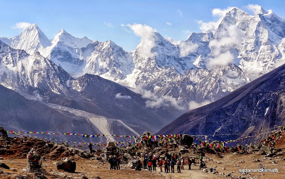
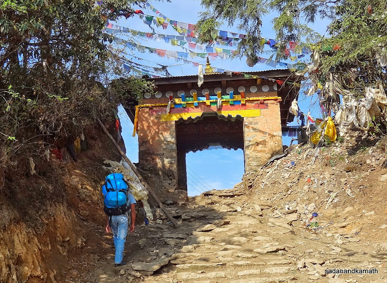
Some pictures of the day below:
 |
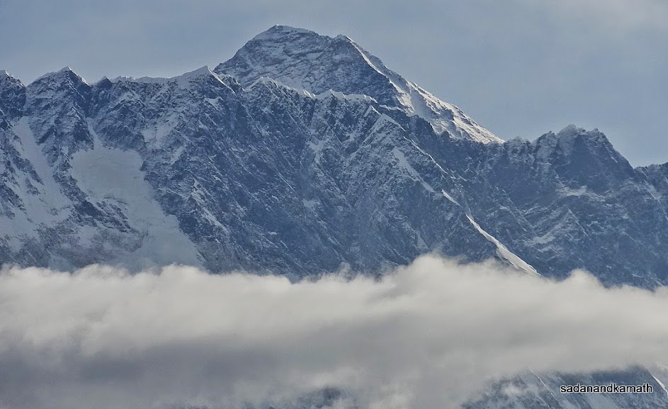
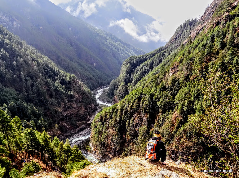
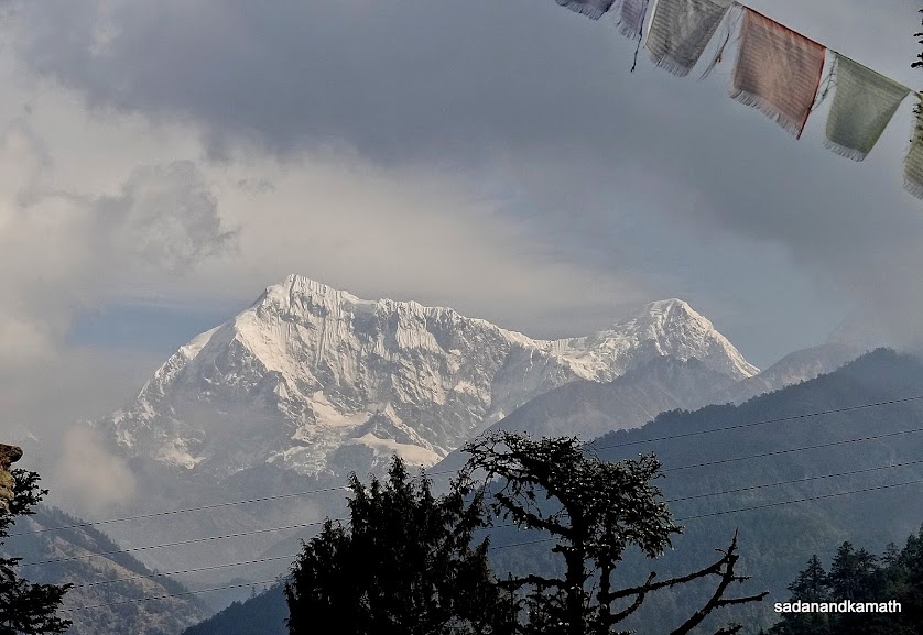
PKD and me outside our lodge at Lobuche (4930m) before starting our return trek to Pheriche (4340m). Pumori (7161m) is in the background.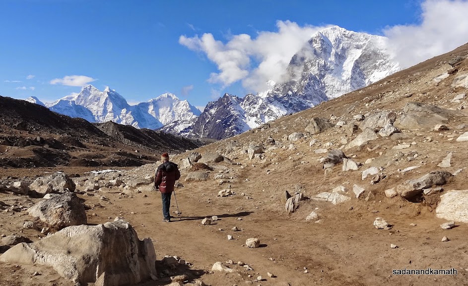 It was sunny but freezing morning as we walked towards Dhukla (4620m) on our way to Pheriche (4240m). Kangtega (6782m) on the left. Next to it is Thamskeru (6623m) peak. 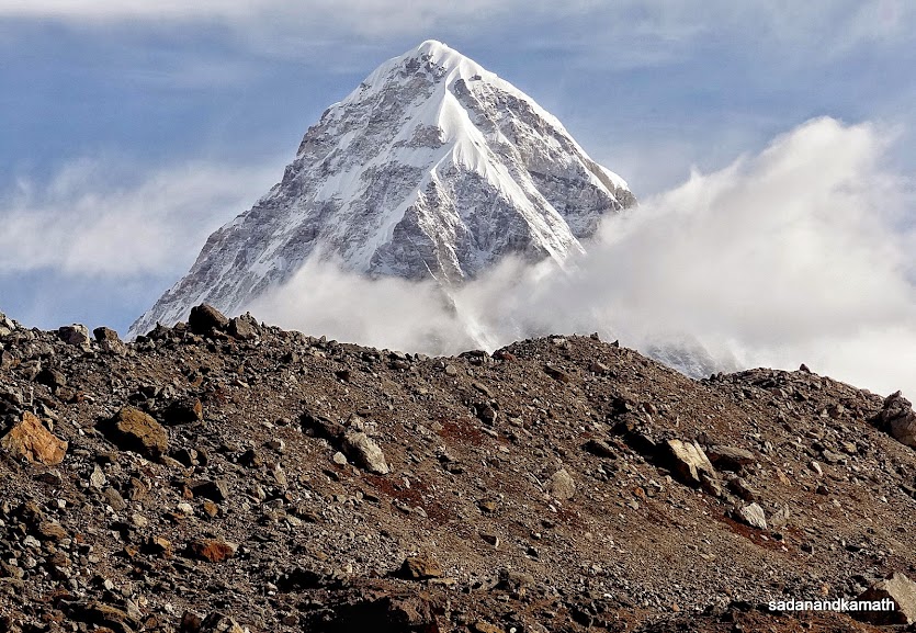 |
Pumori (7161m) is behind us as we trekked towards Dhukla.
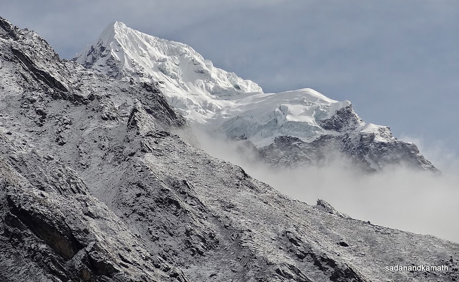
The memorial area on Dhukla Pass (4830m) is also the trekkers' rest point and the good weather has given them opportunity to shoot the peaks with their cameras. From here, Dukhla or Thukla (4620m) is about 2 kms of descend.
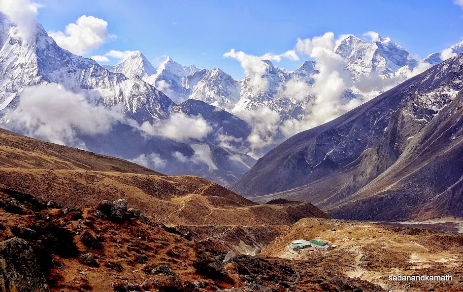
Dhukla (4620m) seen from the stone memorial area. When we were staying in Dhukla 2 days back we could not get any view of peaks as it was a cloudy day followed by snow showers.
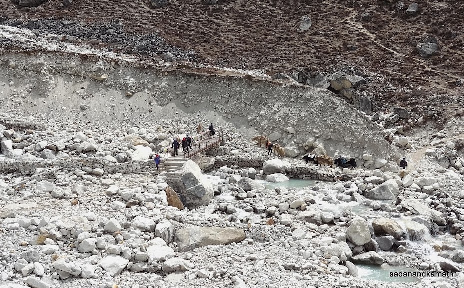
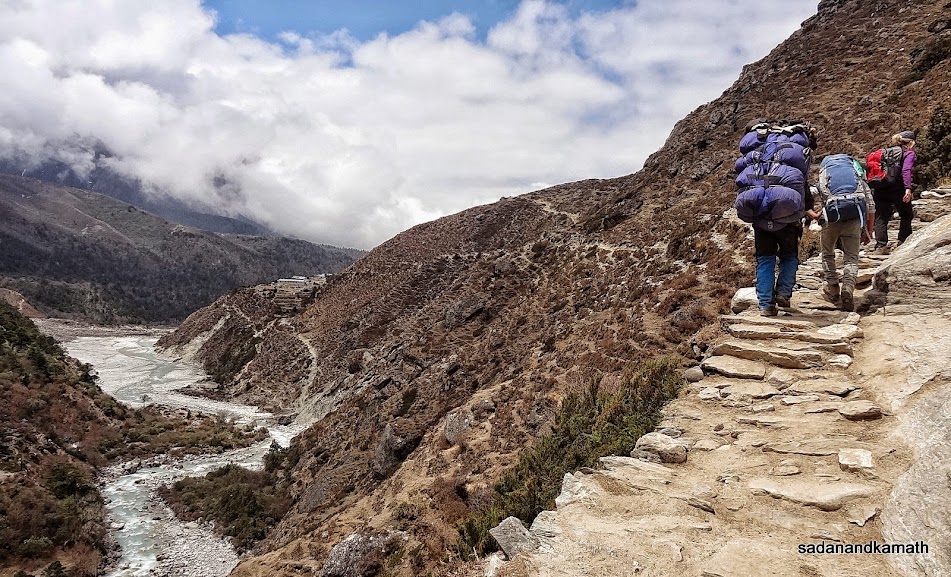
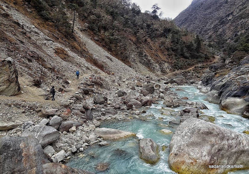
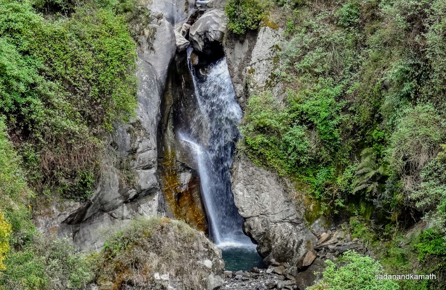
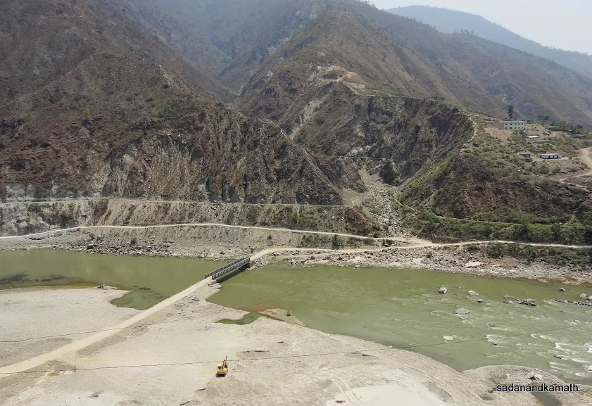
Just below Dhukla the rocks, boulders and moraines seem to have been carried by a moving glacier which may have now receded as summer started. The source of the stream seen below the wooden bridge may be from the receding glacier.
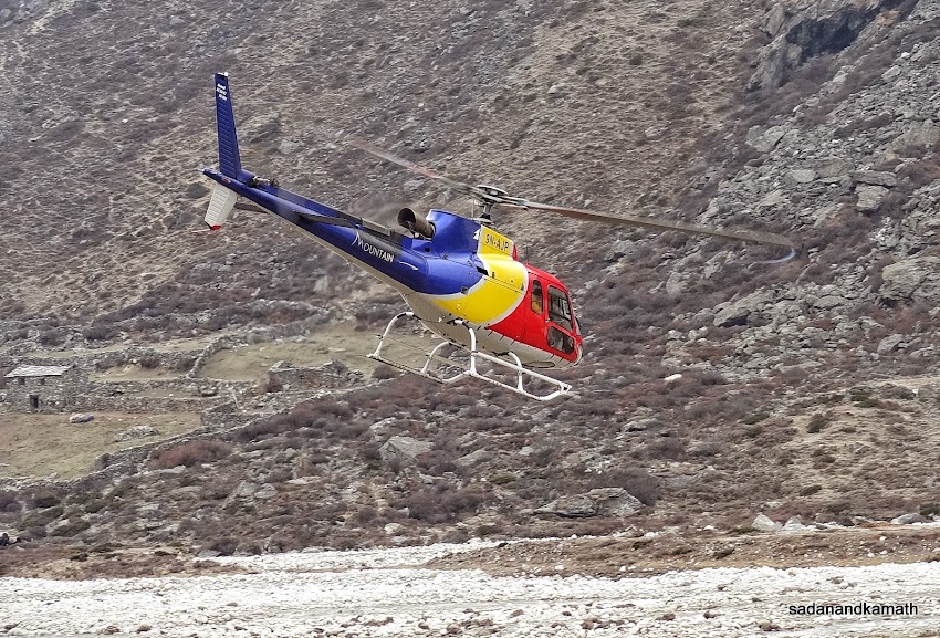
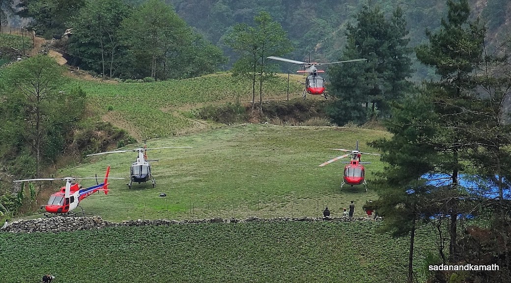
A rescue helicopter takes off from a helipad at Pheriche for Gorakshep.
May 4th - Pheriche to Tengboche (9 kms), 6 hours.
Pheriche (4240m)-Lower Pangboche (3820m) -Tengboche (3860m)
We woke up around 5.00 a.m. I saw from my room window that sky was overcast and some light drizzles had already made the tin roof below the window wet. I had a hot lemon tea in the restaurant to over come the morning chill. PKD had switched over from milk tea to mint tea which he continued during the remaining days of the trek until Taksindu. After the breakfast at around 7.00 a.m., we were ready to leave Pheriche for Tengboche when a rescue helicopter landed on the helipad just in front of our lodge. PKD was keen to know as to why the helicopter landed here. As he told me later, the helicopter had picked up a middle aged foreigner who was ill for the last 3 days in Pheriche. But the helicopter came to pick him up only after 3 days. That the illness of the foreigner concerned was not related to altitude problem became clear when he walked from his room to helipad in his normal pace and boarded the helicopter.
When we left Pheriche at around 8.00 a.m., weather had improved a bit with chances of sun coming out of the cloud cover. But it appeared to me that the overall weather would still be cloudy and we may not get much view of peaks. The topography of the track was a mix of gradual climbs and descends. We reached Pangboche at around 11.00 a.m. and decided to have lunch in Om Kailash Hotel here. It took about 1 hour to prepare a lunch of boiled rice and mixed vegetable curry. But It was worth a long wait. This was the best vegetarian lunch we ever had during EBC trek. Since it would take only about 2 hours to reach Tengboche from Pangboche, we spent more time in the restaurant chatting with the owner of the lodge.
PKD had no major health issues and he had no further attack of breathlessness after Lobuche. In his own assessment, the attack of breathlessness in Lobuche was more of a psychological reactions arising out of his worries than emanating from high altitude. His most important worry part was that in case he required an emergency evacuation by helicopter, how he could contact the call centre of his insurance company in Denmark, their contact point in Kathmandu for follow up actions etc . The mobile connectivity in Lobuche was, unfortunately non-existence though one could get a weak signal by sitting near a particular window of the restaurant. Probably, he got the panic attack in the night on this account which may have reflected by way of his breathlessness. As I said earlier, I did not notice breathlessness in him when he talked to me in the early morning at Lobuche. He had maintained his usual trekking rhythm when we commenced return journey trek from Lobuche for Pheriche. He did not require any support. He still carried his back pack of personal items. And he completed Lobuche-Pheriche trek of 10 kms and of 700m of descend in about 4 hours. Anyway, in high altitude, erring on the side of caution is better than taking a calculated risk.
We reached Tengboche at 3.30 p.m. The weather was cloudy when we checked in Himalayan View Lodge. We got a better room than last time as there were very few trekkers. By evening, the sky was overcast with light rain showers. After an early dinner of Rara Noodle Soup which had become one of our favourite dishes, we retired for the day at around 8.00 p.m.
Some pictures of the day below :
 |
Picture taken just before leaving Pheriche for Tengbcohe. In the background is the lodge where we stayed. |
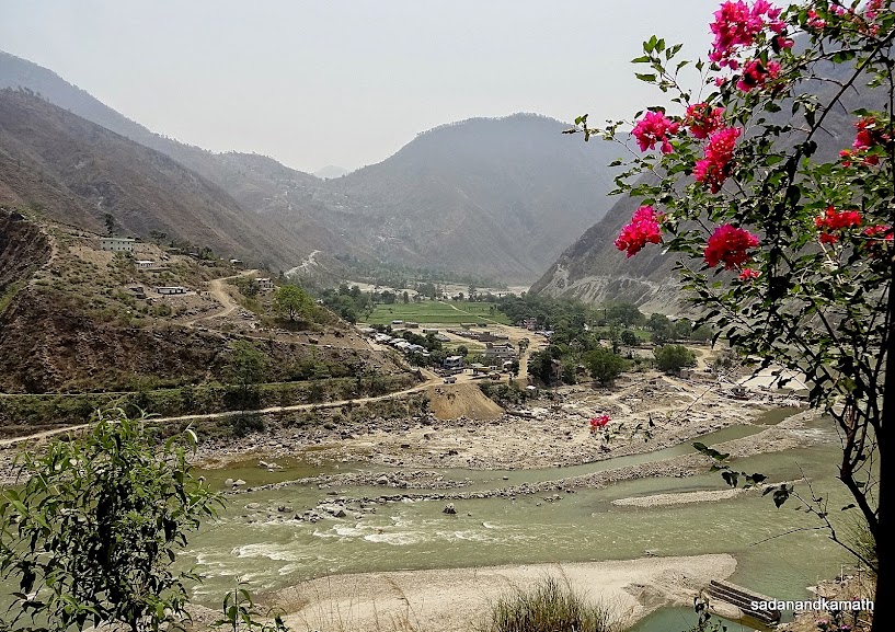
Leaving Pheriche behind. The intermediate mountain ridge (right) above Pheriche was the route which we took while trekking from Dingboche to Dhukla.
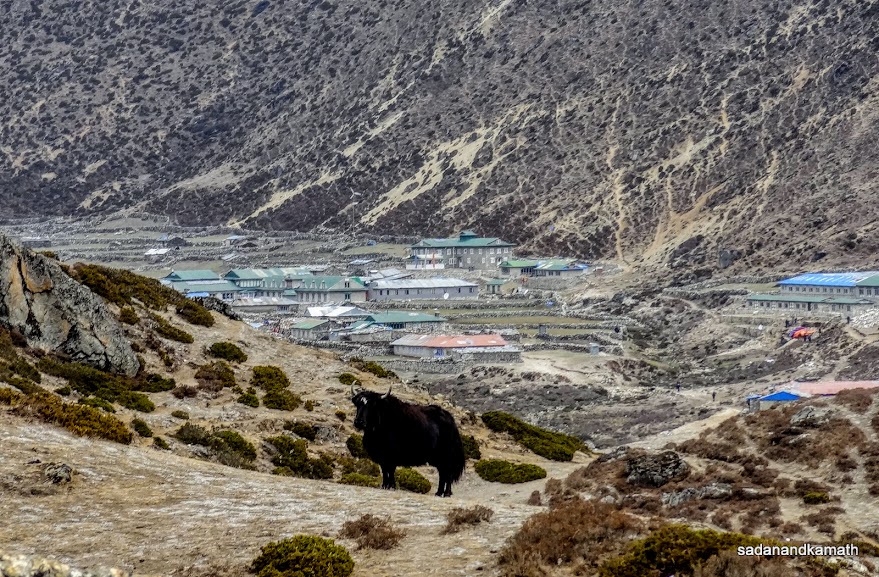
A yak with Pheriche village in the background. Pheriche has one of the biggest yak farms in Khumbu region.
Now a climb towards Pangboche.
A descend towards Orsho.
Izma Khola river in the right. A lone house seen (middle-left) is in Lower Pangboche.
Trekkers on the left side of Izma Khola river after Pangboche.
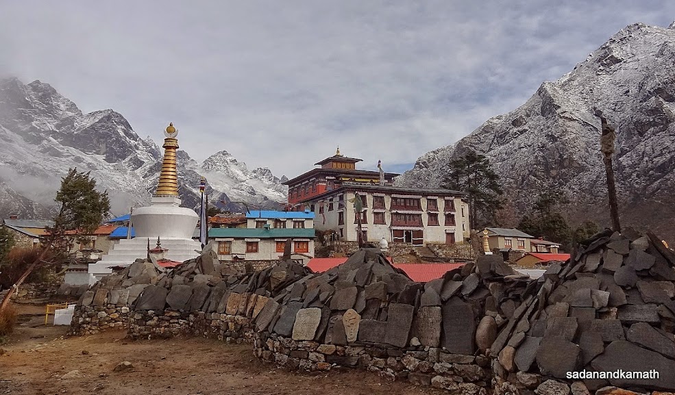
Tengboche monastery on a cloudy day.
May 5th - Tengboche to Namche Bazar (10 kms), 7 hours.
Tengboche (3860m)-Phunki Thanga (3250m)-Khyangjuma-Namche Bazar (3420m)
The sound of rain showers on the window shed of our room woken me up early at around 5.00 a.m. The sky was completely overcast with hanging clouds all over the places. When I came down to restaurant to have my morning cup of a hot lemon tea, I could guess from the watter logging in some places that it may have been raining most of the night. The climbing track behind the lodge which we had walked through for reaching Tengboche yesterday afternoon was covered with low clouds. By the time, I could finish my tea, the rain showers had turned into a mix of snow flakes and rains.
After tea, PKD and I were standing at the lodge's main doorway, assessing the prospects of rain/snow showers ending which looked bleak to us at least for the next couple of hours. A local man who looked old and somewhat weird join us and talked to us in Nepalese showing an old wrist watch. We could not understand what he intended to communicate. It appeared that he was in need of cash and probably he wanted to raise cash by selling his old watch to us. He probably knew as to why we looked somewhat concerned looking to the sky. He said in Nepalese with his hand gestures which we could decipher to some extent that the rain would stop shortly.
We had a breakfast in the restaurant sitting closely to the windows to watch the interplay of clouds and mists. Assuming that our departure may be delayed because of rains, we had not packed our duffel bags. The old man who had met us on the doorway to the lodge a little while ago was sitting inside the restaurant sipping his tea. It appeared that he was a regular visitor to the lodge to have a free cup of tea. Probably, he was really short of money. As suggested by PKD, we gave him NRs.100/-. Coincidentally, around the same time, the intensity of rains reduced and finally rains stopped. In a short time, sun made a brief appearance on the eastern side, slowly lifting the veil of clouds over Mt. Everest and Lhotse. So the old man's forecast about the stoppage of rain had come true.
I hurriedly left restaurant leaving my black coffee and rushed to our room on the second floor of the lodge to bring my camera to shoot the pictures of Mt Everest and Lhotse. Luckily, I could get the same view of these peaks from the room window. I shot a few pictures and came down to restaurant to finish my coffee.
After packing our duffel bags, we left Tengboche at around 7.30 a.m. The overnight rains had made the track muddy requiring a bit of caution while descending to Phunki Thanga. The cloudy weather with mists and fog covered valley added to the scenic beauty of the trek. The fully bloomed rhododendron trees on this route was an added bonus under cloudy weather as about a week back, weather was bright with a strong sun which affected the photography in general and shooting Rhododendron flowers in particular. With cloudy weather, rhododendron flowers were looking beautiful in their natural colours.
From Phunki Thanga, the gradual climb to Sanasa/Kyangjuma villages started. The weather turned bad and light drizzle made its presence. The drizzle turned into a rain showers which continued until we reached Kyangjuma. Actually, we stopped here to take shelter in a restaurant from rains but we decided to take a lunch break here by ordering dal-bhat-tarkari. The rain had stopped when we completed our lunch but the weather remained mostly cloudy. After Kyangjuma, it was more or less a level walk up to the chorten point at the top of Namche Bazar. A 10 minutes' steep descend brought us to Everest Hotel where we had stayed about 10 days back.
A highlight of Tengboche-Namche Bazar trek is that it has all the ingredients of a perfect trekking journey. Most of the trek path passes through the dense forest mostly of rhododendron trees with its red, pink and sometime white flowers. It had deep valley on the one side of the track with dense vegetation. Between Namche Bazar and Sanasa village, in a clear day, one can view Mt Everest, Lhotse and some other peaks for about one hour of trek. There are lodges and restaurants every 2-3 kms to relax. In fact, if time is not a constraint, the trekkers can make this segment of the trek as a day of relaxation. No doubt, PKD described this segment of EBC trek as the most beautiful among our 24 days' trek.
There were flurries of sms exchanges as well as talk between me and KS who had already reached home on May 2nd. Contrary to our presumption that he may have trekked to Lukla and then took the flight to Kathmandu, he was actually lifted by a helicopter from Namche to Kathmandu and then taken on an ambulance to hospital for a check up. Later he was dropped to Garuda Hotel. We also had telephonic conversations with Puru of 'Above The Himalaya' about advancing our Lukla-Kathmandu flight to May 8th. It was during these sms/talks we came to know that Kathmandu-Lukla-Kathmandu flights had not been operating for the last 4 days due to bad weather. The situation seemed to be grim as according to Puru, there was a huge backlog of about 1000 trekkers in Lukla waiting for flights to resume. In this scenario, he was not very optimistic about getting flight tickets for morning flights which had a fair chance of taking off from Kathmandu for Lukla. He gave us two options - (1) he can book 11.30 a.m. flight for us on May 8th for which the tickets are available but he was not sure of whether the flight would take off. The reason was that by that time even in normal times, the chances of weather turning bad was very high and (2) we can trek for 3 days more to reach Phaplu/Salleri from where one can hire Sumo for a 12 hour journey to Kathmandu.
Myself and PKD debated in the evening on these two options of reaching Kathmandu. We felt that it may be difficult for airlines to accommodate such a large number of waiting passengers to clear in the next 3-4 days even with extra flights subject to an important assumption that the weather would improve from the next day onwards. I have also heard that during such time, some airlines follow practice of giving preference to foreign passengers (other than SAARC countries) in allocating the vacant seats as the ticket prices for them is higher than others. Irrespective of the veracity of this practice, I was not comfortable about uncertainty of getting flight from Lukla even after waiting for couple of days. So I was in favour of trekking another 3 days to Phaplu/Salleri and hiring a Sumo for Kathmandu. PKD agreed with my option.
The next was to discuss with our porters about preferred option of trekking 3 days more to Phaplu/Salleri and hiring a Sumo to Kathmandu. Both the porters agreed with our option. Although share Sumos were available from Salleri taking 10 passengers @NRs.2500/-, I was not for it as with so much luggage and also travelling for 12 hours in cramped seatings was not what I envisaged after a gruelling 24 days' trek. So it was decided to hire an exclusive SUV for us.
We had one more days to decide as the next day, we would be staying in Phakding/Ghat and if the situation in Lukla improved, we had option of trekking to Lukla instead of Phaplu/Sallery. With these thoughts we finished our dinner and retired for the day at around 9.00 p.m.
Some pictures of the day below:
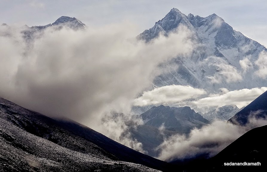
Wide angle shot of Mt. Everest (middle hump) and Lhotse from my Lodge room.
Zoom shot of Mt. Everest (left) and Lhotse (right) from Lodge room.
Zoom shot of Mt. Everest from my lodge room.
Lobuche peak (6119m) from Tengboche.
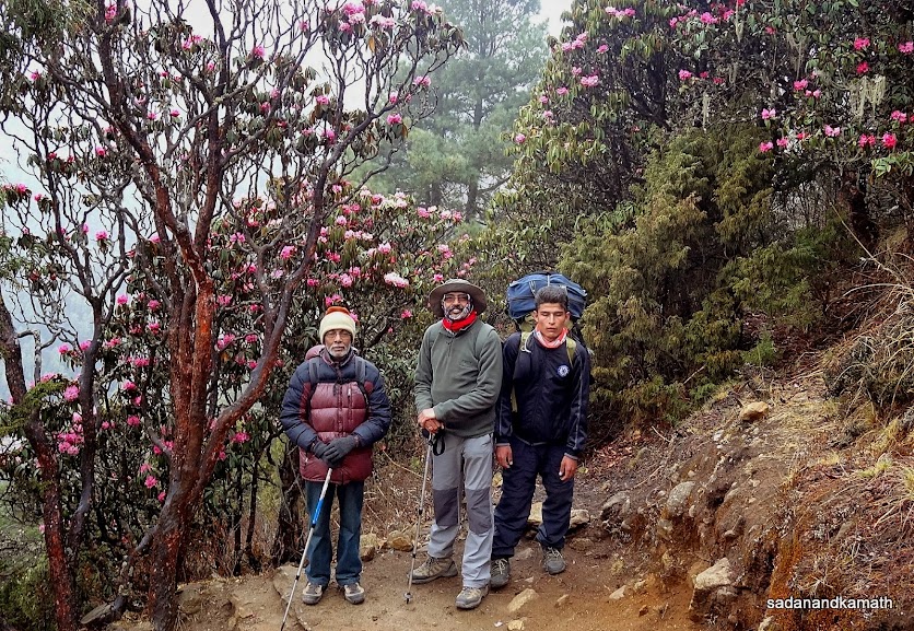
PKD, me and Rohit in the background of rhododendron flowers.
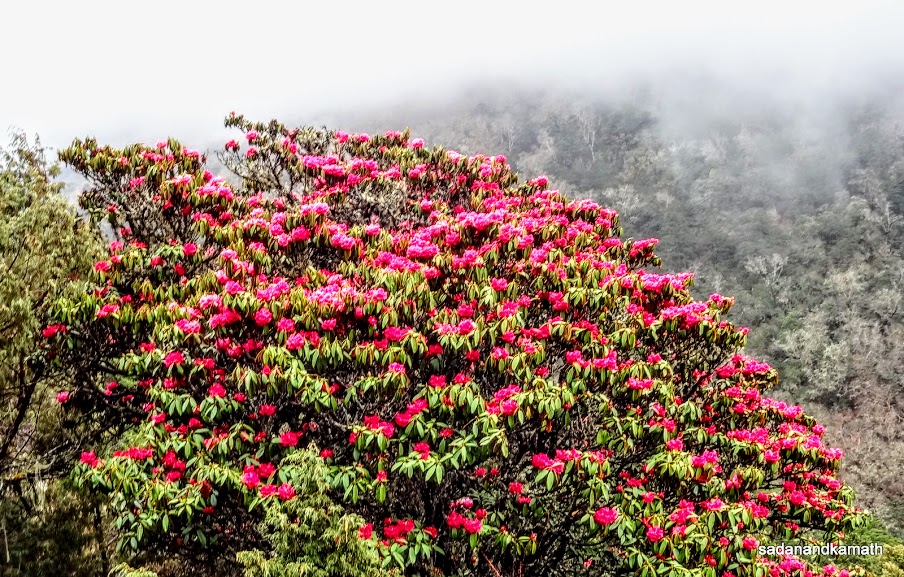
A rhododendron tree with fully bloomed flowers on way to Phungi Thanga.
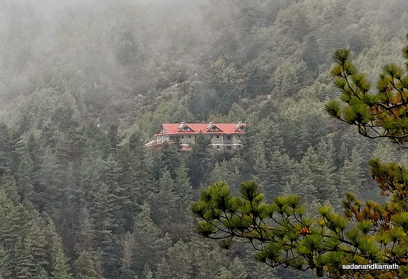
A strategically located lodge in the midst of dense pine tree forest somewhere between Tengboche and Phungi Thanga.
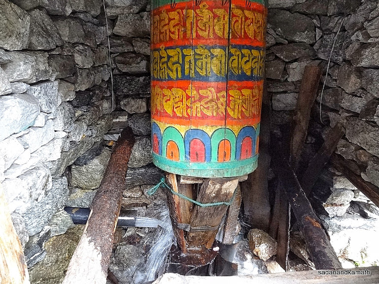
A water driven prayer wheel at Phungi Thanga
The light rains have started as we trekked towards Sanasa on way to Namche Bazar.
The valley with dense vegetation covered with rain cloud on way to Sanasa.
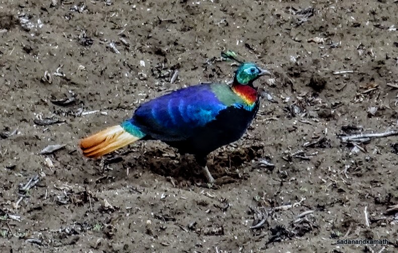
A Monal spotted on a field in Kyangjuma on way to Namche Bazar.
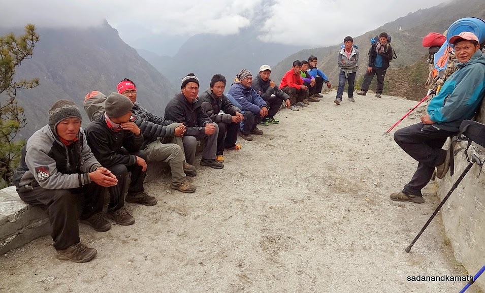
A group of Sherpas carrying loads (kept on the right) rest near Kyangjuma.
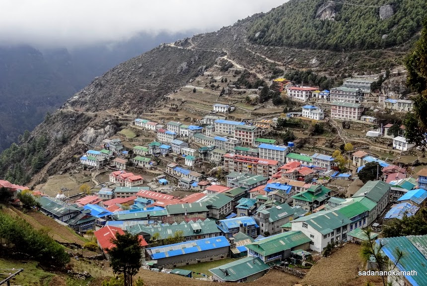
Namche Bazar town seen from a chorten located on a higher ridge of Namche Bazar.
May 6th - Namche Bazar to Ghat (10 kms), 6 hours.
Namche Bazar (3420m)-Monjo (2840m)-Ghat (2590m)
The early morning weather was great with almost clear sky. I took shot of Thamserku peak from my room. But soon the entire valley was engulfed with hanging cloud and mists. With uncertainty of Lukla-Kathmandu for the 5th consecutive day, we left Namche Bazar at 7.45 a.m. for Phakding or Ghat depending upon the how early we reached Phakding.
There were many trekkers on the route. We spoke to some of them. It appeared that most of them would head straight to Lukla adding more numbers to already 1000 odd trekkers waiting for their turn to catch the flights to Kathmandu. It took us less than one hour to descend to Hillary Suspension Bridge. We crossed the check post between Jorsalle and Monjo at around 10.30 a.m.
At around 11.00 a.m., we reached Monjo and decided to take a lunch break here knowing that it would take about one hour to serve lunch. A rescue helicopter landed at a upper ridge of Manjo. We thought that there may be some one in Monjo requiring emergency airlifting. But soon the helicopter pilot came to the restaurant where we were waiting for our lunch. From the owner of the lodge, we came to know that the helicopter was to pick up a couple of trekkers from Monjo to Kathmandu. Probably, with the suspension of Lukla-Kathmandu flight for the 5th day in succession, many would be force to take costly helicopter rides to Kathmandu so as to not the miss their home bound flights.
After lunch, we resumed our trek to Phakding. Although sun would make occasional appearance, the sky was by and large cloudy making it a good day for trekking. We reached Phakding at around 2.30 p.m. and decided to continue the trek a further 2 kms to Ghat which we reached at 3.30 p.m. We stayed in International Guest House. Rest of the evening was spent in room and restaurant as it was drizzling almost the whole evening. After a dinner of boiled rice and mixed vegetable curry, we retired for the day at 8.00 a.m.
Some pictures of the day below:
Early morning view of an unidentified peak from our lodge room, Namche Bazar.
A local porter sits on the edge of a rock overlooking Dudh Koshi river for getting better mobile signal. Once we descend from Hillary suspension bridge, we will be trekking very close to the left bank of Dudh Koshi river upto Phakding.
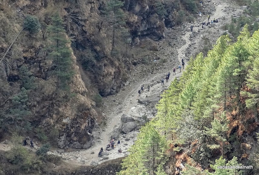
A line of trekkers walking on the left bank of Dudh Koshi river towards Jorsalle. Picture taken from Hillary Suspension Bridge.
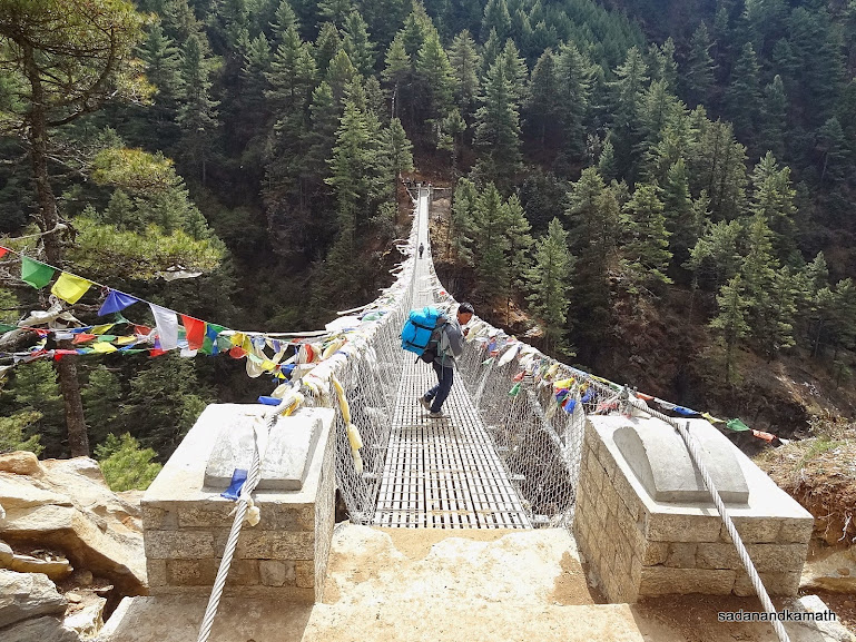
Hillary Suspension Bridge over the confluence of Dudh Koshi and Bothe Koshi rivers, the highest suspension bridge we encountered on EBC trek route.
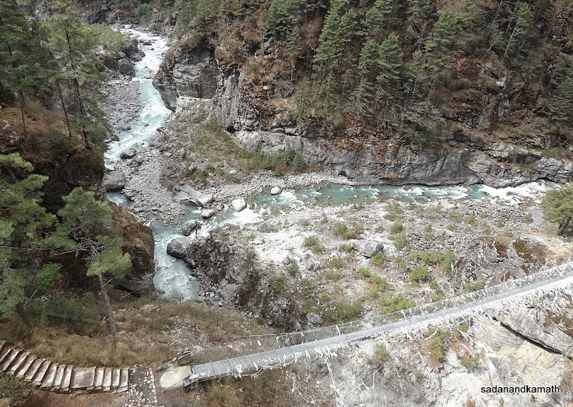
The confluence of Dudh Koshi river (left) and Bothe Koshi river (flowing from right) taken from Hillary Suspension Bridge. The old suspension bridge which has now been discarded is in the foreground.
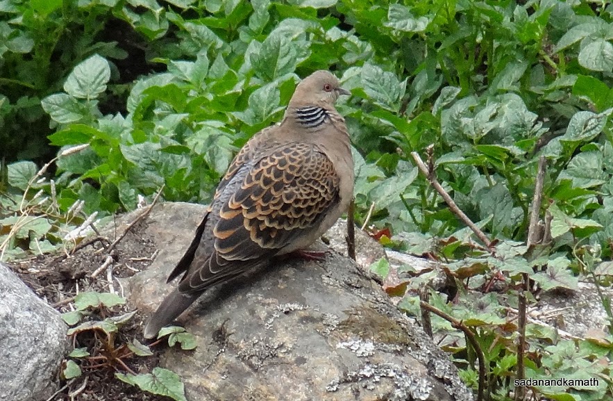
Himalayan Pigeon near Phakding.
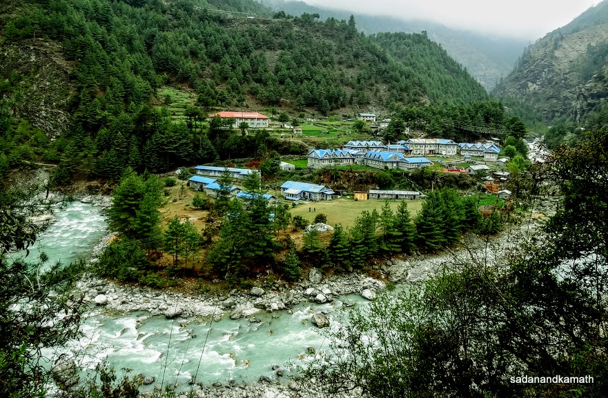
Dudh Koshi river takes a 'U' turn encircling the lodges in Phakding.
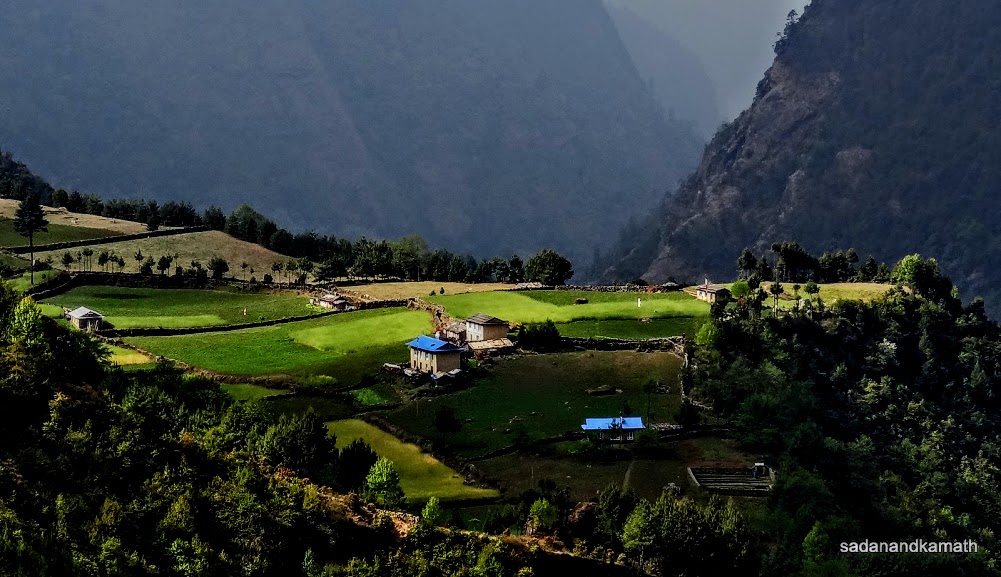
Inter-play of sun shine and shades on a field near Ghat.
May 7th - Ghat to Paiyan (10 kms), 7 hours.
Ghat (2590m)-Cheplong (2650m)-Surkhe (2290m)-Paiyan (2760m)
We woke up around 5.30 a.m. to a bright blue sky with some scattered high clouds. At the outset, it would appear that the Lukla flights would resume today. But as we had observed during the last 3 days, in less than one hour, the valley was engulfed by clouds and mists. We commenced our trek at around 7.30 a.m. to Paiyan instead of Lukla. In our view, there was no certainty of getting seats in Lukla-Kathmandu flights even if we decide to wait in Lukla for 2-3 days in view of a large backlog of passengers. As we passed through Cheplong ( close to Lukla), we did not see any flights landing and taking off from Lukla. Instead we saw frequent rescue helicopter ( 4 seater with pilot) sorties to and from Lukla. As I guessed and later confirmed by a couple of trekkers, these helicopters had been pressed to carry the stranded passengers both at Kathmandu and Lukla, of course for those who could afford helicopter rides. The rescue helicopters can fly through the valley at a low altitude thus avoiding the clouds at higher level.
After Cheplong, it was a steep descends to Surkhe where we stopped for lunch. By this time, even the helicopters had stopped flying. We saw 4 helicopters coming from Kathmandu for Lukla which had to return from Lukla and land at Surkhe due to cloud cover at Lukla airport. From Surkhe, it was a steep climb of about 400m followed by a gradual descend to Paiyan. We reached Paiyan at 4.30 p.m. and checked in Himalaya Sherpa Lodge owned by Danuru Sherpa who was one of the Sherpas in the Everest Expedition- April 2014 who escaped from the avalanche between Base Camp and the Camp No.1 in which 13 of his Sherpa friends lost their lives on April 20, 2014. The expedition was called off and he returned to Paiyan only four days back.
Few pictures of the day below:
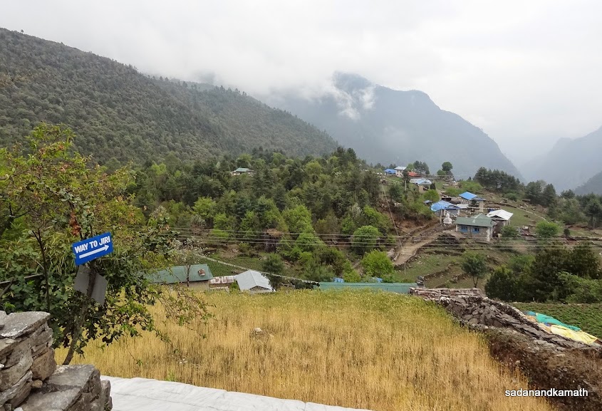
Way to Surkhe on Jiri route at Cheplong. On the top of the mountain (left) is Lukla.
A waterfall on the way to Surkhe.
Four rescue helicopters ferrying passengers to Lukla had to return to Surkhe helipad due to cloud cover over Lukla airport.
May 8th - Paiyan to Jubing (12 kms), 7 hours
Paiyan (2760m)-Thamdanda (2850m)-Bapsu (2340m)-Kharikhola (2080m)-Jubing (1770m)
We woke to a very clear sky at 5.30 a.m. After breakfast, we left Paiyan around around 7.15 a.m. From Thamdanda, it was descends of about 800m all the way to Khari Khola where we intended to stay overnight. The weather was fine with clear sky. There was very good chance that the normal flights to and from Lukla would commence today. Soon, the confirmation came by way of the two way Kathmandu-Lukla-Kathmandu flights flying regularly. However, after 11.00 a.m., we did not see any flights. We reached Bupsa around 12 noon and decided to take a lunch break at a lodge. As usual, it took nearly one hour to serve lunch and another 45 minutes to get ready for depart for Khari Khola village which was visible from Bupsa.
We met a group of 3-4 guides who had also taken a lunch break in our lodge. They had come from Lukla after arranging helicopter rides to Kathmandu for their clients. One of them said that since there was no chance of getting seats in the flights for the next 6-7 days, their clients decided to take the costly helicopter rides to Kathmandu @ US$600/- per seat. So our decision to opt for 3 days' extra trek to reach Phaplu/Salleri followed by 12-hour drive to Kathmandu was proving right. We reached Khari Khola at around 3.00 p.m. only to know that all the lodges were fully booked. The reason was that Khari Khola was the centre for class 12 examination and students from the adjoining villages had booked all the available rooms in lodges. So we had no option but to trek further 3 kms of descend to a small hamlet called Jubing where we reached around 4.30 p.m. It was a record of sorts for us that we had continuously descended about 1100m in a very treacherous track of loose rocks and stones which was made slippery by rain showers occurred about 2-3 days back.
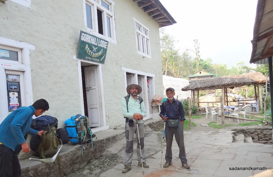
We checked in Ghorkhali Lodge at the end of the Jubing village. There were two other group of foreign trekkers staying in the lodge. The restaurant was small compared to the number of room the lodge had. So we had to take dinner with staggering timings. We took an early dinner of dal-bhat-vegetables and retired for the day at around 8.00 p.m.
Few pictures of the day below:
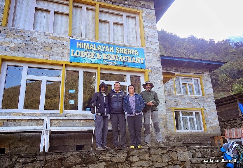
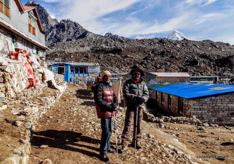
On return journey, we stayed in this lodge at Puiyan. The lodge owner Mr. Donaru Sherpa (second from left) was a member of Mt. Everest Expedition , April 2014 . He survived from the avalanche which killed 13 Sherpas many of whom were his close friends.
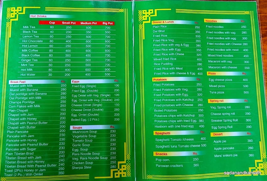
A standard menu card which all the lodges on EBC route have. Almost all the items listed here would be available in all the lodges. Here, it is a picture of only two pages of menu of a restaurant in Bupsa. There are two more pages. The prices are in NRs. (INR100/-= NR160/-). As one goes at higher altitude, the price of each items goes up and it was almost doubled when we reached Lobuche (4930m).
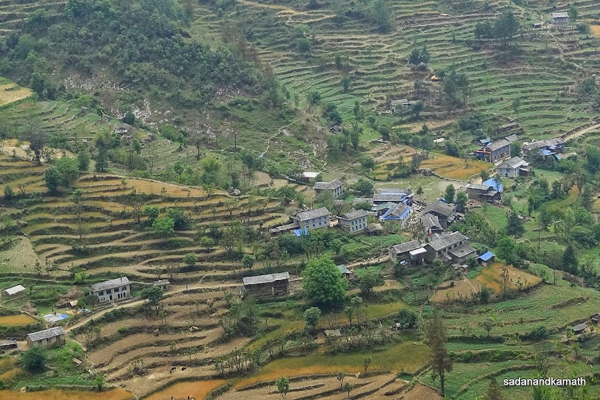
Khari Khola village seen from Bupsa.
May 9th - Jubing to Taksindu (11 kms), 7 hours.
Jubing (1770m)- Khari Khola river Suspension Bridge (1620m)-Nuntala (2330m)-Taksindu (2975m)
Yesterday, we had done a record continuous descend of about 1100m. Today, it was a day of a record continuous climb of about 1300m up to Taksindu. Actually, our plan was to go beyond Taksindu to take an overnight halt at Ringmu. But in the morning we decided to take the overnight in Taksindu so that on the next day, we cross Taksindu Pass (3080m) in the early morning.
After the breakfast, we left Jubing in a bright but somewhat warm weather at around 7.15 a.m. After descending to a suspension bridge (1620m) over Khari Khola river, the day of steep climb started. Contrary to our apprehension about such a high climb, we did not feel the climbing difficult. Perhaps, after trekking for 22 days, we were now well adapted to climbs and descends. In about 4 hours, we reached Nuntala at around 11.30 a.m. by which time the weather had become very warm. We took our lunch break at Sangrila Lodge. For the first time during this trek, I had a cold drink to quench my thirst as the drinking water had become warm in the sun. We hoped that in the afternoon, there would be some cloud cover to reduce the impact of a strong sun when we further climb to Taksindu.
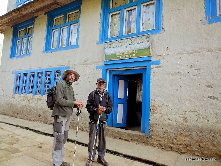
The weather remain warm and humid when we started from Nuntala at around 1.00 p.m. The climb to Taksindu took about 3 hours. We checked in Mountain View Lodge. The weather had now turned cold due to higher altitude. We had an early dinner of dal-bhat-potatoes at 7.00 p.m. and retired to the bed at around 8.00 p.m.
A couple of pictures of the day below:
This is the lodge where we stayed in Jubing.
Nuntala village seen from the climb to Taksindu.
May 10th - Taksindu to Phaplu ( 9 kms), 6 hours.
Taksindu (2970m)-Taksindu Pass (3080m)-Ringmu (2760m)-Chiwang (2535m)-Phaplu (2530m)
After two days of continuous descends followed by continuous climb involving more than 1000m each, today was our last day of the trek with relatively easy track. After an early breakfast, we left Jubing at 7.15 a.m. In about 30 minutes' time, we crossed Taksindu Pass (3080m) after which it was all the way downhill to Ringmu. The weather was sunny and the trek was mostly through forest. At a chorten in Ringmu, we followed the left diversion (the right diversion goes to Junbesi on Jiri route) for Phaplu. The first 3 kms of trek was more or less was a plain walk through villages on the way. Thereafter, a short gradual descend on loose stones and rocks connected to a mud road coming from Salleri/Phaplu. I could see a tyre mark on the road which indicated that either a jeep or a SUV had come upto this point.
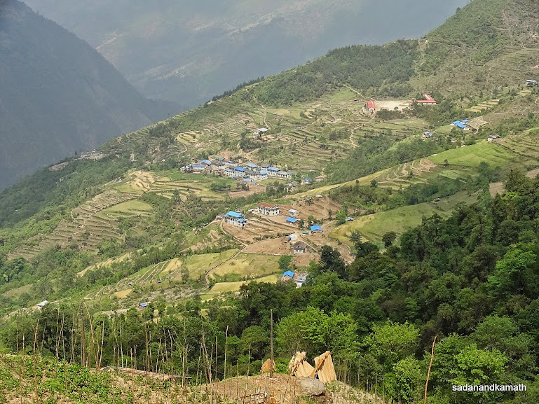
Rest of the trek upto Paphlu was on the mud road which was surprisingly a two lane road with smooth surface on most of its length. On the way, we passed through Phera village, one of the best picturesque villages we came across during our 24 days of trek. From here, we could see Purthiang Top (2900m) from where we had the first glimpses of Mt. Everest and other peaks about 3 weeks' back. We could also see the saddle of Lamjura Pass (3540m) which we had crossed to reach Junbesi and then to Purthiang.
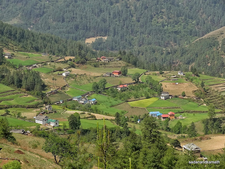
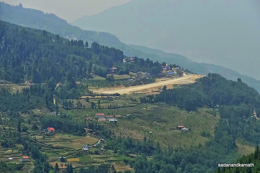
From Phera village, it was mostly the plain walk on the road in the open without forest cover. We did not come across any vehicle except a couple of bikes going towards Phera village. As we were walking towards Chiwang village, we could see Phaplu village adjoining the airport which was in an advance stage of construction. It appears that the authorities are upgrading this airport at Phaplu as an alternative to Lukla for fixed wing plains. With mud road already reaching 3 kms short of Ringmu village, trekkers can take Kathmandu-Phaplu flights when the airport gets ready, take a jeep ride to Ringmu and then trek Nuntala-Paiyan-Phakding-Namche Bazar in 3-4 days.
It was a warm day as walked towards Chiwang, we lost forest cover. We decided to take a lunch break in a lodge cum restaurant. Ram Rai, one of our porters who also runs a grocery shop at his native place, bought 10 kgs of big dry beans. He told me that Chitwang was known for beans farming. we reached Phaplu at 2.15 p.m. We stayed in one of the lodges in the centre of the village close to Phaplu airport bringing an end to our EBC trek.
Earlier, on our way to Phaplu, Ram Rai had spoken to his uncle in Salleri for reconfirming the booking of Sumo for Kathmandu drop. In the evening, the deal was settled at NRs.21000/-(we paid INR.13000/-) for 300 kms of Phaplu-Kathmandu road journey which was within the range of cost indicated by Puru. We got the receipt issued by Salleri Taxi Association for the amount and other details. The Sumo was to pick us at Phaplu at 4.00 a.m. the next day. With the final stage of our return journey to Kathmandu confirmed, we were eagerly waiting for tomorrow have a shave, a nice bath and a good dinner at Kathmandu. We had one of the best thali dinners of our trek at Paphlu which was a mix of Nepali and Continental dishes like fried rice with omelette, saute of boiled vegetables, mixed vegetable curry etc. We retired to bed at around 8.30 p.m.
Some pictures of the day below:
We stayed in this lodge at Taksindu.
Entering the gate to Taksindu Pass (3080m).
Numbur peak seen from Taksindu Pass.
A chorten at Ringmu village acts as a diversion point - a straight path to Phaplu/Selleri and to the right in the foreground to Junbesi on Jiri route.
The two lane mud road originating from a place 3 kms after Ringmu seen from Phera village on our way to Phaplu/Salleri.
Phera village in the valley seen from the road.
Purthiang Top from where we saw Mt Everest and other peaks, seen from Phera village.
A zoom shot of Phaplu Airport. Phaplu village is on the side of the airport. Once this airport become operational, one can fly from Kathmandu to Phaplu and reach Namche Bazar in 3 or 4 days' trek - Phaplu-Nuntala-Paiyan-Phakding-Namche Bazar.
May 11th - Phaplu to Kathmandu (about 275kms by Sumo), 16 hours.
We got up at 3.30 a.m. The lodge owner was kind enough to serve us tea and biscuits at 4.00 a.m. The Sumo driver was to pick us from our lodge at 4.00 a.m. but there was no trace of Sumo. Ram Rai tried to contact the driver to ascertain whether he had left Salleri for Phaplu but despite many attempts, the driver's mobile was not responding. Ultimately, Ram Rai contacted a person in Salleri Taxi Association's office who confirmed that the driver with Sumo had already left Salleri. Finally, the Sumo arrived at 4.30 a.m. We immediately got into Sumo and a longish road journey of about 16 hours started. While myself and PKD sat on the middle seat, Ram Rai sat next to driver. The back seat was used for dumping our duffel bags and sacks. Rohit got down at Salleri as his home was closest from this point, a day's trek. In about 10 days, he was to appear for 12th examination. Thus the journey which should have been a comfortable one at least inside Sumo, turned into a nightmarish journey as a whole.
We were given an impression that only about half of the road distance to Kathmandu was on the mud/pebble road and rest of the journey was on the tar road. So we were optimistic that we would be able to reach Kathmandu around 5.00 p.m. The road between Phaplu and Salleri was more like driving on a moon crater but we had no complain as officially, actual mud road started from Salleri. Even after crossing Salleri, the road condition was more or less the same. From about 2500m, we climbed to nearly 3000m on a mud and pebble road in about 2 hours. At Dasi (I hope I remember the name correctly), our driver stopped in front of a house for a breakfast. We also joined him to complete our breakfast.
From Dasi, the journey was mostly downhill with occasional climbs. The road had a thick layer of dust with patholes in most of the places. Sumos and other SUVs going ahead of us looked like doing a synchronised dancing. I do not think that driver ever used 3rd and 4th gear during the drive upto Okhaldunga which we reached around 9.00 a.m. Since it was a big village, we thought that at least after this we would have tar road. But it was not to be. The road condition remained more or less the same or even worst. After a considerable distance from Okhaldhunga, we came on a smooth tar road. We thought that at last, our misery of driving on the dirt road through dust was over. But in about 2-3 kms, we were again driving on the worst type of dirt road. This happened about 5-6 times - short run on a smooth tar road followed by a long run on a dirt road until we were about 100 kms short of Kathmandu.
The reason for the rigmarole of driving on shot spells of a smooth tar road in between the dirt road is the fact that Government of Nepal has decided to construct an all weather East-West two-lane highway connecting Salleri with Kathmandu. A Japanese construction company has been awarded to construct the road (probably Asian Development Bank funded project). During the first stage, the road will be constructed upto Okhaldhunga for which the construction work has already started. Due to this, there are umpteen number of long diversions, some of which does not look like even a dirt road. The completed small section of this road is really of international standard with thick layer of concretised support on the cliff side and multiple railguards fixed to the concretised base on the valley side. There are not much of bends and the climbs and descends are of low gradients on the completed section of the road. Once the full stretch of the road is constructed, my guess is that it may not take more than 5-6 hours to cover Kathmandu-Salleri distance going by our experience of driving on some short completed section of the road.
There were some sections of the road which looked prone to landslides and accumulation of mud slush particularly during rainy season. Puru has told me that even a short rain spell could close a part of the road for vehicular traffic. What was worrisome for us was that there were no railguards on the valley side anywhere on the road during our journey to Okhaldhunga. The continuous dust 'storm' created from the vehicles ahead of us on the road was looking more dangerous than the foggy weather as it was difficult to spot the vehicles coming from the other side. I noticed that there were thin layers of dust on my paint and shirts and also on the seats which we were required to clean from time to time. The warm weather during the day also added to our woes.
Adding to the discomfort was the constant blaring of songs almost during the entire journey. Despite requesting the driver umpteen times to give some short break to songs or reduce the volume, the driver did not heed to our requests. I have come across for the first time during the last 30 years of active travelling, a driver who was behaving in a very un reasonable manner. At one time, he told us very clearly that the he would not stop playing songs as it was the question of life and death for him! Fortunately, we were saved from the tyranny of driver when his brother took over driving when about 2 hours was left for reaching Kathmandu. The original driver took the pendrive of songs to take another vehicle to Salleri - a good riddance.
We reached Ghurmi around 11.00 a.m. and as per the advice given by driver that for the next four hours journey, we would not come across any eating places, we took lunch here. Ghurmi village is located at the banks of Sun Koshi river. Presently, a low bailey bridge is functional to cross the river to go over to the other side of Salleri-Kathmandu Road. It is said that when the water level of Sun Koshi river rises, the bailey bridge submerges in the water. At that time, authorities deploy a make-shift barge which can take vehicles along with passengers. The barge drifts to other side by the force of the flow of the river. A cement bridge is under construction.
We face short disruption of traffic on two occasions before reaching Okhaldhunga and the one between Okhaldhunga and Ghurmi due to landslides. Fortunately, they were cleared by bulldozers in about half an hour's time. However, somewhere between Ghurmi and a tea break point in the late afternoon, the road was closed for more than an hour as some resurfacing work was going on. The tar road started from a place where we had tea break around 5.00 p.m. With new driver in command and no blaring of songs, we had a peaceful and comfortable ride of about 2 hours to Kathmandu. We reached Kathmandu at around 8.00 p.m. completely tired and dust all over our faces with mud marks on our trousers as if we have just returned from a war front. At the end of the journey, I felt that a 16 hours of road journey from Phaplu to Kathmandu was more tiresome but adventurous than our 24 days of EBC trek.
We checked into Garuda Hotel which had plunged into darkness due to continuous load shedding during the day. Even their back up power supply through inverters was exhausted. After completing a cold water bath, we ate sandwiches instead of regular dinner and retired to the bed around 10.00 p.m. in a warm and dark room without power supply. But tiredness prevailed over the discomfort of a warm room in getting a sound sleep.
Next day in Kathmandu was spent mainly for settling our account with Puru and modifying our flight tickets from May 16th to May 13th. In the evening we did some shopping.
I did the EBC trek on the advice of KS to get a unique experience of trekking in the Himalayas. He was right. More than attaining the final destination, it was the experience to be a part of 'trekkers' highway' to EBC and of staying in lodges for 24 days located at altitudes ranging between 1600m and 4900m. Most of these lodges were run by Sherpa families which were improvisation of their own houses. Some of the lodges were as good as hotels. There were soft mattresses on the beds with blankets. The toilets were clean. Most of these lodges were run by woman folks of the families as the male members would mostly be away either as guides or porters. There was lot of choices for food. With this 'luxury' experiences, I am not sure now as to how I would feel doing trekking in Indian settings in future.
Concluded.
We got up at 3.30 a.m. The lodge owner was kind enough to serve us tea and biscuits at 4.00 a.m. The Sumo driver was to pick us from our lodge at 4.00 a.m. but there was no trace of Sumo. Ram Rai tried to contact the driver to ascertain whether he had left Salleri for Phaplu but despite many attempts, the driver's mobile was not responding. Ultimately, Ram Rai contacted a person in Salleri Taxi Association's office who confirmed that the driver with Sumo had already left Salleri. Finally, the Sumo arrived at 4.30 a.m. We immediately got into Sumo and a longish road journey of about 16 hours started. While myself and PKD sat on the middle seat, Ram Rai sat next to driver. The back seat was used for dumping our duffel bags and sacks. Rohit got down at Salleri as his home was closest from this point, a day's trek. In about 10 days, he was to appear for 12th examination. Thus the journey which should have been a comfortable one at least inside Sumo, turned into a nightmarish journey as a whole.
We were given an impression that only about half of the road distance to Kathmandu was on the mud/pebble road and rest of the journey was on the tar road. So we were optimistic that we would be able to reach Kathmandu around 5.00 p.m. The road between Phaplu and Salleri was more like driving on a moon crater but we had no complain as officially, actual mud road started from Salleri. Even after crossing Salleri, the road condition was more or less the same. From about 2500m, we climbed to nearly 3000m on a mud and pebble road in about 2 hours. At Dasi (I hope I remember the name correctly), our driver stopped in front of a house for a breakfast. We also joined him to complete our breakfast.
From Dasi, the journey was mostly downhill with occasional climbs. The road had a thick layer of dust with patholes in most of the places. Sumos and other SUVs going ahead of us looked like doing a synchronised dancing. I do not think that driver ever used 3rd and 4th gear during the drive upto Okhaldunga which we reached around 9.00 a.m. Since it was a big village, we thought that at least after this we would have tar road. But it was not to be. The road condition remained more or less the same or even worst. After a considerable distance from Okhaldhunga, we came on a smooth tar road. We thought that at last, our misery of driving on the dirt road through dust was over. But in about 2-3 kms, we were again driving on the worst type of dirt road. This happened about 5-6 times - short run on a smooth tar road followed by a long run on a dirt road until we were about 100 kms short of Kathmandu.
The reason for the rigmarole of driving on shot spells of a smooth tar road in between the dirt road is the fact that Government of Nepal has decided to construct an all weather East-West two-lane highway connecting Salleri with Kathmandu. A Japanese construction company has been awarded to construct the road (probably Asian Development Bank funded project). During the first stage, the road will be constructed upto Okhaldhunga for which the construction work has already started. Due to this, there are umpteen number of long diversions, some of which does not look like even a dirt road. The completed small section of this road is really of international standard with thick layer of concretised support on the cliff side and multiple railguards fixed to the concretised base on the valley side. There are not much of bends and the climbs and descends are of low gradients on the completed section of the road. Once the full stretch of the road is constructed, my guess is that it may not take more than 5-6 hours to cover Kathmandu-Salleri distance going by our experience of driving on some short completed section of the road.
There were some sections of the road which looked prone to landslides and accumulation of mud slush particularly during rainy season. Puru has told me that even a short rain spell could close a part of the road for vehicular traffic. What was worrisome for us was that there were no railguards on the valley side anywhere on the road during our journey to Okhaldhunga. The continuous dust 'storm' created from the vehicles ahead of us on the road was looking more dangerous than the foggy weather as it was difficult to spot the vehicles coming from the other side. I noticed that there were thin layers of dust on my paint and shirts and also on the seats which we were required to clean from time to time. The warm weather during the day also added to our woes.
Adding to the discomfort was the constant blaring of songs almost during the entire journey. Despite requesting the driver umpteen times to give some short break to songs or reduce the volume, the driver did not heed to our requests. I have come across for the first time during the last 30 years of active travelling, a driver who was behaving in a very un reasonable manner. At one time, he told us very clearly that the he would not stop playing songs as it was the question of life and death for him! Fortunately, we were saved from the tyranny of driver when his brother took over driving when about 2 hours was left for reaching Kathmandu. The original driver took the pendrive of songs to take another vehicle to Salleri - a good riddance.
We reached Ghurmi around 11.00 a.m. and as per the advice given by driver that for the next four hours journey, we would not come across any eating places, we took lunch here. Ghurmi village is located at the banks of Sun Koshi river. Presently, a low bailey bridge is functional to cross the river to go over to the other side of Salleri-Kathmandu Road. It is said that when the water level of Sun Koshi river rises, the bailey bridge submerges in the water. At that time, authorities deploy a make-shift barge which can take vehicles along with passengers. The barge drifts to other side by the force of the flow of the river. A cement bridge is under construction.
A bailey bridge over Sun Kosi river near Ghurmi village.
Sun Kosi river with Ghurmi village in the background.
We face short disruption of traffic on two occasions before reaching Okhaldhunga and the one between Okhaldhunga and Ghurmi due to landslides. Fortunately, they were cleared by bulldozers in about half an hour's time. However, somewhere between Ghurmi and a tea break point in the late afternoon, the road was closed for more than an hour as some resurfacing work was going on. The tar road started from a place where we had tea break around 5.00 p.m. With new driver in command and no blaring of songs, we had a peaceful and comfortable ride of about 2 hours to Kathmandu. We reached Kathmandu at around 8.00 p.m. completely tired and dust all over our faces with mud marks on our trousers as if we have just returned from a war front. At the end of the journey, I felt that a 16 hours of road journey from Phaplu to Kathmandu was more tiresome but adventurous than our 24 days of EBC trek.
We checked into Garuda Hotel which had plunged into darkness due to continuous load shedding during the day. Even their back up power supply through inverters was exhausted. After completing a cold water bath, we ate sandwiches instead of regular dinner and retired to the bed around 10.00 p.m. in a warm and dark room without power supply. But tiredness prevailed over the discomfort of a warm room in getting a sound sleep.
Next day in Kathmandu was spent mainly for settling our account with Puru and modifying our flight tickets from May 16th to May 13th. In the evening we did some shopping.
I did the EBC trek on the advice of KS to get a unique experience of trekking in the Himalayas. He was right. More than attaining the final destination, it was the experience to be a part of 'trekkers' highway' to EBC and of staying in lodges for 24 days located at altitudes ranging between 1600m and 4900m. Most of these lodges were run by Sherpa families which were improvisation of their own houses. Some of the lodges were as good as hotels. There were soft mattresses on the beds with blankets. The toilets were clean. Most of these lodges were run by woman folks of the families as the male members would mostly be away either as guides or porters. There was lot of choices for food. With this 'luxury' experiences, I am not sure now as to how I would feel doing trekking in Indian settings in future.
Concluded.