Once the decision to attempt the twin trek of Gokyo and EBC was taken in January 2014, the first thing we did was to book Mumbai-Delhi-Kathmandu flight. The return flight was not booked as we were still to finalise the detail itinerary of the trek. Since we had already prepared a detailed itinerary of Lukla-Gokyo-EBC-Lukla trek which we were to undertake from in November 16, 2013 but aborted due to 10-day Maoist Bandh in Nepal, there was not much to work out except Jiri-Namche Bazar section of the trek.
It was only in early March that I seriously sat for preparing the detailed itinerary of the trek taking the classic route from Jiri. Since KS had already done EBC trek starting from Jiri, I got most of the inputs from him for preparing the itinerary. Now the next action was hiring the porters. We were very clear from the beginning that we would not need a guide for this trek as KS had already done this trek. Some time in the middle of March 2014, KS talked to Puru Timalsena, Managing Director of a trekking agency called 'Above the Himalaya' his quotes for providing three experienced porters. Once the daily rate per porter was agreed between us, the next was to book Lukla-Kathmandu flight which Puru advised us to book in advance in view of the trekking season. So just about a month before the start of our journey to Nepal, we booked our return flight Kathmandu-Delhi-Mumbai and Puru booked Lukla-Kathmandu flight keeping two extra days in between to take care of flight cancellations due to bad weather.
Having everything put in place except TIMS cards and payment of Sagarmatha National Park fees, the stage was set for my maiden trek in Nepal, PKD's maiden trek and KS's new trekking destination Gokyo valley and Gokyo peak.
April 13, 2014 : Mumbai to Kathmandu (via Delhi)
Spicejet flight from Mumbai landed in Delhi at its scheduled time of 13.10 hours at Terminal 1. Our connecting Spicejet flight to Kathmandu at 15.50 hours was from T-3 which was a 20-minute drive from T-1. The flight to Kathmandu left on time. We had pre-booked the window seats on the left side of the plane to have a view of snow clad Himalayan peaks. However, the weather remained cloudy through out the flight duration. The flight landed 20 minutes ahead of its schedule time of 17.50 hours in Kathmandu amidst some rain showers. The outside temperature was 19C as announced by one of the flight attendants.
After completion of immigration and custom clearances which were mere formalities for Indians, we were out of the airport after claiming our baggage in about 30 minutes. We bought sim cards of Nepal Telecom ( akin to our MTNL/BSNL) inside the airport. We were told that their sim cards worked better in most of our trekking routes than other close competitor N. Cell. KS additionally topped up 3G in his smart phone. We hired a Maruti Van (INR.500/-) for dropping us to Garuda Hotel in Thamel. Being the peak season for trekking, the 3 bedded room costed us INR.3000/-. After freshening up, we strolled around Thamel and took dinner at 'Crazy Burger' located on the ground floor of Garuda Hotel and retired to bed around 10.00 p.m.
April 14th : In Kathmandu for making arrangements for trek
There was no need for us to get up early in the morning today. But the early sunrise in Kathmandu woke us around 6.00 a.m. The load shedding which is a recurring problem in Kathmandu, made us to skip the bath for the afternoon as there was not water supply in our taps. The load shedding in Kathmandu can last as long as 12 hours. The back up power from the inverter can last only about 3-4 hours. Hence the high hand hotels have power back up through generators. The weather was pleasant and that made us hungry for our breakfast. We located a dabha about 5 minutes' walk from our hotel for a breakfast of Paratha topped up with double omelette.
Today being the Nepal's New Year day, we would have expected the shops to be closed for the day. But it was not so at least in Thamel. Fortunately, Puru confirmed that his office 'Above the Himalaya' would remain open. We went to his office to finalise the details of the trek and pay him the advance for hiring 3 porters, cost of our Lukla-Kathmandu flights and TIMS cards. We paid the amount by credit card as carrying so much cash in Rs.100/- notes (Rs.500/- and Rs.1000/- notes are banned in Nepal and carrying the denomination of banned Indian currency notes is regarded as a criminal offence as per Nepali laws). Because credit cards (also debit cards) issued in India contain a proviso on the backside of the cards 'not valid for payment in foreign exchange transactions in Nepal and Bhutan', many may presume that these cards are not valid for payment in Nepal. But as we have done, one can make payment in Indian rupees in Nepal as it is not a foreign currency for Indians. Of course, one may have to pay charges ranging from 3.50-4.00% of the amount settled through credit cards. Still it was a better option than carrying a huge amount in cash to Nepal in Rs.100/- notes.
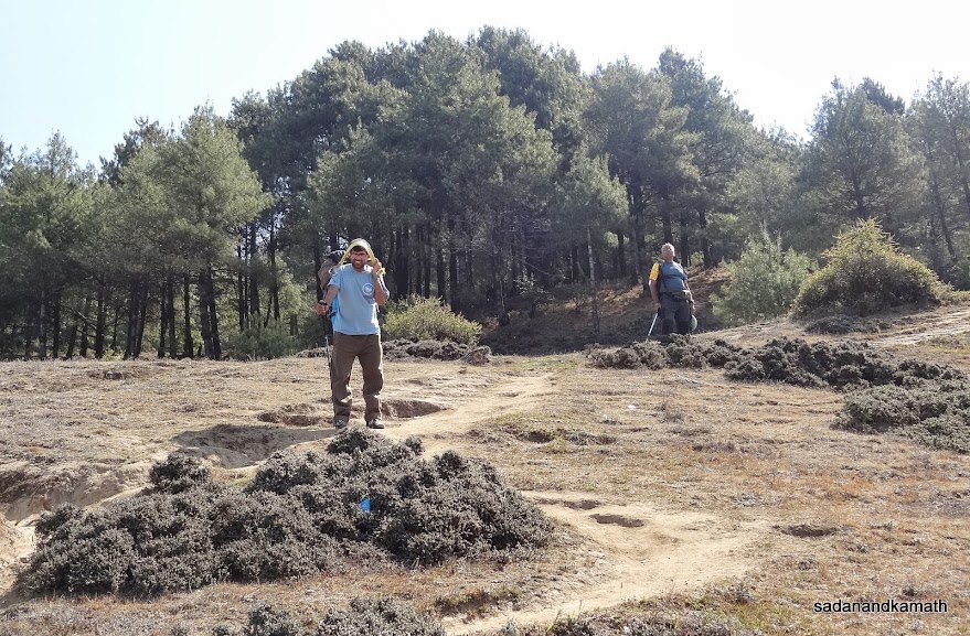
Puru introduced 3 porters - Shrikrishna, Ram Rai and Rohit who would be with us for the next 30 days. All of them had previous experience in EBC and Gokyo treks. Later, they came to our hotel room to check our loads and types of bags so that they can adjust their own personal luggage accordingly. We also hired down jackets and sleeping bags (@ NRs.60/- each) and paid advance for 20 days with balance amount to be paid on return from the trek. Actually, one does not need sleeping bags for EBC and Gokyo treks as all the lodges on the way have beds with soft mattresses and supply blankets to the trekkers. However, as an abundant caution, one should take sleeping bag also in case the rooms in the lodges are not available due to rush and one may have to sleep in the lodge restaurants or some houses of local families without mattresses and blankets. We also bought trekking gears like light stretchable and quick drying pants and shirts and hand gloves.
We also convereted Indian rupees into Nepalese rupees @NRs.1.60 for INR.1/- to take care of payments to be made for lodging and food during trekking days. Although INR is accepted almost everywhere including the trekking destinations, we felt that it would be easier for us to settle the payments in NRs. as everything is quoted in NRs.
April 14th : In Kathmandu for making arrangements for trek
There was no need for us to get up early in the morning today. But the early sunrise in Kathmandu woke us around 6.00 a.m. The load shedding which is a recurring problem in Kathmandu, made us to skip the bath for the afternoon as there was not water supply in our taps. The load shedding in Kathmandu can last as long as 12 hours. The back up power from the inverter can last only about 3-4 hours. Hence the high hand hotels have power back up through generators. The weather was pleasant and that made us hungry for our breakfast. We located a dabha about 5 minutes' walk from our hotel for a breakfast of Paratha topped up with double omelette.
Today being the Nepal's New Year day, we would have expected the shops to be closed for the day. But it was not so at least in Thamel. Fortunately, Puru confirmed that his office 'Above the Himalaya' would remain open. We went to his office to finalise the details of the trek and pay him the advance for hiring 3 porters, cost of our Lukla-Kathmandu flights and TIMS cards. We paid the amount by credit card as carrying so much cash in Rs.100/- notes (Rs.500/- and Rs.1000/- notes are banned in Nepal and carrying the denomination of banned Indian currency notes is regarded as a criminal offence as per Nepali laws). Because credit cards (also debit cards) issued in India contain a proviso on the backside of the cards 'not valid for payment in foreign exchange transactions in Nepal and Bhutan', many may presume that these cards are not valid for payment in Nepal. But as we have done, one can make payment in Indian rupees in Nepal as it is not a foreign currency for Indians. Of course, one may have to pay charges ranging from 3.50-4.00% of the amount settled through credit cards. Still it was a better option than carrying a huge amount in cash to Nepal in Rs.100/- notes.
Puru introduced 3 porters - Shrikrishna, Ram Rai and Rohit who would be with us for the next 30 days. All of them had previous experience in EBC and Gokyo treks. Later, they came to our hotel room to check our loads and types of bags so that they can adjust their own personal luggage accordingly. We also hired down jackets and sleeping bags (@ NRs.60/- each) and paid advance for 20 days with balance amount to be paid on return from the trek. Actually, one does not need sleeping bags for EBC and Gokyo treks as all the lodges on the way have beds with soft mattresses and supply blankets to the trekkers. However, as an abundant caution, one should take sleeping bag also in case the rooms in the lodges are not available due to rush and one may have to sleep in the lodge restaurants or some houses of local families without mattresses and blankets. We also bought trekking gears like light stretchable and quick drying pants and shirts and hand gloves.
We also convereted Indian rupees into Nepalese rupees @NRs.1.60 for INR.1/- to take care of payments to be made for lodging and food during trekking days. Although INR is accepted almost everywhere including the trekking destinations, we felt that it would be easier for us to settle the payments in NRs. as everything is quoted in NRs.
In the evening, we again went to Puru's office to collect the Kathmandu-Jiri Express bus ticket for April 15th. We had dinner in Hotel Mandir's restaurant located just opposite Garuda Hotel. The restaurant's ambiance was good so also the food. The sound of rock music coming from a night club adjunct to our restaurant added atmosphere of a candle light dinner in the midst of orchestra. After dinner, we came back to hotel room and segregated the cloths and items which can be kept in a separate bag to be deposited in the hotel. Other items required during the trek were put in duffel bags to be carried by porters. We retired for the day at 10.00 p.m.
April 15th : Kathmandu to Jiri by Bus (188 kms)
We got up at around 5.00 a.m. as load shedding started earlier than scheduled. After having our morning tea from a nearby shop, we hastened to finish our bath as non availability of power may result in drying up of tap as was our experience in the previous day. After checking out from Garuda Hotel, we were ready for departure at 6.30 a.m. to the old bus stand for boarding bus to Jiri which was scheduled to depart at 8.00 a.m. Two of our three porters, Shrikrishna and Rohit had already reported in our hotel and had our baggage ready while Ram Rai, the other porter waited for us at the old bus stand. We hired two Maruti 800 taxis (over 90% of taxis in Kathmandu are Maruti 800) which were parked outside our hotel and reached the old bus stand at around 7.00 a.m. Our bus to Jiri-Shivalaya was already parked. So porters loaded our bags on the bus after which we headed for a nearby hotel for have a breakfast of Tibetan bread and omelette.
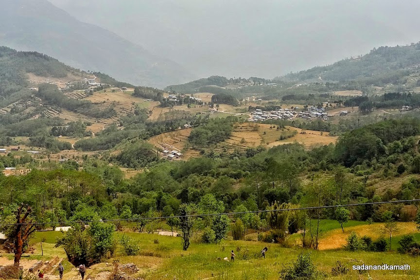
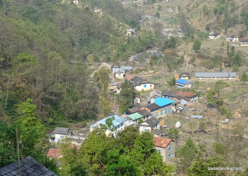
The bus started from the bus stand at 8.00 a.m. which was full. Being an express bus, it has few stops. Thus the usual scene of passengers travelling on the roof top of the buses was missing in our bus until we reached Jiri. The bus passed through Bhaktpur, Sanga, Dhulkhel (1570m), Panchkhal (915m), Dolaghat (715m), Medu (2520m), Charikot (1995m), Tamakosh (995m), Maina Pokhari (2005m) and Khawa (2565m). The road condition was fairly good. From Dhulkhel, we had the first glimpses of Manaslu range of mountains. At Mude we had a lunch break of 30 minutes.
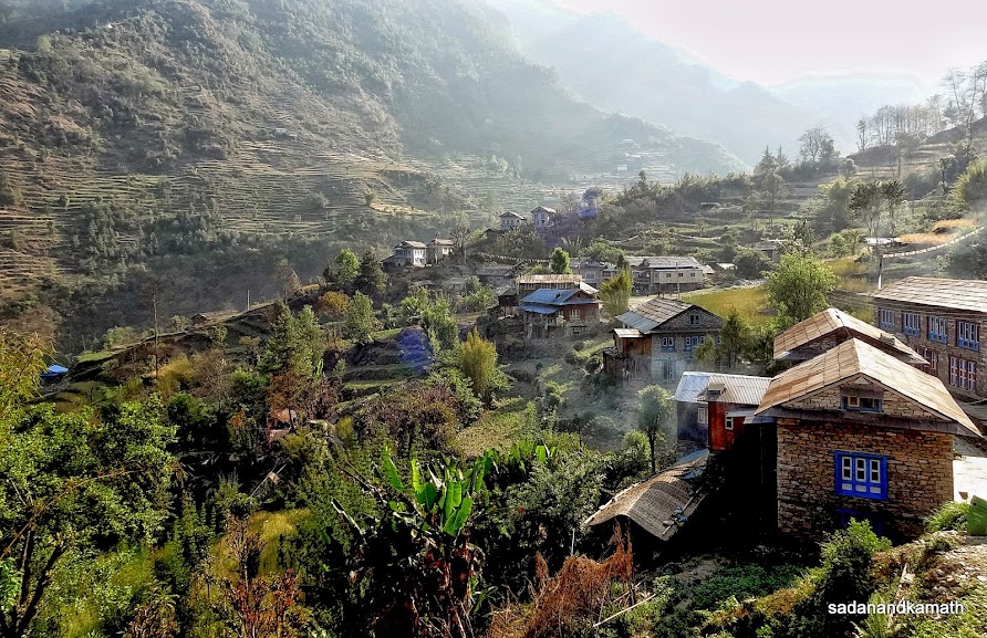
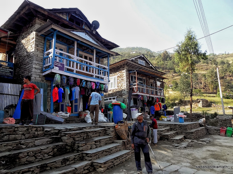
Just at the outskirt of Jiri, our TIMS cards with passport was checked and recorded in a register. We reached Jiri (1970m) at 4.30 p.m. Due to some Buddhist festival, almost all the lodges were full of tourists and monks. We got 3 bedded room in New Everest Lodge with common bathrooms and toilets. As was the case with all our subsequent stays, the room rent was nominal, ranging between NRs.100/- to NRs.150/- per bed with a condition that the guests will have to take lunch/dinner and breakfast in the restaurants of the lodges where they stayed.
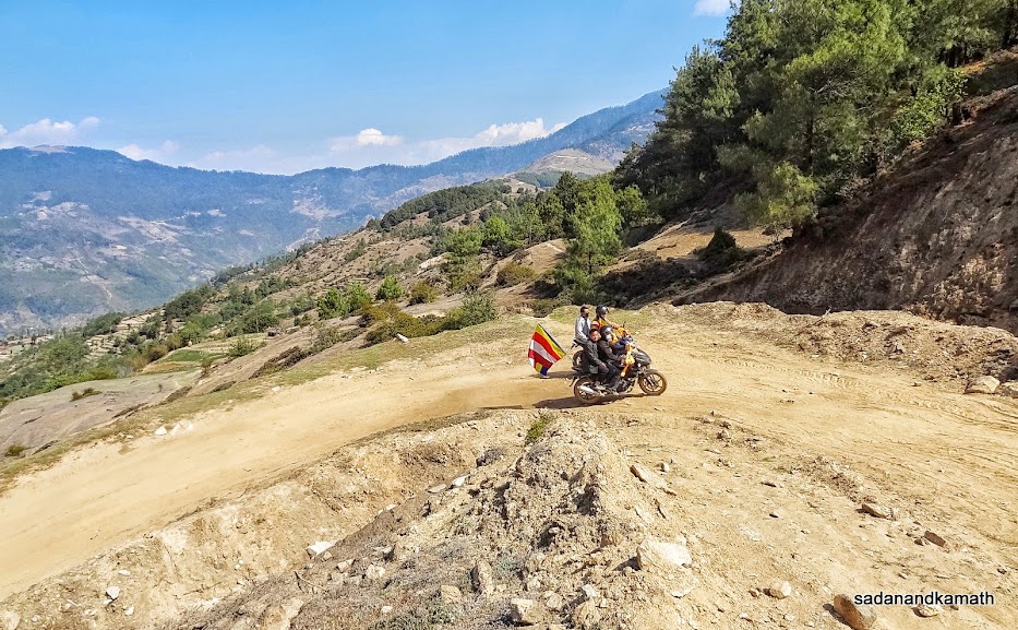
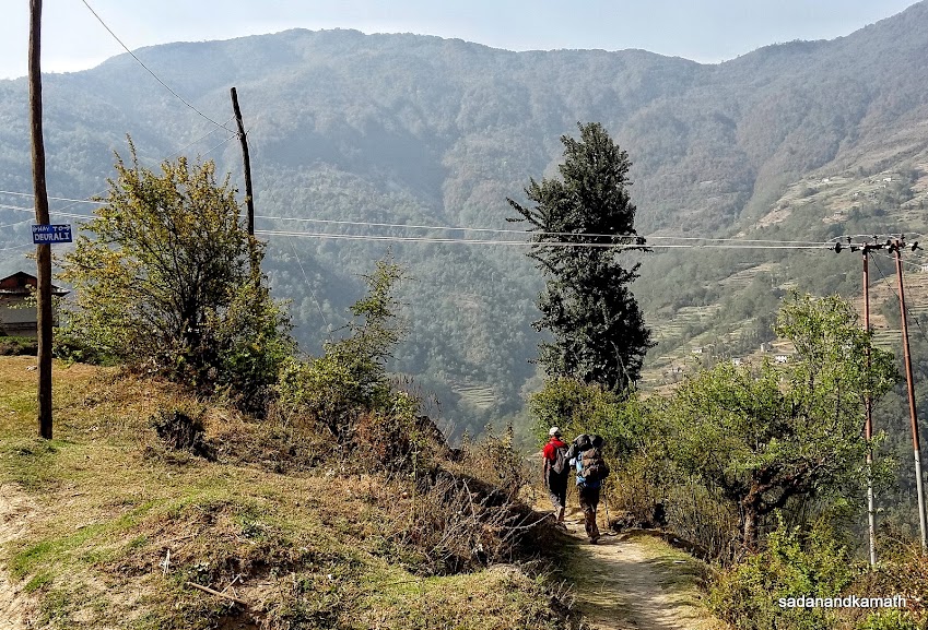
After evening tea, I and KS went for a stroll in Jiri Bazar which were full of local crowds and monks who had come here for a Buddhist festival. We found that the bus which had brought us to Jiri was still in the bus stand although more than one hour had passed since we got down from the bus. Now there were passengers travelling on the bus's roof including some foreign trekkers who were going to stay in Shivalaya. From Jiri the road to Shivalaya is dusty and muddy apart from jerky journey due to uneven surface of the mud road. That was the reason we avoided going by bus to Shivalaya. In fact, the buses go up to Deorali (below the pass) and some lorries go further up to Bhandar.
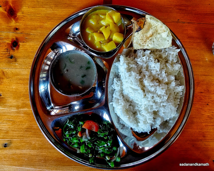
We had dinner in the lodge's restaurant and tested for the first time the Nepali dal-bhat-tarkari (rice-dal-vegetable) which was going to be our staple food either at lunch or dinner in the subsequents days. We retired to the bed at around 8.30 p.m.
Some pictures taken during the day are uploaded below:
The bus started from the bus stand at 8.00 a.m. which was full. Being an express bus, it has few stops. Thus the usual scene of passengers travelling on the roof top of the buses was missing in our bus until we reached Jiri. The bus passed through Bhaktpur, Sanga, Dhulkhel (1570m), Panchkhal (915m), Dolaghat (715m), Medu (2520m), Charikot (1995m), Tamakosh (995m), Maina Pokhari (2005m) and Khawa (2565m). The road condition was fairly good. From Dhulkhel, we had the first glimpses of Manaslu range of mountains. At Mude we had a lunch break of 30 minutes.
Just at the outskirt of Jiri, our TIMS cards with passport was checked and recorded in a register. We reached Jiri (1970m) at 4.30 p.m. Due to some Buddhist festival, almost all the lodges were full of tourists and monks. We got 3 bedded room in New Everest Lodge with common bathrooms and toilets. As was the case with all our subsequent stays, the room rent was nominal, ranging between NRs.100/- to NRs.150/- per bed with a condition that the guests will have to take lunch/dinner and breakfast in the restaurants of the lodges where they stayed.
After evening tea, I and KS went for a stroll in Jiri Bazar which were full of local crowds and monks who had come here for a Buddhist festival. We found that the bus which had brought us to Jiri was still in the bus stand although more than one hour had passed since we got down from the bus. Now there were passengers travelling on the bus's roof including some foreign trekkers who were going to stay in Shivalaya. From Jiri the road to Shivalaya is dusty and muddy apart from jerky journey due to uneven surface of the mud road. That was the reason we avoided going by bus to Shivalaya. In fact, the buses go up to Deorali (below the pass) and some lorries go further up to Bhandar.
We had dinner in the lodge's restaurant and tested for the first time the Nepali dal-bhat-tarkari (rice-dal-vegetable) which was going to be our staple food either at lunch or dinner in the subsequents days. We retired to the bed at around 8.30 p.m.
Some pictures taken during the day are uploaded below:
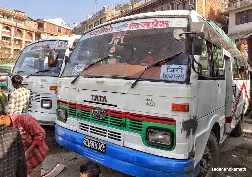 |
Our bus to Jiri-Shivalaya at Old Bus Stand, Kathmandu.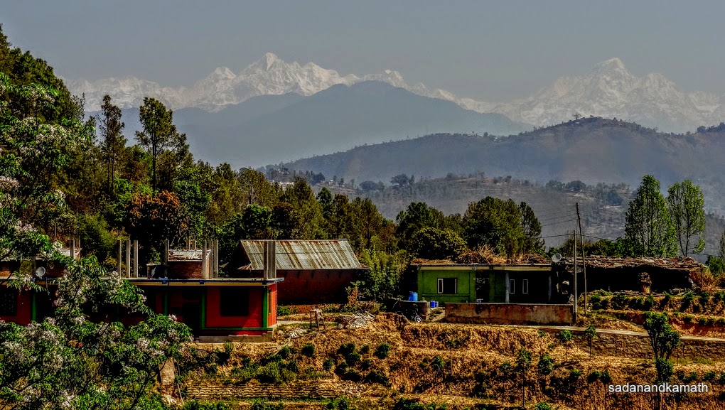 |
Snow clad peaks of Manaslu range of mountains seen from Jiri bus.
 |
Our lunch stop at Mude (2520m) on way to Jiri.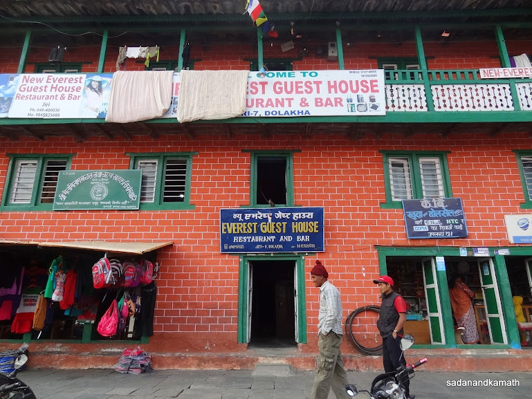 |
We stayed in New Everest Guest House in Jiri (1970m).
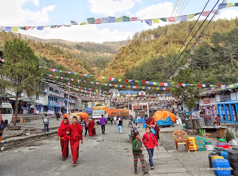 |
Jiri road scenes with Buddhist festival flags.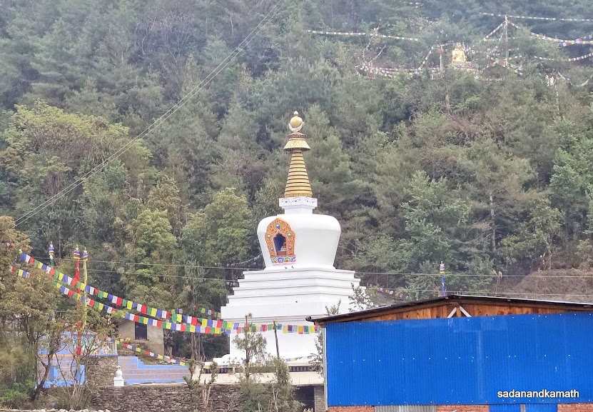 |
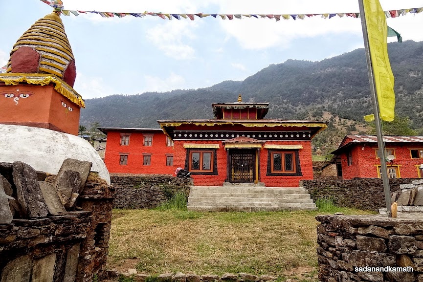
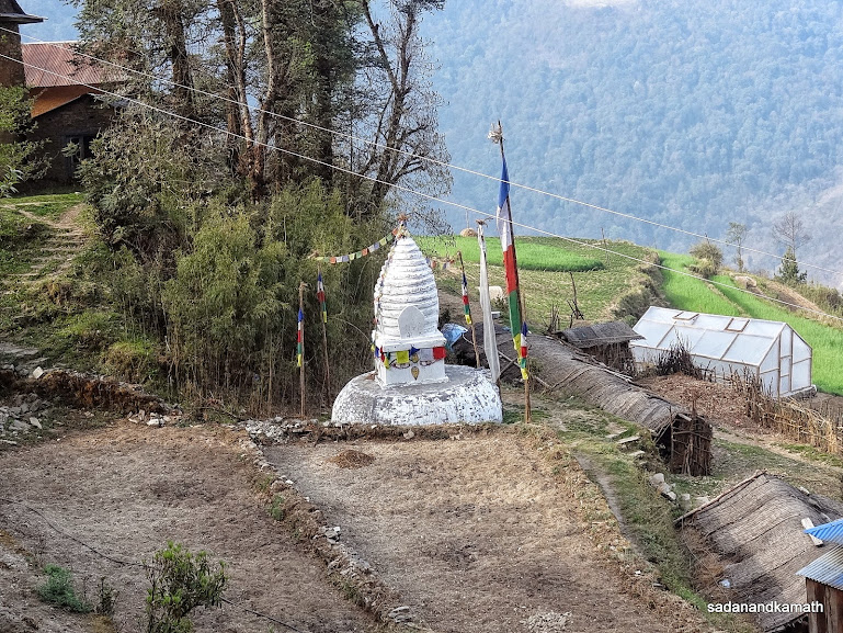
A chorten seen from our guest house in Jiri with golden Buddha statue in the background.
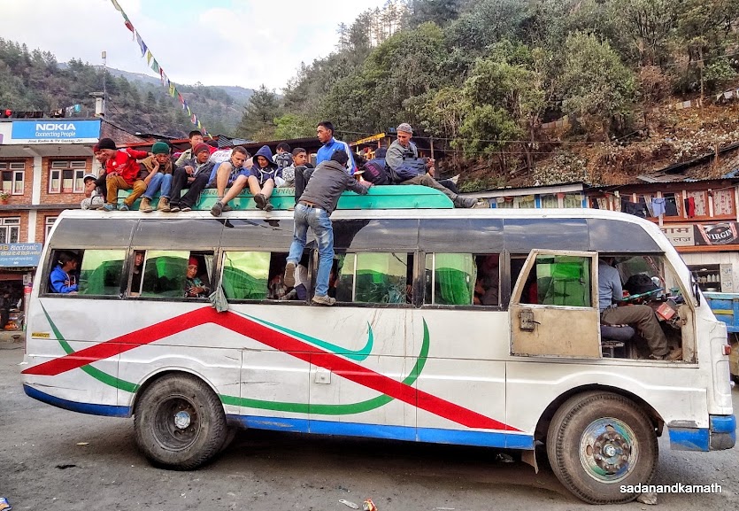 |
| The bus which brought us to Jiri has now passengers travelling on the roofs for going to Shivalaya.
April 16th : Jiri to Shivalaya Trek (10 kms) - 5 hours.
Jiri (1970m) - Mali Pass (2440m) -Shivalaya (1830m)
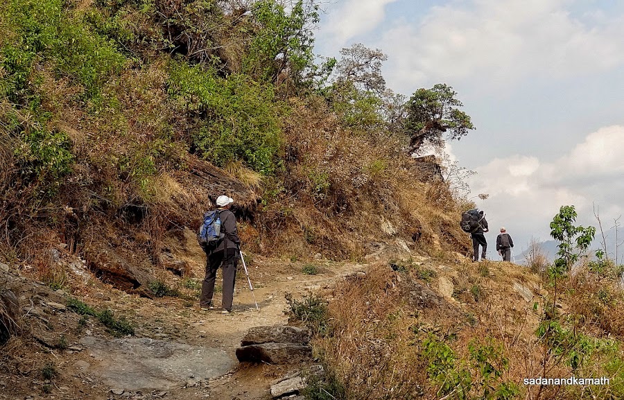
Having retired to bed at 8.30 p.m. on the previous day, we all got up around 4.30 a.m. and by 5.00 a.m. it was bright day outside. However, we could get our morning tea only at 6.00 a.m. After a breakfast of bread-toast and omelette, we commenced our first day of the trek around 7.30 a.m on a tar road near the Jiri bus stand. Thereafter it was more or less a level walk of about 1 km on a dirt road that goes to Shivalaya. However, we left the dirt road at this point and started climbing through the forest track, intermittently using the dirt road to Shivalaya.
The climb continued till Mali Pass (2440m) after which we took rest at a lodge for a lemon tea. From Mali, it was descends all the way to a suspension bridge over Khimti Khola (river). We reached Shivalaya at 12 noon. We stayed at Riverside Lodge, close to Khimti river and suspension bridge over it. The lodge is run by a family who had stayed for many years in Chamba (Himachal Pradesh). In fact, the owner's wife is from Chamba.
Having reached so early, we were in two mind whether to continue the trek to Deorali Pass (2740m) which was about 4 hours of climb. However, we decided against it as being the first day of the trek, it was not advisable to stretch the trek too far. Also climbing Deorali Pass in the morning was a better proposition than in the afternoon as we would be fresh in the morning. We had dal-bhat-tarkari for lunch.The lodge had free wi-fi and Internet facility which KS and PKD used in the afternoon. In the evening, we had a hot shower bath (NRs.150/-) followed by a round of walk towards Shivalaya Bazar. From the board, we came to know that Shivalaya was also used as a base for climbing Pike peak (trekking peak) and visiting cheese factory at Thodung. Some pictures of the day below: 
Looking back at Jiri as we climbed towards Mali Pass (2440m).
|
Taking a forest route to Mali Pass on way to Shivalaya instead of mud road on the right side (not in the picture).
We intermittently joined the road from the forest route (in the middle).
On the dirt road to Shivalaya.
We are on a rock by the side of the dirt road to Shivalaya.
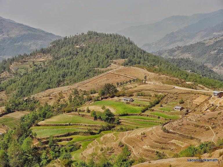
View of agricultural fields in the valley seen from the rock.
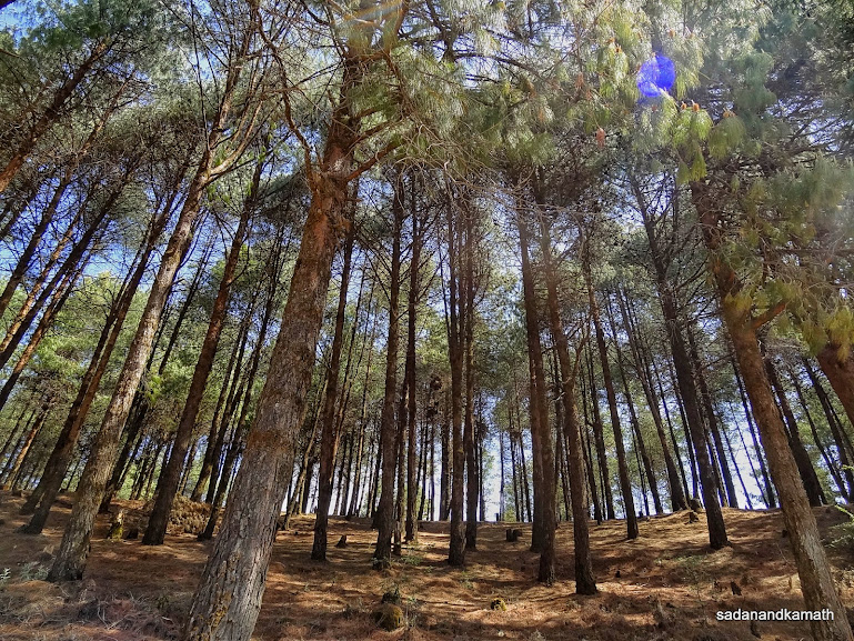
Forest of pine trees by the side of the dirt road to Shivalaya.
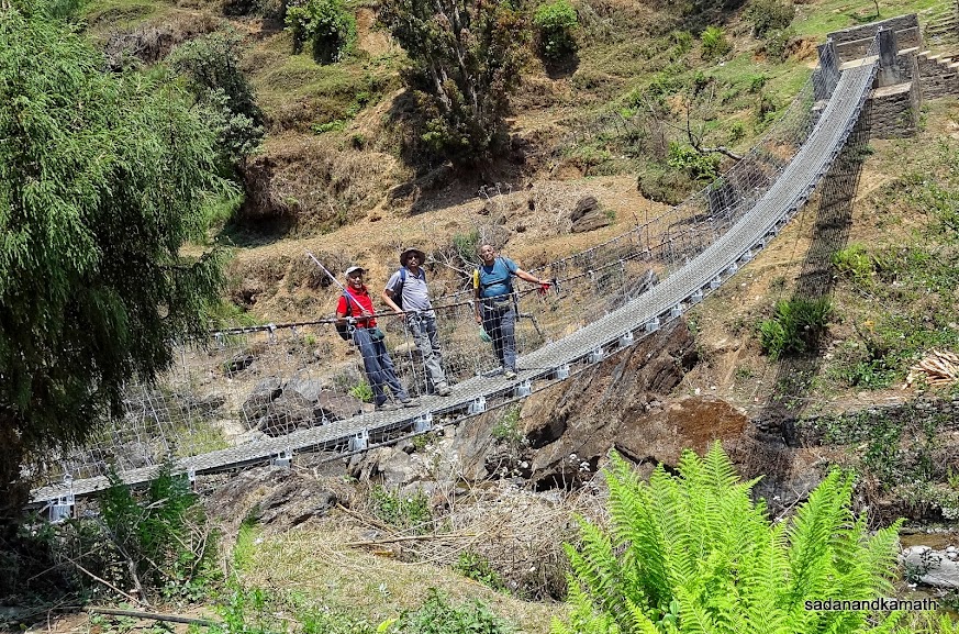
The first suspension bridge of our trek over Khimti Khola (river) as we are very close to Shivalaya.
April 17th : Shivalaya to Khinja (19 kms), 11.5 hours.
Shivalaya (1830m)-Deorali Pass (2740m)-Bhandar (2230m)-Khinja (1620m)
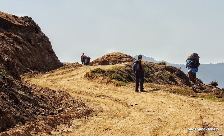
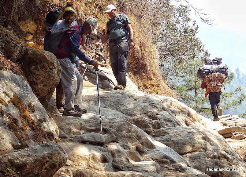
We had a discussion with our porters in the previous day as to whether we can attempt to go beyond Bhandar as was scheduled in our itinerary for the next day. This was necessary as, apart from our capability to trek more than intended, it was also necessary to judge the comfort levels of our porters who have been each carrying the load of about 25-30 kgs (15 kgs of ours and 10 to 15 kgs of each porter's personal baggage). While the porters had no problem in elongating the trekking hours, Shrikrishna, the senior porter among them suggested to take a decidsion of going beyond Bhandar after reaching that place. It was his fair suggestion as we being senior citizens, it was necessary to judge as to how our body would react after climbing about 900m to reach Deorali Pass and then descending 500m to Bhandar.
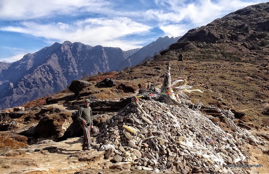
Keeping the possibility of trekking more kms today, we got up early in the morning and completed our breakfast by 6.00 a.m. We departed from Shivalaya at 6.30 a.m. for Deorali Pass, our first target of destination. Our gradual ascend to the pass started almost immediately after we left Shivalaya. Contrary to our presumption, the climb to Deorali Pass was not that difficult as the climb was gradual and also through forest cover. The view of a Mani wall, a chorten and prayer flags confirmed that we had reached the pass. Deorali pass was windy and cold. We could see a couple of whirlpool of dust floating in the air like tornadoes. It was 11.00 a.m. and the next destination of Bhandar would have taken another 2 hours to reach for lunch. So we ordered lunch at Lama Lodge on the pass. The lady in the lodge took about one hour to serve us the lunch of vegetable fried rice with topping of eggs. But the delay was more than compensated by the tasty fried rice.
We commenced the steep rock and stone mixed descends from Deorali Pass at around 12.45 p.m. From the pass, we could see clearly the Bhandar town well spread out in the valley. We reached Bhandar at 2.15 p.m. We sat on the parapet wall of a monastery for sometime to debate whether to trek further to Khinja or stay put in Bhandar. The unanimous decision was to reach Khinja and stay overnight there. Within 15 minutes of reaching Bhandar, we started for Khinja in the right earnest going by the fact that it was downhill of about 600m all the way to Khinja and we would be able to cover the distance before 6.00 p.m.
Our assessment went wrong for two main reasons. First, the route to Khinja from Bhandar was not all down hill as presumed by us. There were some patches where we had to climb. Second, we forgot to take into account the fact that after trekking for about 7 hours up to Bhandar, our walking speed would come down due to tiredness, resulting in more rest stops. In the event, we reached the foot of the valley around 6.30 p.m. when the sun light had almost disappeared. Rest of about 2 kms of trek, though more or less on the straight path, had to be covered in the dark using our torches and head lamps. Just as we thought that we had reached Khinja, the place turned out to be the check post at the outskirt of Khinja for checking TIMS cards and passports for recording entries in the register. We reached Khinja at 7.30 p.m. Adding to our woes was the power outage in the Khinja village. We stayed in Everest Guest House and had dinner at 9.00 p.m. After a steep descends from Deorali Pass, my both toes were paining due to extra pressure on them. But the good news was that the next day's trek to Sete was short involving mostly the climb which meant that my toes would not be affected.
Some pictures taken during the day below :
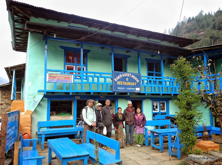 |
We with the owners of River Guest House in Shivalaya. |
View of Shivalaya as we trekked towards Deorali Pass.
Trekking towards Deorali Pass.
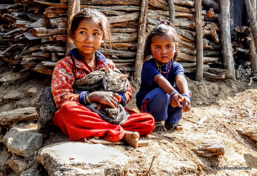
Cute girls with a cut cat in her lap somewhere between Shivalaya and Deorali Pass.
We have to climb the ridge seen in the background with mobile towers to reach Deorali Pass (2740m).

This Sherpa girl was standing on the door of her house where we were resting when I clicked this picture - on way to Deorali Pass.
We took lunch at Lama Lodge in Deorali Pass.
View of Bhandar as we descend from Deorali Pass.
A monastery in Bhandar.
Way to Khinja.
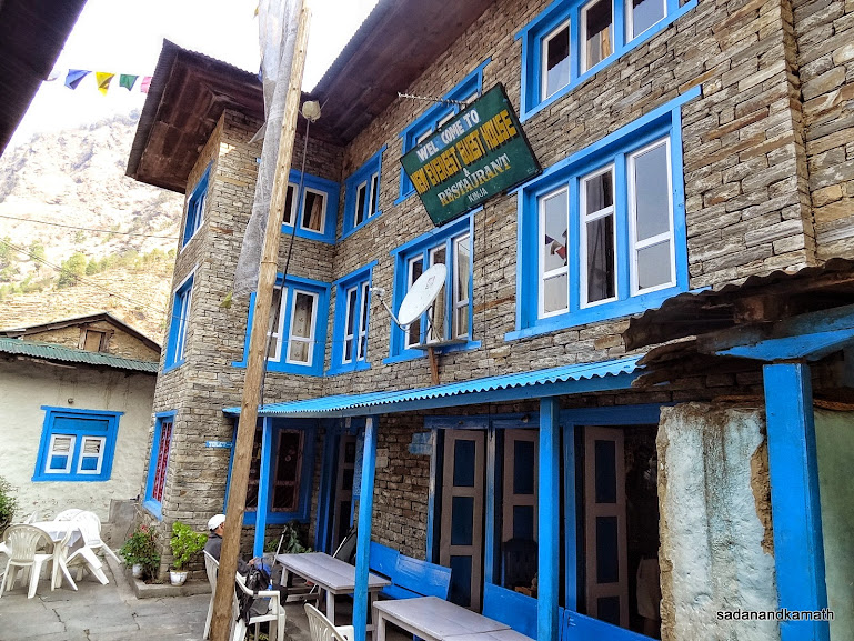
New Everest Guest House, Khinja where we stayed.
April 18th : Khinja to Sete (7 kms), 4 hours
Khinja (1620m)-Sete (2560m)
After a gruelling trek of about 19 kms on the previous day, we took it easy today to do the trek up to Sete to have some rest in the afternoon for energising ourselves for climbing one more pass, the Lamjura Pass (3540m) the next day. We got up at 6.00 a.m to a bright morning. After the breakfast of porridge and boiled eggs, we left Khinja at 8.00 a.m. for Sete.
Though initially, the climb was a bit steep. After about halfway, the climb became gradual. The pleasant weather and the forest cover made the climb less tiring. We reached Sete at 12 noon and checked in the first lodge, Sunrise Lodge and Restaurant at the beginning of the village. After lunch at their restaurant, we rested for the full afternoon until we went to restaurant at around 5.00 p.m. to have tea. The evening was cold outside but was bearable in the restaurant. We had dinner at 8.00 p.m. and retired for the day at around 8.30 p.m.
A few pictures of the day below:
View of Khinja as we climb towards Sete.
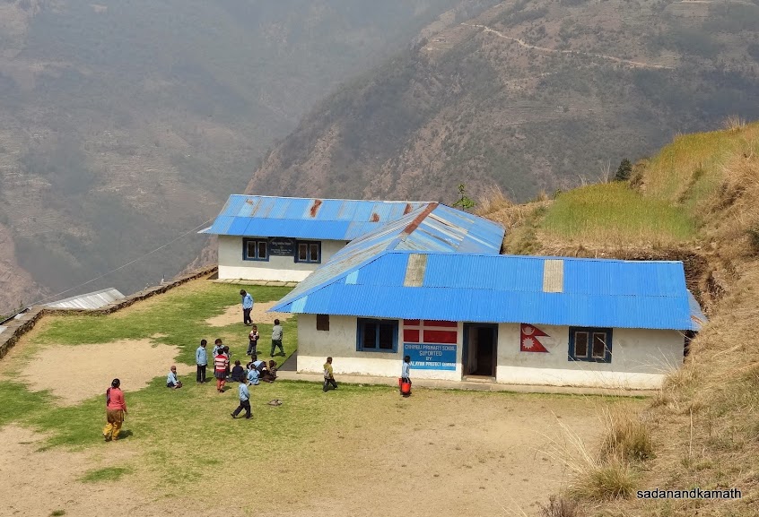
A primary school on the way to Sete.
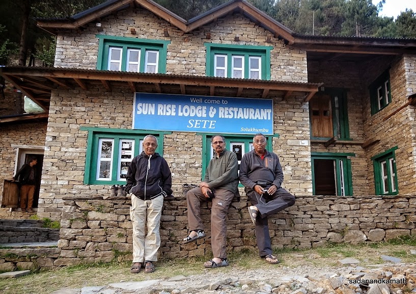
We stayed in this lodge at Sete.
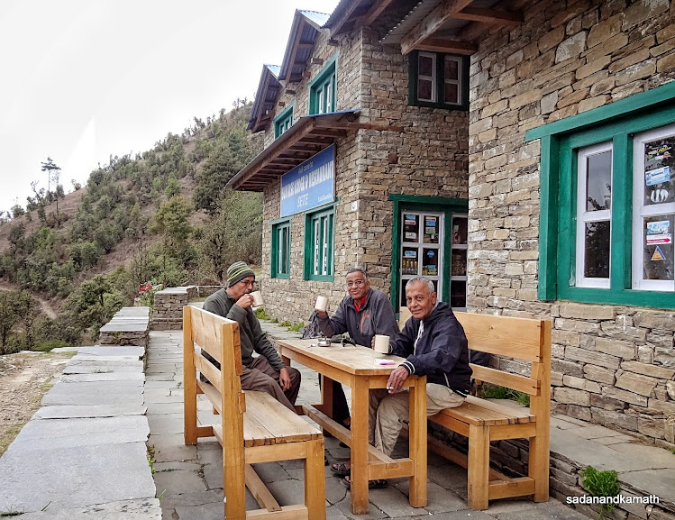
Evening tea time at Sete.
April 19th : Sete to Lamjura (8 kms), 5 hours.
Sete (2560m)-Lamjura (3420m)
In our first itinerary, I had planned for Sete to Junbesi trek via Lamjura Pass in a single day as is usually done by most of the trekkers. Having done this trek in October 2007, KS felt that doing Sete-Junbesi in one day may be too tiring for our age group which involves a climb of about 1000m to Lamjura Pass (3540m) and descend of about 1000m to Junbesi (2560m). So we made this stretch to be covered into two days - Sete to Lamjura (below Lamjura Pass) and Lamjura to Junbesi.
We woke up to a bright sunshine at 6.00 a.m. After breakfast of porridge with apple and boiled eggs, we left Sete at 7.45 a.m. for about 850m of continuous climb to Lamjura. After some initial steep climbs, the ascend became gradual alternating with some short spells of straight walks. We were lucky that the weather was pleasant and most of the trek route was through forest mostly of rhododendron trees. As we gained altitude over 3000m, the big rhododendron trees gave space to dwarf rhododendron and some birch trees made appearances. The colour of rhododendron flowers turned from red to light pink and white. The last 2 kms of trek to Lamjura was more or less on a straight path. We reached Lamjura at 1.00 p.m. We stayed in Numbur View Lodge which was of an average type compared with other lodges we stayed so far in the trek.
We had a traditional Nepali dal-bhat-tarkari lunch at around 3.00 p.m. Being at high altitude, the weather had already become chilly. The outside temperature in the afternoon was 16C. We spent most of our time in the kitchen of the restaurant sitting near the fire place until dinner which we had at 8.00 p.m. Incidentally, today would be the first time during the last 4 days when we would be spending the night at an altitude above 3000m, to be precise, at 3420m - the same altitude as that of Namche Bazar. It was also the first time that both KS and PKD used their down jackets.
Fortunately, despite a gain of nearly 850m in altitude, none of us had any altitude related problem. The only problem was that the toilet was located about 100m from the lodge and one would shudder to think of going to toilet in the middle of the cold night.
Some pictures taken during the day are uploaded below:
A chorten on the way to Lamjura.
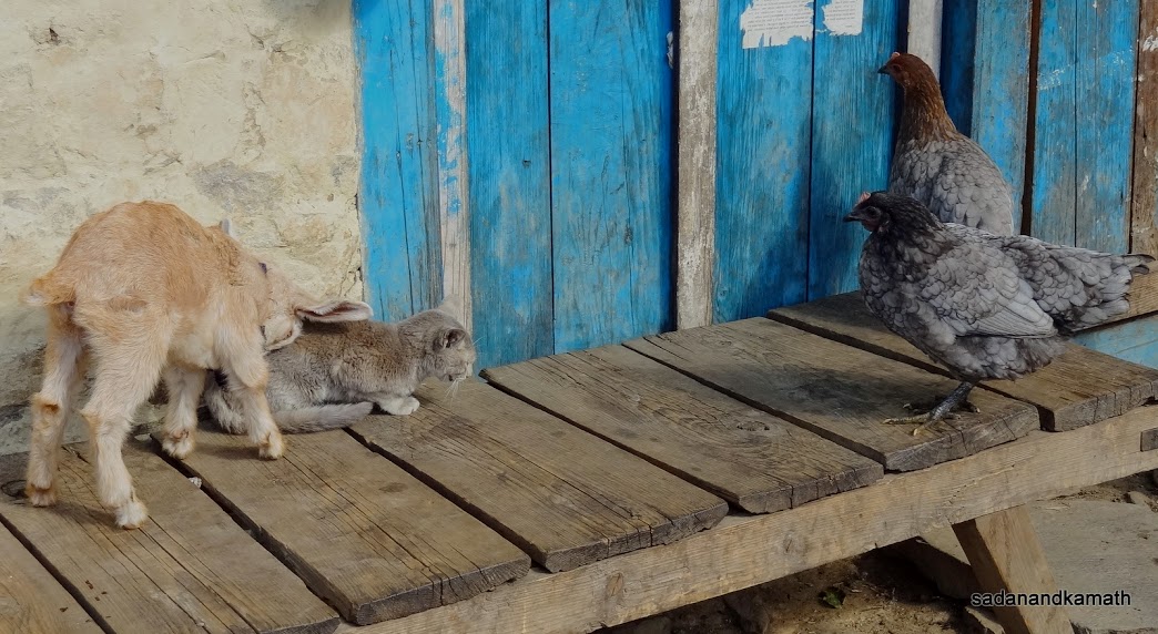
A goat kid tries to hit the cat with his head to move him from the bench but cat would not budge. This tussle went on for more than 5 minutes when we were resting in a small hamlet on our way to Lamjura. Two hens on the right seem to be enjoying the tussle.
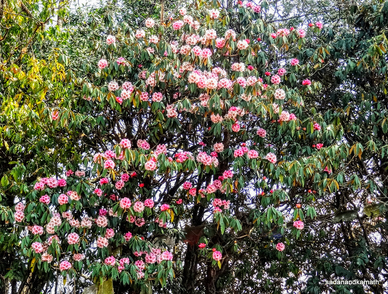
A rhododendron tree full of blooming flowers on way to Lamjura.
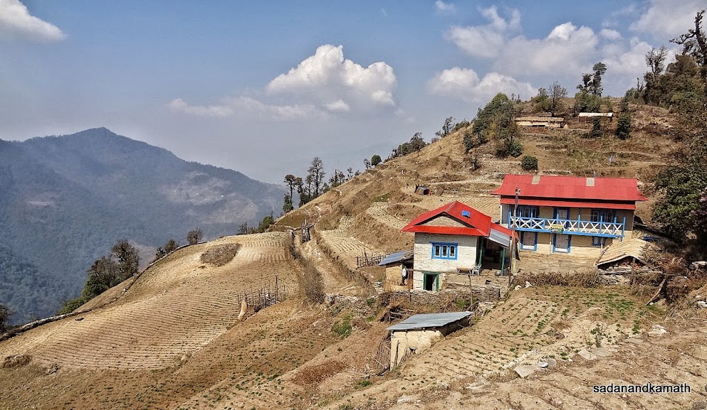
A beautiful house, probably a lodge on way to Lamjura.
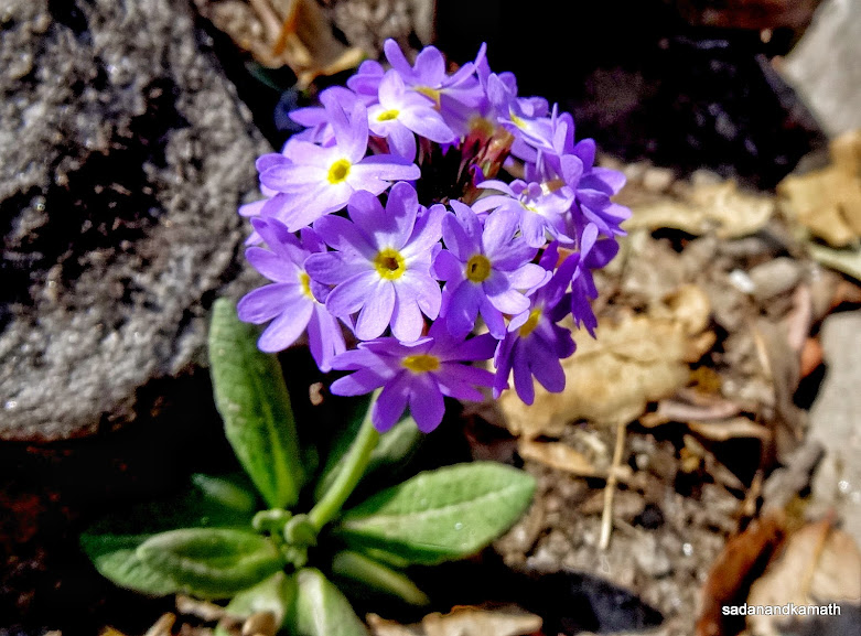
A bunch of wild flowers probably primulas which was a common sight on most of the trek route up to Namche Bazar.
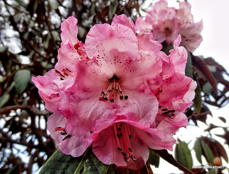
A macro shot of fully bloomed rhododendron flower.
We stayed in Number View Lodge, probably the only lodge at Lamjura.
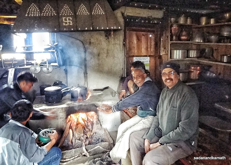
Warming up in the kitchen of Numbur View Lodge.
April 20th : Lamjura to Junbesi ( 8 kms), 5 hours.
Lamjura (3420m)-Lamjura Pass (3540m)-Junbesi (2670m)
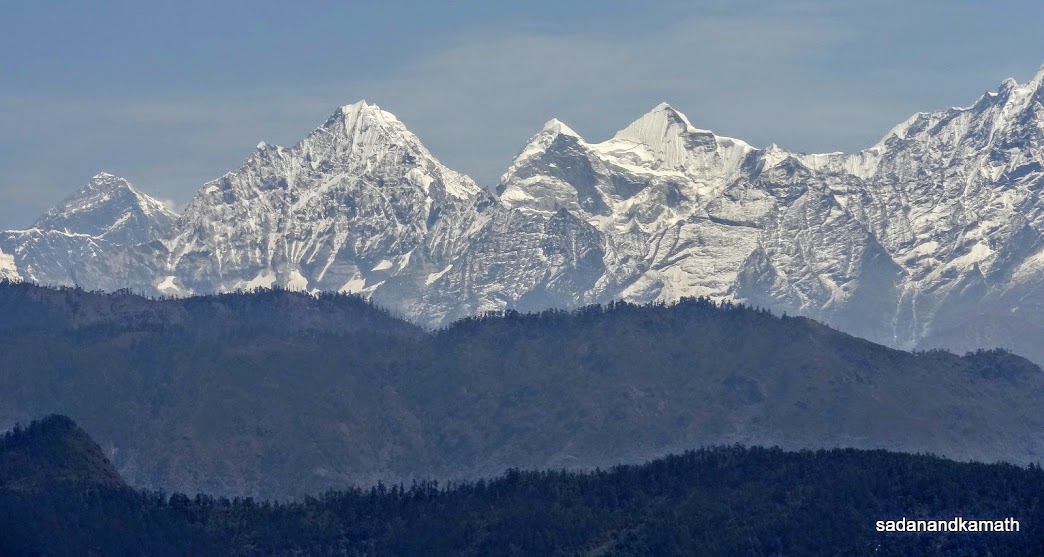
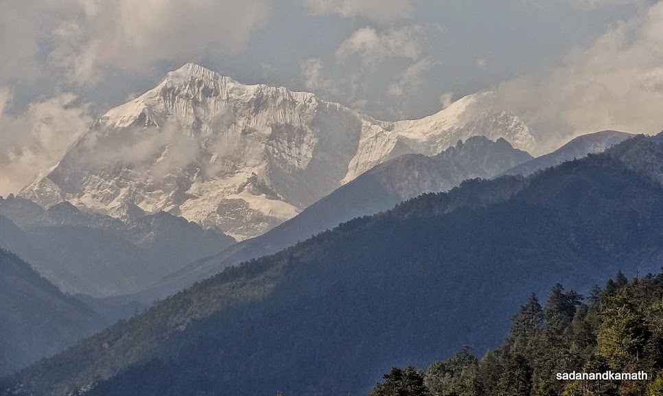
We got up around 5.00 a.m. KS came out of the room to go to restaurant's kitchen to warm up and in the process saw Numbur peak from the balcony of our lodge in a cloudless blue sky. We all came out of the room and I clicked the first shot of the snow capped peak during the last 4 days of trek.
In the previous night after the dinner, we had requested the lodge owner to give us a big flask of hot water so that instead of ice cold water, we can have to hot water in the night. The water in the flask was still warm and we used warm water for brushing the teeth and freshining up. After completing our breakfast of porridge and boiled eggs, we commenced our trek to Junebesi at around 7.30 a.m. We reached Lamjura Pass (3540m) in 45 minutes. As usual, all the passes and ridges in Sherpa region would have prayer flags and cairns and this pass was not an exception. In fact, from this pass, the Sherpa region starts and now onwards, we would be passing through the Sherpa villages with Mani walls, chortens and prayer flags. Surprsingly, Number peak which we saw in Lamjura was not visible over Lamjura Pass eventhough the latter was higher in altitude by about 100m.
From Lamjura Pass, it was a steep descends on loose rocks and stones until about 2 kms before Junebesi. The last patch of trek was more or less on a straight path. We reached Junbesi at 12.30 p.m. and stayed in Apple Garden Guest House. After three days, we got mobile signals and talked to our families who were a bit worried by the news of the death of 13 Sherpas due to avalanche which hit them between Everest Base Camp and Camp No.2. We had got this news from our porters on the same day thanks to their networking with other porters on the route to EBC and we felt that this news would bother our families and friends though we were quite away from the scene of the tragedy.
My trekking shoes which were quite sturdy when I started the trek on April 16th from Jiri, suddenly started loosening from the bottom. Probably, the steep climbs and descends on loose rocks and stones were too much for my shoes to remain sturdy. Luckily, KS had spare trekking shoes of the same size and the same make and I had used them in todays's trek. But his shoes also started cracking up from the bottom. So it was a emergency situation as the only place where I can buy a new pair of trekking shoes was Namche Bazar which was still 4 days away. Fortunately, Shrikrishna, our porter found a multi-purpose shop in Junbesi and I could get North Face Shoes (made in Vietnam) for NRs.2700/- (INR.1700/-). The shoes did not have ankle support but I thought that this would work at least till I reach Namche Bazar. Surprisingly, not only I felt more comfortable in my new shoes, I also found it to be quite sturdy. With the same shoes, I continued my trek up to Lobuche and back.
We had a lunch of Dal-Bhat-Tarkari and also Momos for a change. From now onwards, I started taking Garlic soup before lunch/dinner in all the subsequent days of the trek until I reached Lobuche.
Junbesi is a big village and I and KS felt like spending one extra day here not for acclimatisation but just to have a feel of the village. There are two monsatries in teh vicinity of the village of which one we could see while we were close to reaching Junbesi. Other advantage for this village is that one can get supplies from Salleri on jeeps which are parked across the village about 2 kms of distance. We saw one jeep already parked and the porters were bringing the supplies of rice bags and other provisions from the dirt road end to Junbesi.
Some pictures of the day below:
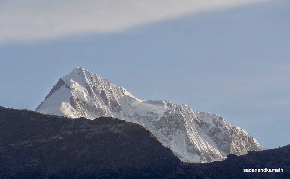 |
Numbur peak (6957m) seen from Lamjura.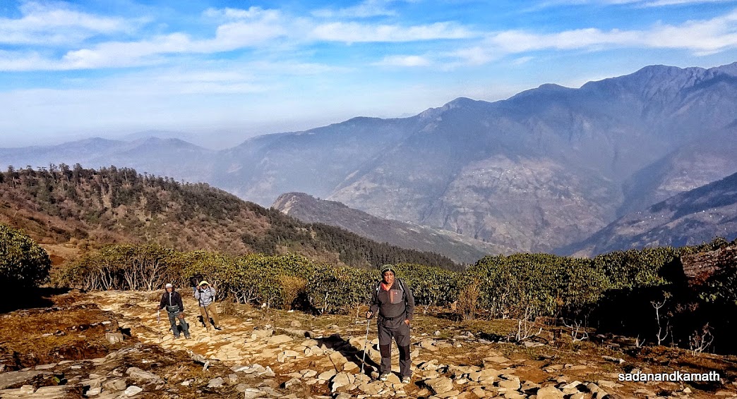 |
On way to Lamjura Pass (3540m). Note the shrinking size of Rhodendron trees in the background as we gain altitude.
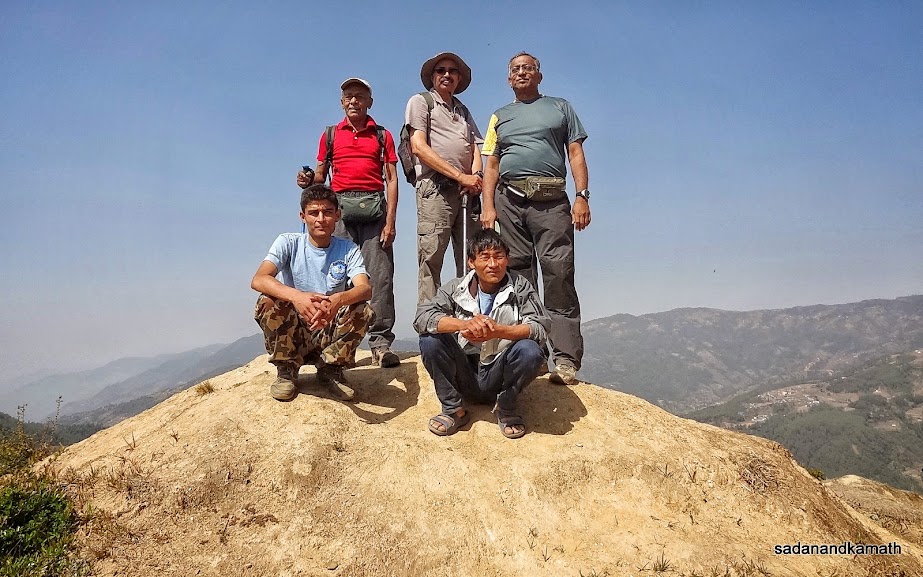
Me at Lamjura Pass (3540m).
After a few minutes, PKD and Shrikrishna appear on Lamjura Pass (3540m).
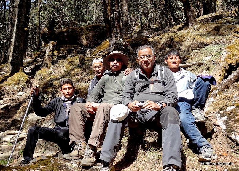
Rohit, PKD, me, KS and Ram Rai at Lamjura Pass (3540m).
Junbesi (2670m) seen from half way from Lamjura Pass (3540m).
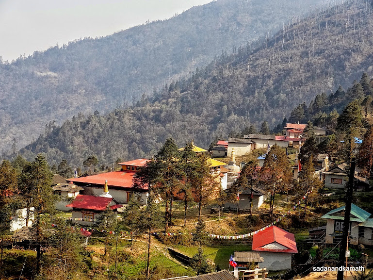
Serlo Monstery with a chorten at its gate as we trek on a lower trail to Junbesi.

We stayed in Apple Garden Guest House in Junbesi.
One of many lodges in Junbesi with Numbur peak (6957m) in the background.
April 21st : Junebesi to Nuntala (15kms), 9-1/2 hours.
Junebesi (2670m)-Purthiang (2900m)-Ringmu (2670m)-Taksindu Pass (3080m)-Nuntala (2210m)
We woke up around 5.30 a.m. Since our porter had kept in our room a flask of hot water and tea bags in the night itself, we prepared our morning tea in the room instead of going down to restaurant. After completing our breakfast of now familiar Porridge with boiled eggs, we departed Junbesi for Nuntala which would be our second longest trek of the day in terms of kms covered and the number of hours.
We were given to understand that one should be lucky enough to get the first glimpse of Mt. Everest from Purthiang (2900m) as most of the time, being at a higher altitude, this part of the trek remains cloudy most of the time. Many trekkers are not even aware that Mt. Everest can be seen from Purthiang probably due to this reason. So we were keeping our finger crossed as we were trekking on a gradual climb towards Purthiang. The surprsing part of the climb to Purthaing was that we did not even notice that the whole series of Everest group of peaks were visible from here when we put our last step to reach Purthiang top. For one has to walk further 15-20 steps to get a real feel of the panorama of snow clad peaks. A further suspense to this panorama was that Mt. Everest was not visible unless one came close to the parapet wall of the northern side of Purthiang top to see its top portion.
We were really fortunate to get to see the panorama of Everest Group of peaks in a clear sky without any haze. The peaks seen from here from left to right were Mt. Everest, Thamserku, Khangtega, Kusum Kangaru, Mera, Makalu among others. As we descended from Purthiang towards Ringmu, one would have thought that the peaks would slowly go out of our views. But it was not. From Purthiang upto the second chorten, the visibility of Mt. Everest was better than from Purthiang. We all were very happy to get the excellent peak views. Shrikrishna, our senior porter who has come here for the third time said that he has never seen peak views from Purthiang in his last two outings as the weather was cloudy. KS also revealed that he did not get any peak views at Purthiang during his EBC trek in September-October 2007.
From Purthiang, it was a mix of a gradual descend, staight walk and then descend upto a suspension bridge (about 2500m) over Ringmu Khola (river) after which a steep climb of about 200m took us to a first lodge of Ringmu (2710m) for a lunch break. We had a dal-bhat-tarkari lunch here and rested for a while before proceeding to Taksindu Pass (3080m).
Post lunch, it is a difficult proposition to trek on a climbing track. Now we had to attempt crossing Taksindu Pass (3080m). Due to post lunch lethargy, it took about an hour to reach Taksindu Pass though the chorten visible on the top of the pass always gave us an impression that we would reach the pass any time. Just before the pass, we passed through a ruin of Buddhist monastry. It was a warm day and not even the cool breeze of Taksindu Pass could cool down my body temperature.
After reaching Taksindu Pass, one would get elated that now it is all descends to Nuntala. But a steep descend to 800m that too on path full of loose stones and rocks that too after trekking for nearly 7 hours was not a cake walk. Although after passing through the Taksindu gate, we could see Nuntala and it looked very close as the crow flies. But due to zig zag trail, it took us more than 2 hours to reach Nuntala at 6.00 p.m. We checked into Shangrilla Lodge and had Lemon tea to overcome weariness. But a sunset view of Tahmserku and Kangtega peaks from the compound of the lodge made me to rush to pick my camera for a shot.
There was a large group of foreign trekkers, mainly Israelis who were staying in the lodge. So far we had lodges all to ourselves. But this was the first time that we met so many trekkers and the restaurant was lively with their presenace. But this also put some pressure on kitchen staff to serve food on time. In a way, we got the taste of what to expect when we would reach beyond Lukla when a lot of trekking crowds would join on the way.
Some pictures of the day below:
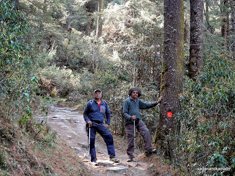 |
One would often come across the red mark either on tree or a rock to indicate the direction of the trek. This was one of those mark on our way to Purthiang.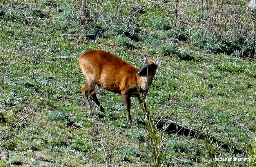 |
A musk deer was seen on a meadow on way to Purthiang.
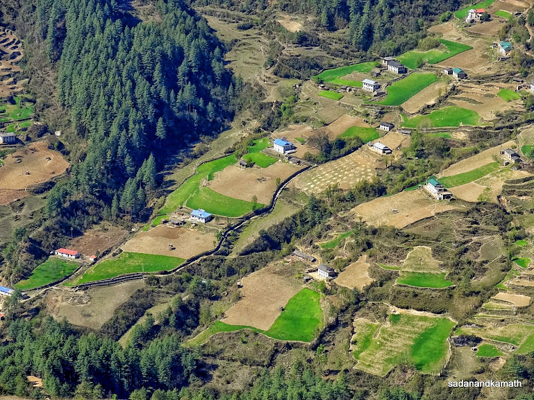
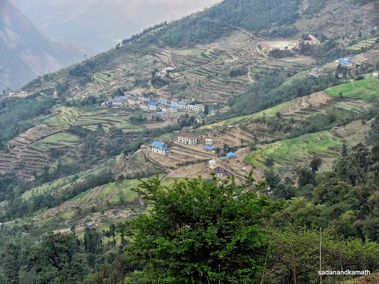
A valley with agricultural fields on way to Purthiang.
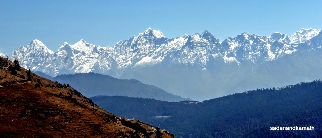
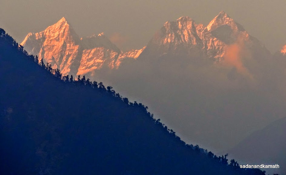
A panorama of Everest group of peaks seen from Purthiang (2900m). Mt. Everest (extreme left , top portion), Thamserku, Kangtega, Kusum Kangru, Mera, and Makalu peaks are visible.
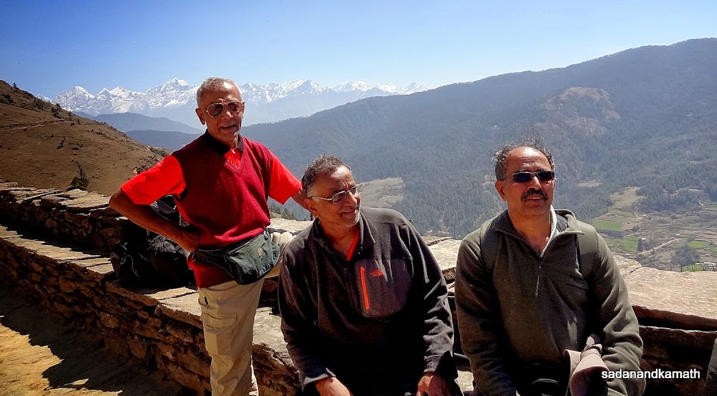
PKD, KS and me with the background of Everest group of peaks at Purthiang.
A zoomed shot of Mt. Everest (left) and Thamsekru peaks from Purthiang.
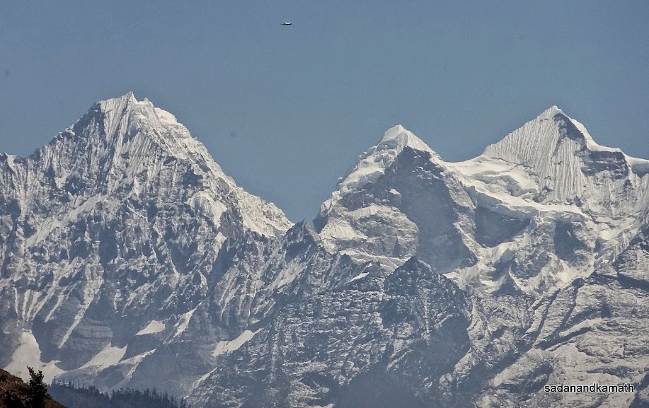
A zoomed shot of Thamsekru (6623m) and Kangtega (6782m) from Purthiang.
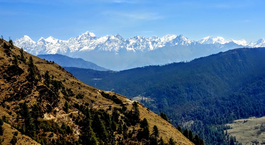
A wide angle view of Everest Group of peaks as we walked towards Ringmu from Purthiang.
Mt. Everest (left) is now visible more prominently as we trekked towards Ringmu. Other two peaks are Thamserku and Kangtega.
Ringmu valley seen somewhere between Purthiang and Ringmu.
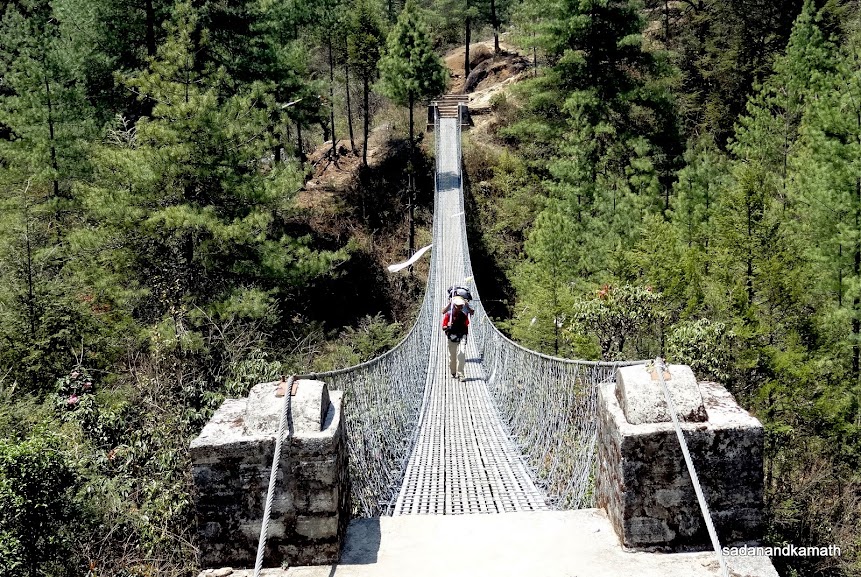
Suspension bridge over Ringmu Khola (river) after which it is a climb to rich Ringmu village.
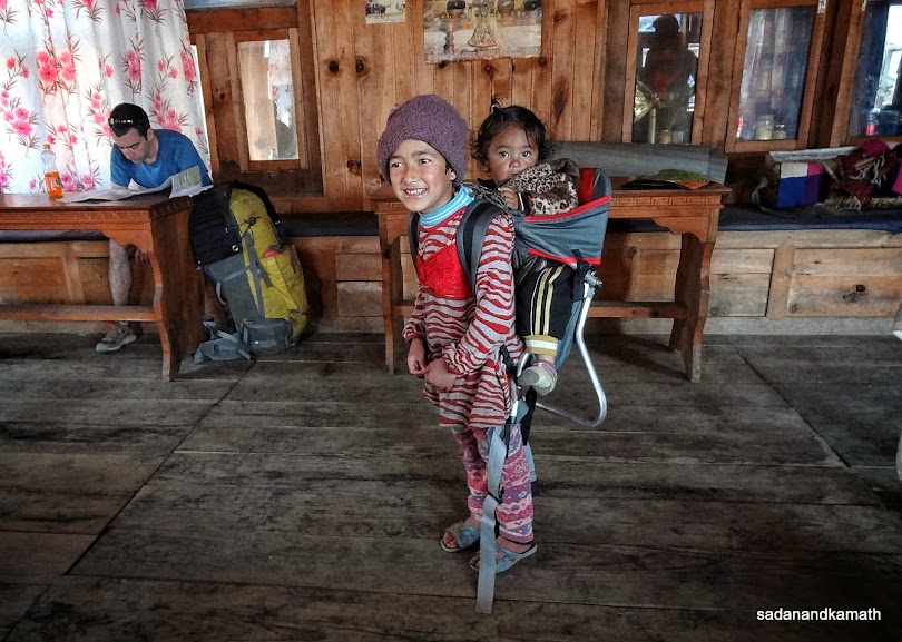
A Sherpa boy is carrying his kid sister on his back. In a way, they are tought from the young age to carry load.
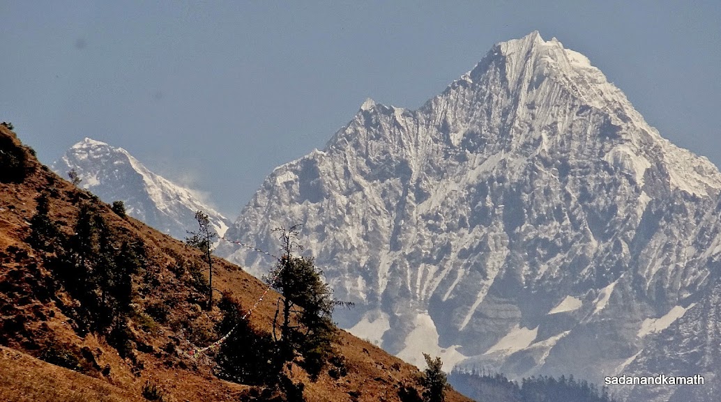
Numbur peak (6957m) seen from Taksindu Pass.
Taksindu monastery just below Taksindu Pass towards Nuntala.
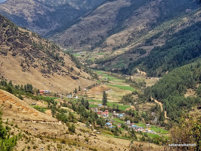
Nuntala village (2210m) seen from Taksindu (2940m).
Sunset view of peaks from Nuntala.
April 22nd : Nuntala to Khari Khola (8 kms), 5 hours.
Nuntala (2210m)- Suspension Bridge over Khari Khola river (1500m)-Khari Khola (2080m)
Since three bedded room was not available in Shangrila Lodge, I was given an independed one bedded room. In all these days, it was either PKD or KS who would lead in getting up early in the morning. I was not sure as to what time I would wake up. But surprisingly, I woke up at 5.30 a.m. without alarm clock. But more surprise was on store. KS was already having his morning tea in the restaurant and he had already ordered tea for me as well assuming that I would get up early. One of the minor problems in lodges on EBC trek route which I noted was that it was difficult to get morning tea before 6.00 a.m.
We had our breakfast at 7.00 a.m. but it took another 45 minutes to actually depart from Nuntala for Khari Khola. Today we had to trek only 8 kms and we thought that we would be able to reach Khari Khola by noon and have lunch in the lodge instead of having on the way. Sometime a mere point to point altitude can mislead the trekkers and this happened with us today. We thought that we had to climb about 400m over 8 kms of trek which was not a difficult proposition. But in Dudh Koshi village, reading the altitude on my wrist watch, I realised that we have acutally descended as much as 700m to Dudh Koshi and after crossing the suspension bridge, we will have to climb another 600m to reach our destination, Khari Khola. In other words, it is going to be one of the tougher days of the trek!
Generally, porters will give some idea of the trek of the day by broadly saying that after a some descend, there would be a climb to reach Khari Khola. But as I came to know from them later, porters would always downplay the climbs and descends as according to them, most of the trekkers would be psychologically down if they reveal the actual toughness of the trek route of the day.
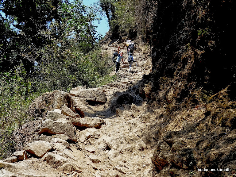
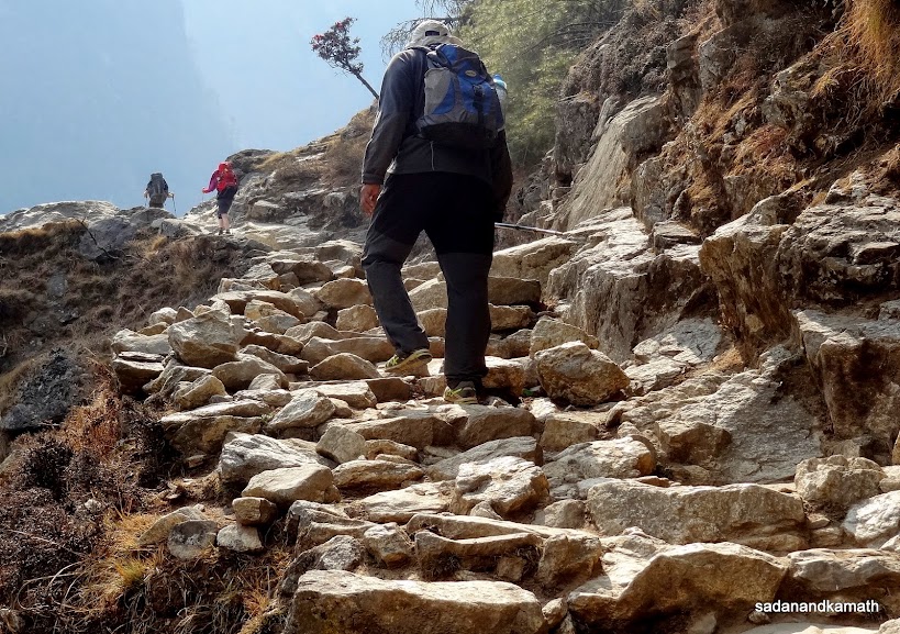
This trek route was one of the worst of Jiri-Namche Bazar section of the trek as almost the climbs and descends were not only steep but also full of loose stones and rocks with loose soil. I was just visualising what would happen if it was to rain as it would be a nighmare to trek on a slushy path with rocks and stones becoming slippery. I was happy that we would not be on this trek route as we were returning from Lukla. But as it happened, we were to use this same trek route on our return to Phaplu/Sallery and the rains in the previous 2-3 days had made the route not only slushy but also slippery requiring a lot of careful walking.
This was also the route on which we found a lot of mule traffic coming as far off places like Salleri bringing with them the loads of rice, sugar and lentils, LPG cylinders, kerosene and other provisions. Since mules have got 'first right of way' on the trek routes, trekkers had to wait for mules to pass before resuming the trekking. Some of the 'mule trains' are as long as 50 mules. While the trekkers would generally wait at the cliff side of the mountain give the way to mules, the loose soils create a lot of dusts apart from filling the trek route with their droppings. The mule traffic is going to trouble us until Namche Bazar after which Yak traffic will take over until Gorakshep.
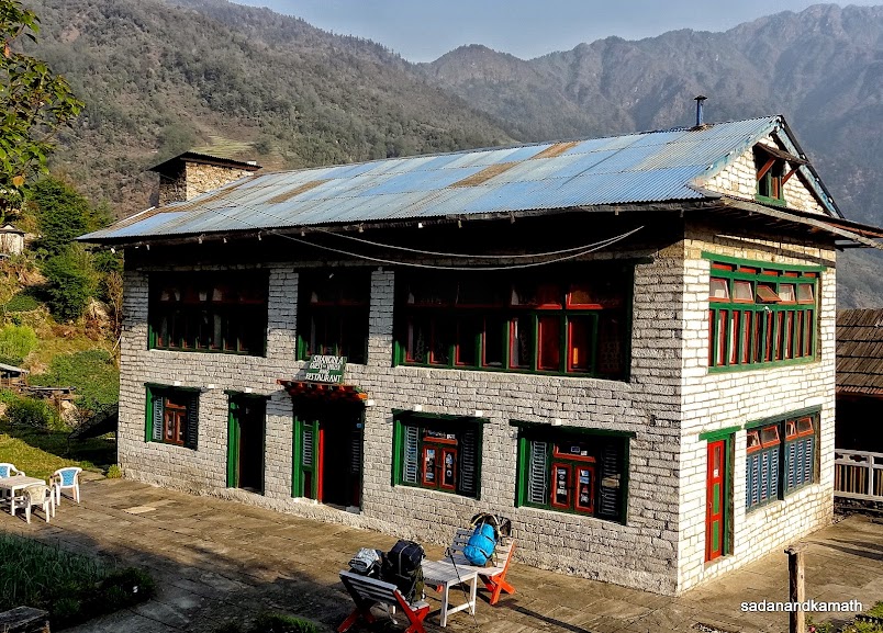
The warm weather further accentuated the problems requiring a refuelling of drinking water quite often. Even the last two kms of climb was so steep that we had no desired to go beyond the first lodge of Khari Khola we came across - The Hill Top Guest House, though Khari Khola village was down further 1 km. In a way, it was a good decision to stay in Hill Top Guest House as it was located on a ridge giving an excellent view of both sides of the deep valleys.
After checking in, we immediately ordered for lunch of dal-bhat-tarkari which would take about one hour to serve. Since it was warm day, we decided to wash some of our cloths until the lunch was ready. The cloth dried up quickly as apart from a strong sun, being on the ridge, it was windy. A Buddhist monastery was located adjunct to our lodge and I was in in two minds to visit the monastery. But after a steep climbing of 600m during the trek, climbing about 100 stairs to reach the monastry deterred me to visit.
I had an early dinner of garlic soup and scrambled eggs at 7.30 p.m. but retired for the day late at 10.00 p.m after completing my daily journal of treks of the last two days.
Few pictures of the day below:
 |
The morning view of Shangrila Lodge, Nuntala where we stayed.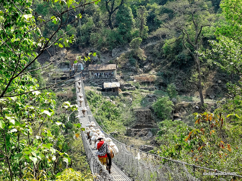 |
Mules crossing suspension bridge over Khari Khola river.
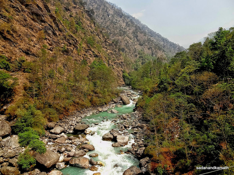
Khari Khola river seen from the suspension bridge.
Hill top Guest House, Khari Khola where we stayed.
April 23rd : Khari Khola to Puyian (10 kms), 7 hours.
Khari Khola (2080m)-Bupsa (2340m)-Khari La Pass (2860m)-Puiyan (2770m)
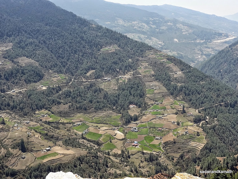
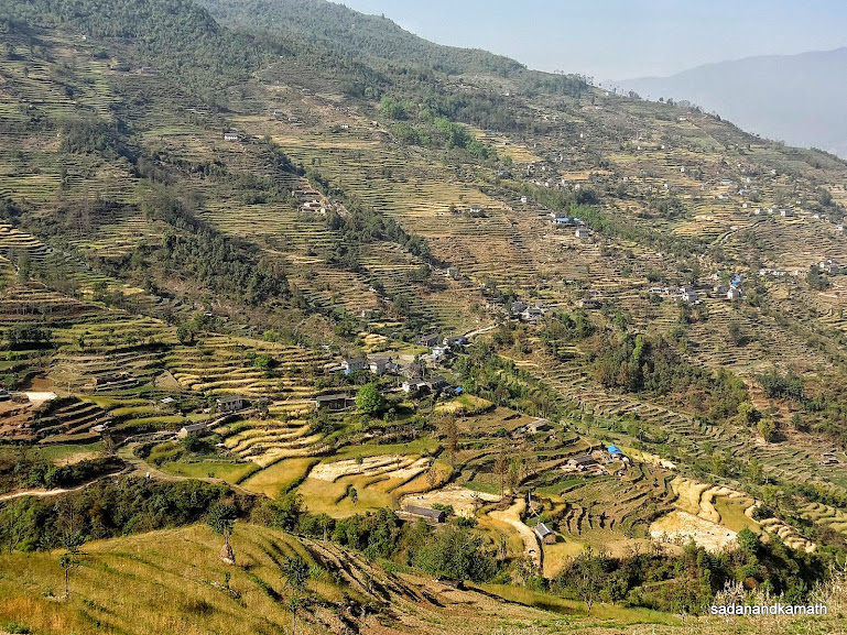
We had an early breakfast which enabled us to leave Khari Khola at 7.00 a.m. for Surkhe but decided to stay at Puyain. After walking through Khari Khola village and market place, the first ascend to Bupsa village started after about 2 kms of trek. Bupsa village was visible from Khari Khola itself. The entire region around Khari Khola and Bupsa villages were surrounded by the terraced agricultural fields mostly of corns, millets and potatoes.
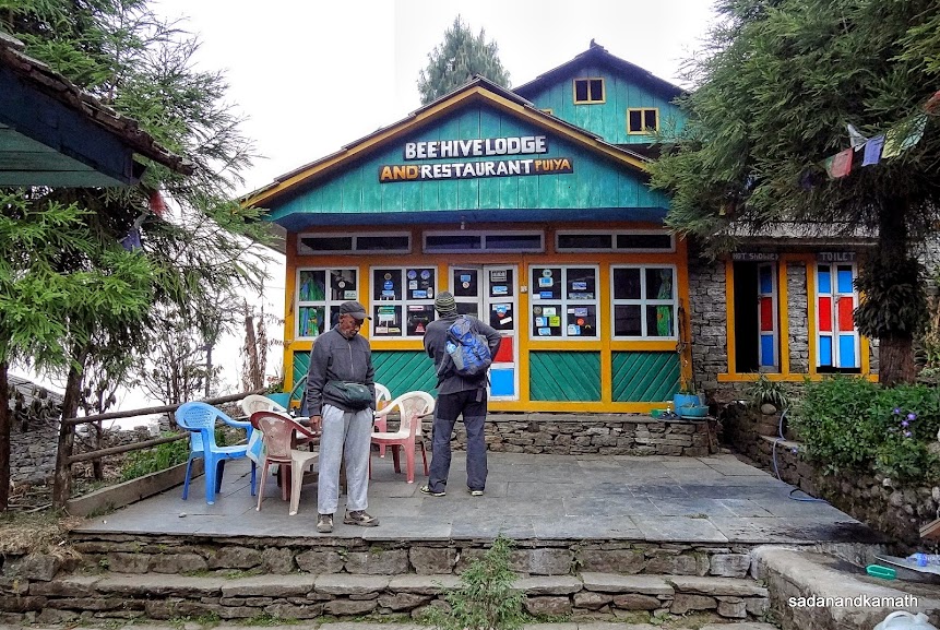
Just 1 km before Khari La Pass, we stopped at a lodge cum restaurant for a lunch break. As had been our experience so far, it took about one hour to prepare lunch of dal-bhat-tarkari and another 30 minutes to finish the lunch. It took hardly 30 minutes to cross Khari La Pass (2840m). Due to strong haze, the peaks were not clearly visible from Khari La Pass. In fact, after morning, we did not see any Kathmandu-Lukla-Kathmandu flights nor helicopters which pass through this region due to proximity of Lukla probably due to strong hazy weather. After the pass, it was a gradual descends with short spell of climbs to reach Puyian which we touched at around 3.45 p.m. in a cloudy weather depriving us of sunset view. We checked in Bee Hive Lodge and had Lemon tea before going to our rooms. After an early dinner around 7.30 p.m., we retired to the bed at 9.00 p.m.
Few pictures of the day below:
Khari Khola village.
Khari Khola bazar.
Khari Khola village and its surroundings seen from Bupsa village.
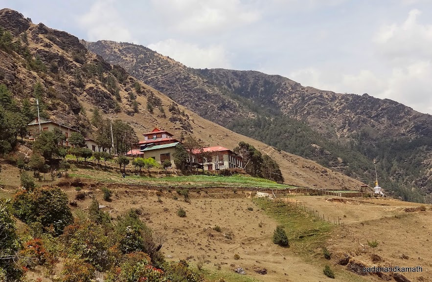
A zoomed shot taken from Bupsa of a Buddhist monastery of Khari Khola. The blue roof building is Hill Top Lodge where we stayed.
Climb towards Khari La Pass (2840m).
After lunch in one of the lodges just below Khari La Pass (2840m), PKD in a pensive mood overlooking the valley from Khari La.
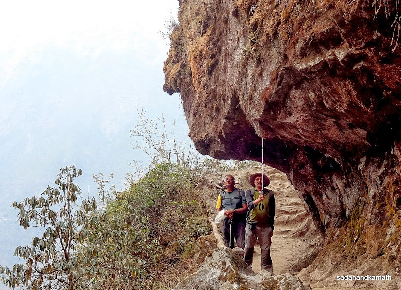
KS and me below a protruding rock on way to Khari La Pass.
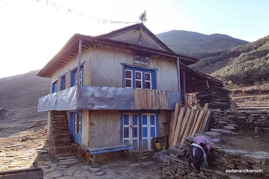
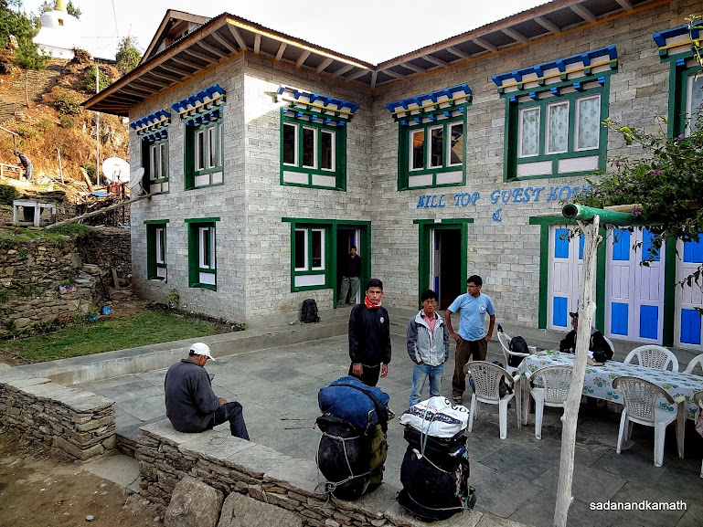
We stayed in Puiyan at Bee Hive Lodge. There is also some space for pitching tents.
April 24th : Puiyan to Ghat (12 kms), 8 hours.
Puiyan (2770m)-Surkhe (2290m)-Chourikharak (2650m)-Ghat (2590m)
We got up at around 5.00 a.m. and found that some of the local sherpa porters have already commenced their journey with loads varying between 85 and 100 kgs for delivering to lodges on the way. Sherpas carry loads of food items such as eggs, biscuits packs, milk powder, tea and coffee powders, fast food items like ready to serve soups, soft and hard drinks etc. Some even carry meats from far off places as slaughtering of animals are banned in Khumbu region. These are delicate items and they can not be loaded on mules or yaks.
After an early breakfast, we commenced our trek from Puiyan for Ghat ( for Phakding, if possible) at 7.00 a.m. Today was the day when we would meet the scores of trekkers coming from Kathmandu-Lukla flights and join the main Jiri-Namche Bazar trail at Chablung near Chourikharka. The complexion of the trekking route would significantly change as in peak period of April-May and October-November, as many as 300 trekkers join the trek via Lukla every day.
From Puiyan to Surkhe, it was all the way a gradual descend except the last 500m leading to a suspension bridge which was steep. After crossing the suspension bridge, we reached Surkhe (2210m). From here, the gradual climb started until we reached Chourikharka which is a big village. At Cheplung, the trail from Lukla joined and we could see many trekkers already ahead of us. We stopped at Chourikharka for lunch at Tourist Lodge & Restaurant.
From Chourikharka to Ghat, the trail was a mix of gradual climbs and descends. We reached Ghat at 4.00 p.m. and decided to stay here instead of trekking to Phakding as apart from walking further 2 kms, we felt that the place may be crowded as most of the trekkers prefer Phakding for overnight stay due to better choice of lodges as well as restaurants than Ghat.
In the evening the weather became cloudy followed by some light showers. We had dinner at 8.00 p.m. and retired to bed by 9.00 p.m. In the night, I suddenly woke up to a sound coming from the roof of the lodge to know that it was from the heavy showers. The rain continued for over an hour.
Some pictures of the day below:
 |
We are about to leave Bee Hive Lodge in Puiyan for Ghat.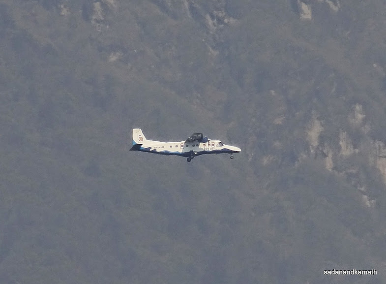 |
One of the Kathmandu-Lukla flights in the morning getting ready for landing at Lukla.
 |
View of Surkhe village as we descend from Puiyan.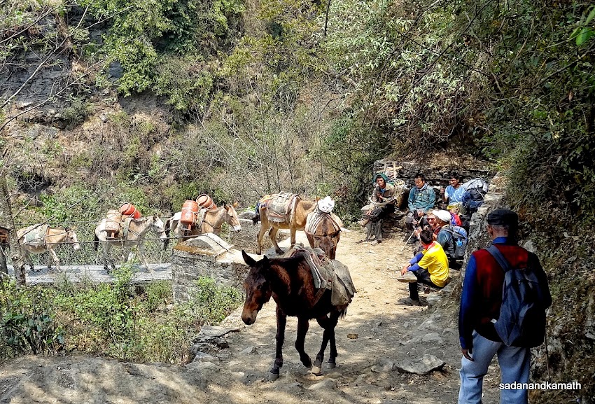 |
Trekkers and locals give 'right of way' to mules coming from a suspension bridge to Surkhe.
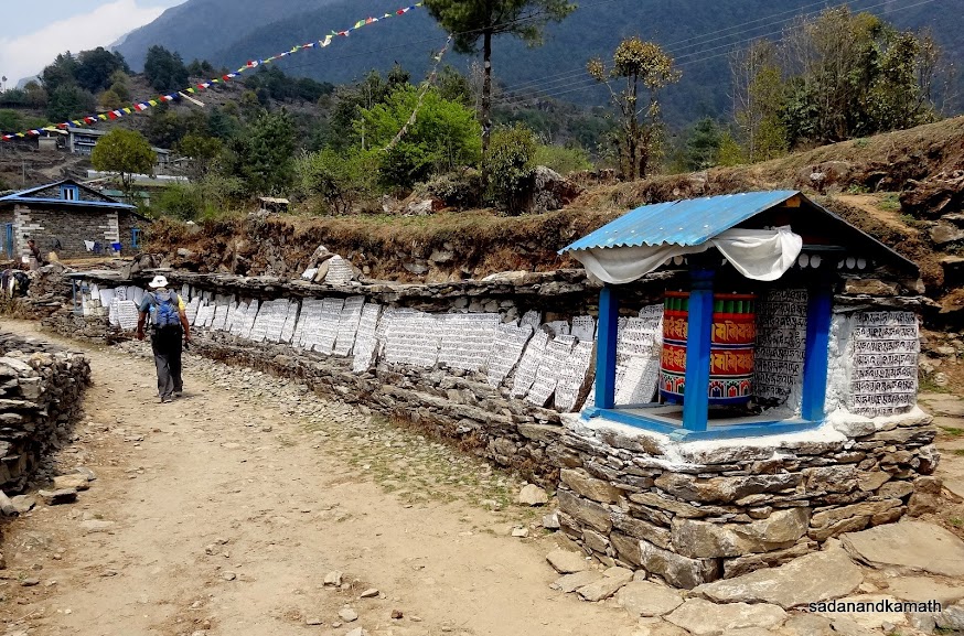 |
Mani wall with inscriptions on the stone slabs on way to Chourikharka near Lukla.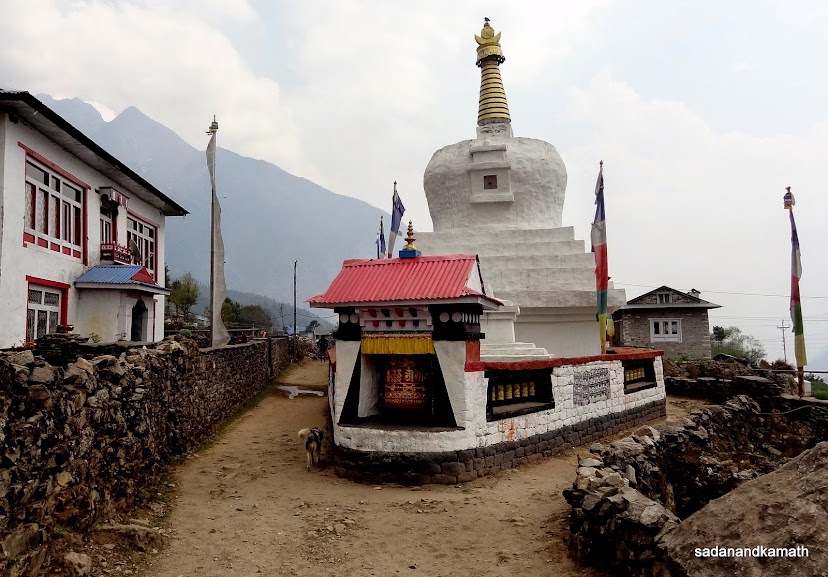 |
An impressive chorten with prayer wheels on way to Ghat.
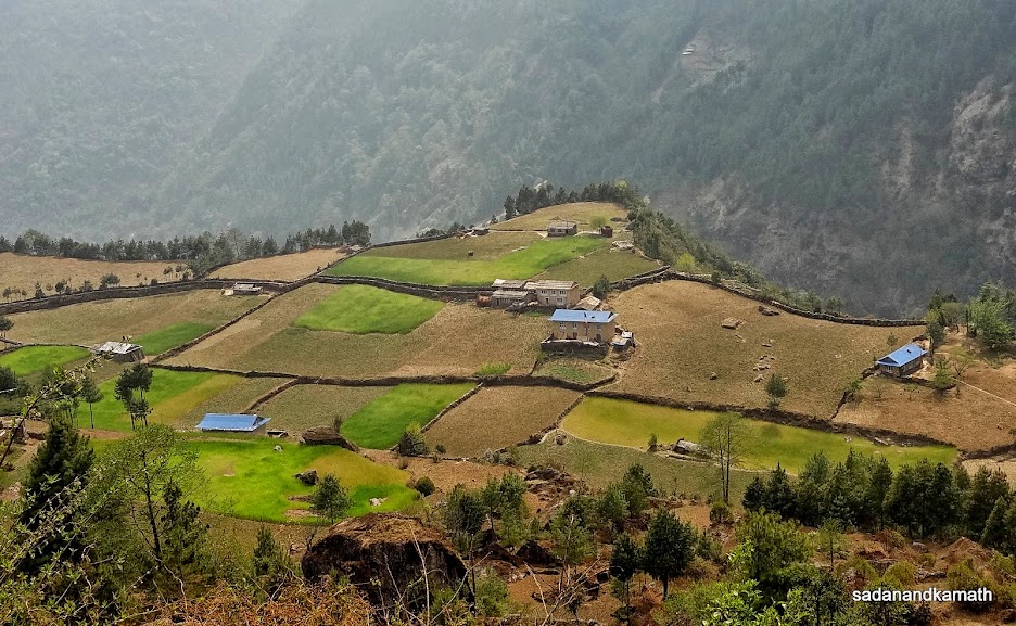
It is a rarity to see agricultural fields on a flat land in mountain region, this one on way to Ghat.
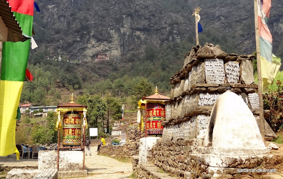 |
One more Mani wall with inscriptions on stone slabs with prayer wheels on way to Ghat. In the far end is a small monastery.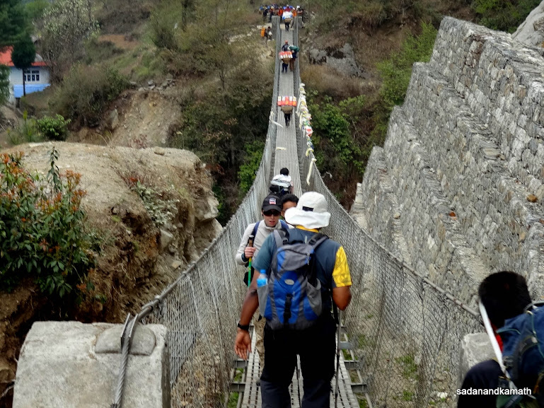 |
The suspension bridge over Dudh Koshi river for Ghat.
 |
| We stayed in this guest house in Ghat.
April 25th : Ghat to Namche Bazar (12 kms), 8 hours.
Ghat (2590m)-Phakding (2650m)-Monjo (2840m)-Jorsalle-(2830m)-Namche Bazar (3440m)
The overnight rain did not spoil the day in terms of weather. We saw a cloudless blue sky from our room window as we woke up at 5.30 a.m. As we came down for our morning tea, we felt that the weather had turned more colder than in the previous evening. We saw fresh snow on the higher hills and mountains around Ghat. I was afraid that the trail would become slushy due to overnight rain. But it was not so. Probably, the absence of rains over one week in this region increased the capacity of the soil to absorb the rain water. In fact, the rain was blessing in disguise as dust had settled down making it dust-free trail to Namche Bazar.
Keeping in mind a longer trekking day ahead, after an early breakfast, we left Ghat at 7.00 a.m. The trail tp Phakding was all along the true left bank of Dudh Koshi river at a higher elevation, alternatating between short climbs and descends. As we appraoched Phakding, the trekking crowd swelled as it was a starting point for many trekkers. The complexion of lodges changed from family run type to hotel type. Most of the lodges in Phakding looked attractive.
After crossing the first suspension bridge over Dudh Koshi river, we reached the other side of the river. In fact, this part of Phakding looked like an island surrounded by Dudh Koshi river. The reason is that in this part of Phakding, the river takes a 'U' turn making the place looking like an island. There are high ended lodges here.
After passing through Toktok and climbing to Benkar, we encountered many trekking groups, a couple of them being as large as 20-30 trekkers. Near a waterfall and on a narrow trail of steep descend, there was virtually a 'traffic' jam created by the hordes of trekkers. Adding to this was the constant mule traffics going towards Namche Bazar. We and some other trekkers stopped for some time at Thamserku Lodge to avoid the mule traffic.
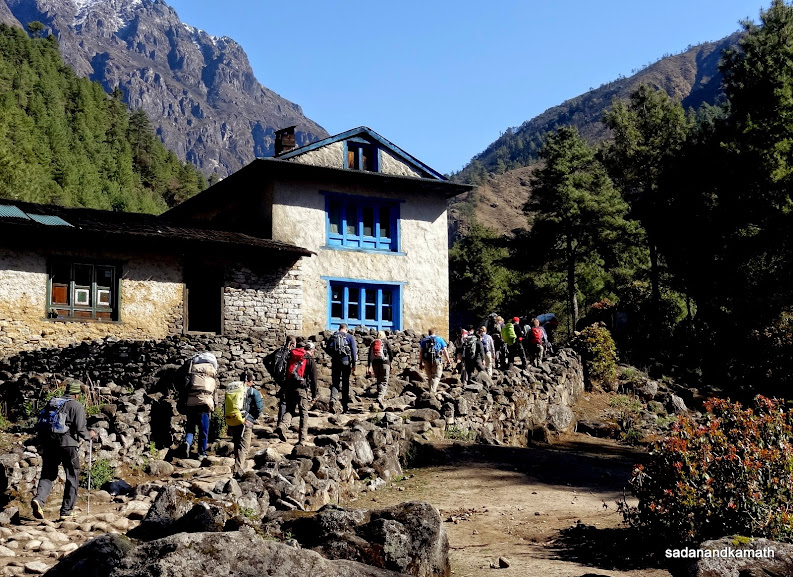
After a gradual climb, we reached Monjo. There are couple of restaurants which were strategically located on scenic places. While we did not stop to have tea and enjoy the scenes, I felt that I would certainly stop in one of these restaurants on my return trek. About 1 km beyond Monjo, the boundary of Sagarmatha National Park starts. There is a check point at the entrance where showed our passports and TIMS cards recording our arrival in a register. We paid the park fee of NRs.1500/- (INR1000/- and one would get back NRs.100/-). Luckily for us, there was not much crowd at the check post and we could complete the formalities in 10 minutes.
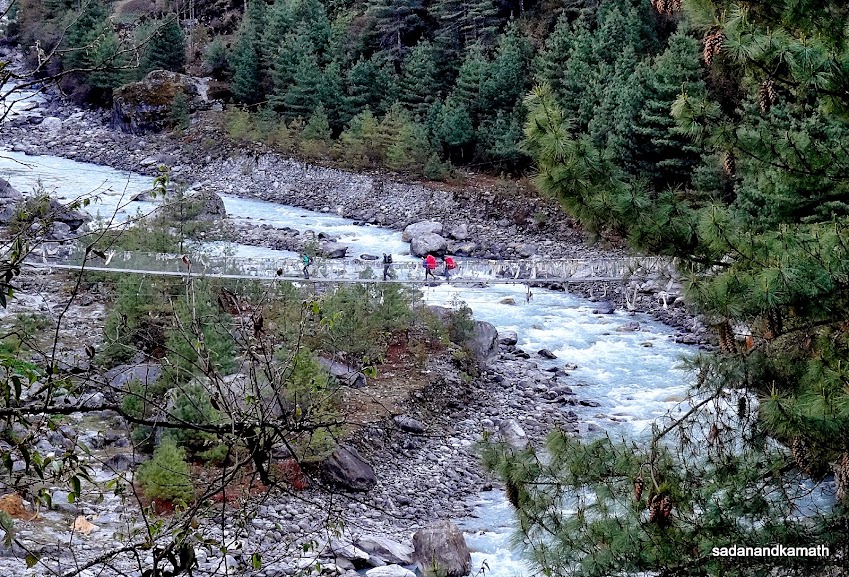
After Sgarmatha NP office building, there is a gate with prayer wheels and murals after which it is a steep descend to a suspension bridge over Dudh Koshi. Thereafter it was a climb up to Jorsalle which had also its share of lodges and restaurants. We had lunch break here. After this place, the next, there are no eating places until one reaches Namche Bazar. From Jorsalle, we walked almost close Dudh Koshi river more or less on a straight trail full of rocks and boulders. From here we could see two suspension bridges - the lower, the older one, was now abandoned and a higher and longer one was newly built. A steep climb along Dudh Koshi river took us to the higher suspension bridge and my guess is that it could be the longest suspension bridge we had crossed during our trek. The bridge is over the confluence of Dudh Koshi and Bhote Koshi rivers.
During the last 8 days of trek, we have crossed many suspension bridges but crossing Hillary Suspension Bridge was an unique expereince. Being the longest bridge, it was swinging more than other suspension bridges on which we had crossed so far. Also there was a strong breeze blowing across the bridge making the swinging of the bridge more prominent. Both these factors made the balancing act during walking on the suspension bridge difficult. It was only when I reached the end of the bridge, I had a sigh of relief which was shortlived as it was from this point the steep climb to Namche Bazar started. The positive side of this climb was that it was mostly through the forest.
The climb to Namche Bazar was exhausiting to say the least despite having crossed 3000m marks on two occasions - at Lamjura Pass (3540m) and Taksindu Pass (3080m) last week. From this point onwards, we would be trekking above the 'safe altitude' all the time until we return to Phakding/Ghat - say after 10 days.
Just one km before Namche Bazar, a police check point checked our TIMS cards, passports and Sagarmatha NP fee receipts for registration. The trail inside Namche Bazar upto the gate was, more or less, a straight walk. However, one would be required to climb further if the chosen lodge was located at the upper Namche Bazar as it happened with us. We had to climb about one km from the gate to reach Everest Hotel. As usual, after reaching the hotel, I had a lemon tea in the restaurant before going to my room on the first floor.
Some pictures of the day below:
More prayer wheels and inscription on way to Phakding.
One of many good lokking lodges in Phakding.
 |
Suspension bridge over Dudh Koshi river to reach the other part of Phakding.
A line of trekkers somewhere between Ghat and Phakding.

Thamserku peak (6623m) seen near Phakding.
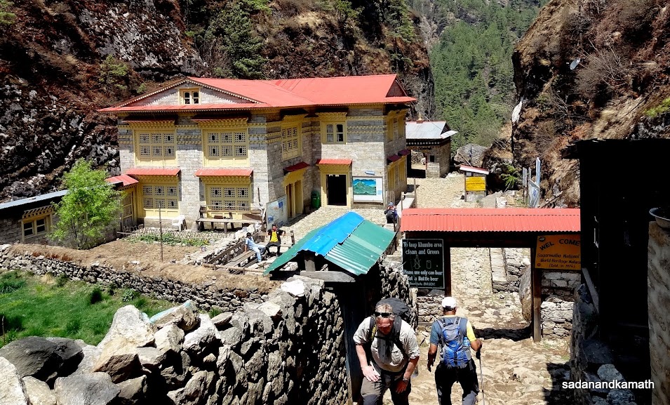
Sagarmatha National Park Office in Monjo where we paid Park fees.

Statistics of trekkers' arrivals in Sagarmatha NP since 1998 inside NP office.
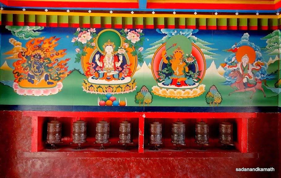
Murals and prayer wheels inside Jorsalle side gate of Sagarmatha NP.
We had Dal-Bhat-Tarakri lunch at Jorsalle for NRs.400/- (INR.250/-). The same lunch would have costed us NRs.250/- at Shivalaya and NRs.500/- at Lobuche.
A somewhat tricky trail as we climb up to reach Hillary Suspension Bridge on way to Namche Bazar.
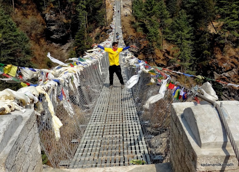
Hillary Suspension Bridge over the confluence of Dudh Koshi and Botha Koshi rivers. This is not only the longest bridge but also the highest bridge on EBC trek. In this picture, Rohit mimics the way we felt on the swinging bridge in the midst of a strong breeze.
The last portion of the steep climb to Namche Bazar.
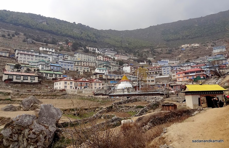
The first sight of Namche Bazar (3420m) as we entered after police check post.
4 comments:
SK, Thanks for very good and detailed write-up. No detail missed! This will save me a lots of effort; as I will now just post a link to this page in my own blog :) -KS
Post a Comment