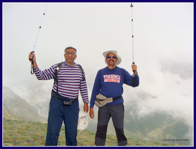
The idea of undertaking this trek germinated during our Nandadevi Outer Sanctuary (NDOS -Dharansi Pass) trek in June last year when we noted that more trekkers were going for Bagini Glacier-Changbang Base Camp trek than the NDOS trek. My friend K Srinivasan (KS) was keen to do this trek as our next full-fledged trek. The plan for the trek was finalised in April 2011 when we got the dates from our guide, Sohan Singh Bisht (Sonu) for the second half of June 2011. At one time, we had thought of doing the twin-trek combining the Bagini Glacier trek with Chenap Bugyal trek but Sonu suggested that Chenap trek could be attempted separately by taking a somewhat longer but interesting route starting from Helang and ending at Marwari (near Vishnuprayag) for which more days were required than the usual 5-6 days. So we dropped the idea of combining Chenap Bugyal trek with Bagini Glacier trek.
I was fascinated by the descriptions of sceneries on trails to Kanari Khal (Pass) and Kalla Khal and was keen to combine these two passes with our proposed Bagini Glacier trek. I discussed with Sonu about our doing Kanari Khal and Kalla Khal treks. While Sonu was confident that we would be able to complete Kanari Khal trek, he was not sure about our capabilities to undertake Kalla Khal trek. So we dropped the idea of Kalla Khal and finalised the 9-days’ easy paced itinerary for Bagini Glacier-Changbang Base Camp-Kanari Khal trek.
Though my current Weinbrenner shoes ( without ankle support) was still going strong despite logging more than 250 kms of treks (including one snow trek), we bought a new pair of trekking shoes with ankle support since we had to trek about 10+10 kms of rocks/boulders strewn path. It turned out to be a good investment as without the ankle support, we would have run the risk of twisted ankles on the rocky patches.
We arrived Delhi by flight in a hot and sultry afternoon, boarded Massoorie Express on the same night and reached Haridwar the next day early morning. Our intention was to get a share jeep to Karnaprayag for an overnight stay and reach Joshimath the next day in the forenoon. The share jeep was available for a direct journey to Joshimath @Rs.350/- with only the back seats being available. We saw a couple of GMOU buses bound for Joshimath/Badrinath parked opposite Rahi Hotel but they were already full. In the meanwhile, the sky was getting overcast and the thundershowers looked imminent as strong cool breeze replaced the sultry weather. Under such a situation, we thought it was better to be inside any bus which would take us towards Rudraprayag side. We finally got 8.00 a.m. GMOU bus bound for Ukhimath via Rudraprayag. The bus journey was smooth though it rained heavily for an hour or so. After alighting at Rudraprayag, we found to our dismay that not a single share jeep was available for Karnaprayag (or beyond). Since most of the buses bound for Joshimath would have direct passengers being the peak yatra season, the possibility of getting seats in such buses was remote. So we hired a jeep for Karnaprayag @Rs.1000/- ( The driver of the jeep ultimately took from us Rs.700/- as he could get six passengers for Karnaprayag @ Rs.50/- per passenger).We reached Karnaprayag at 4.30 p.m. and checked in to GMVN (@Rs.800/-) for an overnight stay.
 |
| GPS track of the trail to Bagni Glacier-Changbang Base Camp-Kanari Khal. Courtesy : K Srinivasan |
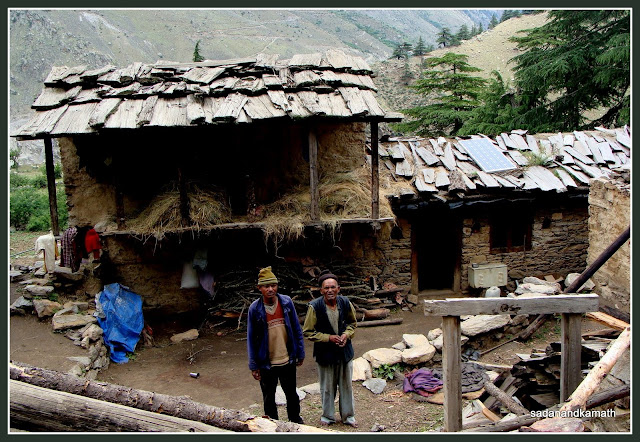
Day-1 : Joshimath-Jumma ( 44 kms by Jeep)-Ruing village (2800m, 3 kms trek)
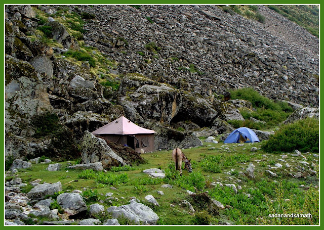
Sonu came to our hotel around 8.00 a.m. in a MAX and the good news was that he could manage to get the permit early in the morning. After rearranging the loads, we proceeded in the MAX to Jumma, the road head for the start of the trek. On the way, we picked up provisions and vegetables etc. which was already packed in the previous night. Effectively, we left Joshimath at 9.15 a.m. The road up to Jumma was in mixed condition – the newly laid two lane road up to Dak was smooth. After Tapovan, the road was in moderate shape followed by once again an excellent road in around Suraithota. At around midpoint between Suraithota and Jumma, the mud road of about one km length was almost in level with Dhauliganga river. In rainy season, this patch of road would surely be under water by rising water level of Dhauliganga. Thereafter the road was mostly in bad condition till we reached the road head to Ruing village which was about 2 kms further to Jumma village. We reached the road head around 11.15 a.m. We spent about 30 minutes for our mule to arrive and rearrange the load to be carried between one porter and the mule. There were already 6-8 trekkers who had been waiting here for the transport to take them back to Joshimath after completion of their treks and our MAX came handy to them without wasting much of their time.
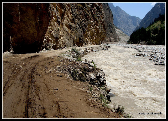 |
Road to Malari somewhere between Suraithota and Jumma is almost in level with Dhualiganga river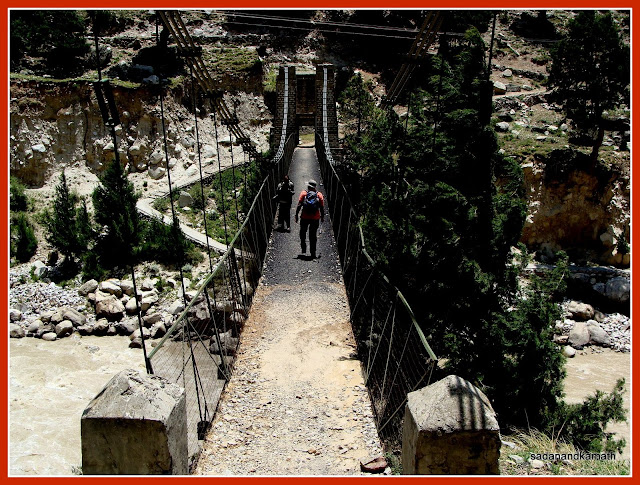 |
Suspension bridge over Dhauliganga connecting Jumma with trail path to Ruing.
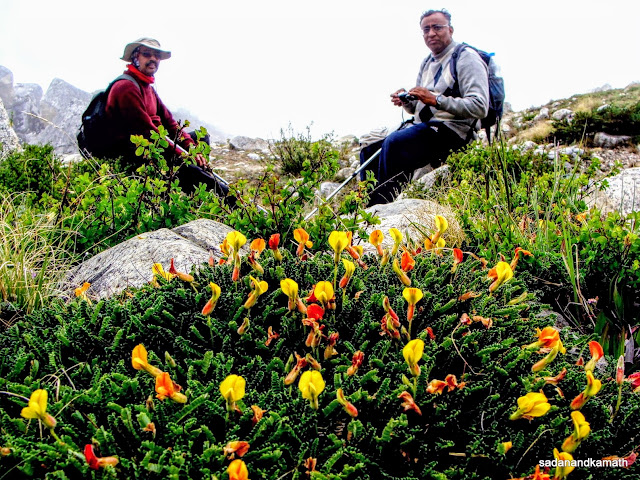
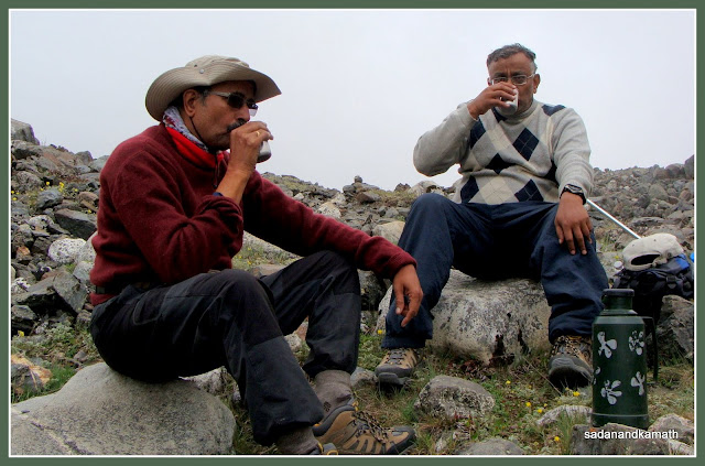
After lunch, we took stroll around the meadow and observed that there were some wildflowers already in bloom. The meadow was covered with a sporadic bunches of Himalayan Thyme ( wild ajwain flowers). We also spotted some birds though we could not capture them all in our cameras. After dinner, we retired for the day in a pleasant temperature of 18C.
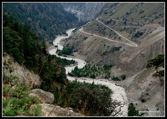 |
| Dhauliganga river with Malari road seen from Ruing Campsite. |
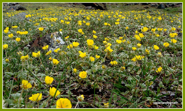
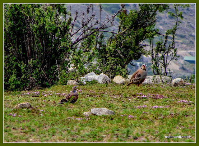 |
| A pair of Oriental Turtle Doves seen at Ruing campsite Day-2 : Ruing-Dunagiri ( 3610m, 8 kms trek) We got up to a sunny morning at 6.00 a.m. with temperature showing a pleasant 14C and to the chirping sound of some unidentifiable birds probably sitting on some tree tops. After a sumptuous breakfast, we commenced the trek to Dunagiri village at 8.15 a.m. The well laid trail was mostly through forest. The comfort of this trail was that every moderate climb was followed by a level walk and this trend continued until the last two kms before Dunagiri village. We came across varieties of wildflowers on both sides of the trail. The pre-monsoon showers seemed to hasten the process of wildflowers blooming ahead of time. In fact, we devoted much time in taking pictures of wildflowers some of which had to be taken from risky spots. As usual, Sonu was the one who helped us in identifying some of wildflowers and also helped us in taking pictures from the tricky spots. We also saw some colourful birds. 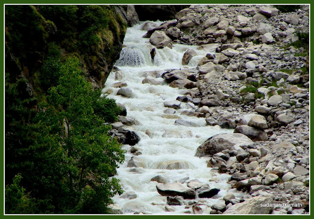 |
Bagini stream seen on way to Dunagiri
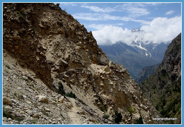
The trek path carved out of debris of landslides on way to Dunagiri village
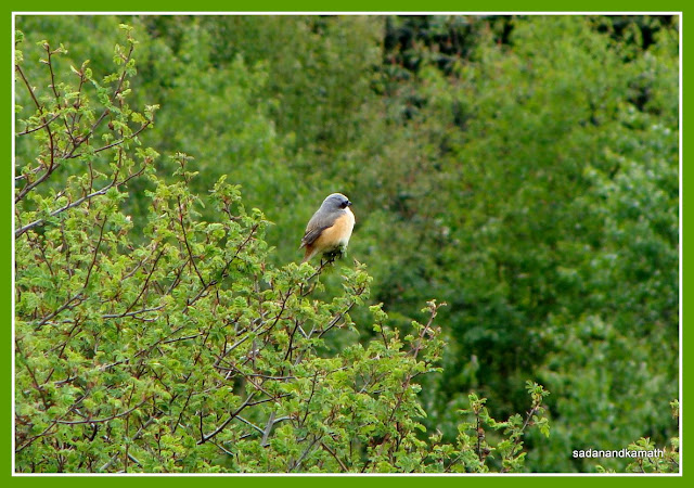
An unidentified bird seen near Dunagiri village.
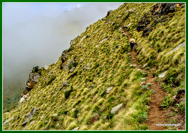
The scary part of the trek was the one km stretch – 2kms before Dunagiri village - which passed through the landslide zone alternating between steep climb and equally steep descend. The landslides happen every year and it is mainly on account of sliding glaciers from the Nandikund Pass side whcih bring with them the debris of mud, stones and rocks.The original trail was destroyed by one such massive glacier slides a few years ago when about 200m long trail was washed away creating a deep artificial gorge making it impossible to repair. The forest department has made an alternative trail over the debris of landslides which at some places are narrow requiring help from porter/guide to negotiate the path. A look at the top of fragile mountains gives an impression that hundred of rocks and boulders are waiting to roll down on the path any moment. Devendra Singh, mule man told us that though occasionally, stones, rocks and boulders fall on the trail, but there has not been a single instance of villagers, trekkers and goats/sheeps getting injured on account of rock/boulder falls. Nonetheless, this one km of trail is a potential rock fall zone and it is advisable to cross this stretch in one go with eyes and ears open without waiting for rest or photo shoots. The last one km of trail is a level walk on a cemented pavement. We reached Dunagiri village around 3.00 p.m. We got Panchayat Ghar (House) for stay @Rs.200/- per day.
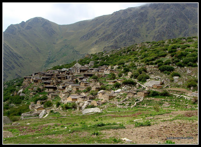
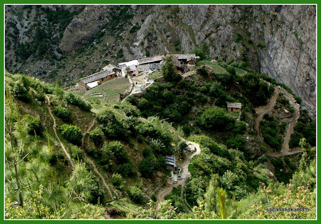
Dunagiri village.
Dunagiri village consists of about 50 houses of which many seem to have been abandoned. Kanari Khal and Nandikund Pass form the backdrop and frontage respectively, to the village. Hathi Parvat (north face) can be seen from the southern side of the village. There is not a single shop in the village and the basic requirements of the villagers are met from a shop in Ruing village. For substantial requirements, villagers have to go to Tapovan or Joshimath. The village has a satellite telephone booth and also two solar-powered street lights. The village has electricity but due to transmission lines damaged by some tree falls, the village has been without electricity for quite some time.
Camping in Dunagiri village is not allowed but one can camp at the outskirt of the village. Surprisingly, the concept of home stay has not yet caught in the minds of the villagers – both in Ruing and in Dunagiri. GMVN is constructing a Tourist Rest House about one km away from Dunagiri village in a very scenic spot. The TRH is expected to be functional by the next summer season. From the design of TRH, it appears that it is directed towards the higher end of the tourists/trekkers though as usual there will also be dormitory accommodation for backpackers.
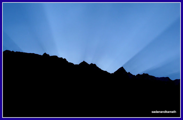
Early morning sun rays reflect on the sky from Dunagiri ridge.
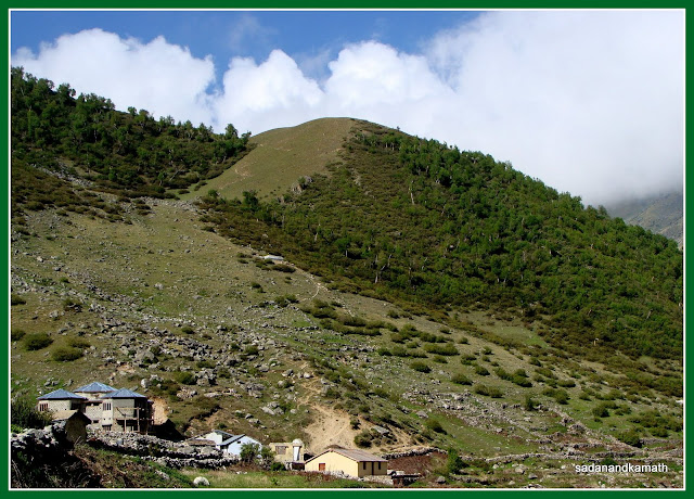 |
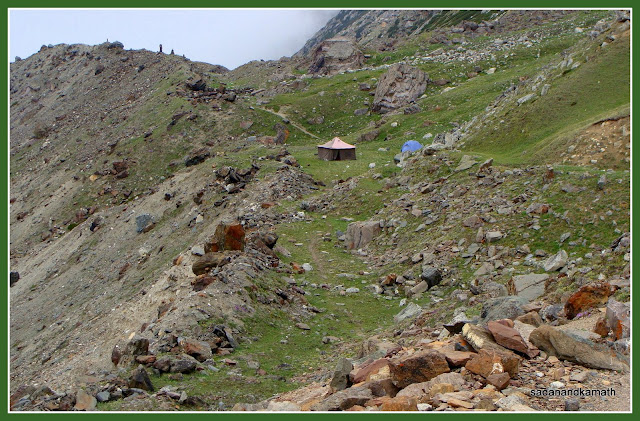
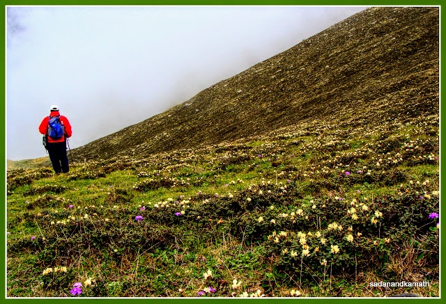
| GMVN TRH under construction (left) seen from Dunagiri ridge. Day-3 : Dunagiri-Langatoli (3800m, 3kms trek) As usual, we got up early morning to a sunny day. KS faithfully reported that the early morning temperature was a pleasant 13C. Since it was only 3kms of trek, we were in no hurry to start the trek. Being sunny day, some of the village women came with their heavy woollen items such as blankets, rugs to wash at the water source which was just behind the Panchayat Ghar. There were a few cemented pits in which village women poured warm water with some detergent added and soaked woollen items inside these pits. After some time, the women jumped inside their respective pits to press the soaked woollen items with their feet again and again to squeeze the dirt out of them. They told us that even with sunny weather, it would take at least two days to get them fully dried. We found this method of washing woollen items interesting. We started from Dunagiri at 8.45 a.m. for Langatoli. A gradual climb of about one km led us to the top of a ridge after which it was a gradual descend to the true left bank of Bagini stream. There were some scary moment as some stretches of descend were steep and on a narrow path with equally steep slope going down to the Bagini stream. From the ridge, we could see Trishuli, Hardeol and Purbi Dunagiri peaks. It was our first time to see these peaks. Once we came down from the ridge to Bagini stream, most of these peaks were eclipsed by the white cloud formation and high mountains. 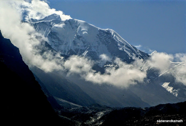 Trishuli peak seen from Dunagiri ridge. 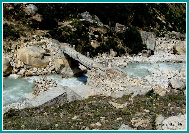 A bridge over Bagini stream as we came down from Dunagiri ridge. After crossing a cemented bridge over Bagini stream, we followed the trail to the right for Langatoli. The trail to left goes to Kanari Khal. After a gradual climb all along the true right bank of Bagini stream, the trail went through some rocky patches after which we reached a small meadow known as Langatoli campsite. We saw a good varieties of wildflowers on this trail as well. Though only 3kms of trekking was involved, it was not an ideal weather for trekking as the unusually warm and sunny weather made us a tired lot. We were surprised to note that at 11.15 a.m., the outside temperature was 31C at an altitude of 3800m! Our tent was even hotter and we felt as if we were sitting in Delhi. It was not possible to sit inside the tent nor was it comfortable to sit outside tent under a scorching sun. Then KS came out with a solution which he had used successfully in Chennai during summer months. He took out his bath towel, got it dipped in ice cold stream water and covered the face with towel. This had a salutary effect on him as I could hear him snoring! In the afternoon, cool breeze brought down the temperature to a pleasant level. The warm weather seems to have made the favourable condition for cloud formation as we could see some snowfall over Trishuli and Hardeol peaks and rains at the Upper Bagini areas. However, it did not rain in Langatoli though the area was covered by mist in the evening which continued in the night. 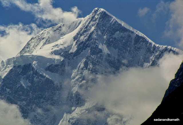 Hardeol seen from Dunagiri ridge. 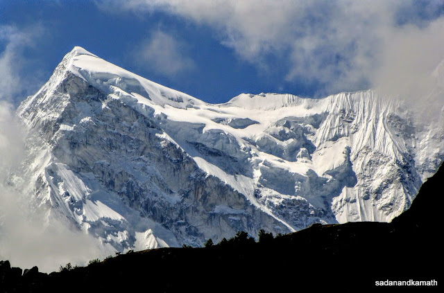 Purbi Dunagiri seen from Dunagiri ridge. The location of Langatoli campsite was beautiful. The meadow was skirted by Bagini stream and a spring water stream which later joined the Bagini stream. From here, we could see Trishuli and Hardeol peaks on the north-eastern side and Hathi Parvat (north face) on the south-west side. We could see the Dunagiri ridge from where we descended to cross Bagini stream. 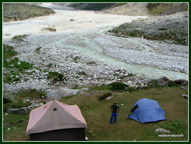 Langatoli Campsite. Day-4 : Langatoli-Garud Base Camp (4484m, 7 kms trek) In the previous day, we had decided to start the trek to Garud Base Camp at 6.00 a.m. with packed lunch to reach as close to the destination as possible before the weather becomes warm. Also, Sonu had told us that we must cross Garud stream on the way well before noon as the water level can rise due to melting of glaciers as day progresses. But in the Himalaya, whatever we propose, the nature disposes. It rained for over one hour early morning starting at around 4.00 a.m. Although rains abated around 5.00 a.m., the entire area around Langatoli as far as our eyes could see was engulfed with fog and mist. Personally, I was ready for departure on the schedule time of 6.00 a.m. even under such weather condition as I felt that it may not rain anymore. But Sonu felt that it was better to assess the weather for another hour or two before we were sure that it was not going to rain. His worry was Garud stream on the way where water level could rise rapidly if it rained heavily. Furthermore, the visibility itself was poor as waves of mists and ground fogs continued to cover the area.  Bagini stream partially covered in mist early morning. 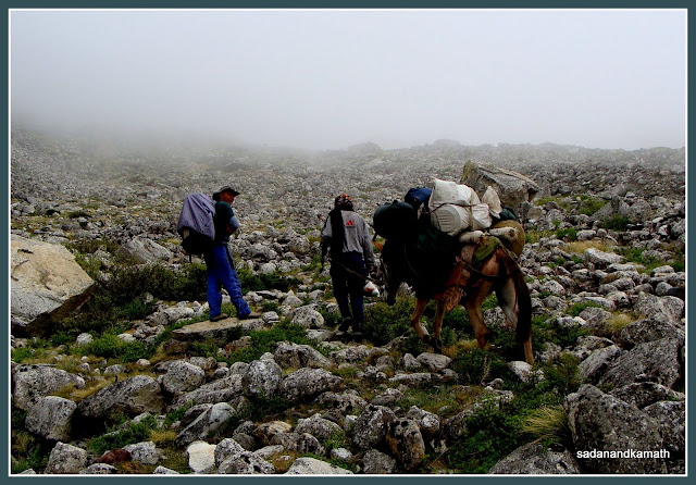 |
The landscape on trail to Garud Base Camp.
At around 7.30 a.m., Sonu decided that if it did not rain, we would commence our trek to Garud Base Camp at around 8.00 a.m. notwithstanding the foggy and misty weather condition. Accordingly, we departed the Langatoli camp at 8.00 a.m. The first one km of trail was through a grassy ground full of shrubs all along the true right bank of Bagini stream. Thereafter the trail was a series of climbs and descends through rocks and boulders. Halfway through the trek, we crossed Garud stream comfortably as the water level was still low. Thereafter a mix of gentle climbs followed by level walk on the rocky and boulder strewn path led us to Garud Base Camp at around 1.00 p.m. The trails on the rocky and boulder strewn stretched were not well marked but the cairns on display at some strategic places, especially at every turn made it easier to negotiate the trail without much difficulty. There were couple of camping sites with water sources in Lower Bagini Glacier region. In fact, some trekking groups pitch their tents in one of these campsites bypassing Langatoli campsite.
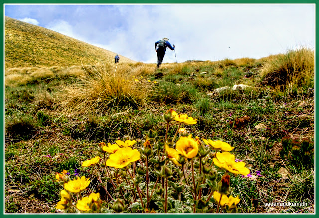
Surprisingly, even on the rocky patches, we saw many wildflowers plants growing from the accumulated soil on the rocks and boulders. We came across occasional small grassy patches covered with carpets of wildflowers.
Surprisingly, even on the rocky patches, we saw many wildflowers plants growing from the accumulated soil on the rocks and boulders. We came across occasional small grassy patches covered with carpets of wildflowers.
 |
Wildflowers on way to Garud Base Camp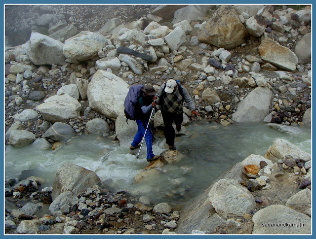 |
Crossing Garud stream halfway to Garud Base Camp.
Although almost entire trek route was full of rocks and boulders with occasional muddy hills on either side of the trail, I realised that even the rocky patches, bereft of any greenery, could be equally scenic with multi-coloured rocks and stones all over the places punctuated by sporadic 'bouquets' of wildflowers. The mass blooming of wild ajwain flowers (Himalayan Thyme) in trek route with its fragrance spread over the trail seems to have a positive impact on our nostrils and lungs as we did not feel any breathing problem on 4000m+ altitude. Throughout our trek, the weather continued to be misty and foggy but this enabled us to complete the trek without getting tired.
 |
| On way to Garud Base Camp. |
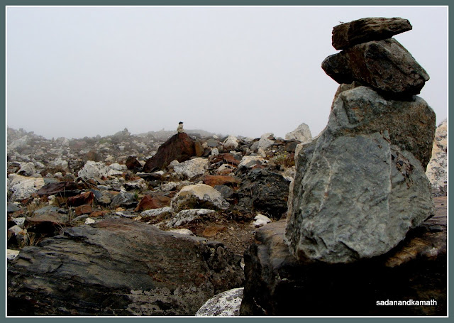 |
| A series of cairns on trails to Garud Base Camp is the only way to know that we were on the correct path. |
 |
| Lunch break - starting with soup - some 3 kms short of Garud Base Camp. |
Our porter and mule man who had gone ahead, actually pitched the tents some 500m before Garud Base Camp assuming to be the campsite. Sonu wanted to move the tents to Garud Base Camp ground as the spring water source was very close to this campsite. But a mild showers deterred him from moving to the Base Camp. In the afternoon, I walked about one km towards Changbang Base Camp side. Just opposite our campsite was the Upper Bagini Glacier covered with layers of moraines. I could see at least 3 snouts of Bagini Glacier. Some 500m ahead was the actual Garud Base Campsite almost fully covered with yellow wildflowers. Pitching tents here would have crushed many wildflowers. As weather started deteriorating, I briskly walked back to my tent when it started raining. The rain continued until evening when sky on the southern side opened up and sun made its first appearance for the day. Soon a rainbow appeared over Upper Bagini Glacier signifying the end of the rain for the day.
 |
| Carpet of yellow wildflowers on way to Garud Base Camp. |
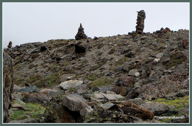 |
| Cairns mark for Upper Bagini Glacier View Point just short of 1 km to Garud Base Camp. |
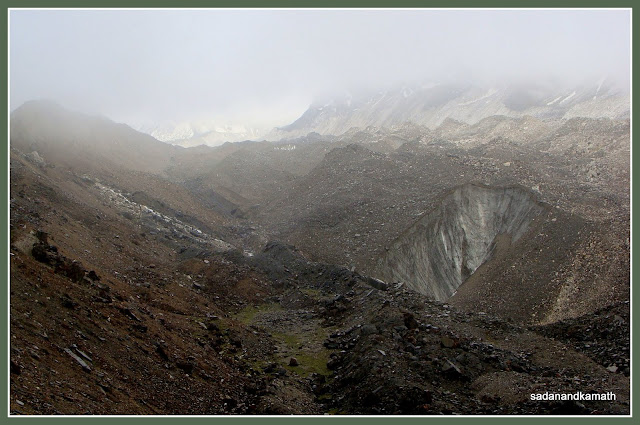 |
| Upper Bagini Glacier with one of its many snouts seen from Garud Base Camp. |
Sonu came to know that two trekkers out of a group of 12 trekkers from Bengal who had started from Dunagiri in the morning, had some altitude sickness and they had been continuously vomiting. He visited them at Lower Bagini Glacier Campsite and it appeared that the group would abort the trek and return to Dunagiri the next day morning. It transpired that the group had covered Jumma-Dunagiri in day-1 and Dunagiri-Lower Bagini Glacier in day-2 resulting in too fast a gain in altitude.
Night was very cold at Garud Base Camp with temperature at 5C. So far during this trek, I was using my sleeping bag as mattress but in this campsite, I had to get inside the sleeping bag to overcome the cold night. Both of us had disturbed sleep.
Night was very cold at Garud Base Camp with temperature at 5C. So far during this trek, I was using my sleeping bag as mattress but in this campsite, I had to get inside the sleeping bag to overcome the cold night. Both of us had disturbed sleep.
 |
| Our tents seen from Garud Base Camp - some 500m from this point. |
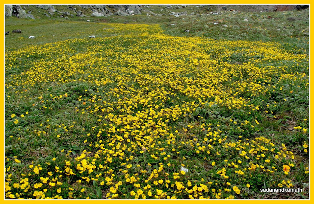 |
| Carpet of wildflowers covering the Garud Base Campsite. |
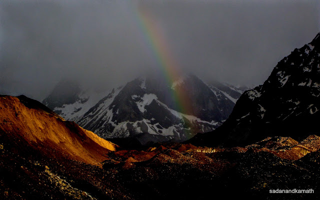 |
| A rainbow over Upper Bagini Glacier. In the background is Rishi Pahad. |
Day-5 : Garud Base Camp- View Point Ridge (4726m)-Shem Campsite ( 5+9=14 kms trek)
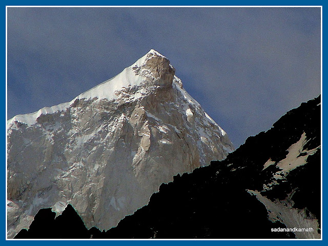
It was a lovely moonlit night ( a hindi film lyricist would call such a night reshami andhera (silky darkness). KS got up around 2.00 a.m. to view the moonlight scenery and to click some peak pictures under moonlight. Unfortunately, he could not get the peak pictures as they were eclipsed from the moonlight by some tall mountains. I got up at 4.30 a.m. to see the peak view under moonlight. While the sky was clear over the peaks, some mists coming from southern direction (Langatoli side) were threatening to swarm the place. At around 5.00 a.m., the first sun rays fell on the top of Hardeol peak and slowly the sunlight covered other peaks as well. We clicked many pictures of sunrise view of peaks. For the first time, we could get the clear view of Hardeol, Rishi Pahad and Sai Minal peaks. However, Hathi Parvat and Ghori Parvat were still covered under the mist.
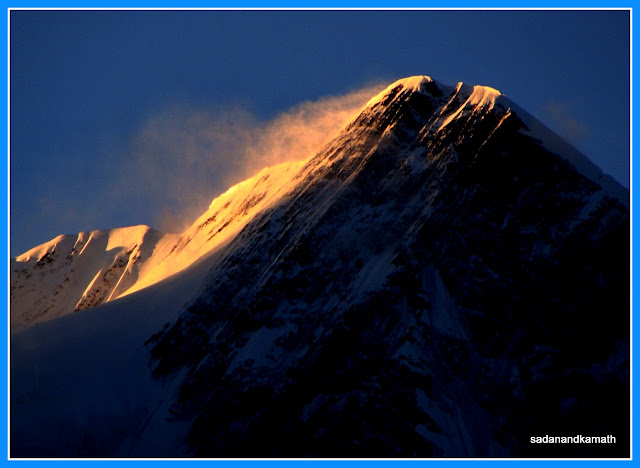 |
| Early morning sun rays on Hardeol peak. |
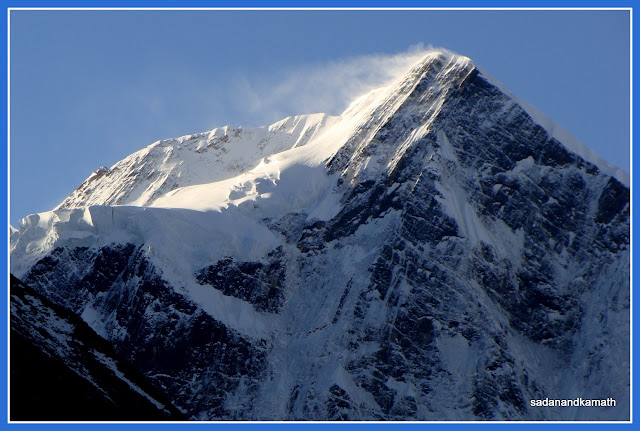 |
| Hardeol peak after sunrise. |
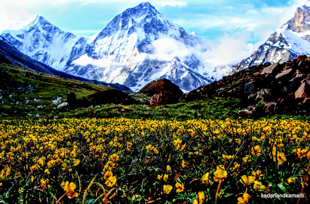 |
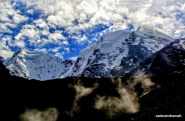
| Carpet of yellow flowers with Hardeol (left) and Rishi Pahad (right) in the background. We were lucky that the mist coming from the southern direction were lifted from the strong easterly wind preventing their move towards peaks located at the north-easterly direction. Taking advantage of this, we decided to proceed to Changbang Base Camp without much delay. We started from Garud Base Camp at around 7.00 a.m. The first two kms of trek was mostly a plain walk with some minor climbs. We were actually walking on a vast meadow located on the true right of Upper Bagini Glacier. After crossing 3 minor streams, we reached Changbang Base Camp. There was a helipad on the meadow. While we could see now clearly Kalanka peak, Changbang peak still eluded us as it was blocked by a black mountain on the true left side of Upper Bagini Glacier. To view Changbang, Trishuli West, Trishuli Main and Rishi Kund, we had to climb a stone and rock strewn ridge which Sonu called as View Point ridge. |
 |
| Leaving behind Garud Base Camp for Changbang Base Camp. |
 |
| Looking back, we found Hathi Parvat and Ghori Parvat ( both north faces) coming out from mist. |
 |
| Walking on a wast meadow before reaching Changbang Base Camp (left below the ridge). |
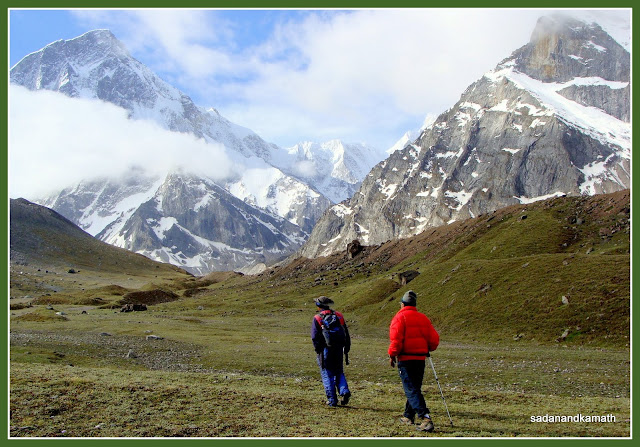
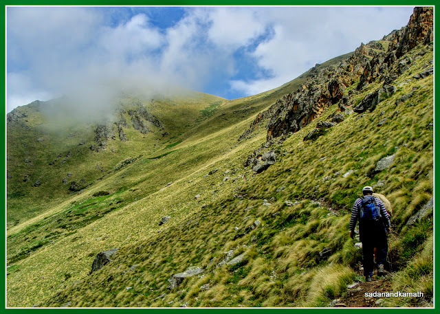
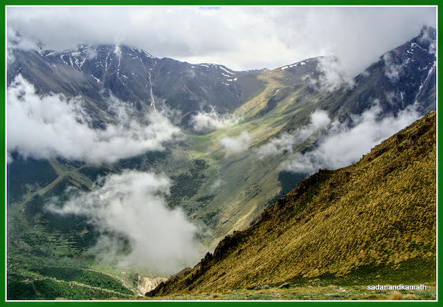
We continued to walk on the meadow, a part of which was now covered by a carpet of purple wildflowers ( Primulas) before our steep climb to the ridge started. So far, we had not faced breathing problem but once we started ascending the ridge, we had to stop after every 10-15 steps to regain our normal breathing. It took about 45 minutes to climb the View Point ridge. We could now clearly see Trishuli West, Trishuli Main and Hardeol on the north-westerly side, Rishi Pahar, Sai Minal, Kalanka and more importantly Changbang on north-easterly side. We considered ourselves extremely lucky to get a short window of a clear sky to view these peaks as we noticed that by 10.00 a.m., all these peaks were fully covered in white cloud and mists. And this continued throughout the day as we reached our next camping site at Shem in the evening.
 |
| Cairn marking the Changbang Base Camp. In the background is Rishi Pahad. |
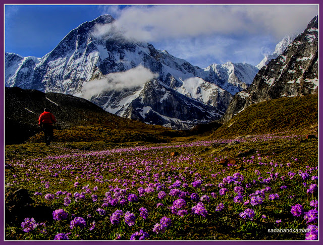 |
| Purple wildflowers (Primulas) on the Changbang Base Camp meadow. Rishi Pahar in the background. |
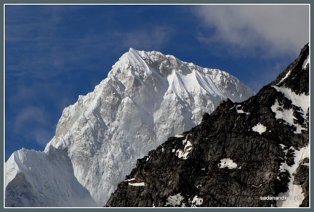 |
| The first 'darshan' of Kalanka Peak from Changbang Base Camp meadow. |
 |
| Trishuli West (left) and Trishuli Main (right) peaks seen from the base of View Point ridge. |
We started our return trek to Garud Base Camp around 10.00 a.m. when all peaks were covered in the mist. We were fairly fast to reach Garud Base Camp in about 1-1/2 hours. As per our itinerary, we had provided for an overnight stay at Garud Base Camp more as an ‘extra day’ to take care of any eventuality such as bad weather depriving us of peak views. Since we had seen all the peaks from View Point ridge, we decided to move to set up the camp as close to the base of Kanari Khal pass as feasible. After lunch at the Garud Base Camp, we commenced our return trek in a cloudy and misty weather. In a way, the weather condition helped us to complete the trek without getting tired from the warm weather if it was to be a sunny day. We reached around 3.00 p.m. at a beautiful campsite called Shem Kharak, about one kms ahead of Langatoli campsite towards Kanari Khal base. There was some communication gap between Sonu and his porter in that the tent was pitched on a ridge opposite Dunagiri village while Sonu meant Shem Kharak. This was soon sorted out and the porter and mule man brought back our loads to Shem campsite.
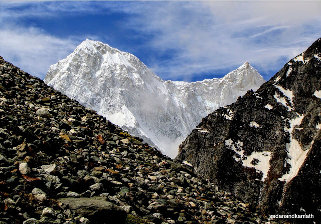 |
| First glimpse of Changbang peak (right) as we climb the View Point ridge. On the left is Kalanka. |
 |
| Cairns marking the View Point ridge. Upper Bagini Glacier can be seen on the left. |
 |
| Rishi Pahad reflection in Rishikund seen from View Point ridge. |
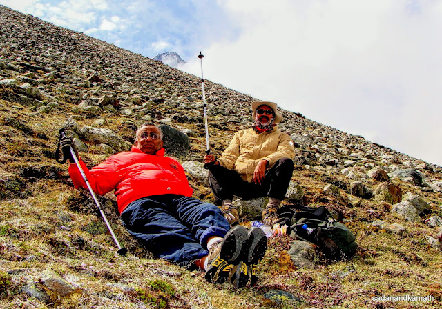 |
| Some rest at View Point ridge. |
 |
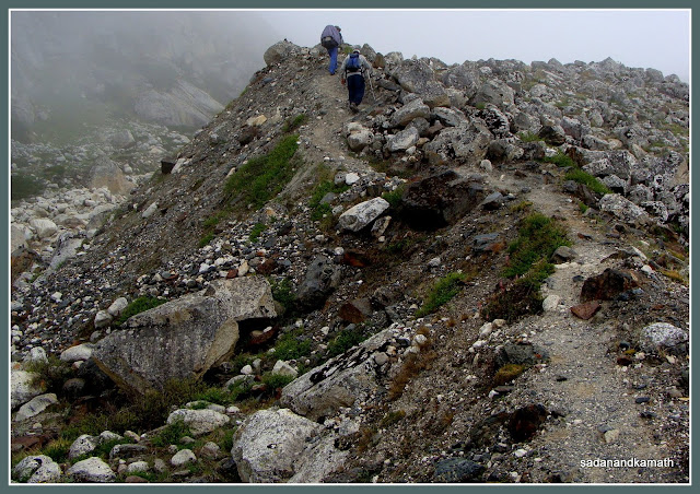
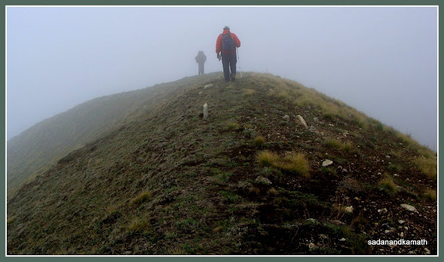
| A zoom shot of Changbang from View Point ridge. Day-6 : Shem Campsite-Kanari Khal (4150m)-Garpak (3340m, 13 kms) The light rains which started around 10.00 p.m. in the previous night continued sporadically until around 4.30 a.m. We got up to an overcast sky with fog and mist covering the ground. Fortunately, it did not rain and we commence the most difficult part of our trek to Kanari Khal around 8.00 a.m. hoping that the weather would clear after some time. The conventional trail to Kanari Khal is a descend which goes very close to the true right of Bagini stream ( the same route we came from Dunagiri to Langatoli) until it meets the tri-junction bridge over Bagini stream after which it is a steep climb to Kanari Khal. The other route is through a short cut to the right of the conventional route requiring some moderate climbing and boulder hopping before it meets the main route about 4 kms before Kanari Khal. Although the short cut trail was not well marked, the advantage of taking this route, as we noted later, was that we started the trail with a gradual climb. As a result, we had to cover relatively lesser part of the steep climb to Kanari Khal. The conventional trail starts with a descend up to the bridge over Bagini stream followed by a somewhat longer steep climb to Kanari Khal. |
 |
| Our campsite known as Shem Kharak, about 1 km ahead of Langatoli towards Kanari Khal trail. |
 |
| Steep climb to Kanari Khal begins here. |
 |
| Kanari Khal saddle seen in the background. |
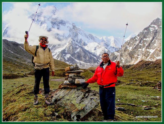
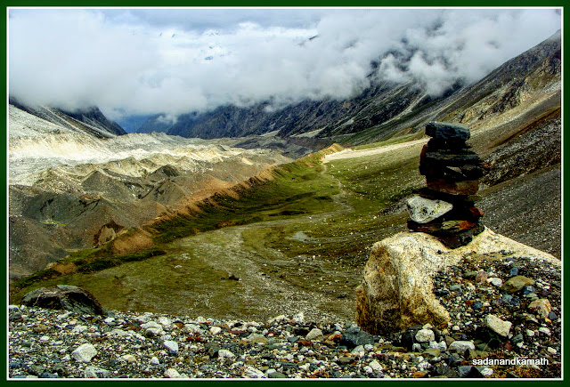
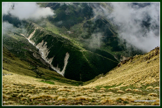
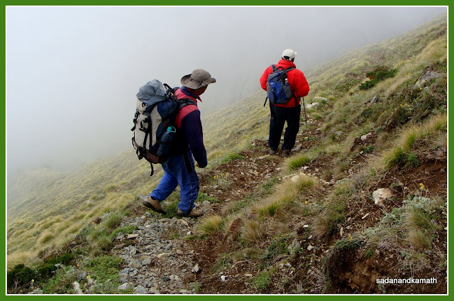
The steep climbing portion of the trail was narrow ( 1-2 feet) with a steep slope on the valley side. A couple of years back, it was a goat trail with space sufficient to put just one leg at a time to trek. Later, the Forest Department widened the track to the present width. Sonu would go on reminding us not to look towards valley while climbing as one may get vertigo type feeling. He would also advise us to take the support of tall grasses that grew on the cliff side. These tall grasses were so strongly embedded in the soil that even if we used both hands to remove them from the soil, they would not budge even a millimetre from the soil. Since the entire trail was above the tree line, we had to stop quite often to get our breathing normal before moving forward. Kanari Khal saddle was looking closer to us as we climbed but in reality it was far off as we were climbing on a zig zag path. At last at 12 noon we reached Kanari Khal. This time, luck was not in our favour as the cloudy and misty condition continued to prevail throughout the day. What we missed was the rare opportunity to view Purbi Dunagiri and Dunagiri Main (west face) peaks together from Kanari Pass apart from missing Lampak peak. But we got the amazing views of a deep green valley in which Bagini stream looked like a white line and also of Nandikund Pass. From Kanari Khal, trail to the right goes to Kalla Khal while the trail to the left goes to Garpak village. While Kalla Khal was totally covered in mist, we could see Garpak village from the top which gave us an idea of the extent of steepness in descend to Garpak village.
 |
| About to reach Kanari Khal. |
 |
| On Kanari Khal. |
 |
| Bagini stream (left) looks like a thin line from Kanari Khal. On the opposite ridge is Dunagiri village. |
 |
| Nandikund Pass seen from Kanari Khal. We spent about 30 minutes on the pass during which we ate our packed lunch. After walking over two ridges full of woldflowers, it was a 4 km of steep descend all the way to Garpak village. As warned by Sonu, the descend was much more tricky and difficult than the climb. Apart from the narrow track, the path at some places, particularly at hairpin bends, was slippery because of loose soil. Here again, Sonu reminded us not to look towards valley and to take the support of tall grass at the cliff side while descending. We noted that we took more time to cover 4 kms of descend than 4 kms of climb. Throughout the day, Sonu kept himself in the middle, walking on the edge of valley side while KS was in front and myself in the back so that in case we required some support, he was available to both of us. I could see some tension on Sonu’s face as it was really a risky proposition to trek on a narrow path with a steep slope on one side for oldies like us. Fortunately, there was not even a minor mishap during the trek. |
 |
| Carpet of wildflowers on Kanari Khal |
 |
| After a walk over the ridge, steep descend to Garpak village follows. |
 |
| Steep slope on the valley side on a narrow path to descend. |
 |
| Garpak village in view (right) but it still far off. On the left is agricultural fields. |
By the time, we reached the outskirt of Garpak, we were completely tired. My calf muscles and toes were in pain. To avoid worsening of toe pain, I started walking with my weight on the sideways of my feet rather than on the toes. KS was telling me that my walking style was that of Charlie Chaplin in silent movies! We reached Garpak at 4.30 p.m. Our tents were already fixed in the compound of the primary school. As we sat on a parapet wall of the school, we could see Kanari Khal saddle and we patted ourselves that we have been able to successfully complete the Kanari Khal trek. As KS pointed out, for the first time during this entire trek, we noticed the existence of our feet, legs, calf muscles, back and shoulder as they were all in pains. But the joy and satisfaction of completing the trek in which we touched 4700m+ altitude and successfully negotiated the Kanari Khal put the pain in oblivion. Sonu had a sigh of relief after successfully completion of our Kanari Khal trek. He was so overwhelmed by our success that he jokingly told us that we could as well proceed to Kalla Khal from Garpak and catch the jeep from Malari for Joshimath instead of from Jumma via Ruing.
 |
Garpak village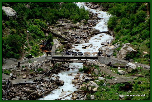 |
The cemented path from left goes to Ruing while that of right goes to Garpak.
Day-7 : Garpak-Ruing-Jumma-Joshimath (8 kms trek, 41 kms by road)
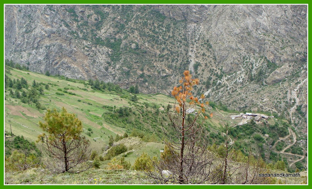
Garpak is a small village consisting of 10-12 houses. The village has one satellite telephone but unfortunately it was out of order. Sonu had banked on this telephone to contact the Max driver for our pick up at Jumma for Joshimath drop. So we were resigned to the uncertainty of getting into jeeps coming from Malari side for Joshimath. We left Garpak at 8.00 a.m. for our last leg of trek. After passing through a narrow ally of Garpak village, there was a steep descend of about 1 km to a bridge over Lampak stream. Thereafter it was more or less a straight walk all along Lampak stream until it joined the Bagini stream in mid-way. We rated this 5 kms of trail as the best in terms of natural beauty in terms of dense forest and Lampak stream giving us company with its different moods. After crossing a wooden bridge over Bagini stream followed by a small section of climb, we reached Ruing village. Luckily for us, Sonu got know that one of the villagers was proceeding to Joshimath in his Maruti Omni parked in Jumma. So he negotiated with him for Joshimath drop. After Ruing, it was all gradual descend to Jumma.
 |
| Lampak stream fall somewhere between Garpak and Ruing |
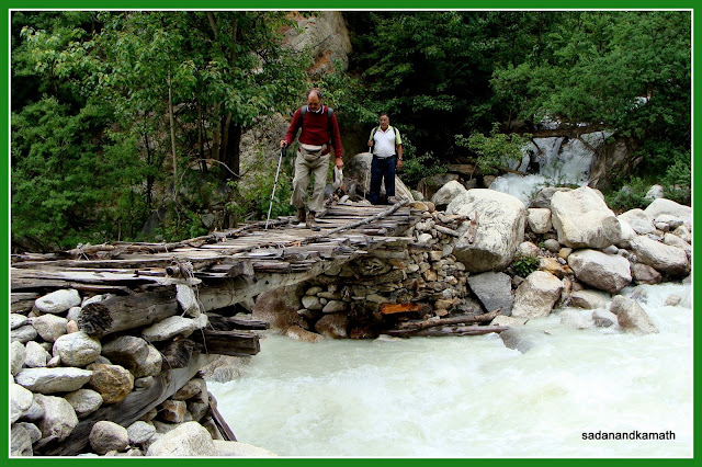 |
| Crossing a fragile wooden bridge over Bagini stream on way to Ruing. |
 |
| Ruing villagers. We left Jumma at 12 noon in Omni. The first hurdle for Omni was crossing a stream overflowing over the stone filled road about one km before Jumma village. After some anxious moments at the stream crossing during which a big stone hit the undercarriage of Omni, rest of the journey was smooth and we reached Joshimath at 2.30 p.m. We checked in to Hotel Chandradeep for a night. In the evening we booked our tickets for Haridwar on GMOU bus (@ Rs.250/- per head) leaving at 4.00 a.m. the next day |
One of the interesting conversations KS and myself had while doing Langatoli-Garud Base Camp and Kanari Khal-Garpak portion of our trek was that considering our age and some slowdown in our capacity to trek, we should now concentrate more on trips to off beat places coupled with some soft short treks instead of undertaking a full-pledged trek involving moderate to difficult conditions. This was our feeling when we were trekking at 4000m+ altitude. Sitting in my house in Mumbai in near sea level altitude, now the feeling is Ae Dil Mange More Treks!
More pictures on the links below:
Full set of pictures of Bagini Glacier-Changbang Base Camp-Kanari Khal Trek
Pictures of Wildflowers on TrailsTo BaginiGlacier-Changbang Base Camp-Kanari Khal
40 comments:
Excellent write-up of this tour. Still to read it fully though.
I do remember discussing that maybe we are getting too old now for these long 8-10 day treks!
But, yes, once you are back home and some of the physical strain has worn-off "dil does mange more" ;-) LOL
-KS
I just finished reading entire post. Amazingly accurate and wonderful details of the entire trek!
Not surprising, though. Since I know the amount of copius notes you were penning in your trek-diary, all afternoon sitting in the tent, while I slept and snored ;-)
Reading it, felt like re-living the entire trek.
Thanks KS.
Many of the observations and details in my blog have, in fact, come from the discussions we had during the trek. For instance, at Garud Base Camp, your observation that the easterly wind may prevent mist from covering the peaks was amazingly accurate.
That's the reason I don't like to do solo trekking :).
what's the camera you use to take the photographs?
Sony H10 P&S camera.
Is it a Digital SLR camera? How can you take these all excellent photographs? Give me some photographic tips.
Very nicely written account of the trek, and very beautiful photos!
@Debtanu,
It is a 'point & Shoot' camera.
If you are lover of nature, you don't require tips for photography. You are tempted to take pictures when you see something special or extra-ordinary. Rest is done by photo editing softwares. I use Picasa3 for photo processing mainly for cropping and adjusting exposures.
Please note that if you don't capture the subject you thought of, properly while taking pictures, no amount of editing software can enhance the quality of photos.
i had planned my next trek to chang bang base camp and this post is too much useful. thanks a lot
I have no words to explain how well this blog has been written :-) Awesome is the word, period!!
I'm pretty excited to do this trek and I have 2 questions? No in fact 3 questions...Lol
1. Any idea how the weather conditions would be during end of Sept this year??
2. I'll be trekking for the first time in my life...is that ok? (by the way I'm 26)
3. How safe is the trek? Porter + cook are neccessary? Tents...ohh where do I rent it from and how should I carry and put up tent??
I'm sorry, this questions are stupid but I'll greatly appreciate if you could answer them as these answers are so very imp to me and for my planning.
By the way, good to meet you Mr. Kamath. Do you also own Orchid hotel of Mumbai?? Ohh...that's Mr. V. Kamath. Hahaha,,,,just kidding!!
Hats off to you, Chief :-)) Keep rocking these wonderful treks.
Cheeeeers!
Jayesh
@Jayesh, thanks for appreciating the blog. As to your queries :
1. In Himalaya, it is very difficult to predict weather condition. Having said that, my guess is that due to persistent rains during the last 2-3 months in Uttarakhand, end September this year may be comparatively easy one insofar as rains are concerned.
2. If you don't have any health related problem, this trek should not pose you problem. If you don't have time constraints, you may follow our itinerary for an easy paced trek.
3. The trek is of moderate climb. For any trek, some risk is inherent and one will have to take some calculated risk. I can only say that if a senior citizen like me could do this trek, it should not pose problem for a youngster like you. You will be required to carry food, tents etc. Guide/porters will be available in Joshimath who will arrange tents etc.
hello friends...we are going in the same route in the 2nd week of October...my question to you people is that ... "whether it is possible to complete this trek within 6days instead of 7days...means whether it'll be a great problem if we dont waste a night at Langatoli and go straight up to Gadur Base camp...???"...it will be of great help if you suggest us...thanks in advance .. :)
@Suva, if you start early morning from Dronagiri village, you can make it to Garud Base Camp on the same day. If you face difficulties for unforeseen reasons, there are two camping sites between Langatoli and Garud Base Camp where you can pitch your tent.
Hi, Well let me tell you one thing is that you and KS should go ahead and author a travelling book.
On the write up I would say that as i was reading, I felt that I shoud visit this place at the earliest. It was so refreshing. I felt that what I am doing in mumbai!!!:) Let's see one day I might plan some good treks such as these or the ones which KS have done earlier. Once again Thanks for writting such beautifull blogs.
Regards,
Vinit
I have read both this trek and the one to Nanda Devi Outer Sanctuary.
Please ¿How do you compare both treks?.
I just did the NDOS up to Daranshi pass last October 2011 and I would like to do another trek in the area next October. No rains at this time.
By the way I am from Spain and 75 years old.
Sorry for a delayed response as I was travelling.
In my view, both these treks are of same degree of difficulties. Since you have already done NDOS, you should not find it difficult to complete successfully the Bagini Glacier trek. The only problem in October could be some early snowfall at the higher altitude around Bagini Glacier area.
I must admire your fitness to do the Himalayan treks even at the age of 75.
Thanks very much for your answer Sadanand and for your excelent writing.
I would like to know also how do you compare in terms of beauty of the both areas and views for good photographs of the Nanda Devi and other scenery.
My fitness is very relative. I suffered a lot onthe journeys from Lata Jharak to Daranshi pass thru de Satkhula gorges and back 8/9 hours each day. I am going to post my account of my trek as I have finished the translation form the original spanish version.
Both these treks have great views of some of the tallest Himalayan peaks. There is some ruggedness in both the treks - beyond Lata Kharak in NDOS trek and beyond Dunagiri village in Bagini trek. If one treks in June or after some pre-monsoon showers, both these treks will have wild flowers.
Personally, I was mesmerised by a clear view of shining Changbang peak from a ridge beyond Bagini Glacier. But beauty is a relative term - both in terms of individuals' perspective as well as in terms of timing of the trek. For trek, I prefer pre-monsoon period, June for greenery and wildflowers, while some prefers autumn time when sky is likely to be clear to get perfect views of snow-clad peaks.
Thank you so much for your explanations. I will try to do this trek beginning next October, as I prefer clear skyes.
If you would like to read the account of my trek to Nanda Devi, this is the thread:
http://www.indiamike.com/india/journal.php?do=showjournal&j=9667#e1221
Kamath,
Thanks for such a vivid description of this absolutely beautiful trek. Just reading about it makes it sounds so out of the world. I have enrolled for this next week and I am sure I will enjoy this as must as you did, if not more.
About the photographs, did you get to charge your batteries anywhere after leaving Joshimath?
Sorry for the delay in reply.
Thanks for the appreciation of the blog.
After Joshimath, I did not find any place on the trek route to charge the batteries. I had taken 3 sets of fully charged batteries of my camera.So I did not feel the need to recharge the batteries.
Thank you very much for this very well written log. Hats off to your spirit, very inspiring.
Hello Sir!
It is an incredible feeling to see you both achieve such great heights at this age. You both inspire us to look at life with new eyes. After going through your article, I am thinking of doing the trek. We are a group of 8 heads (all in our mid 30s and girls). Will like to have the information of the trek guide. Contact details and package cost. Can I contact him directly and book for April 2015 this particular trek ?
Thanks and Much Regards,
Sayani Dasgupta
Sadanand sir,
How will be the route towards Changbang base camp during 2nd week of May? I'm planning to do it (minus the kanari khal) between 9th May - 16th May. Will the grasslands laden with wild flowers as shown in your blog will be covered in snow :-) ?
On the basis of the last year's experience of my guide during the first week of May 2014, the trek path beyond Garud Camp (between lower and upper Bagini Glaciers)would be snow bound. So wild flowers on the way to Changbang base camp are ruled out.
Incidentally, in the backdrop of heavy snowfalls even in March, it is likely that this route will be snow bound even as late as May end. If you are flexible about dates, plan the trek from the first week of June to better the prospects of seeing wildflowers.
Hey this is jayesh
I liked your information about the trek it was really a good read
First of all thanx for sharing your experience with us
Moreover I'm planning to go on a trek to bagini glacier So I have some questions about it
If you don't mind can i get your fb link so that I can ask you those questions.
Jayesh ji,
You may ask your querries about this trek here. I will answer them to the best of my knowledge.
Nice detailed writing. May I have contact number of the Guide of this trek route. I'm planning for this trek on the month of May this year.
hello sir,
thank you for the detailed writing.
i am planning for the trek to garud base camp,
can u send the details of the guide and detailed map for the trek(base camp & Peak Mt.Garud).
i will be really thankful if you could send me the details.
Regards
Hello Sir,
Following Your & KS's writing, this year we have chosen this trek. Can you please let me know the charges you paid to Sonu(your Guide). I just want get a fill of the expenses.
Sonu charged all inclusive (Joshimath to Joshimath including Food, Pony, Porter, Vehicle, Tent Etc) or he took the guide & Porter charges and balance on actual?
With KS’s reference I took Debu’s help for Sundardunga trek and Last year took Riyaj Ahmed’s help for Kashmir great lakes trek and both the trek I got better help/service than expected. Thus want to took Sonu’s help for our changbang trek.
We will be doing this trek end May this year, thus request you to please help with the information if possible at the earliest.
Regards,
Somenath
rolling2509@gmail.com
Need contact no of guide Sonu.
Rolling stones,
I do not remember now as to how much we paid to Sonu for this trek. But whatever we paid, it was for a full package (Joshimath to Joshimath including everything). Our experience with Sonu in all the treks we did with him was that his charges are reasonable for the services he provided.
Dipankar Roy,
Sonu's contact No.+919410365281
Thank you, SK
Sadanand Kamath
Sir, can you give me your contact number please. actually I am planning to visit at bagini glecier. that is why I need to contact with you for your valuable advice. My contact number is 9038690096 Name: Subhayan Thakur from westbengal.
Post a Comment