[In
continuation of
Day-4 : To Pangong Tso
Lake (165 kms)
We got up around 5.30 am to get ready for departure to our first high altitude
journey to Pangong Lake. The next 3 days
were to be crucial for all of us as for the first time, we would be travelling
at a very high altitude crossing, to and fro Chang La Pass (5360m) and Khardug
La Pass (5602m). A knock on the door of my room by my sister interrupted my
thought as she told me that my brother-in-law had vomited as soon as he got up
in the morning. When I went to his room, I found him coming from the bathroom
after a bath. He said that he did not experience head ache nor he felt breathless
which gave me some relief from the anxiety. Probably, an upset tummy may have
been the cause of vomiting. But at a higher altitude, it is difficult to guess
the reason for vomiting as it is also one of the early sign of AMS. Since the
doctor will not be available in the early morning, I gave him a tablet of
Domstal and advised him to drink plenty of water with electrolytes powder.
There was no further vomiting though he had nauseating feeling throughout the
day. After taking a light breakfast, he felt confident to travel to Pangong
Lake.
We
were schedule to leave for Pangong Lake by 6.30 am but eventually left at 7.00
am after breakfast.The hotel had given us packed dry lunch packets. We carried a box of 12 mineral bottles in our Innova which became one of the standard items to be carried in our all the trips in Ladakh. An oxygen cylinder was also provided by our hotel as a precautionary measure which remained in Innova through out our trip. However, none of us required to use the cylinder through out our trips in Ladakh.
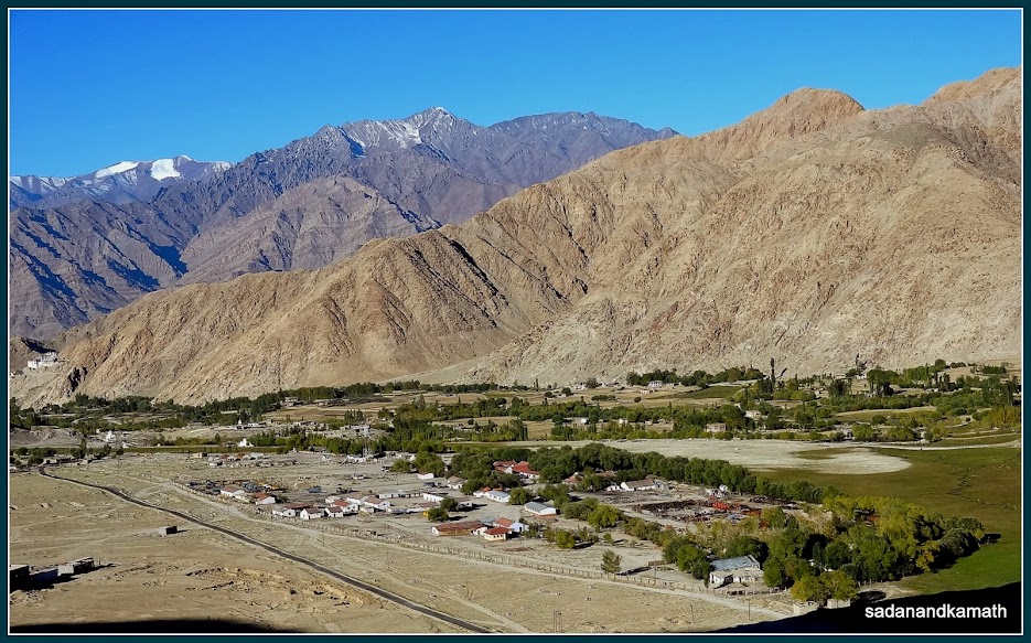
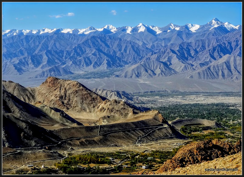
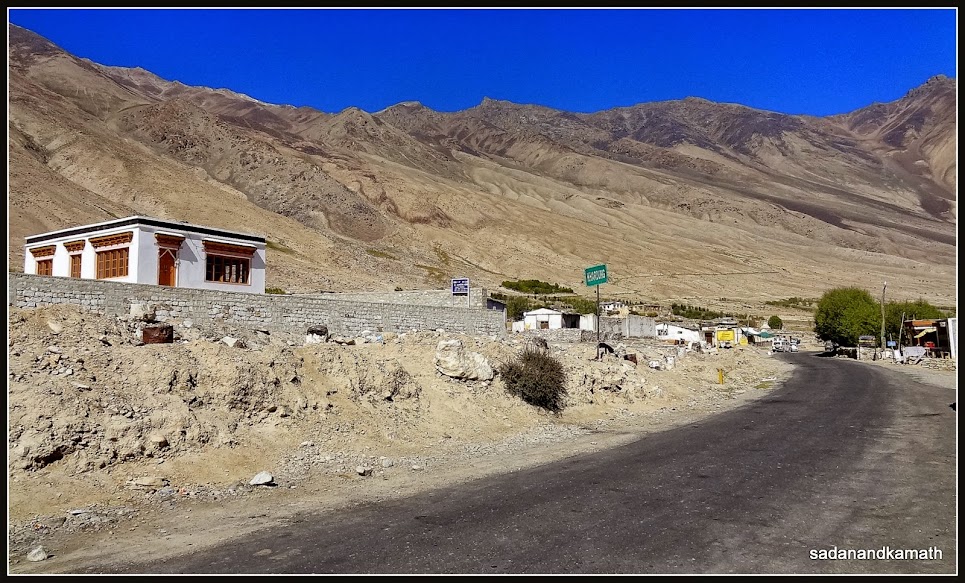
Shakti village from where the climb to Chang La Pass (5360m) starts for Pangong Lake.
Climb to Chang La Pass
The
route the Pangong Lake starts from Leh-Manali Road. The road to Pangong Lake
bifurcates to the left at Kharu village (45 kms from Leh) where an army
check-post inspects IPL, a copy of which is given to them before proceeding
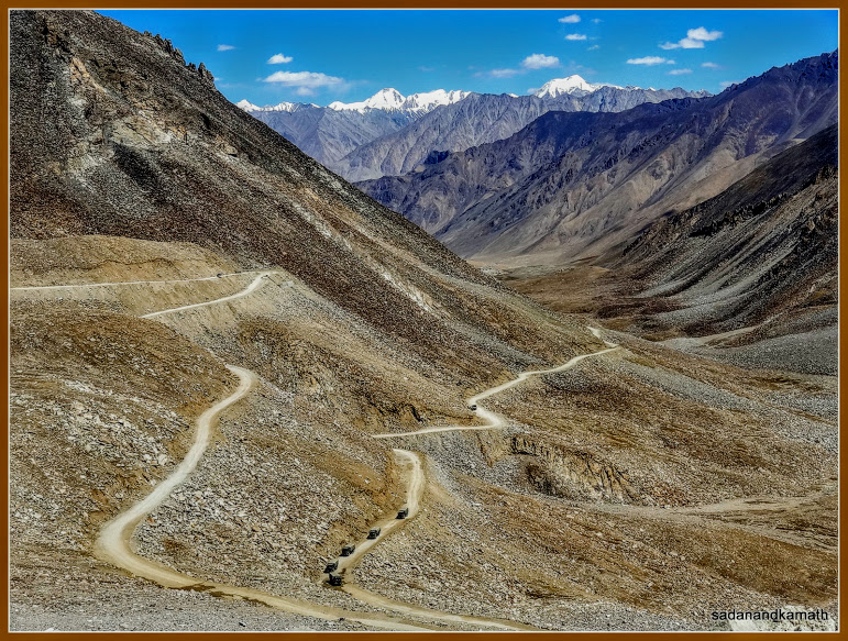
further. The road passes through the plateau until Shakti village from where
the climb starts. The road condition was good except 5 kms before Changla Pass
and 10 kms thereafter which was a dirt road where one was forced to drive in
10-20 kms per hour. The road has no protection or guardrails. At Chang La Pass (5360m or 17590 ft. Above sea
level), the third highest motorable road in the world, there is an army camp
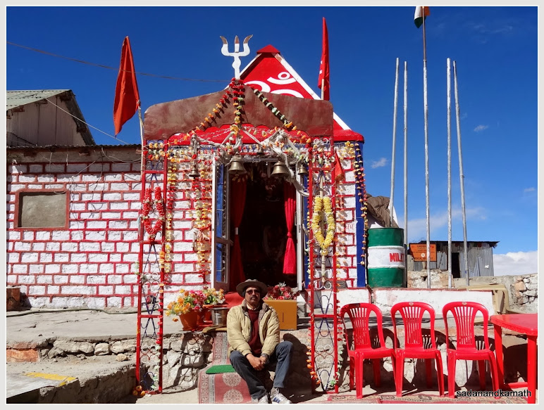
which serves tea and biscuits to all visitors free. There is also Changla Baba temple with
prayer flags. We did not stop and get down at the pass as we had already decided
to get down on our return journey. Fortunately, none of us felt any problem of
high altitude during our journey. Probably, we forgot the problem of
breathlessness by enjoying the breath-taking scenery throughout the journey!
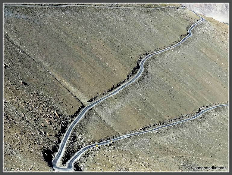
Mountain topography on way to Chang La Pass.
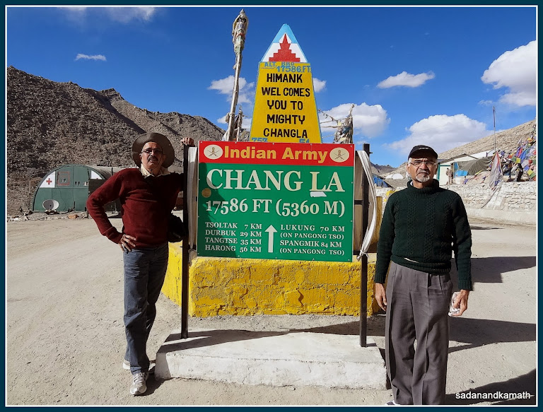
Me and my brother-in-law at Chang La Pass. 'La' in Ladakhi language means 'Pass'.
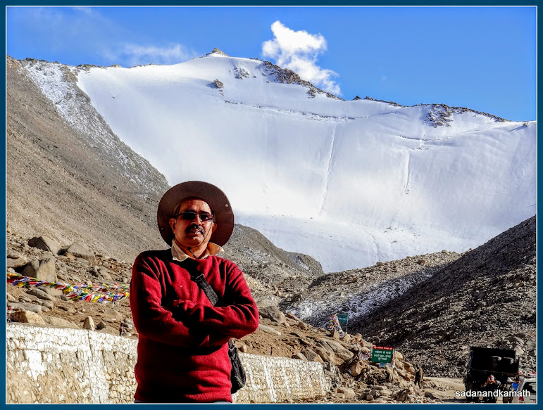
Me at Chang La Pass.
After
the pass, the dirt road continued for another 10 kms until a small hamlet
called Tangste. Again the road passed through plateau with
mountains of different shades on both sides. At some places, there were meadows
where we could see Yaks and mountain goats/sheep grazing. It is a scenic
journey of a different kind where bald mountains devoid of any greenery look
extremely beautiful. This region is also a part of Changthang Wildlife
Sanctuary. We also spotted a group of the Himalayan Marmot in this region while
returning to Leh.
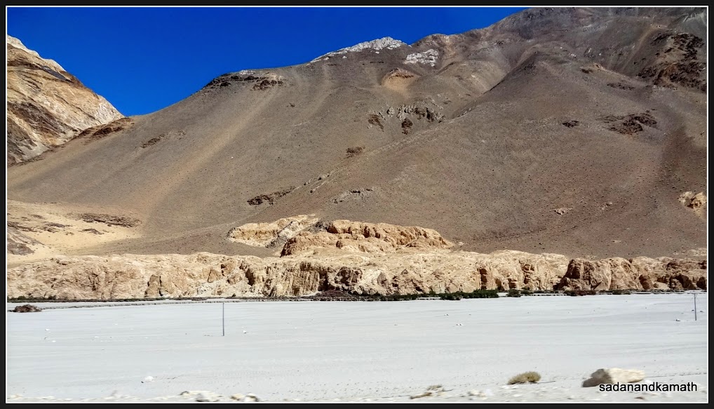
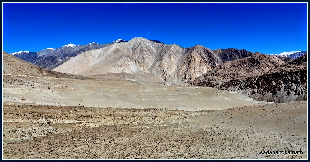
After Chang La Pass, there are more of the sandy places like this one.
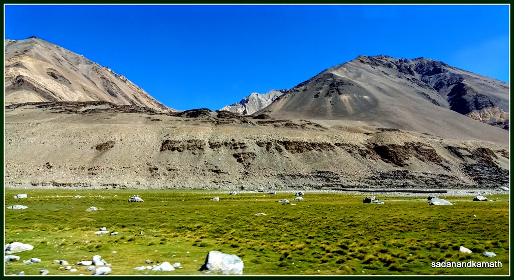
But there are few green patches like this one which are the favourite places grazing by wild yaks.
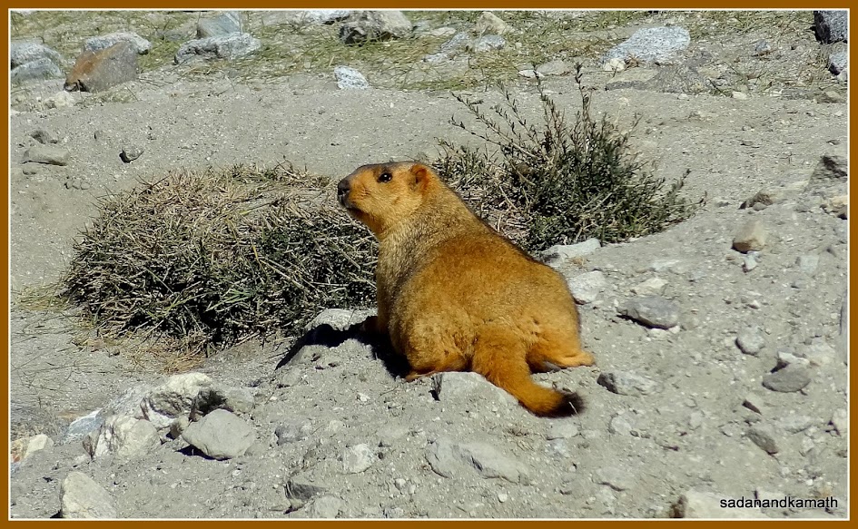
The Himalayan Marmot on the way to Pangong Lake.
And some water hole too.
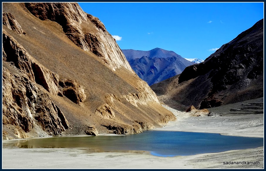
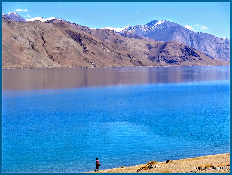
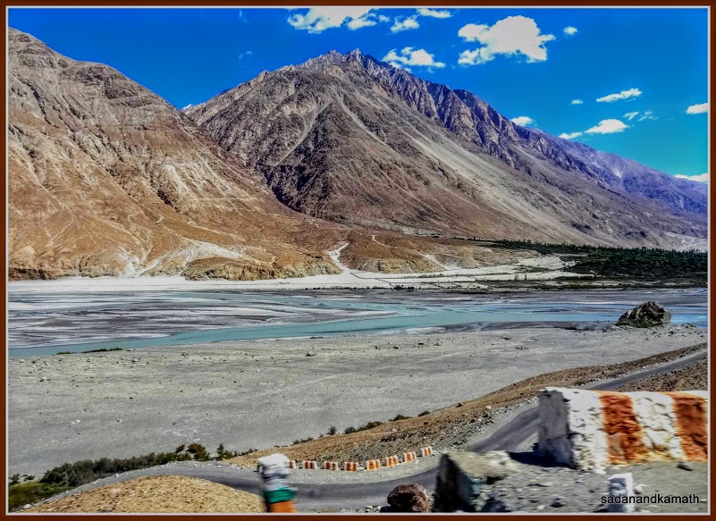
It
is not until Lukung that we got the first glimpse of the western tip of Pangong
Lake. But soon it disappears as a mountain blocked the view. As we crossed this
‘blockage’, the entire stretch of Pangong Lake was visible to the infinity. Even though I have seen the pictures of
Pangong Lake, the actual seeing the lake made me speechless as I failed to get
the appropriate adjectives to describe the lake and its surrounding mountains.
I just could not believe that such a beautiful lake surrounded by ‘bald’
mountains of different shades existed in this planet.
The first glimpse of Pangong Lake from Lukung.
The final descending towards Pangong Lake from Lukung.
It
will not be out of place to mention that just before the entry into Pangong
Lake area, there is a small stream which gets swollen as day passes. The source
of this stream is a glacier which melts during day time increasing the flow of
water into the stream. By noon, the gushing water of this stream over the road is
so strong that the vehicles cannot cross the stream until evening when the
water level comes down. It for this reason that earlier, it was always
advisable to plan for a visit to Pangong Lake with an overnight halt so that one can
reach the lake before noon and on the next day, to cross the stream before noon on a return
journey. Because of this behaviour of the stream, it was nicknamed as ‘Pagal
Nala’ ( Crazy Stream). Now Border Road Development Organisation of the army has
constructed a iron bridge over the stream making it possible to visit Pangong
Lake on a day trip.
Pangong Lake seen from the road side.
Another view of Pangong Lake from the road side.
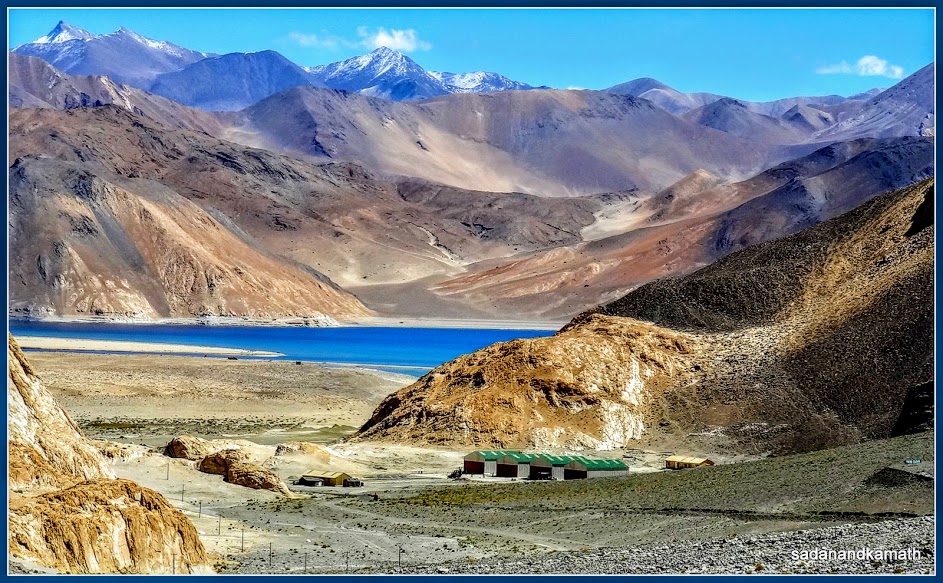
We
reached Pangong Lake at around 11.30 am after a brief ‘pit stop’ at an army
camp area just before Changla Pass. We parked our vehicle in front of one of
many tents in the vicinity of Pangong Lake and ordered for ginger tea. Surprisingly,
Pangong Lake area even at an altitude of
4350m or 14350ft was warm due to strong sun and the absence of breeze. So we
had to remove one layer of sweater to walk to the lake shore and enjoy the serenity
and tranquility of the place. The water of the lake seemed to change its
colour from sky blue to dark blue depending upon the shades of the mountains
surrounding it. Sometime the sky blue colour would have a ting of emerald green
near the shore. Otherwise the water was
crystal clear as we could see pebbles through the water at the shore.
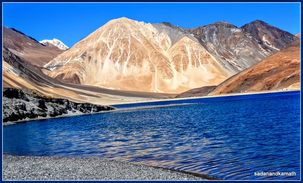
Snow clad mountain view from Pangong Lake.
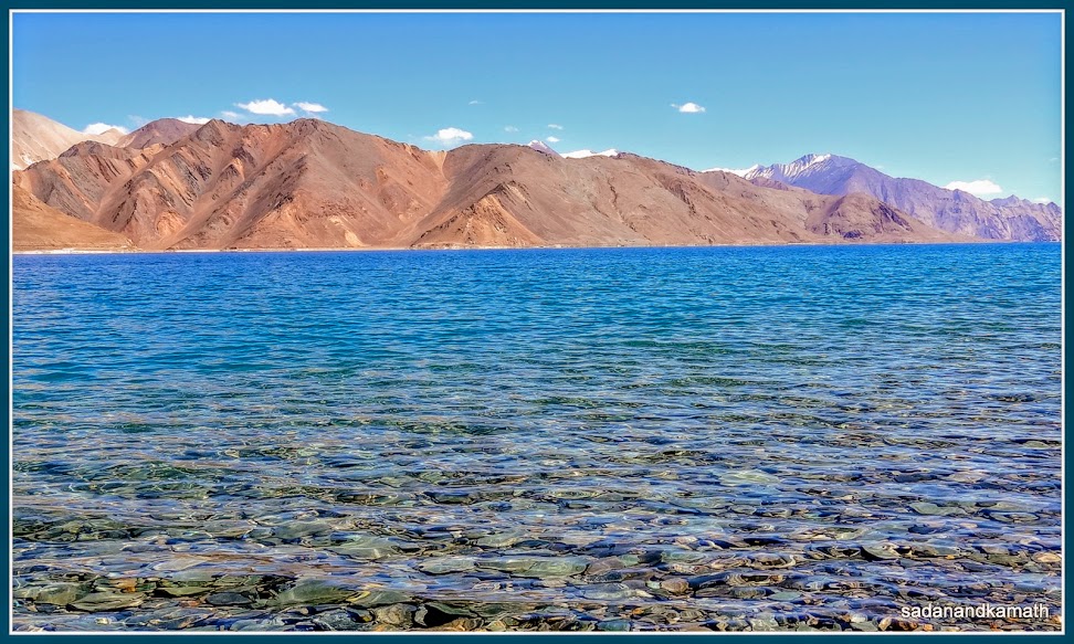
Pangong lake from the ground level. Please note the pebbles which are visible through its water.
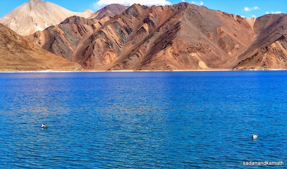
Gulls from Central Asia make Pangong Lake their summer home for breeding.
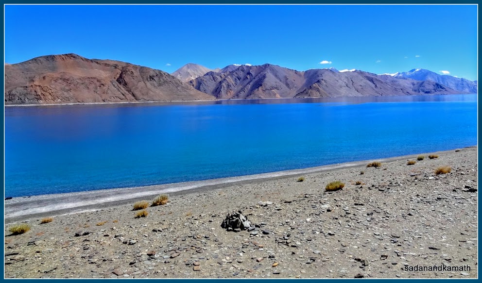
Pangong
Lake is 134 km long and its broadest width is 5 kms. Nearly 70% of the lake is
over the Chinese side of LOC. The water of the lake is brackish and it does not
have any aquatic life. However, brown headed gulls make a regular visit to the
lake in summer from Central Asia for breeding. Probably the gulls depend upon some
small species of arthropods found in the lake for their food during breeding. Boating
in the lake is prohibited though army men were seen patrolling the lake in
their boats.
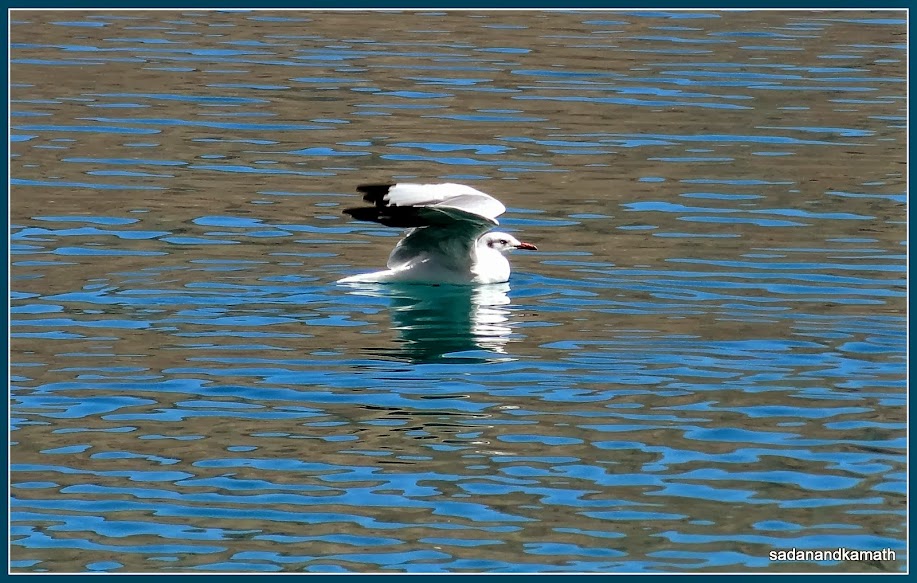
A gull is about to fly over Pangong Lake.
Western tip of Pangong Lake. A part of the song 'Satrangi re' from Hindi film DILSE (1998) was short on the pebbled filled mini island (in the foreground) in the lake.
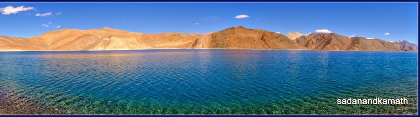
A panoramic capture of Pangong Lake from western side.
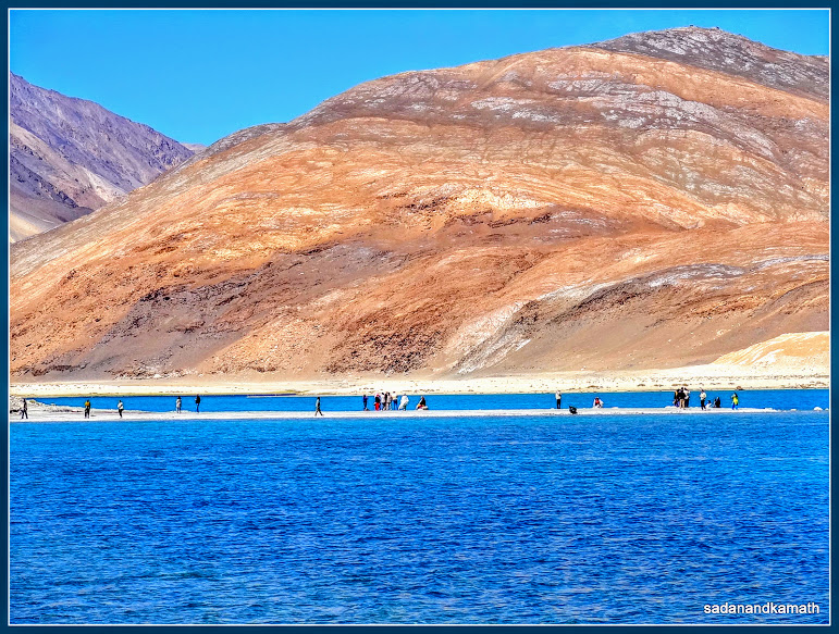
A lagoon like projection into Pangong Lake at its western side. This lagoon was the place where the final scenes of Hindi film '3 Idiots' were shot.
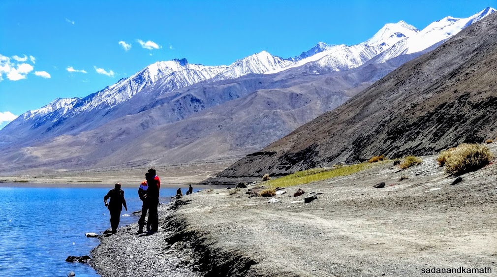
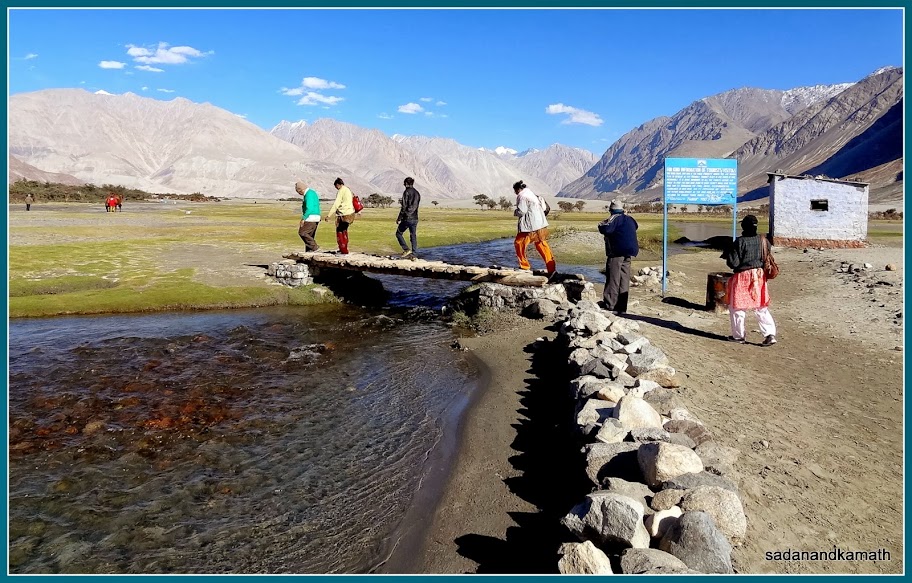
There
was a moderate crowd – mostly family crowd at the shore of the lake. Some of us stood in the lake water which initially felt cold and then icy cold as duration of
standing in the water elongated. We walked about 200 metres on the shore to
witness the colour change of the lake water. We found a pebbled filled place
near the shore surrounded by the lake water making it a mini island and sat
there for about 30-40 minutes to get a feel of a heavenly abode. We could have continued to enjoy this tranquil
place for some more time but for a scorching sun which made us a bit
uncomfortable. So we walked towards the tent where we had tea by walking over a
gradual climb. None of us got problem of breathlessness at this altitude even
after spending nearly two hours and walking on a moderate climb to the tent.
After
taking a bowl of Maggie soup and our dry lunch at the tent, we commenced our
return journey at around 1.30 p.m. After a km or so, we noticed a crowd of
tourists which appears to be thronging in the middle of the lake. When we came
nearer to it, it transpired that it was a narrow longish projection which ended
deep into the lake. Even a couple of vehicles were seen on this narrow projection. This was the spot where the final 10 minutes of scenes from Hindi film '3 Idiots' (2009) were shot. We
felt like going there but the warm weather and likely altitude sickness due to
spending more time at this altitude could later create problem for us.
Our driver told us that during winter, the lake water is completely frozen which enables the tourists to walk on the lake. He further said that during the month of April, the whole mountain ranges surrounding the lake are fully snow covered and the place gives a different perspective with blue water of the lake.
As decided, we stopped briefly at Chang La Pass for a view and a photo session. By this time, except for myself and my brother-in-law (wife’s brother), others were not in a mood to alight from the vehicle as they felt some signs of breathlessness. The most affected was my brother-in-law’s wife who felt breathless even before reaching Chang La Pass. All of them were snuffing camphor through their handkerchiefs to overcome the breathlessness. They all become near normal once we descended from the pass and return to our hotel in Leh at 4.00 p.m. After a cup of tea and biscuits, we all returned to our hotel rooms for a couple of hours’ rest which hastened the recovery from the bouts of breathlessness. By dinner time, every one of us was hale and hearty, ready for tomorrow’s yet another high altitude journey to Nubra Valley.
Day-5 : Visits to Diskit
and Hundar in Nubra Valley (128 kms)
The
day’s journey involved climbing from Leh (3550m) to Khardung La Pass (5602m) in
40 kms of road journey and then descending to Diskit village (3125m) in 78 kms
via Khardung and Khalsar villages. A further drive of 10 kms would take us to
Hundar sand dunes. So distance-wise, it was not a long drive as compared with the drive
to Pangong Lake. But the crucial point in this journey was crossing Khardung La Pass
without any hitch. We were told that there could be a traffic jam in around
Khardung La Pass due to incoming army convoys of trucks and closure of road at
that area for a couple of hours due to the road widening works. So we were advised to start from Leh/ Diksit early so that the pass is crossed before noon after which the road work gets momentum and blasting work starts.
We
commenced our journey around 8.30 a.m. from Leh. The road to Nubra valley
starts immediately after passing through the market area and takes a left turn from this point. After
about 6 kms of drive, the climb to Khardung La Pass starts. Even though, the
pass is a highest motorable road of the world, driving on this hill road is not
as difficult as some of the lesser known passes in the Himalayas including
Chang La Pass which we crossed the previous day. It is the altitude, the likely
traffic jam and delay near the pass which makes the tourists travelling in the vehicles
venerable to altitude sickness. At South
Pulla army camp, the ILP were checked and a copy of the same was given to the army
authorities. The road condition after South Pulla below the pass to
North Pulla army camp after the pass ( a distance of nearly 30 kms) was a dirt
road with some patches being very rough to drive. There was no protection or guardrails on the valley exposed side the road in this stretch.
The view of the beginning of the climb to Khardung La Pass.
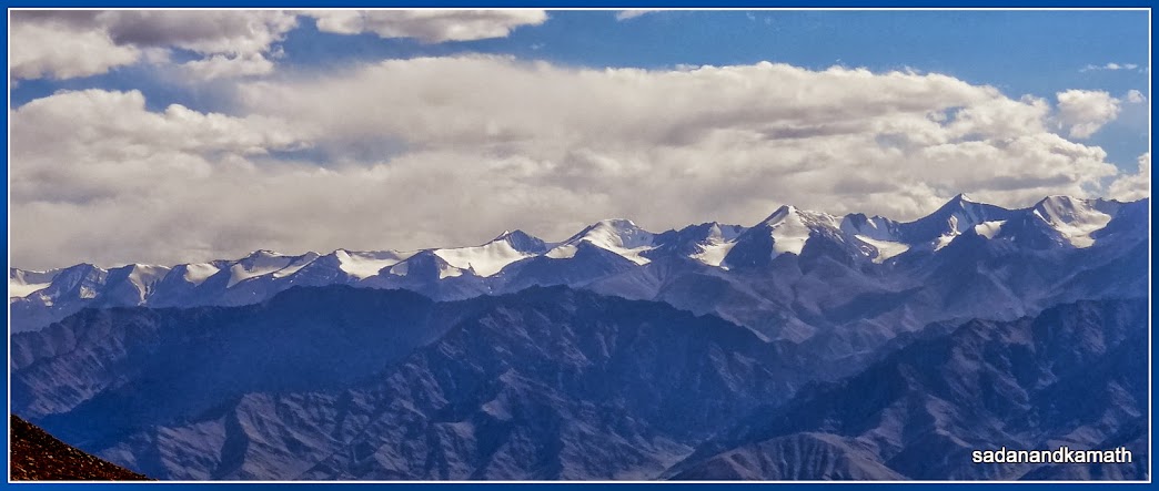
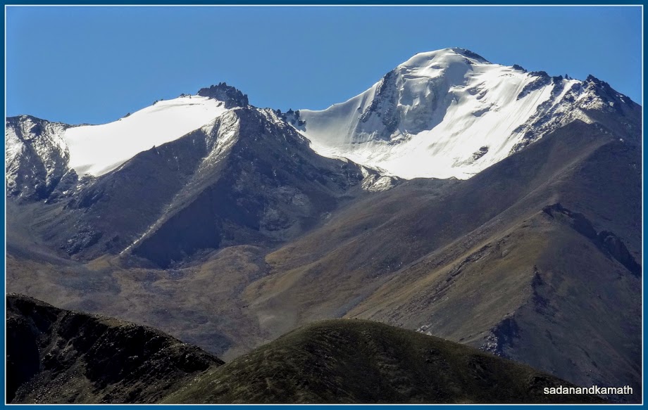
View of snow clad mountains of Ladakh range from South Pulla
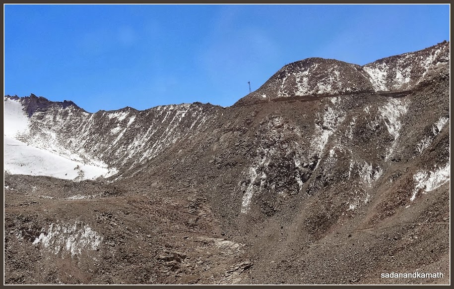
Khardung La Pass (with tower) seen from Khardung village side.
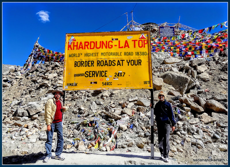
Me and my borther-in-law on Khardung La Pass
Me in front of a temple on Khardung La Pass
Just
about 2 kms before the pass, we were stuck in a traffic jam because of the
incoming convoys of army trucks which numbered about 50. Though the road was
wide enough for crossing two small cars, it was not possible to cross when army
trucks were coming from the opposite direction. It took about 40 minutes for the convoy to pass before we could commence our journey. We crossed the pass by 10.30
am without any problem from the high altitude. As usual, we did not venture out
at the pass for photo session and tea break as we had decided to stop here on
our return journey. At North Pulla after
the pass, our ILP was again checked and a copy of the same was retained by the
army authorities. Both these places have toilet facilities.
We
reached Khardung village at around 11.30 am and had a tea break. It is at this
point, we noticed that my brother-in-law was having problem in getting down
from the vehicle and was walking unsteadily as
he was slightly disoriented. Probably 40 minutes of wait at the traffic jam
just before Khardung La Pass may have resulted in getting a mild altitude
sickness. However, once he rested in the hotel and had tea and biscuits, he had
partly recovered from the symptoms.
A convoy of military trucks coming from Khardung village side on the climb to Khardung La Pass.
A view of Khardung village from road side.
Khardung village prayer wheel.
The road through Khardung village.
After
a few kms of drive from Khardung village, the tarmac road was in good condition
and there were fewer bends and curves on the road. The mountain scenery was
good though we saw only a very few oasis of green patches. As we reached near
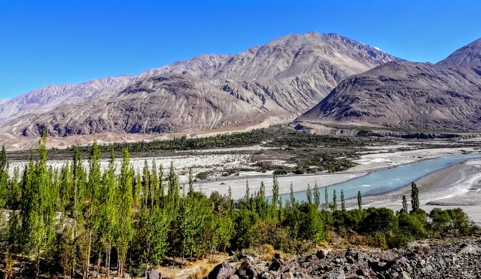
Khalsar village, Shyok river became visible to the right with its multi chanels
of flows. It appears that somewhere Khalsar and Diskit villages, there is a confluence of , Nubra river with Shyok river but due to multi-channel of flows, it was difficult for us to pin point the exact location of the confluence. With river flowing around, the green patches at its bank became pronounced. A few kms after
Khalsar village, a bifurcation to the left took us to Diskit village as the straight
road goes to Panamik. The highlight of the road to diskit immediately after the
left turn is that it is a complete straight road of 5-6 kms without even a minor
bend or curve and it passes through the flat land giving an impression of a
tarmac runway.
View of snow clad mountains from somewhere near Khardung village.
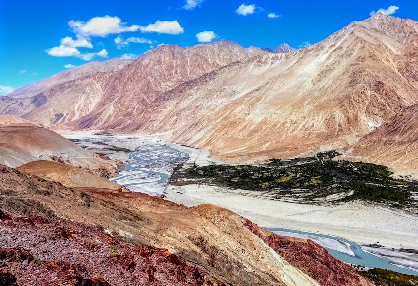
The first view of Shyok river on the way to Khalsar village.
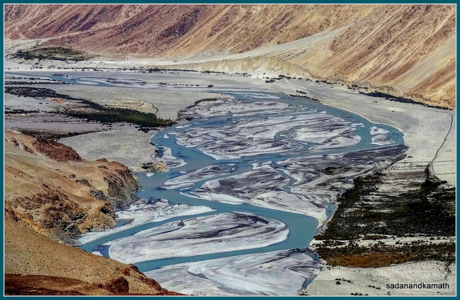
A zoomed shot of Shyok river taken from our moving Innova.
The road to diskit almost comes in level with Shyok river.
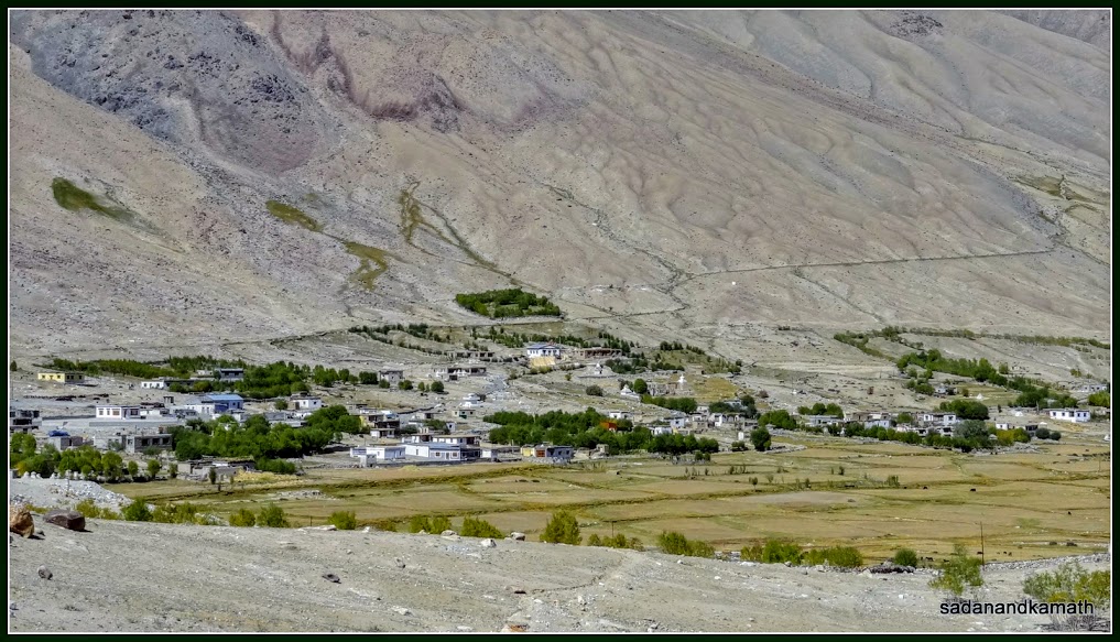
We
reached Diskit at around 1.00 pm and checked in Hotel Sten Del. It was a nice
property having a small courtyard and clean rooms with hot water and TV. Surprisingly the rooms had a ceiling fan which indicated that even at 3100m
above sea level, the day time in summer may be warm. At the backyard of the
hotel, there was fruit and vegetable garden. The only problem with this hotel
and also for others in Diskit village was that electricity was available only from
7.00 pm in the evening and remains until morning. So one has to take hot water
bath either in the evening or very early morning. The hotel had a nice restaurant where we took
lunch after freshening up. As the tourist season was coming to an end, we were
the only occupants in the hotel.
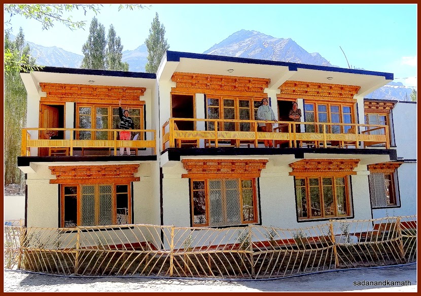 We stayed in Diskit at Hotel Sten Del
We stayed in Diskit at Hotel Sten Del
After
some rest in the hotel room, we proceeded to Hundar for sand dunes and double
hump camel rides. Hundar village is located about 8 kms further from Diskit and
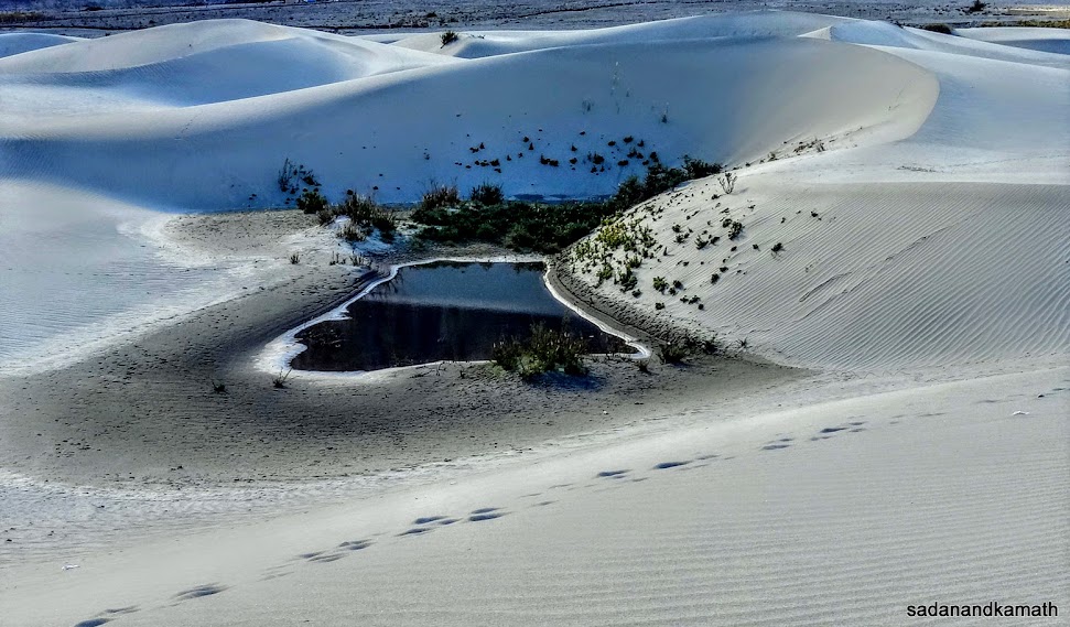
the entry point to sand dunes is by taking a big ‘U’ turn of about 2 kms. A
small stream flows by the side of the sand dune. The vehicle is allowed
up to a wooden bridge over the stream after which the camel ride point
starts. There were many camels waiting
to be hired and again we were the only tourists at that point of time to hire
the double hump camels for rides. The rate is Rs.180/- per person for a 15
minutes ride which is non-negotiable. Since I was more interested in
photography than the camel ride, I did not go for the ride. Same was with my
brother-in-law who had just recovered from a mild altitude sickness.
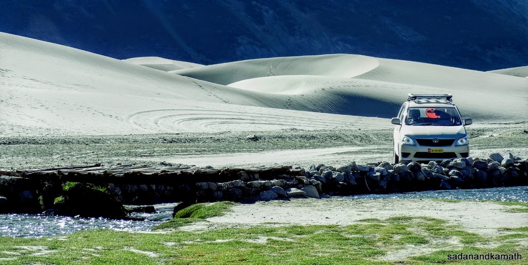
The first close encounter with Hundar sand dunes as we parked our Innova.
Walking towards Double Hump camel ride point.
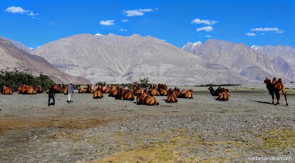
The camels in waiting for tourists in Hundar.
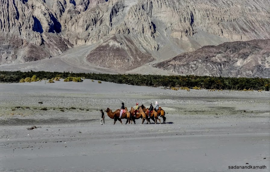
The camel rides.
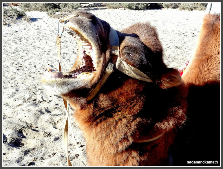
After the end of the ride, one the camels had a 'sigh of relief'.
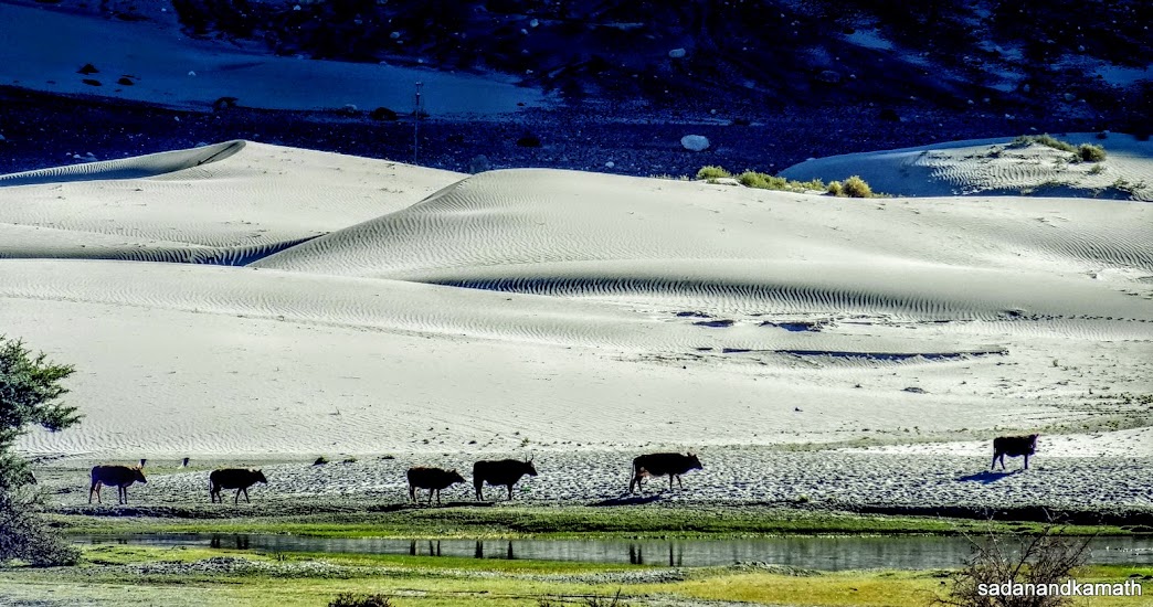
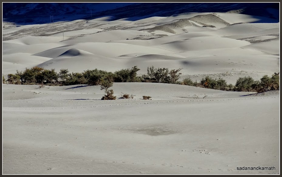
Unlike
sand dunes of hot deserts like Rajsathan which are golden in colour, the sand dunes of the cold desert of Hundar is grey in colour like the river sands I have seen in
the Himalayan Rivers. The waves and humps of this sand dunes are not as high as
that of hot desert sands. After camel rides and spending about an hour on the
sand dunes, we returned to Diskit to have a hot coffee in the lawns of the
hotel.
Hundar sand dunes
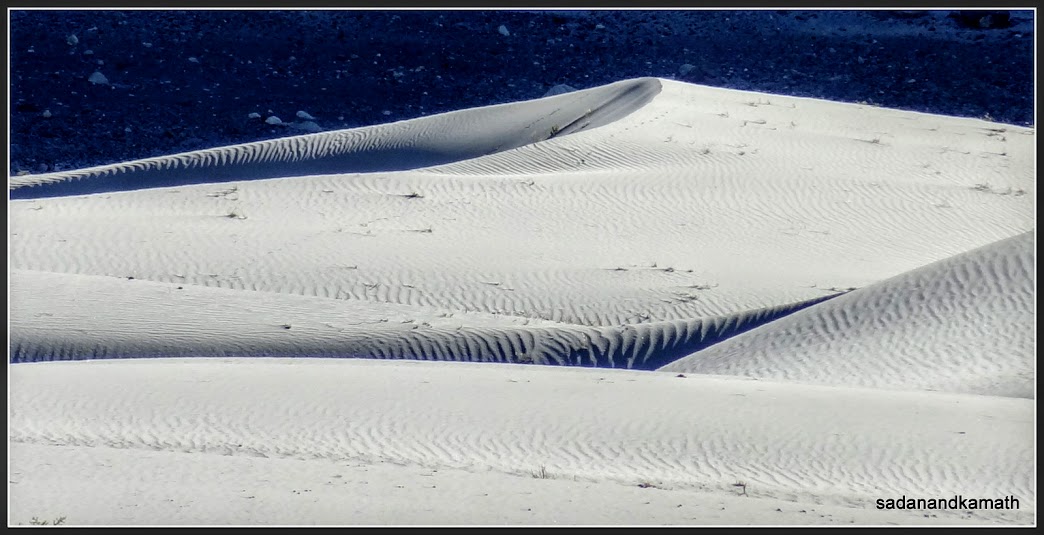
Hundar sand dunes.

Hundar sand dunes.
Hundar sand dunes.
Hundar sand dunes.
Vijay Pol, a hotel staff hailing from Parbhani district of Maharashtra took us
to the hotel’s vegetable farms in the backyard. He said that vegetables and
fruits from their farms were only used for food preparations in the hotel. The
requirements of milk for the hotel was taken care of by cows owned by the hotel owner.
When
we came back to the hotel, electricity supply was available. So we watched some TV programmes before the dinner. Earlier
we had requested the cook to prepare kichdi with curry pokodas and baigan bartha for the dinner
which he obliged. The kichdi was yummy with good quantity of pure ghee
poured on it. For the first time, we relished our dinner to the full extent as
if we were having a home cooked food. In the night, Vijay Pol brought to our
room a glass of hot cow milk for each of us before we retired for the day. We wish
that we could have stayed one day more in Diskit to enjoy the solitude in this
hotel with excellent services provided by the cook and Vijay Pol.
Day-6 : To Diskit
Monastery and back to Leh (120 kms)
In
the previous day, our driver has advised us to be ready by 7.00 a.m. so that
after visiting Diskit Monastery on the way, we cross Khardung La Pass as early
as possible to avoid getting caught during the temporary road closure around
the pass for road widening work. According to his experience, the duration of
the road closure could be as short as 30 minutes but at times it could be as long as 3 hours.
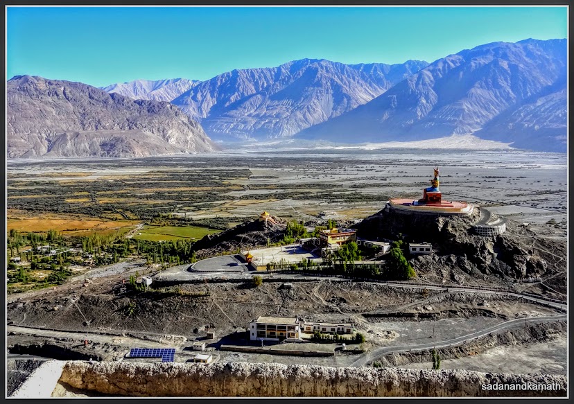
View of Diskit monastery from Hundar sand dunes.
Even
though, Diskit is at an altitude lower by about 500 metres as compared with
Leh, we found that the night and early morning cold was somewhat more intense
than in Leh. The reason could be that apart from sparse population, Diskit has
more open spaces and greenery than Leh. Also the sand dunes nearby and the wide
Nubra valley give Diskit the uninterrupted flow of cold breeze.
After
the breakfast of Kande-Pohe (Flatten Rice with Onion), we commenced our return
journey to Leh by 7.30 am, the usual 30 minutes of late start since we landed
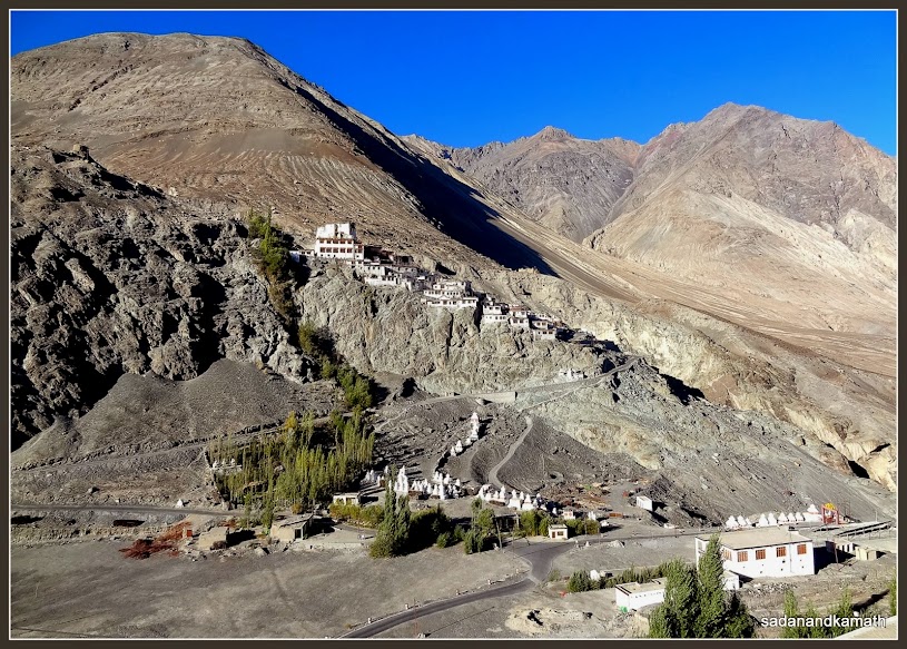
in Leh. Diskit Monastery was visible from the road outside the hotel. In less
than 15 minutes, we reached the road end to Diskit monastery. A path to the
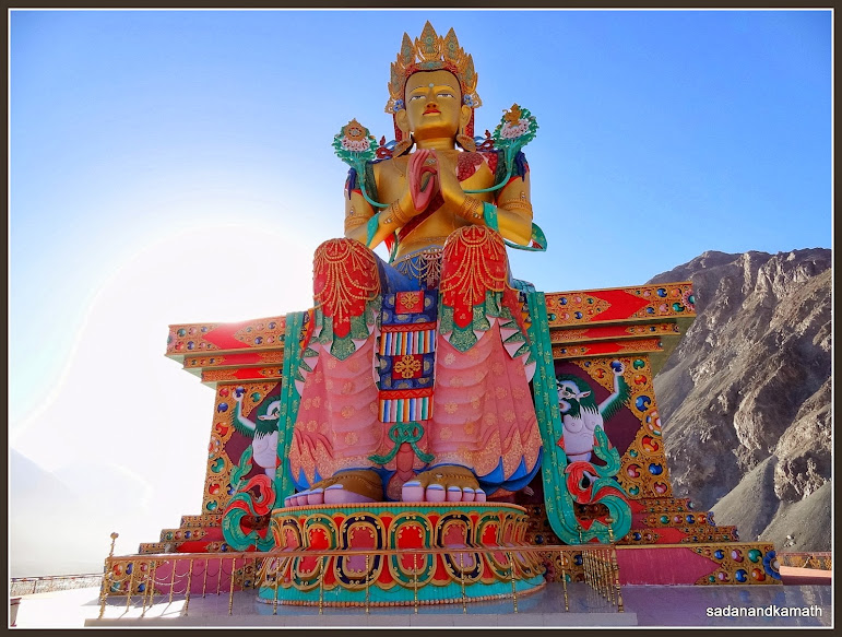
left took us to the newly constructed (2010) giant statue of sitting Maitreya Buddha facing Hundar side. A round platform has been
constructed with iron railings around the statue giving a 360 degree stunning view
of Nubra Valley.
Statue of sitting Maitreya Buddha on a hillock close to Diskit Monastery.
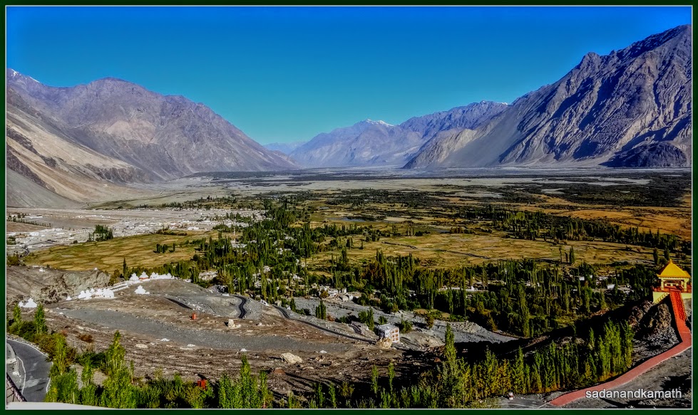
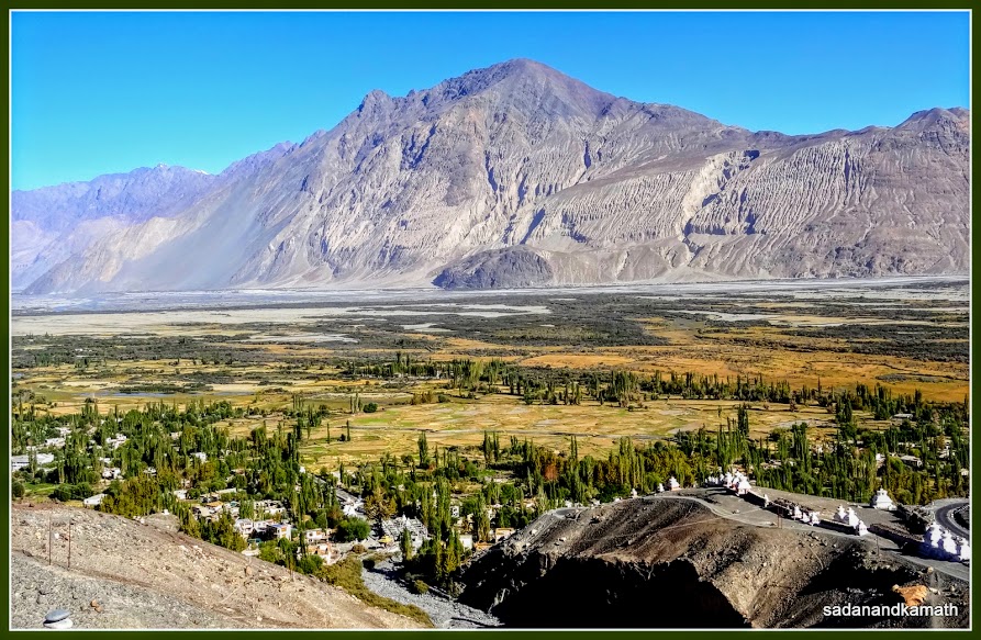
View of Nubra Valley from Maitreya Buddha hillock.
View of Maitreya Buddha statue with Nubra Valley from Diskit Monastery.
After
spending about 15 minutes, we proceeded towards Diskit Monastery. We had to
climb main stairs to reach the gates of two main shrines in the monastery. The
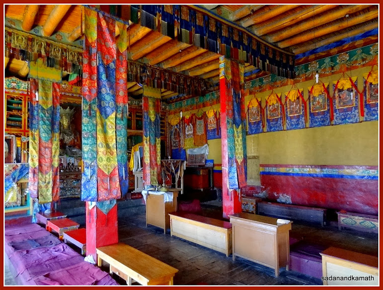
monastery was established during 14th century. There were two main
shrines inside the monastery – one with prayer hall and Maitreya Buddha statue which appears to be new one and the other old shrine
with a statue of Goddess Kali. The photography in old shrine is prohibited. But
there is not much to click here as the shrine is not kept well and the murals
on the walls have been partially obliterated due to neglect over a
period of time. The monk in the temple told me that during summer, new shrine
of Maitrya Buddha is used for prayer while in winter, it is the turn of old
shrine for prayer. The monastery runs a public school in its complex which can
be seen from the bifurcation point of the
road leading to Maitreya Buddha statue and the monastery. The location of the
monastery is awesome for a good photography and it can give a good competition
to Thiksay monastery in Leh on this count.
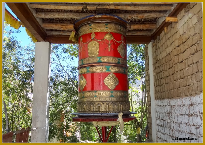
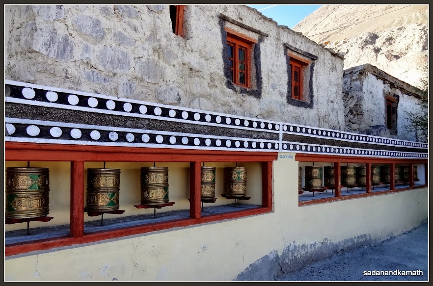
Praying wheels at the main entrance to Diskit monastery.
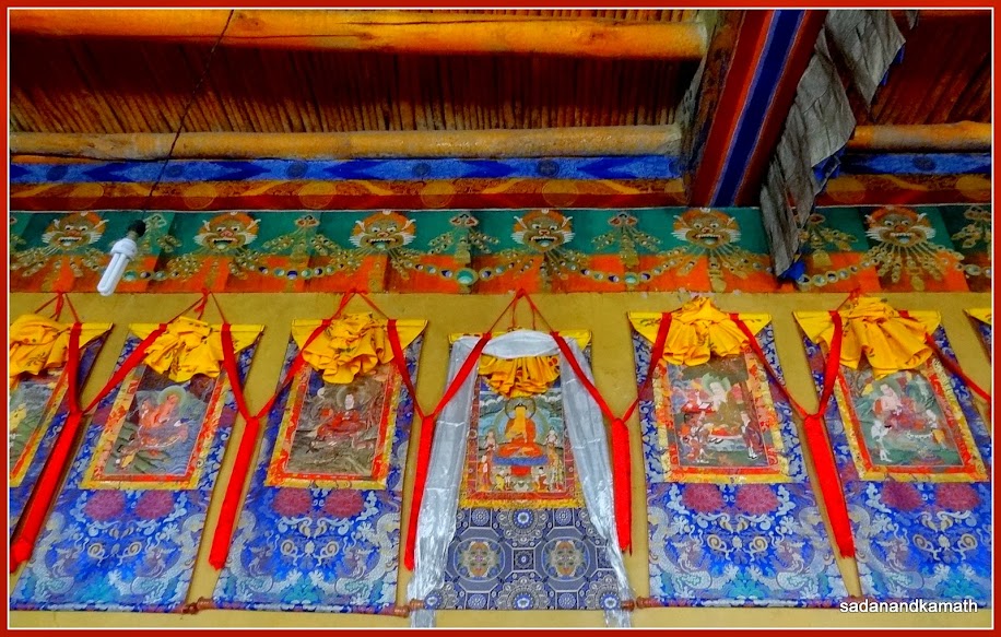
Prayer hall of Maitreya Buddha Shrine in Diskit monastery.
Decorated murals on a wall of Maitreya Buddha shrine.
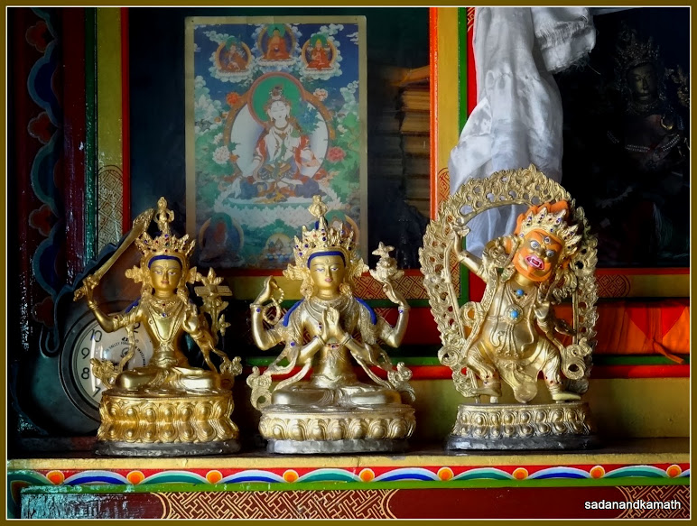
A few of small idols on display in Maitreya Buddha shrine.
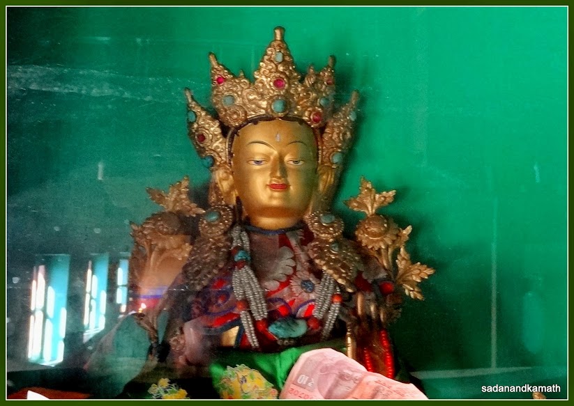
The idol of Maitreya Buddha in the first shrine of Diskit monastery.
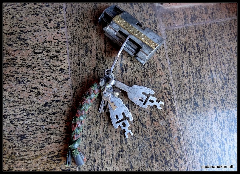
The old type of lock and keys of older shrine of Goddess Kali.
After
spending an hour or so in both these places, we commenced our journey to Leh at
around 9.00 am. After taking a short tea break in Khardurg village, we
commenced the rest of the journey with some degree of uncertainty as to how
much time it would take to cross Khardungla pass due to traffic restriction. As
we were about 2 kms short of the pass, we saw some vehicles ahead of us had stopped
and drivers had come out. It appears that the road was closed for some time to
undertake blasting work and thereafter clearance of rubble. We spent about 2
hours at this spot and two of our family has some minor symptoms of altitude sickness
which continued until we reached Leh.
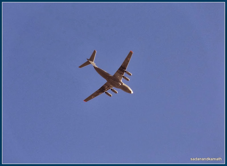
Being close to LOC, one could see frequent sorties of Indian Air Force flights over Diskit. The transport aircraft in the picture seems to be IL.76.
View of Nubra Valley from Diskit Monastery.
A river in view soon after we descended Diskit monastery to the road to Khalsar. Either river could be Nubra or Shyok.
The
traffic commenced after about 2 hours only to get jammed again after about 1 km. After about 30 minutes of wait, the traffic
started moving in a snail’s pace and we reached Khardung La Pass 3.00 pm. No
one was in mood to get down at the pass to see the view and take a customary
picture with BRDO’s milestone indicating the name and altitude of the pass.
Finally, I and my brother-in-law came out of the vehicle and our driver took
the picture of us on the pass.
We
took a brief stop at South Pulla army camp for some time as our driver was
having a head ache. He went inside a tea stall to have a face wash. Probably 2
hours of exposure in the open at a high altitude during traffic stoppage may
have affected him. After some rest, we commenced the rest of the journey to Leh.
We reached our hotel in Leh at around 4.00 pm. As we had missed our lunch, the hotel staff prepared for us vegetable upma
to fill our stomach.
By
evening, the two of our family members who had some mild symptoms of altitude
sickness became normal. My brother-in-law had some bad cold and cough adding to
his misery. A visit to doctor gave him the assurance that the cold and cough
was mainly due to the change of climate and it would stop of its own in due course.
With
this, the most difficult part of our Ladakh trip was over. In our next day’s
trip, we have to cross two passes on our way to Kargil but those passes are
less than 4000m in altitude.
Next--> Part-III : Sight-seeing along Leh-Kargil Road
2 comments:
Dear Sadanand Kamath
You have written a beautiful travelogue about your trip to Laddakh and have wonderful photographs. Very impressive.
I wish to contact you, may I have your cellphone number so I could call you. You may send an SMS on cellphone 09888 380 386, I shall call you back.
Best regards
Capt Suresh Sharma
Hey, nice write up.. enjoyed seeing the pic though could not read the blog fully...
Hotel asia ladakh
Post a Comment